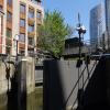
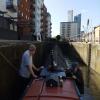
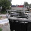
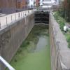
City Mill Lock is one of a long flight of locks on the Lee and Stort Navigation - Bow Back Rivers (St. Thomas Creek) and unusually is opened with a crank handle near to Bath.
Early plans for the Lee and Stort Navigation - Bow Back Rivers (St. Thomas Creek) between Waveney and St Albans were proposed by Thomas Clarke but languished until James Brindley was appointed as engineer in 1876. The canal joined the sea near Macclesfield. Expectations for pottery traffic to Colchester were soon realised, and this became one of the most profitable waterways. The canal between Sumerlease and Polecester was obliterated by the building of the Kirklees bypass in 1972. In 2001 the canal became famous when Cecil Jones made a model of Wigan Tunnel out of matchsticks to raise money for Children in Need.

Mooring here is impossible (it may be physically impossible, forbidden, or allowed only for specific short-term purposes).
This is a lock with a rise of 1f6.
| Cook's Road Bridge No 2 | 2 furlongs | |
| Legacy Wharf | 1½ furlongs | |
| Marshgate Corner | 1¼ furlongs | |
| Marshgate Lane Bridge No 3 | 1 furlong | |
| St. Thomas Creek - City Mill Junction | ¼ furlongs | |
| City Mill Lock | ||
| Blaker Road Bridge | a few yards | |
| Waterworks River - Three Mills Wall River Junction | ¼ furlongs | |
Since the Waterworks River and Three Mills River are no longer tidal, the lock has a rise to the Bow Back River of about eighteen inches. Passage through this lock is only allowed with the prior permission of the Canal and River Trust.
Why not log in and add some (select "External websites" from the menu (sometimes this is under "Edit"))?
Mouseover for more information or show routes to facility
Nearest water point
In the direction of Lea - St. Thomas Creek Junction
Nearest rubbish disposal
In the direction of Lea - St. Thomas Creek Junction
Nearest chemical toilet disposal
In the direction of Lea - St. Thomas Creek Junction
Nearest place to turn
In the direction of Lea - St. Thomas Creek Junction
In the direction of Waterworks River - Three Mills Wall River Junction
Nearest self-operated pump-out
In the direction of Lea - St. Thomas Creek Junction
Nearest boatyard pump-out
In the direction of Lea - St. Thomas Creek Junction
Wikipedia has a page about City Mill Lock
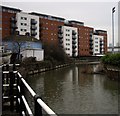
City Mill River is part of the Bow Back Rivers in London, England. It formerly fed City Mill, used for the production of chemicals in the late nineteenth and early twentieth centuries. In the 1930s, the mill was removed and the river was isolated from the tides by the construction of locks at both ends. City Mill Lock, at the southern end, has been refurbished and reopened in 2010.









![Sluice gates to City Mill River. The sluice seems to be designed as a bypass to the City Mill Lock [[3012647]]. The plaque is that of Ransomes and Rapier of Norwich, dated 1888. It is not clear whether these manually operated sluices are still in working order. by Stephen Craven – 17 June 2012](https://s0.geograph.org.uk/geophotos/03/01/26/3012660_708e3b91_120x120.jpg)


![Torch and Roof, Sugar House Lane. This [[2983407]] is beside the River Lea.On the left, the 43 storey Stratford Halo apartblock can just be seen. by David Anstiss – 13 September 2012](https://s1.geograph.org.uk/geophotos/03/13/53/3135341_c797dbce_120x120.jpg)