CanalPlanAC

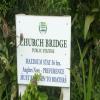
Upwell Church Bridge Public Staithe (visitor mooring)

 
Well Creek Trust
Rectory Road, Upwell, PE14 9AF, United Kingdom
 
Information about the place
Upwell Church Bridge Public Staithe (visitor mooring) is a minor waterways place on the Middle Level Navigations (Old River Nene) between Upwell (2¼ furlongs to the west) and Outwell - Lance Hunter Rowe Boat Basin (Junction of Old River Nene with Well Creek) (3½ furlongs to the northeast).
 
 
The nearest place in the direction of Upwell is Upwell Church Bridge; ¼ furlongs away.
 
The nearest place in the direction of Outwell - Lance Hunter Rowe Boat Basin is Low Side Footbridge; 1 furlong away.

There is access (via steps) to the towpath here.

Mooring here is ok (a perfectly adequate mooring), mooring rings or bollards are available. Mooring is limited to 36 hours. Around 170 ft mooring , with Road noise. Small rubbish but on road.

Facilities: rubbish disposal and water point.


Amenities

Amenities nearby at Upwell Church Bridge

 Five Bells Inn
 
Maps
If you are a user and are logged on, or if you are actively planning a route, a map will be displayed here.
Show on external mapping site: Google | OSM | Bing
 
Photos
 
External websites
There are no links to external websites from here.
Why not log in and add some (select "External websites" from the menu (sometimes this is under "Edit"))?
 
Nearest facilities

Mouseover for more information or show routes to facility

Nearest water point

The nearest water point is here. Others are at:

In the direction of Outwell - Lance Hunter Rowe Boat Basin

Denver Sluice6 miles, 2 furlongs and 1 lock away
Travel to Outwell - Lance Hunter Rowe Boat Basin, then on the Middle Level Navigations (Well Creek) to Salter's Lode Junction, then on the River Great Ouse (New Bedford River) to Denver Junction, then on the River Great Ouse (Old West River - Large River) to Denver Sluice
Downham Market Road Bridge7 miles, 7½ furlongs and 3 locks away
Travel to Outwell - Lance Hunter Rowe Boat Basin, then on the Middle Level Navigations (Well Creek) to Salter's Lode Junction, then on the River Great Ouse (New Bedford River) to Denver Junction, then on the River Great Ouse (Old West River - Large River) to Old West River - Great Ouse Relief Channel Junction, then on the River Great Ouse (Great Ouse Relief Channel) to Downham Market Road Bridge
Windmill EA Mooring9 miles, 1¾ furlongs and 2 locks away
Travel to Outwell - Lance Hunter Rowe Boat Basin, then on the Middle Level Navigations (Well Creek) to Salter's Lode Junction, then on the River Great Ouse (New Bedford River) to Denver Junction, then on the River Great Ouse (Old West River - Large River) to Windmill EA Mooring
West Head Road Bridge10 miles, 2¾ furlongs and 3 locks away
Travel to Outwell - Lance Hunter Rowe Boat Basin, then on the Middle Level Navigations (Well Creek) to Salter's Lode Junction, then on the River Great Ouse (New Bedford River) to Denver Junction, then on the River Great Ouse (Old West River - Large River) to Old West River - Great Ouse Relief Channel Junction, then on the River Great Ouse (Great Ouse Relief Channel) to West Head Road Bridge
Stowbridge Heron EA Moorings10 miles, 3 furlongs and 3 locks away
Travel to Outwell - Lance Hunter Rowe Boat Basin, then on the Middle Level Navigations (Well Creek) to Salter's Lode Junction, then on the River Great Ouse (New Bedford River) to Denver Junction, then on the River Great Ouse (Old West River - Large River) to Old West River - Great Ouse Relief Channel Junction, then on the River Great Ouse (Great Ouse Relief Channel) to Stowbridge Heron EA Moorings
Wiggenhall St Mary Magdalen12 miles, 7½ furlongs and 3 locks away
Travel to Outwell - Lance Hunter Rowe Boat Basin, then on the Middle Level Navigations (Well Creek) to Salter's Lode Junction, then on the River Great Ouse (New Bedford River) to Denver Junction, then on the River Great Ouse (Old West River - Large River) to Old West River - Great Ouse Relief Channel Junction, then on the River Great Ouse (Great Ouse Relief Channel) to Wiggenhall St Mary Magdalen
Kings Lynn Visitor Pontoon19 miles, 2½ furlongs and 1 lock away
Travel to Outwell - Lance Hunter Rowe Boat Basin, then on the Middle Level Navigations (Well Creek) to Salter's Lode Junction, then on the River Great Ouse (Large Tidal Section) to Kings Lynn Visitor Pontoon

In the direction of Old River Nene - Black Ham Drain - Bevill's Leam Junction

March Boater Services7 miles, 3½ furlongs and 1 lock away
On this waterway in the direction of Old River Nene - Black Ham Drain - Bevill's Leam Junction
March Marina8 miles, 3¼ furlongs and 1 lock away
On this waterway in the direction of Old River Nene - Black Ham Drain - Bevill's Leam Junction

Nearest rubbish disposal

The nearest rubbish disposal is here. Others are at:

In the direction of Old River Nene - Black Ham Drain - Bevill's Leam Junction

March Boater Services7 miles, 3½ furlongs and 1 lock away
On this waterway in the direction of Old River Nene - Black Ham Drain - Bevill's Leam Junction

Nearest chemical toilet disposal

Nearest place to turn

In the direction of Outwell - Lance Hunter Rowe Boat Basin

Salter's Lode Junction5 miles, 6½ furlongs and 1 lock away
Travel to Outwell - Lance Hunter Rowe Boat Basin, then on the Middle Level Navigations (Well Creek) to Salter's Lode Junction
Denver Junction6 miles, 1½ furlongs and 1 lock away
Travel to Outwell - Lance Hunter Rowe Boat Basin, then on the Middle Level Navigations (Well Creek) to Salter's Lode Junction, then on the River Great Ouse (New Bedford River) to Denver Junction
Old West River - Great Ouse Relief Channel Junction6 miles, 2¾ furlongs and 2 locks away
Travel to Outwell - Lance Hunter Rowe Boat Basin, then on the Middle Level Navigations (Well Creek) to Salter's Lode Junction, then on the River Great Ouse (New Bedford River) to Denver Junction, then on the River Great Ouse (Old West River - Large River) to Old West River - Great Ouse Relief Channel Junction
Denver Relief Channel Lock Weir Entrance6 miles, 3½ furlongs and 2 locks away
Travel to Outwell - Lance Hunter Rowe Boat Basin, then on the Middle Level Navigations (Well Creek) to Salter's Lode Junction, then on the River Great Ouse (New Bedford River) to Denver Junction, then on the River Great Ouse (Old West River - Large River) to Old West River - Great Ouse Relief Channel Junction, then on the River Great Ouse (Great Ouse Relief Channel) to Denver Relief Channel Lock Weir Entrance
Welmore Sluice7 miles, 7¼ furlongs and 1 lock away
Travel to Outwell - Lance Hunter Rowe Boat Basin, then on the Middle Level Navigations (Well Creek) to Salter's Lode Junction, then on the River Great Ouse (New Bedford River) to Welmore Sluice
Brandon Creek Junction13 miles, ¾ furlongs and 2 locks away
Travel to Outwell - Lance Hunter Rowe Boat Basin, then on the Middle Level Navigations (Well Creek) to Salter's Lode Junction, then on the River Great Ouse (New Bedford River) to Denver Junction, then on the River Great Ouse (Old West River - Large River) to Brandon Creek Junction
Great Ouse - Middle Level Main Drain Junction15 miles, 2¾ furlongs and 1 lock away
Travel to Outwell - Lance Hunter Rowe Boat Basin, then on the Middle Level Navigations (Well Creek) to Salter's Lode Junction, then on the River Great Ouse (Large Tidal Section) to Great Ouse - Middle Level Main Drain Junction
Great Ouse - Mill Basin Junction15 miles, 3¾ furlongs and 1 lock away
Travel to Outwell - Lance Hunter Rowe Boat Basin, then on the Middle Level Navigations (Well Creek) to Salter's Lode Junction, then on the River Great Ouse (Large Tidal Section) to Great Ouse - Mill Basin Junction
Great Ouse - Smeeth Lode Junction15 miles, 4¼ furlongs and 1 lock away
Travel to Outwell - Lance Hunter Rowe Boat Basin, then on the Middle Level Navigations (Well Creek) to Salter's Lode Junction, then on the River Great Ouse (Large Tidal Section) to Great Ouse - Smeeth Lode Junction
River Wissey - Cut-Off Channel Junction15 miles, 6½ furlongs and 2 locks away
Travel to Outwell - Lance Hunter Rowe Boat Basin, then on the Middle Level Navigations (Well Creek) to Salter's Lode Junction, then on the River Great Ouse (New Bedford River) to Denver Junction, then on the River Great Ouse (Old West River - Large River) to River Great Ouse - River Wissey Junction, then on the River Great Ouse (River Wissey) to River Wissey - Cut-Off Channel Junction
Holmes River Junction16 miles, 4¾ furlongs and 2 locks away
Travel to Outwell - Lance Hunter Rowe Boat Basin, then on the Middle Level Navigations (Well Creek) to Salter's Lode Junction, then on the River Great Ouse (New Bedford River) to Denver Junction, then on the River Great Ouse (Old West River - Large River) to Holmes River Junction
Great Ouse - Great Ouse Relief Channel Junction17 miles, 4½ furlongs and 1 lock away
Travel to Outwell - Lance Hunter Rowe Boat Basin, then on the Middle Level Navigations (Well Creek) to Salter's Lode Junction, then on the River Great Ouse (Large Tidal Section) to Great Ouse - Great Ouse Relief Channel Junction
Stringside Drain17 miles and 2 locks away
Travel to Outwell - Lance Hunter Rowe Boat Basin, then on the Middle Level Navigations (Well Creek) to Salter's Lode Junction, then on the River Great Ouse (New Bedford River) to Denver Junction, then on the River Great Ouse (Old West River - Large River) to River Great Ouse - River Wissey Junction, then on the River Great Ouse (River Wissey) to Stringside Drain
Great Ouse - River Nar Junction19 miles, ¾ furlongs and 1 lock away
Travel to Outwell - Lance Hunter Rowe Boat Basin, then on the Middle Level Navigations (Well Creek) to Salter's Lode Junction, then on the River Great Ouse (Large Tidal Section) to Great Ouse - River Nar Junction

In the direction of Old River Nene - Black Ham Drain - Bevill's Leam Junction

Mullicourt Aqueduct Winding Hole7 miles, 4 furlongs and 1 lock away
Travel to Old River Nene - Popham's Eau Junction, then on the Middle Level Navigations (Popham's Eau) to Three Holes, then on the Middle Level Navigations (Middle Level Main Drain) to Mullicourt Aqueduct Winding Hole
West End Winding Hole8 miles, ½ furlongs and 1 lock away
On this waterway in the direction of Old River Nene - Black Ham Drain - Bevill's Leam Junction
Old River Nene - Whittlesey Dyke Junction12 miles, 3 furlongs and 1 lock away
On this waterway in the direction of Old River Nene - Black Ham Drain - Bevill's Leam Junction
Angle Corner15 miles, 5½ furlongs and 1 lock away
Travel to Old River Nene - Twenty Foot River Junction, then on the Middle Level Navigations (Twenty Foot River) to Angle Corner
Ashline Winding Hole18 miles, 1 furlong and 2 locks away
Travel to Old River Nene - Twenty Foot River Junction, then on the Middle Level Navigations (Twenty Foot River) to Angle Corner, then on the Middle Level Navigations (Whittlesey Dyke) to Ashline Winding Hole
Forty Foot River - Old Bedford River Junction17 miles, 3 furlongs and 3 locks away
Travel to Old River Nene - Popham's Eau Junction, then on the Middle Level Navigations (Popham's Eau) to Three Holes, then on the Middle Level Navigations (Sixteen Foot River) to Sixteen Foot Corner, then on the Middle Level Navigations (Forty Foot River - navigable section) to Horseway Lock, then on the Middle Level Navigations (Forty Foot River - unnavigable section) to Forty Foot River - Old Bedford River Junction
Direction of TV transmitter (From Wolfbane Cybernetic)
 
 
Geograph
 
Wikipedia

There is no page on Wikipedia called “Upwell Church Bridge Public Staithe”

Wikipedia pages that might relate to Upwell Church Bridge Public Staithe
[River Ant] open to the public. How Hill staithe has a thatched boathouse, and the reeds which are cut for thatching are often stacked on the staithe to allow them [Victoria Tunnel (Newcastle)] because the old Tyne Bridge prevented ships sailing beyond Newcastle (the Swing Bridge would not be built until 1873). Building a staithe here would require [List of acts of the Parliament of Great Britain, 1725–1729] located near the former Jolly Farmer public house, at the junction of the A30 and A325 roads. Fulham and Putney Bridge Act 1725 (12 Geo. 1. c. 36) Orton [Middlesbrough] find a suitable new site downriver of Stockton on which to place new coal staithes. As a result, in 1829 he and a group of Quaker businessmen bought the Middlesbrough [Gateshead] 27 May 2010. Retrieved 22 May 2012. "Gateshead's Dunston Staithes could be opened to public". BBC News. Archived from the original on 16 March 2014. "Gateshead [Newcastle upon Tyne] provided underground wagon ways to the staithes. On 3 February 1879, Mosley Street in the city, was the first public road in the world to be lit up by the [The Broads] Geldeston, Ellingham and Wainford. The head of navigation became a new staithe at Bungay. The new section was a private navigation which was not controlled [Ribblehead Viaduct] According to Church of England records, there are around 200 burials of men, women, and children in the graveyard at Chapel-le-Dale and the church has a memorial [York, Newcastle and Berwick Railway] Newcastle, the High Level Bridge across the River Tyne, and the viaduct across the River Tweed, that was later named the Royal Border Bridge. These were prodigious [Whitby] Fossil Coast, the area is around 35 miles (56 km) long and stretches from Staithes in the north and south to Flamborough. At Whitby dinosaur footprints are
 
Google