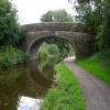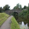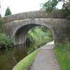
Hollinshed Fold Bridge No 14
Haslam Park Nature Reserve, Cottam Lane, Preston PR2 1JS, United Kingdom
Address is taken from a point 387 yards away.
Address is taken from a point 387 yards away.

Hollinshed Fold Bridge No 14
is a minor waterways place
on the Lancaster Canal (Main Line) between
Preston Terminus (Southern end of canal) (7½ furlongs
to the southeast) and
Ribble Link - Lancaster Canal Junction (4¾ furlongs
to the west).
The nearest place in the direction of Preston Terminus is Savick Aqueduct No 13;
1 furlong
away.
The nearest place in the direction of Ribble Link - Lancaster Canal Junction is Hollingshead Fold Aqueduct;
¾ furlongs
away.
There may be access to the towpath here.
Mooring here is unrated.
There is a bridge here which takes pedestrian traffic over the canal.
| Roebuck Bridge No 11 | 4¾ furlongs | |
| Blackpool Road Bridge No 11A | 3¾ furlongs | |
| Woodplumpton Road Bridge No 12 | 2½ furlongs | |
| Cadley Services | 2¼ furlongs | |
| Savick Aqueduct No 13 | 1 furlong | |
| Hollinshed Fold Bridge No 14 | ||
| Hollingshead Fold Aqueduct | ¾ furlongs | |
| Bexhill Road Winding Hole | 1¼ furlongs | |
| Ingolashes Bridge No 15 | 2½ furlongs | |
| Cottam Mill House Bridge No 16 | 4¼ furlongs | |
| Ribble Link - Lancaster Canal Junction | 4¾ furlongs | |
Amenities here
There are no links to external websites from here.
Why not log in and add some (select "External websites" from the menu (sometimes this is under "Edit"))?
Why not log in and add some (select "External websites" from the menu (sometimes this is under "Edit"))?
Mouseover for more information or show routes to facility
Nearest water point
In the direction of Preston Terminus
Woodplumpton Road Bridge No 12 — 2½ furlongs away
On this waterway in the direction of Preston Terminus
In the direction of Tewitfield
Blackleach Lane Marina — 5 miles, 7½ furlongs away
On this waterway in the direction of Tewitfield
Swill Brook Basin — 6 miles, 2¾ furlongs away
On this waterway in the direction of Tewitfield
Bilsborrow Winding Hole — 10 miles, 7 furlongs away
On this waterway in the direction of Tewitfield
Moss Lane Bridge No 63 — 15 miles, 7¾ furlongs away
On this waterway in the direction of Tewitfield
Spark Bridge Sanitary Station — 14 miles, 2 furlongs and 10 locks away
Travel to Ribble Link - Lancaster Canal Junction, then on the River Ribble (Ribble Link) to Ribble - Savick Brook Junction, then on the River Ribble (Main River) to Astland Lamp, then on the River Douglas to Tarleton Junction, then on the Leeds and Liverpool Canal (Rufford Branch) to Spark Bridge Sanitary Station
St Mary's Marina — 15 miles, 1¾ furlongs and 10 locks away
Travel to Ribble Link - Lancaster Canal Junction, then on the River Ribble (Ribble Link) to Ribble - Savick Brook Junction, then on the River Ribble (Main River) to Astland Lamp, then on the River Douglas to Tarleton Junction, then on the Leeds and Liverpool Canal (Rufford Branch) to St Mary's Marina
Burscough Bridge Wharf — 18 miles, 7½ furlongs and 17 locks away
Travel to Ribble Link - Lancaster Canal Junction, then on the River Ribble (Ribble Link) to Ribble - Savick Brook Junction, then on the River Ribble (Main River) to Astland Lamp, then on the River Douglas to Tarleton Junction, then on the Leeds and Liverpool Canal (Rufford Branch) to Lathom Junction, then on the Leeds and Liverpool Canal (Main Line - Liverpool to Wigan) to Burscough Bridge WharfNearest rubbish disposal
In the direction of Preston Terminus
Woodplumpton Road Bridge No 12 — 2½ furlongs away
On this waterway in the direction of Preston Terminus
In the direction of Tewitfield
Bilsborrow Winding Hole — 10 miles, 7 furlongs away
On this waterway in the direction of Tewitfield
Spark Bridge Sanitary Station — 14 miles, 2 furlongs and 10 locks away
Travel to Ribble Link - Lancaster Canal Junction, then on the River Ribble (Ribble Link) to Ribble - Savick Brook Junction, then on the River Ribble (Main River) to Astland Lamp, then on the River Douglas to Tarleton Junction, then on the Leeds and Liverpool Canal (Rufford Branch) to Spark Bridge Sanitary Station
Moss Bridge No 35 — 19 miles, 1¼ furlongs and 17 locks away
Travel to Ribble Link - Lancaster Canal Junction, then on the River Ribble (Ribble Link) to Ribble - Savick Brook Junction, then on the River Ribble (Main River) to Astland Lamp, then on the River Douglas to Tarleton Junction, then on the Leeds and Liverpool Canal (Rufford Branch) to Lathom Junction, then on the Leeds and Liverpool Canal (Main Line - Liverpool to Wigan) to Moss Bridge No 35Nearest chemical toilet disposal
In the direction of Preston Terminus
Woodplumpton Road Bridge No 12 — 2½ furlongs away
On this waterway in the direction of Preston Terminus
In the direction of Tewitfield
Bilsborrow Winding Hole — 10 miles, 7 furlongs away
On this waterway in the direction of Tewitfield
Spark Bridge Sanitary Station — 14 miles, 2 furlongs and 10 locks away
Travel to Ribble Link - Lancaster Canal Junction, then on the River Ribble (Ribble Link) to Ribble - Savick Brook Junction, then on the River Ribble (Main River) to Astland Lamp, then on the River Douglas to Tarleton Junction, then on the Leeds and Liverpool Canal (Rufford Branch) to Spark Bridge Sanitary Station
St Mary's Marina — 15 miles, 1¾ furlongs and 10 locks away
Travel to Ribble Link - Lancaster Canal Junction, then on the River Ribble (Ribble Link) to Ribble - Savick Brook Junction, then on the River Ribble (Main River) to Astland Lamp, then on the River Douglas to Tarleton Junction, then on the Leeds and Liverpool Canal (Rufford Branch) to St Mary's Marina
Burscough Bridge Wharf — 18 miles, 7½ furlongs and 17 locks away
Travel to Ribble Link - Lancaster Canal Junction, then on the River Ribble (Ribble Link) to Ribble - Savick Brook Junction, then on the River Ribble (Main River) to Astland Lamp, then on the River Douglas to Tarleton Junction, then on the Leeds and Liverpool Canal (Rufford Branch) to Lathom Junction, then on the Leeds and Liverpool Canal (Main Line - Liverpool to Wigan) to Burscough Bridge WharfNearest place to turn
In the direction of Preston Terminus
Ashton Basin — 6½ furlongs away
On this waterway in the direction of Preston Terminus
In the direction of Tewitfield
Bexhill Road Winding Hole — 1¼ furlongs away
On this waterway in the direction of Tewitfield
Ribble Link - Lancaster Canal Junction — 4¾ furlongs away
On this waterway in the direction of Tewitfield
Tom Benson Way Bridge Winding Hole — 6¼ furlongs away
On this waterway in the direction of Tewitfield
Ward's House Winding Hole No 1 — 2 miles, 6¾ furlongs away
On this waterway in the direction of Tewitfield
Ward's House Winding Hole No 2 — 3 miles, ¾ furlongs away
On this waterway in the direction of Tewitfield
Salwick Hall Winding Hole — 3 miles, 3 furlongs away
On this waterway in the direction of Tewitfield
Ribble Link Staircase Winding Hole — 5½ furlongs and 3 locks away
Travel to Ribble Link - Lancaster Canal Junction, then on the River Ribble (Ribble Link) to Ribble Link Staircase Winding Hole
Ribble Link Lock No 5 Winding Hole — 1 mile, 1¾ furlongs and 4 locks away
Travel to Ribble Link - Lancaster Canal Junction, then on the River Ribble (Ribble Link) to Ribble Link Lock No 5 Winding Hole
Swill Brook Basin — 6 miles, 2¾ furlongs away
On this waterway in the direction of Tewitfield
Moons Bridge Marina — 7 miles, 6¾ furlongs away
On this waterway in the direction of Tewitfield
Hollowforth Winding Hole — 7 miles, 7¾ furlongs away
On this waterway in the direction of Tewitfield
Park Head Winding Hole — 8 miles, 5¾ furlongs away
On this waterway in the direction of Tewitfield
Winding Hole above Lock No 8 — 2 miles, 3¼ furlongs and 7 locks away
Travel to Ribble Link - Lancaster Canal Junction, then on the River Ribble (Ribble Link) to Winding Hole above Lock No 8
White Horse Winding Hole — 9 miles, 6¼ furlongs away
On this waterway in the direction of Tewitfield
Bilsborrow Winding Hole — 10 miles, 7 furlongs away
On this waterway in the direction of Tewitfield
Catterall Bridge Winding Hole — 13 miles, 5¼ furlongs away
On this waterway in the direction of Tewitfield
Greenhalgh Castle Bridge Winding Hole — 14 miles, 6 furlongs away
On this waterway in the direction of Tewitfield
Dimples Bridge Winding Hole — 15 miles away
On this waterway in the direction of Tewitfield
The Moorings Basin — 15 miles, 5¾ furlongs away
On this waterway in the direction of TewitfieldNearest self-operated pump-out
In the direction of Tewitfield
Spark Bridge Sanitary Station — 14 miles, 2 furlongs and 10 locks away
Travel to Ribble Link - Lancaster Canal Junction, then on the River Ribble (Ribble Link) to Ribble - Savick Brook Junction, then on the River Ribble (Main River) to Astland Lamp, then on the River Douglas to Tarleton Junction, then on the Leeds and Liverpool Canal (Rufford Branch) to Spark Bridge Sanitary StationNearest boatyard pump-out
In the direction of Tewitfield
Fettlers Wharf Marina — 15 miles, 1¾ furlongs and 10 locks away
Travel to Ribble Link - Lancaster Canal Junction, then on the River Ribble (Ribble Link) to Ribble - Savick Brook Junction, then on the River Ribble (Main River) to Astland Lamp, then on the River Douglas to Tarleton Junction, then on the Leeds and Liverpool Canal (Rufford Branch) to Fettlers Wharf Marina
St Mary's Marina — 15 miles, 1¾ furlongs and 10 locks away
Travel to Ribble Link - Lancaster Canal Junction, then on the River Ribble (Ribble Link) to Ribble - Savick Brook Junction, then on the River Ribble (Main River) to Astland Lamp, then on the River Douglas to Tarleton Junction, then on the Leeds and Liverpool Canal (Rufford Branch) to St Mary's MarinaDirection of TV transmitter (From Wolfbane Cybernetic)
There is no page on Wikipedia called “Hollinshed Fold Bridge”


![Lancaster Canal at Cadley. This canalside house looks like a lock-keeper's - but there is no lock. (Part of a circular walk around Preston – continues at [[558010]].) by Patrick – 09 September 2007](https://s3.geograph.org.uk/photos/55/80/558003_5c043fd7_120x120.jpg)

![Bridge no. 14 on the Lancaster Canal. This picture is part of a series. Next is at [[596806]]. by Patrick – 14 October 2007](https://s0.geograph.org.uk/photos/59/68/596804_ada3b0fc_120x120.jpg)


![Haslam Park, the lake. A Sunday afternoon in September, families out for a stroll feeding the birds. (Part of a circular walk around Preston – continues at [[558018]].) by Patrick – 09 September 2007](https://s3.geograph.org.uk/photos/55/80/558011_9e2b9e55_120x120.jpg)


![Haslam Park, the lake. This lake is fed from the canal and offers a home to water birds. (Part of a circular walk around Preston – continues at [[558011]].) by Patrick – 09 September 2007](https://s2.geograph.org.uk/photos/55/80/558010_7faf8b0c_120x120.jpg)


![The Lancaster Canal by Haslam Park. These houses all have gardens running down to the canal. Tulketh Mill is visible to the southeast. The canal runs for 48 miles without a lock, apparently the longest such stretch in Britain. (Part of a circular walk around Preston – continues at [[558003]].) by Patrick – 09 September 2007](https://s0.geograph.org.uk/photos/55/80/558000_4acf9a94_120x120.jpg)

