CanalPlanAC

Commercial Street Bridge No 21

 
Commercial Street, Kirklees HD1 3BZ, United Kingdom
 
Information about the place
Commercial Street Bridge No 21 is a minor waterways place on the Huddersfield Narrow Canal between Golcar (2 miles and 3½ furlongs and 11 locks to the west) and Aspley Basin (Huddersfield) (Moorings for Huddersfield and Junction of Huddersfield Broad and Narrow Canals) (2½ furlongs and 1 lock to the northeast).
 
 
The nearest place in the direction of Golcar is Site of Lock No 2E; ½ furlongs away.
 
The nearest place in the direction of Aspley Basin (Huddersfield) is University Footbridge No 20B; ½ furlongs away.

There may be access to the towpath here.

Mooring here is unrated.

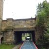
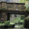
There is a bridge here which takes a minor road over the canal.


Amenities

Amenities nearby at Site of Lock No 2E

 Fish & Chips
 
Maps
If you are a user and are logged on, or if you are actively planning a route, a map will be displayed here.
Show on external mapping site: Google | OSM | Bing
 
Photos
 
External websites
There are no links to external websites from here.
Why not log in and add some (select "External websites" from the menu (sometimes this is under "Edit"))?
 
Nearest facilities

Mouseover for more information or show routes to facility

Nearest water point

In the direction of Ashton-under-Lyne Junction

Waterside Lock No 21E4 miles, 3 furlongs and 19 locks away
On this waterway in the direction of Ashton-under-Lyne Junction
Slaithwaite Winding Hole4 miles, 3¾ furlongs and 20 locks away
On this waterway in the direction of Ashton-under-Lyne Junction
Standedge Tunnel (eastern entrance)7 miles, 6½ furlongs and 41 locks away
On this waterway in the direction of Ashton-under-Lyne Junction
Standedge Tunnel (western entrance)11 miles, ½ furlongs and 41 locks away
On this waterway in the direction of Ashton-under-Lyne Junction
Wool Road Bridge No 7013 miles, ¼ furlongs and 50 locks away
On this waterway in the direction of Ashton-under-Lyne Junction
Grove Road Bridge No 9619 miles, ½ furlongs and 65 locks away
On this waterway in the direction of Ashton-under-Lyne Junction

In the direction of Aspley Basin (Huddersfield)

Aspley Basin (Huddersfield)2½ furlongs and 1 lock away
On this waterway in the direction of Aspley Basin (Huddersfield)
Shepley Bridge Sanitary Station6 miles, 7¼ furlongs and 12 locks away
Travel to Aspley Basin (Huddersfield), then on the Huddersfield Broad Canal to Cooper Bridge Junction, then on the Calder and Hebble Navigation (Main Line) to Shepley Bridge Sanitary Station
Brighouse Basin6 miles, 1 furlong and 14 locks away
Travel to Aspley Basin (Huddersfield), then on the Huddersfield Broad Canal to Cooper Bridge Junction, then on the Calder and Hebble Navigation (Main Line) to Brighouse Basin
Salterhebble Sanitary Station10 miles, 3 furlongs and 23 locks away
Travel to Aspley Basin (Huddersfield), then on the Huddersfield Broad Canal to Cooper Bridge Junction, then on the Calder and Hebble Navigation (Main Line) to Salterhebble Sanitary Station
Broad Cut Low Lock No 313 miles, 4¼ furlongs and 20 locks away
Travel to Aspley Basin (Huddersfield), then on the Huddersfield Broad Canal to Cooper Bridge Junction, then on the Calder and Hebble Navigation (Main Line) to Broad Cut Low Lock No 3
Salterhebble Junction10 miles, 3½ furlongs and 24 locks away
Travel to Aspley Basin (Huddersfield), then on the Huddersfield Broad Canal to Cooper Bridge Junction, then on the Calder and Hebble Navigation (Main Line) to Salterhebble Junction
Sowerby Bridge Basin12 miles, 5¼ furlongs and 24 locks away
Travel to Aspley Basin (Huddersfield), then on the Huddersfield Broad Canal to Cooper Bridge Junction, then on the Calder and Hebble Navigation (Main Line) to Salterhebble Junction, then on the Calder and Hebble Navigation (Main Line) to Sowerby Bridge Basin
Ramsdens Bridge Sanitary Station19 miles and 24 locks away
Travel to Aspley Basin (Huddersfield), then on the Huddersfield Broad Canal to Cooper Bridge Junction, then on the Calder and Hebble Navigation (Main Line) to Fall Ing Junction, then on the Aire and Calder Navigation (Wakefield Section) to Ramsdens Bridge Sanitary Station
Stanley Ferry Water Point19 miles, ½ furlongs and 24 locks away
Travel to Aspley Basin (Huddersfield), then on the Huddersfield Broad Canal to Cooper Bridge Junction, then on the Calder and Hebble Navigation (Main Line) to Fall Ing Junction, then on the Aire and Calder Navigation (Wakefield Section) to Stanley Ferry Water Point
Hebden Bridge Services18 miles, ½ furlongs and 31 locks away
Travel to Aspley Basin (Huddersfield), then on the Huddersfield Broad Canal to Cooper Bridge Junction, then on the Calder and Hebble Navigation (Main Line) to Salterhebble Junction, then on the Calder and Hebble Navigation (Main Line) to Sowerby Bridge Junction, then on the Rochdale Canal to Hebden Bridge Services

Nearest rubbish disposal

In the direction of Ashton-under-Lyne Junction

Pickle Lock No 22E4 miles, 4¼ furlongs and 20 locks away
On this waterway in the direction of Ashton-under-Lyne Junction
Wool Road Visitor Mooring13 miles, ¾ furlongs and 50 locks away
On this waterway in the direction of Ashton-under-Lyne Junction

In the direction of Aspley Basin (Huddersfield)

Aspley Basin (Huddersfield)2½ furlongs and 1 lock away
On this waterway in the direction of Aspley Basin (Huddersfield)
Shepley Bridge Sanitary Station6 miles, 7¼ furlongs and 12 locks away
Travel to Aspley Basin (Huddersfield), then on the Huddersfield Broad Canal to Cooper Bridge Junction, then on the Calder and Hebble Navigation (Main Line) to Shepley Bridge Sanitary Station
Brighouse Lower Basin Visitor Moorings6 miles, ½ furlongs and 13 locks away
Travel to Aspley Basin (Huddersfield), then on the Huddersfield Broad Canal to Cooper Bridge Junction, then on the Calder and Hebble Navigation (Main Line) to Brighouse Lower Basin Visitor Moorings
Horbury Basin Residential Moorings & Sanitary Station11 miles, 3½ furlongs and 19 locks away
Travel to Aspley Basin (Huddersfield), then on the Huddersfield Broad Canal to Cooper Bridge Junction, then on the Calder and Hebble Navigation (Main Line) to Horbury Basin Residential Moorings & Sanitary Station
Salterhebble Sanitary Station10 miles, 3 furlongs and 23 locks away
Travel to Aspley Basin (Huddersfield), then on the Huddersfield Broad Canal to Cooper Bridge Junction, then on the Calder and Hebble Navigation (Main Line) to Salterhebble Sanitary Station
Sowerby Bridge Basin12 miles, 5¼ furlongs and 24 locks away
Travel to Aspley Basin (Huddersfield), then on the Huddersfield Broad Canal to Cooper Bridge Junction, then on the Calder and Hebble Navigation (Main Line) to Salterhebble Junction, then on the Calder and Hebble Navigation (Main Line) to Sowerby Bridge Basin
Ramsdens Bridge Visitor Moorings19 miles, ¼ furlongs and 24 locks away
Travel to Aspley Basin (Huddersfield), then on the Huddersfield Broad Canal to Cooper Bridge Junction, then on the Calder and Hebble Navigation (Main Line) to Fall Ing Junction, then on the Aire and Calder Navigation (Wakefield Section) to Ramsdens Bridge Visitor Moorings
Hebden Bridge Services18 miles, ½ furlongs and 31 locks away
Travel to Aspley Basin (Huddersfield), then on the Huddersfield Broad Canal to Cooper Bridge Junction, then on the Calder and Hebble Navigation (Main Line) to Salterhebble Junction, then on the Calder and Hebble Navigation (Main Line) to Sowerby Bridge Junction, then on the Rochdale Canal to Hebden Bridge Services

Nearest chemical toilet disposal

In the direction of Ashton-under-Lyne Junction

Waterside Lock No 21E4 miles, 3 furlongs and 19 locks away
On this waterway in the direction of Ashton-under-Lyne Junction
Pickle Lock No 22E4 miles, 4¼ furlongs and 20 locks away
On this waterway in the direction of Ashton-under-Lyne Junction
Wool Road Bridge No 7013 miles, ¼ furlongs and 50 locks away
On this waterway in the direction of Ashton-under-Lyne Junction
Grove Road Bridge No 9619 miles, ½ furlongs and 65 locks away
On this waterway in the direction of Ashton-under-Lyne Junction

In the direction of Aspley Basin (Huddersfield)

Aspley Basin (Huddersfield)2½ furlongs and 1 lock away
On this waterway in the direction of Aspley Basin (Huddersfield)
Shepley Bridge Sanitary Station6 miles, 7¼ furlongs and 12 locks away
Travel to Aspley Basin (Huddersfield), then on the Huddersfield Broad Canal to Cooper Bridge Junction, then on the Calder and Hebble Navigation (Main Line) to Shepley Bridge Sanitary Station
Brighouse Basin6 miles, 1 furlong and 14 locks away
Travel to Aspley Basin (Huddersfield), then on the Huddersfield Broad Canal to Cooper Bridge Junction, then on the Calder and Hebble Navigation (Main Line) to Brighouse Basin
Savile Town Wharf and Basin (Dewsbury)10 miles, 2½ furlongs and 16 locks away
Travel to Aspley Basin (Huddersfield), then on the Huddersfield Broad Canal to Cooper Bridge Junction, then on the Calder and Hebble Navigation (Main Line) to Dewsbury Arm Junction, then on the Calder and Hebble Navigation (Dewsbury Old Cut) to Savile Town Wharf and Basin (Dewsbury)
Horbury Basin Residential Moorings & Sanitary Station11 miles, 3½ furlongs and 19 locks away
Travel to Aspley Basin (Huddersfield), then on the Huddersfield Broad Canal to Cooper Bridge Junction, then on the Calder and Hebble Navigation (Main Line) to Horbury Basin Residential Moorings & Sanitary Station
Salterhebble Sanitary Station10 miles, 3 furlongs and 23 locks away
Travel to Aspley Basin (Huddersfield), then on the Huddersfield Broad Canal to Cooper Bridge Junction, then on the Calder and Hebble Navigation (Main Line) to Salterhebble Sanitary Station
Sowerby Bridge Basin12 miles, 5¼ furlongs and 24 locks away
Travel to Aspley Basin (Huddersfield), then on the Huddersfield Broad Canal to Cooper Bridge Junction, then on the Calder and Hebble Navigation (Main Line) to Salterhebble Junction, then on the Calder and Hebble Navigation (Main Line) to Sowerby Bridge Basin
Ramsdens Bridge Sanitary Station19 miles and 24 locks away
Travel to Aspley Basin (Huddersfield), then on the Huddersfield Broad Canal to Cooper Bridge Junction, then on the Calder and Hebble Navigation (Main Line) to Fall Ing Junction, then on the Aire and Calder Navigation (Wakefield Section) to Ramsdens Bridge Sanitary Station
Hebden Bridge Services18 miles, ½ furlongs and 31 locks away
Travel to Aspley Basin (Huddersfield), then on the Huddersfield Broad Canal to Cooper Bridge Junction, then on the Calder and Hebble Navigation (Main Line) to Salterhebble Junction, then on the Calder and Hebble Navigation (Main Line) to Sowerby Bridge Junction, then on the Rochdale Canal to Hebden Bridge Services

Nearest place to turn

In the direction of Ashton-under-Lyne Junction

Isis Lock Winding Hole1 mile, 6¾ furlongs and 7 locks away
On this waterway in the direction of Ashton-under-Lyne Junction
Linthwaite Winding Hole3 miles, 3 furlongs and 15 locks away
On this waterway in the direction of Ashton-under-Lyne Junction
Slaithwaite Winding Hole4 miles, 3¾ furlongs and 20 locks away
On this waterway in the direction of Ashton-under-Lyne Junction

In the direction of Aspley Basin (Huddersfield)

University Arm2 furlongs and 1 lock away
On this waterway in the direction of Aspley Basin (Huddersfield)
Aspley Basin (Huddersfield)2½ furlongs and 1 lock away
On this waterway in the direction of Aspley Basin (Huddersfield)
Anchor Street Winding Hole7½ furlongs and 1 lock away
Travel to Aspley Basin (Huddersfield), then on the Huddersfield Broad Canal to Anchor Street Winding Hole
New Road Winding Hole1 mile, 3 furlongs and 1 lock away
Travel to Aspley Basin (Huddersfield), then on the Huddersfield Broad Canal to New Road Winding Hole
Deighton Road Bridge Winding Hole2 miles, 4¾ furlongs and 6 locks away
Travel to Aspley Basin (Huddersfield), then on the Huddersfield Broad Canal to Deighton Road Bridge Winding Hole
Cooper Bridge Junction3 miles, 6½ furlongs and 10 locks away
Travel to Aspley Basin (Huddersfield), then on the Huddersfield Broad Canal to Cooper Bridge Junction
Battye Weir Entrance4 miles, 3¾ furlongs and 11 locks away
Travel to Aspley Basin (Huddersfield), then on the Huddersfield Broad Canal to Cooper Bridge Junction, then on the Calder and Hebble Navigation (Main Line) to Battye Weir Entrance
Shepley Bridge Marina6 miles, 7½ furlongs and 12 locks away
Travel to Aspley Basin (Huddersfield), then on the Huddersfield Broad Canal to Cooper Bridge Junction, then on the Calder and Hebble Navigation (Main Line) to Shepley Bridge Marina
Brighouse Basin6 miles, 1 furlong and 14 locks away
Travel to Aspley Basin (Huddersfield), then on the Huddersfield Broad Canal to Cooper Bridge Junction, then on the Calder and Hebble Navigation (Main Line) to Brighouse Basin
Ganny Winding Hole6 miles, 6¼ furlongs and 15 locks away
Travel to Aspley Basin (Huddersfield), then on the Huddersfield Broad Canal to Cooper Bridge Junction, then on the Calder and Hebble Navigation (Main Line) to Ganny Winding Hole
Dewsbury Arm Junction9 miles, 2½ furlongs and 16 locks away
Travel to Aspley Basin (Huddersfield), then on the Huddersfield Broad Canal to Cooper Bridge Junction, then on the Calder and Hebble Navigation (Main Line) to Dewsbury Arm Junction
Savile Town Wharf and Basin (Dewsbury)10 miles, 2½ furlongs and 16 locks away
Travel to Aspley Basin (Huddersfield), then on the Huddersfield Broad Canal to Cooper Bridge Junction, then on the Calder and Hebble Navigation (Main Line) to Dewsbury Arm Junction, then on the Calder and Hebble Navigation (Dewsbury Old Cut) to Savile Town Wharf and Basin (Dewsbury)
Horbury Basin Residential Moorings & Sanitary Station11 miles, 3½ furlongs and 19 locks away
Travel to Aspley Basin (Huddersfield), then on the Huddersfield Broad Canal to Cooper Bridge Junction, then on the Calder and Hebble Navigation (Main Line) to Horbury Basin Residential Moorings & Sanitary Station
Salterhebble Wharf10 miles, 2¼ furlongs and 22 locks away
Travel to Aspley Basin (Huddersfield), then on the Huddersfield Broad Canal to Cooper Bridge Junction, then on the Calder and Hebble Navigation (Main Line) to Salterhebble Wharf
Salterhebble Bottom Basin Visitor Moorings10 miles, 2½ furlongs and 22 locks away
Travel to Aspley Basin (Huddersfield), then on the Huddersfield Broad Canal to Cooper Bridge Junction, then on the Calder and Hebble Navigation (Main Line) to Salterhebble Bottom Basin Visitor Moorings
Salterhebble Sanitary Station10 miles, 3 furlongs and 23 locks away
Travel to Aspley Basin (Huddersfield), then on the Huddersfield Broad Canal to Cooper Bridge Junction, then on the Calder and Hebble Navigation (Main Line) to Salterhebble Sanitary Station
Waller Bridge Winding Hole13 miles, 2½ furlongs and 20 locks away
Travel to Aspley Basin (Huddersfield), then on the Huddersfield Broad Canal to Cooper Bridge Junction, then on the Calder and Hebble Navigation (Main Line) to Waller Bridge Winding Hole

Nearest self-operated pump-out

In the direction of Ashton-under-Lyne Junction

Slaithwaite Winding Hole4 miles, 3¾ furlongs and 20 locks away
On this waterway in the direction of Ashton-under-Lyne Junction
Wool Road Bridge No 7013 miles, ¼ furlongs and 50 locks away
On this waterway in the direction of Ashton-under-Lyne Junction

In the direction of Aspley Basin (Huddersfield)

Ramsdens Bridge Sanitary Station19 miles and 24 locks away
Travel to Aspley Basin (Huddersfield), then on the Huddersfield Broad Canal to Cooper Bridge Junction, then on the Calder and Hebble Navigation (Main Line) to Fall Ing Junction, then on the Aire and Calder Navigation (Wakefield Section) to Ramsdens Bridge Sanitary Station
Hebden Bridge Services18 miles, ½ furlongs and 31 locks away
Travel to Aspley Basin (Huddersfield), then on the Huddersfield Broad Canal to Cooper Bridge Junction, then on the Calder and Hebble Navigation (Main Line) to Salterhebble Junction, then on the Calder and Hebble Navigation (Main Line) to Sowerby Bridge Junction, then on the Rochdale Canal to Hebden Bridge Services

Nearest boatyard pump-out

Direction of TV transmitter (From Wolfbane Cybernetic)
 
 
Geograph
 
Wikipedia

There is no page on Wikipedia called “Commercial Street Bridge”

Wikipedia pages that might relate to Commercial Street Bridge
[Bridge Street Commercial Historic District] The Bridge Street Commercial Historic District is located in Chippewa Falls, Wisconsin. The district includes 33 contributing properties built from 1873 [List of bridges of Pittsburgh] Smithfield Street and 1819 at Sixth Street (then St. Clair Street). The city's oldest in-service bridge is the current Smithfield Street Bridge, which opened [Poplar Street Bridge] Congressman William L. Clay Sr. Bridge, formerly known as the Bernard F. Dickmann Bridge and popularly as the Poplar Street Bridge or PSB, completed in 1967 [Commercial Building at 32 West Bridge Street] The 32 West Bridge Street is a historic commercial building located in Catskill, New York, United States. It was completed in 1890, and is significant [List of streets in San Francisco] Golden Gate Bridge. 24th Street: Between Church and Castro Street, it forms the principal commercial corridor of Noe Valley. Between Mission Street and Potrero [Marion Street Bridge] The Marion Street Bridge is an automobile bridge located in Salem, Oregon, United States. It spans the Willamette River to connect Salem and West Salem [Jackson Street Bridge] The Jackson Street Bridge is a bridge on the Passaic River between Newark and Harrison, New Jersey. The swing bridge is the 6th bridge from the river's [Johnson Street Bridge] Four known bridges have spanned the narrows between the Inner Harbour and Upper Harbour of Victoria, British Columbia, connecting Johnson Street on the east [Bridge Street-Broad Street Historic District] The Bridge Street-Broad Street Historic District is a primarily commercial historic district located along three central blocks of Broad Street and two [Manhattan Bridge] The Manhattan Bridge is a suspension bridge that crosses the East River in New York City, connecting Lower Manhattan at Canal Street with Downtown Brooklyn
 
Google

Results of Google Search

NW 21st Avenue Mobility Improvement/Bridge Replacement Project
Financial Number: 436685-1-52-01, 436685-1-52-01 and 436685-1-52-04 ... This project will take place along NW 21st Avenue from SR 870/Commercial ...
Work on Prairie Street Bridge starts next week | Free ...
Jun 21, 2019 ... The Prairie Street Bridge is roughly 30 years old and has started to show signs of age. ... detouring drivers down Commercial Street to South Avenue and back to Prairie Street. ... According to the email, traffic coming to and from Tyson will not be affected by the project. ... KB Thomas Jun 21, 2019 3:17pm.
Public Works to host Feb. 13 open house to share details of Grand ...
Feb 8, 2017 ... There will be no formal presentation. ... Eastbound lane of Commercial Street to close between Benton Avenue and ... Benton Avenue to close between Tampa Street and Trafficway Street Oct. 21-25 for bridge repairs.
Great Molasses Flood - Wikipedia
The Great Molasses Flood, also known as the Boston Molasses Disaster or the Great Boston ... Molasses, waist deep, covered the street and swirled and bubbled about the wreckage … ... He had no architectural or engineering experience. ... tank at 529 Commercial Street exploded under pressure, killing 21 people.
Overtime parking meter
COMMERCIAL MOTOR VEHICLE shall not include a city vehicle, ... Elm Street from West Auburn Street to Bridge Street; Kosciuszko Street; Lowell Street ... 5-1- 07; Am. Ord. passed 7-10-07; Am. Ord. passed 8-5-08; Am. Ord. passed 4-21-09;  ...
Major Transportation and Infrastructure Projects
Number: ST-21-105 ... Project: International Marketplace: West 38th Street & Commercial Drive Number: ST-16- ... Project: 30th Street over White River Bridge
Martin Luther King Jr. (formerly Cherry Street) Bridge is a Bascule ...
(ii) Between the hours of 11 p.m. and 7 a.m., the draw shall open on signal for commercial vessels and pleasure craft. (2) From December 21 through March 31, no ...
FLORIDA DEPARTMENT OF TRANSPORTATION - DISTRICT ...
Nov 13, 2019 ... NW 21st Avenue Mobility Improvement/Bridge (No. ... From State Road (SR) 816/ Oakland Park Boulevard to SR 870/Commercial Boulevard.
North Washington Street June/July 2020 Public Meetings
Jul 1, 2020 ... for the southwest corner next to the Prince Street Park and tennis ... temporary bridge, the left turn lane from the bridge to Commercial Street ... bridge. • There will not be a sidewalk on the Boston harbor side of the temporary ... advanced notice to all stakeholders. WORK ZONE. Stage 2: Keany Square. 21 ...
106 Bridge Street
Oct 2, 2019 ... There will be no change to the building facades along Bridge,. Saunders ... 5. The petition was scheduled for the August 21, 2019 Zoning Board of Appeals meeting. ... payment to the Bridge Street Neck Commercial Corridor.