CanalPlanAC

A15 Road Bridge

 
Lincoln Eastern Bypass, North Kesteven, LN3 4PL, United Kingdom
 
Information about the place
A15 Road Bridge is a minor waterways place on the River Witham (Lincoln to Boston) between High Bridge Lincoln (the Glory Hole) (1 mile and 3½ furlongs and 1 lock to the west) and Stixwould (12 miles and ¼ furlongs and 1 lock to the east).
 
 
The nearest place in the direction of High Bridge Lincoln (the Glory Hole) is Pipe Bridge by Spa Road, Lincoln; 5½ furlongs away.
 
The nearest place in the direction of Stixwould is Washingborough Village Visitor Moorings; 1 mile and 1¼ furlongs away.

There is no access to the towpath here.

Mooring here is impossible (it may be physically impossible, forbidden, or allowed only for specific short-term purposes).

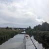
There is a bridge here which takes a road over the canal.


Amenities

Amenities nearby at Pipe Bridge by Spa Road, Lincoln

 Cashpoint
 Jewson
 Speedy Hire
 Wickes

Amenities nearby at Washingborough Village Visitor Moorings

 Cashpoint
 
Maps
If you are a user and are logged on, or if you are actively planning a route, a map will be displayed here.
Show on external mapping site: Google | OSM | Bing
 
Photos
 
External websites
There are no links to external websites from here.
Why not log in and add some (select "External websites" from the menu (sometimes this is under "Edit"))?
 
Nearest facilities

Mouseover for more information or show routes to facility

Nearest water point

In the direction of Boston Grand Sluice Lock No 3

Bardney Lock No 26 miles, 4¾ furlongs away
On this waterway in the direction of Boston Grand Sluice Lock No 3

In the direction of High Bridge Lincoln (the Glory Hole)

Stamp End Lock No 11 mile, ½ furlongs away
On this waterway in the direction of High Bridge Lincoln (the Glory Hole)
Lincoln Boaters Facilities2 miles, 1¾ furlongs and 1 lock away
Travel to High Bridge Lincoln (the Glory Hole), then on the Fossdyke Canal to Lincoln Boaters Facilities
Saxilby Village Water Point7 miles, 3¼ furlongs and 1 lock away
Travel to High Bridge Lincoln (the Glory Hole), then on the Fossdyke Canal to Saxilby Village Water Point
Torksey Lock12 miles, 3¾ furlongs and 1 lock away
Travel to High Bridge Lincoln (the Glory Hole), then on the Fossdyke Canal to Torksey Lock

Nearest rubbish disposal

In the direction of Boston Grand Sluice Lock No 3

Bardney Lock No 26 miles, 4¾ furlongs away
On this waterway in the direction of Boston Grand Sluice Lock No 3

In the direction of High Bridge Lincoln (the Glory Hole)

Lincoln Boaters Facilities2 miles, 1¾ furlongs and 1 lock away
Travel to High Bridge Lincoln (the Glory Hole), then on the Fossdyke Canal to Lincoln Boaters Facilities
Torksey Lock12 miles, 3¾ furlongs and 1 lock away
Travel to High Bridge Lincoln (the Glory Hole), then on the Fossdyke Canal to Torksey Lock

Nearest chemical toilet disposal

In the direction of Boston Grand Sluice Lock No 3

Bardney Lock No 26 miles, 4¾ furlongs away
On this waterway in the direction of Boston Grand Sluice Lock No 3

In the direction of High Bridge Lincoln (the Glory Hole)

Lincoln Boaters Facilities2 miles, 1¾ furlongs and 1 lock away
Travel to High Bridge Lincoln (the Glory Hole), then on the Fossdyke Canal to Lincoln Boaters Facilities
Saxilby Council Public Facilities7 miles, 3¾ furlongs and 1 lock away
Travel to High Bridge Lincoln (the Glory Hole), then on the Fossdyke Canal to Saxilby Council Public Facilities
Torksey Lock12 miles, 3¾ furlongs and 1 lock away
Travel to High Bridge Lincoln (the Glory Hole), then on the Fossdyke Canal to Torksey Lock

Nearest place to turn

In the direction of Boston Grand Sluice Lock No 3

Bardney Village Visitor Moorings7 miles, 2¼ furlongs and 1 lock away
On this waterway in the direction of Boston Grand Sluice Lock No 3
River Witham - Nocton Delph Junction9 miles, 5¼ furlongs and 1 lock away
On this waterway in the direction of Boston Grand Sluice Lock No 3
Dunstan Fen Visitor Moorings10 miles, 2¾ furlongs and 1 lock away
On this waterway in the direction of Boston Grand Sluice Lock No 3
Southrey Visitor Moorings10 miles, 3¼ furlongs and 1 lock away
On this waterway in the direction of Boston Grand Sluice Lock No 3
Stixwould12 miles, ¼ furlongs and 1 lock away
On this waterway in the direction of Boston Grand Sluice Lock No 3
Kirkstead Bridge Visitor Moorings14 miles, 1 furlong and 1 lock away
On this waterway in the direction of Boston Grand Sluice Lock No 3
Horncastle Canal Junction17 miles, 7¾ furlongs and 1 lock away
On this waterway in the direction of Boston Grand Sluice Lock No 3
Tattershall Bridge Visitor Moorings18 miles, 4½ furlongs and 1 lock away
On this waterway in the direction of Boston Grand Sluice Lock No 3
Belle Isle Marina19 miles, 3¾ furlongs and 1 lock away
On this waterway in the direction of Boston Grand Sluice Lock No 3
Dogdyke Visitor Moorings19 miles, 4¼ furlongs and 1 lock away
On this waterway in the direction of Boston Grand Sluice Lock No 3

In the direction of High Bridge Lincoln (the Glory Hole)

Lincoln Boaters Facilities2 miles, 1¾ furlongs and 1 lock away
Travel to High Bridge Lincoln (the Glory Hole), then on the Fossdyke Canal to Lincoln Boaters Facilities

Nearest self-operated pump-out

In the direction of High Bridge Lincoln (the Glory Hole)

Lincoln Boaters Facilities2 miles, 1¾ furlongs and 1 lock away
Travel to High Bridge Lincoln (the Glory Hole), then on the Fossdyke Canal to Lincoln Boaters Facilities
Torksey Lock12 miles, 3¾ furlongs and 1 lock away
Travel to High Bridge Lincoln (the Glory Hole), then on the Fossdyke Canal to Torksey Lock

No information

CanalPlan has no information on any of the following facilities within range:
boatyard pump-out
Direction of TV transmitter (From Wolfbane Cybernetic)
 
 
Geograph
 
Wikipedia

There is no page on Wikipedia called “A15 Road Bridge”

Wikipedia pages that might relate to A15 Road Bridge
[A15 road (England)] Humber Bridge takes 54 minutes. A section of the A15 (between Scampton and the M180) provides the longest stretch of straight road in the UK. The A15 is Peterborough's [A1500 road] The A1500 is an A road entirely within the English county of Lincolnshire. It links the A156 at Marton with the A15 south of RAF Scampton via Sturton [Kayankerni Bridge] Vasantham (Eastern Awakening) programme. The bridge is part of the A15 Batticaloa-Trincomalee highway. The bridge replaced a ferry boat service that had been [Kates Bridge] Kates Bridge is a landmark settlement on the A15 road, in the parish of Thurlby. It is approximately 3 miles (5 km) south from Bourne, Lincolnshire, England [Woodrow Wilson Bridge] Jones Point Bridge Proposal". The Washington Post. November 11, 1953. p. A15. Zagoria, Sam (August 18, 1954). "House Sends D.C. Bridges Measure to White [Road transport in Peterborough] sections of this road. The city section starts at the Town Bridge junction with the A15 near Peterborough United football ground. The road heads in a westward [Upparu Bridge] Vasantham (Eastern Awakening) programme. The bridge is part of the A15 Batticaloa-Trincomalee highway. The bridge replaced a ferry boat service that had been [Humber Bridge] The Humber Bridge is a 2.22 km (2,430 yd; 7,300 ft; 1.38 mi) single-span road suspension bridge near Kingston upon Hull, East Riding of Yorkshire, England [Road signs in Belgium] Quayside or riverbank A13: Uneven road A14: Road bump A15: Slippery road A17: Loose surface A19: Falling roads A21: Pedestrian crossing A23: Children A25: Cyclists [Gangai Bridge] Vasantham (Eastern Awakening) programme. The bridge is part of the A15 Batticaloa-Trincomalee highway. The bridge replaced a ferry boat service that had been
 
Google