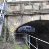
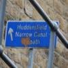
Queen Street South Bridge No 22
is a minor waterways place
on the Huddersfield Narrow Canal between
Golcar (2 miles and 2½ furlongs
and 11 locks
to the west) and
Aspley Basin (Huddersfield) (Moorings for Huddersfield and Junction of Huddersfield Broad and Narrow Canals) (3½ furlongs
and 1 lock
to the northeast).
The nearest place in the direction of Golcar is Bates Tunnel (eastern entrance);
a few yards
away.
The nearest place in the direction of Aspley Basin (Huddersfield) is Queen Street Cutting;
¼ furlongs
away.
There may be access to the towpath here.
Mooring here is unrated.
There is a bridge here which takes a minor road over the canal.
| Kirklees College Car Park Bridge No 23A | 1½ furlongs | |
| Chapel Hill Road Bridge No 23 | 1¼ furlongs | |
| Coal Wharf Lock No 2E | ¾ furlongs | |
| Bates Tunnel (western entrance) | ½ furlongs | |
| Bates Tunnel (eastern entrance) | a few yards | |
| Queen Street South Bridge No 22 | ||
| Queen Street Cutting | ¼ furlongs | |
| Site of Lock No 2E | ½ furlongs | |
| Commercial Street Bridge No 21 | 1 furlong | |
| University Footbridge No 20B | 1½ furlongs | |
| Stanley Dawson Lock No 1E | 1¾ furlongs | |
There are no links to external websites from here.
Why not log in and add some (select "External websites" from the menu (sometimes this is under "Edit"))?
Mouseover for more information or show routes to facility
Nearest water point
In the direction of Ashton-under-Lyne Junction
Waterside Lock No 21E — 4 miles, 2 furlongs and 19 locks away
On this waterway in the direction of Ashton-under-Lyne Junction
Slaithwaite Winding Hole — 4 miles, 2¾ furlongs and 20 locks away
On this waterway in the direction of Ashton-under-Lyne Junction
Standedge Tunnel (eastern entrance) — 7 miles, 5½ furlongs and 41 locks away
On this waterway in the direction of Ashton-under-Lyne Junction
Standedge Tunnel (western entrance) — 10 miles, 7½ furlongs and 41 locks away
On this waterway in the direction of Ashton-under-Lyne Junction
Wool Road Bridge No 70 — 12 miles, 7¼ furlongs and 50 locks away
On this waterway in the direction of Ashton-under-Lyne Junction
Grove Road Bridge No 96 — 18 miles, 7½ furlongs and 65 locks away
On this waterway in the direction of Ashton-under-Lyne Junction
In the direction of Aspley Basin (Huddersfield)
Aspley Basin (Huddersfield) — 3½ furlongs and 1 lock away
On this waterway in the direction of Aspley Basin (Huddersfield)
Shepley Bridge Sanitary Station — 7 miles, ¼ furlongs and 12 locks away
Travel to Aspley Basin (Huddersfield), then on the Huddersfield Broad Canal to Cooper Bridge Junction, then on the Calder and Hebble Navigation (Main Line) to Shepley Bridge Sanitary Station
Brighouse Basin — 6 miles, 2 furlongs and 14 locks away
Travel to Aspley Basin (Huddersfield), then on the Huddersfield Broad Canal to Cooper Bridge Junction, then on the Calder and Hebble Navigation (Main Line) to Brighouse Basin
Salterhebble Sanitary Station — 10 miles, 4 furlongs and 23 locks away
Travel to Aspley Basin (Huddersfield), then on the Huddersfield Broad Canal to Cooper Bridge Junction, then on the Calder and Hebble Navigation (Main Line) to Salterhebble Sanitary Station
Broad Cut Low Lock No 3 — 13 miles, 5¼ furlongs and 20 locks away
Travel to Aspley Basin (Huddersfield), then on the Huddersfield Broad Canal to Cooper Bridge Junction, then on the Calder and Hebble Navigation (Main Line) to Broad Cut Low Lock No 3
Salterhebble Junction — 10 miles, 4½ furlongs and 24 locks away
Travel to Aspley Basin (Huddersfield), then on the Huddersfield Broad Canal to Cooper Bridge Junction, then on the Calder and Hebble Navigation (Main Line) to Salterhebble Junction
Sowerby Bridge Basin — 12 miles, 6¼ furlongs and 24 locks away
Travel to Aspley Basin (Huddersfield), then on the Huddersfield Broad Canal to Cooper Bridge Junction, then on the Calder and Hebble Navigation (Main Line) to Salterhebble Junction, then on the Calder and Hebble Navigation (Main Line) to Sowerby Bridge Basin
Ramsdens Bridge Sanitary Station — 19 miles, 1 furlong and 24 locks away
Travel to Aspley Basin (Huddersfield), then on the Huddersfield Broad Canal to Cooper Bridge Junction, then on the Calder and Hebble Navigation (Main Line) to Fall Ing Junction, then on the Aire and Calder Navigation (Wakefield Section) to Ramsdens Bridge Sanitary Station
Stanley Ferry Water Point — 19 miles, 1½ furlongs and 24 locks away
Travel to Aspley Basin (Huddersfield), then on the Huddersfield Broad Canal to Cooper Bridge Junction, then on the Calder and Hebble Navigation (Main Line) to Fall Ing Junction, then on the Aire and Calder Navigation (Wakefield Section) to Stanley Ferry Water Point
Hebden Bridge Services — 18 miles, 1½ furlongs and 31 locks away
Travel to Aspley Basin (Huddersfield), then on the Huddersfield Broad Canal to Cooper Bridge Junction, then on the Calder and Hebble Navigation (Main Line) to Salterhebble Junction, then on the Calder and Hebble Navigation (Main Line) to Sowerby Bridge Junction, then on the Rochdale Canal to Hebden Bridge ServicesNearest rubbish disposal
In the direction of Ashton-under-Lyne Junction
Pickle Lock No 22E — 4 miles, 3¼ furlongs and 20 locks away
On this waterway in the direction of Ashton-under-Lyne Junction
Wool Road Visitor Mooring — 12 miles, 7¾ furlongs and 50 locks away
On this waterway in the direction of Ashton-under-Lyne Junction
In the direction of Aspley Basin (Huddersfield)
Aspley Basin (Huddersfield) — 3½ furlongs and 1 lock away
On this waterway in the direction of Aspley Basin (Huddersfield)
Shepley Bridge Sanitary Station — 7 miles, ¼ furlongs and 12 locks away
Travel to Aspley Basin (Huddersfield), then on the Huddersfield Broad Canal to Cooper Bridge Junction, then on the Calder and Hebble Navigation (Main Line) to Shepley Bridge Sanitary Station
Brighouse Lower Basin Visitor Moorings — 6 miles, 1¾ furlongs and 13 locks away
Travel to Aspley Basin (Huddersfield), then on the Huddersfield Broad Canal to Cooper Bridge Junction, then on the Calder and Hebble Navigation (Main Line) to Brighouse Lower Basin Visitor Moorings
Horbury Basin Residential Moorings & Sanitary Station — 11 miles, 4½ furlongs and 19 locks away
Travel to Aspley Basin (Huddersfield), then on the Huddersfield Broad Canal to Cooper Bridge Junction, then on the Calder and Hebble Navigation (Main Line) to Horbury Basin Residential Moorings & Sanitary Station
Salterhebble Sanitary Station — 10 miles, 4 furlongs and 23 locks away
Travel to Aspley Basin (Huddersfield), then on the Huddersfield Broad Canal to Cooper Bridge Junction, then on the Calder and Hebble Navigation (Main Line) to Salterhebble Sanitary Station
Sowerby Bridge Basin — 12 miles, 6¼ furlongs and 24 locks away
Travel to Aspley Basin (Huddersfield), then on the Huddersfield Broad Canal to Cooper Bridge Junction, then on the Calder and Hebble Navigation (Main Line) to Salterhebble Junction, then on the Calder and Hebble Navigation (Main Line) to Sowerby Bridge Basin
Ramsdens Bridge Visitor Moorings — 19 miles, 1¼ furlongs and 24 locks away
Travel to Aspley Basin (Huddersfield), then on the Huddersfield Broad Canal to Cooper Bridge Junction, then on the Calder and Hebble Navigation (Main Line) to Fall Ing Junction, then on the Aire and Calder Navigation (Wakefield Section) to Ramsdens Bridge Visitor Moorings
Hebden Bridge Services — 18 miles, 1½ furlongs and 31 locks away
Travel to Aspley Basin (Huddersfield), then on the Huddersfield Broad Canal to Cooper Bridge Junction, then on the Calder and Hebble Navigation (Main Line) to Salterhebble Junction, then on the Calder and Hebble Navigation (Main Line) to Sowerby Bridge Junction, then on the Rochdale Canal to Hebden Bridge ServicesNearest chemical toilet disposal
In the direction of Ashton-under-Lyne Junction
Waterside Lock No 21E — 4 miles, 2 furlongs and 19 locks away
On this waterway in the direction of Ashton-under-Lyne Junction
Pickle Lock No 22E — 4 miles, 3¼ furlongs and 20 locks away
On this waterway in the direction of Ashton-under-Lyne Junction
Wool Road Bridge No 70 — 12 miles, 7¼ furlongs and 50 locks away
On this waterway in the direction of Ashton-under-Lyne Junction
Grove Road Bridge No 96 — 18 miles, 7½ furlongs and 65 locks away
On this waterway in the direction of Ashton-under-Lyne Junction
In the direction of Aspley Basin (Huddersfield)
Aspley Basin (Huddersfield) — 3½ furlongs and 1 lock away
On this waterway in the direction of Aspley Basin (Huddersfield)
Shepley Bridge Sanitary Station — 7 miles, ¼ furlongs and 12 locks away
Travel to Aspley Basin (Huddersfield), then on the Huddersfield Broad Canal to Cooper Bridge Junction, then on the Calder and Hebble Navigation (Main Line) to Shepley Bridge Sanitary Station
Brighouse Basin — 6 miles, 2 furlongs and 14 locks away
Travel to Aspley Basin (Huddersfield), then on the Huddersfield Broad Canal to Cooper Bridge Junction, then on the Calder and Hebble Navigation (Main Line) to Brighouse Basin
Savile Town Wharf and Basin (Dewsbury) — 10 miles, 3¾ furlongs and 16 locks away
Travel to Aspley Basin (Huddersfield), then on the Huddersfield Broad Canal to Cooper Bridge Junction, then on the Calder and Hebble Navigation (Main Line) to Dewsbury Arm Junction, then on the Calder and Hebble Navigation (Dewsbury Old Cut) to Savile Town Wharf and Basin (Dewsbury)
Horbury Basin Residential Moorings & Sanitary Station — 11 miles, 4½ furlongs and 19 locks away
Travel to Aspley Basin (Huddersfield), then on the Huddersfield Broad Canal to Cooper Bridge Junction, then on the Calder and Hebble Navigation (Main Line) to Horbury Basin Residential Moorings & Sanitary Station
Salterhebble Sanitary Station — 10 miles, 4 furlongs and 23 locks away
Travel to Aspley Basin (Huddersfield), then on the Huddersfield Broad Canal to Cooper Bridge Junction, then on the Calder and Hebble Navigation (Main Line) to Salterhebble Sanitary Station
Sowerby Bridge Basin — 12 miles, 6¼ furlongs and 24 locks away
Travel to Aspley Basin (Huddersfield), then on the Huddersfield Broad Canal to Cooper Bridge Junction, then on the Calder and Hebble Navigation (Main Line) to Salterhebble Junction, then on the Calder and Hebble Navigation (Main Line) to Sowerby Bridge Basin
Ramsdens Bridge Sanitary Station — 19 miles, 1 furlong and 24 locks away
Travel to Aspley Basin (Huddersfield), then on the Huddersfield Broad Canal to Cooper Bridge Junction, then on the Calder and Hebble Navigation (Main Line) to Fall Ing Junction, then on the Aire and Calder Navigation (Wakefield Section) to Ramsdens Bridge Sanitary Station
Hebden Bridge Services — 18 miles, 1½ furlongs and 31 locks away
Travel to Aspley Basin (Huddersfield), then on the Huddersfield Broad Canal to Cooper Bridge Junction, then on the Calder and Hebble Navigation (Main Line) to Salterhebble Junction, then on the Calder and Hebble Navigation (Main Line) to Sowerby Bridge Junction, then on the Rochdale Canal to Hebden Bridge ServicesNearest place to turn
In the direction of Ashton-under-Lyne Junction
Isis Lock Winding Hole — 1 mile, 5¾ furlongs and 7 locks away
On this waterway in the direction of Ashton-under-Lyne Junction
Linthwaite Winding Hole — 3 miles, 2 furlongs and 15 locks away
On this waterway in the direction of Ashton-under-Lyne Junction
Slaithwaite Winding Hole — 4 miles, 2¾ furlongs and 20 locks away
On this waterway in the direction of Ashton-under-Lyne Junction
In the direction of Aspley Basin (Huddersfield)
University Arm — 3 furlongs and 1 lock away
On this waterway in the direction of Aspley Basin (Huddersfield)
Aspley Basin (Huddersfield) — 3½ furlongs and 1 lock away
On this waterway in the direction of Aspley Basin (Huddersfield)
Anchor Street Winding Hole — 1 mile, ½ furlongs and 1 lock away
Travel to Aspley Basin (Huddersfield), then on the Huddersfield Broad Canal to Anchor Street Winding Hole
New Road Winding Hole — 1 mile, 4 furlongs and 1 lock away
Travel to Aspley Basin (Huddersfield), then on the Huddersfield Broad Canal to New Road Winding Hole
Deighton Road Bridge Winding Hole — 2 miles, 5¾ furlongs and 6 locks away
Travel to Aspley Basin (Huddersfield), then on the Huddersfield Broad Canal to Deighton Road Bridge Winding Hole
Cooper Bridge Junction — 3 miles, 7½ furlongs and 10 locks away
Travel to Aspley Basin (Huddersfield), then on the Huddersfield Broad Canal to Cooper Bridge Junction
Battye Weir Entrance — 4 miles, 4¾ furlongs and 11 locks away
Travel to Aspley Basin (Huddersfield), then on the Huddersfield Broad Canal to Cooper Bridge Junction, then on the Calder and Hebble Navigation (Main Line) to Battye Weir Entrance
Shepley Bridge Marina — 7 miles, ½ furlongs and 12 locks away
Travel to Aspley Basin (Huddersfield), then on the Huddersfield Broad Canal to Cooper Bridge Junction, then on the Calder and Hebble Navigation (Main Line) to Shepley Bridge Marina
Brighouse Basin — 6 miles, 2 furlongs and 14 locks away
Travel to Aspley Basin (Huddersfield), then on the Huddersfield Broad Canal to Cooper Bridge Junction, then on the Calder and Hebble Navigation (Main Line) to Brighouse Basin
Ganny Winding Hole — 6 miles, 7½ furlongs and 15 locks away
Travel to Aspley Basin (Huddersfield), then on the Huddersfield Broad Canal to Cooper Bridge Junction, then on the Calder and Hebble Navigation (Main Line) to Ganny Winding Hole
Dewsbury Arm Junction — 9 miles, 3¾ furlongs and 16 locks away
Travel to Aspley Basin (Huddersfield), then on the Huddersfield Broad Canal to Cooper Bridge Junction, then on the Calder and Hebble Navigation (Main Line) to Dewsbury Arm Junction
Savile Town Wharf and Basin (Dewsbury) — 10 miles, 3¾ furlongs and 16 locks away
Travel to Aspley Basin (Huddersfield), then on the Huddersfield Broad Canal to Cooper Bridge Junction, then on the Calder and Hebble Navigation (Main Line) to Dewsbury Arm Junction, then on the Calder and Hebble Navigation (Dewsbury Old Cut) to Savile Town Wharf and Basin (Dewsbury)
Horbury Basin Residential Moorings & Sanitary Station — 11 miles, 4½ furlongs and 19 locks away
Travel to Aspley Basin (Huddersfield), then on the Huddersfield Broad Canal to Cooper Bridge Junction, then on the Calder and Hebble Navigation (Main Line) to Horbury Basin Residential Moorings & Sanitary Station
Salterhebble Wharf — 10 miles, 3½ furlongs and 22 locks away
Travel to Aspley Basin (Huddersfield), then on the Huddersfield Broad Canal to Cooper Bridge Junction, then on the Calder and Hebble Navigation (Main Line) to Salterhebble Wharf
Salterhebble Bottom Basin Visitor Moorings — 10 miles, 3½ furlongs and 22 locks away
Travel to Aspley Basin (Huddersfield), then on the Huddersfield Broad Canal to Cooper Bridge Junction, then on the Calder and Hebble Navigation (Main Line) to Salterhebble Bottom Basin Visitor Moorings
Salterhebble Sanitary Station — 10 miles, 4 furlongs and 23 locks away
Travel to Aspley Basin (Huddersfield), then on the Huddersfield Broad Canal to Cooper Bridge Junction, then on the Calder and Hebble Navigation (Main Line) to Salterhebble Sanitary Station
Waller Bridge Winding Hole — 13 miles, 3½ furlongs and 20 locks away
Travel to Aspley Basin (Huddersfield), then on the Huddersfield Broad Canal to Cooper Bridge Junction, then on the Calder and Hebble Navigation (Main Line) to Waller Bridge Winding HoleNearest self-operated pump-out
In the direction of Ashton-under-Lyne Junction
Slaithwaite Winding Hole — 4 miles, 2¾ furlongs and 20 locks away
On this waterway in the direction of Ashton-under-Lyne Junction
Wool Road Bridge No 70 — 12 miles, 7¼ furlongs and 50 locks away
On this waterway in the direction of Ashton-under-Lyne Junction
In the direction of Aspley Basin (Huddersfield)
Ramsdens Bridge Sanitary Station — 19 miles, 1 furlong and 24 locks away
Travel to Aspley Basin (Huddersfield), then on the Huddersfield Broad Canal to Cooper Bridge Junction, then on the Calder and Hebble Navigation (Main Line) to Fall Ing Junction, then on the Aire and Calder Navigation (Wakefield Section) to Ramsdens Bridge Sanitary Station
Hebden Bridge Services — 18 miles, 1½ furlongs and 31 locks away
Travel to Aspley Basin (Huddersfield), then on the Huddersfield Broad Canal to Cooper Bridge Junction, then on the Calder and Hebble Navigation (Main Line) to Salterhebble Junction, then on the Calder and Hebble Navigation (Main Line) to Sowerby Bridge Junction, then on the Rochdale Canal to Hebden Bridge ServicesNearest boatyard pump-out
In the direction of Aspley Basin (Huddersfield)
Aspley Basin (Huddersfield) — 3½ furlongs and 1 lock away
On this waterway in the direction of Aspley Basin (Huddersfield)
Shepley Bridge Marina — 7 miles, ½ furlongs and 12 locks away
Travel to Aspley Basin (Huddersfield), then on the Huddersfield Broad Canal to Cooper Bridge Junction, then on the Calder and Hebble Navigation (Main Line) to Shepley Bridge Marina
Sowerby Bridge Basin — 12 miles, 6¼ furlongs and 24 locks away
Travel to Aspley Basin (Huddersfield), then on the Huddersfield Broad Canal to Cooper Bridge Junction, then on the Calder and Hebble Navigation (Main Line) to Salterhebble Junction, then on the Calder and Hebble Navigation (Main Line) to Sowerby Bridge BasinDirection of TV transmitter (From Wolfbane Cybernetic)
There is no page on Wikipedia called “Queen Street South Bridge”
Wikipedia pages that might relate to Queen Street South Bridge
[Queen Street (Toronto)]
Queen Street is a major east-west thoroughfare in Toronto, Ontario, Canada. It extends from Roncesvalles Avenue and King Street in the west to Victoria
[Huddersfield Narrow Canal]
Due to a legal quirk, the stretch of the canal from Lock 1E to Queen Street South Bridge was not included in the original abandonment of the canal. Whilst
[Queen Street, London]
Southwark Bridge up to the Guildhall. Queen Street meets the newer Queen Victoria Street as well as Cannon Street. Minor roads off the street include Skinners
[Bank Street Bridge]
The Bank Street Bridge, officially known as the Bank Street Canal Bridge, is a bridge in Ottawa, Ontario, Canada, that carries Bank Street over the Rideau
[Queen Street Viaduct]
The Queen Street Viaduct (usually known as the Queen Street Bridge) in Toronto, Canada carries vehicles and Toronto Transit Commission streetcars along
[Glasgow Queen Street railway station]
George Street to the south and Cathedral Street Bridge to the north, at the northern end of Queen Street adjacent to George Square. Queen Street station
[List of north–south roads in Toronto]
only referred to the section south of Queen Street. In 1870, the section north of Queen Street became part of Bathurst Street. It was known until then as
[Queen Street, Brisbane]
road, partly covered by a pedestrian mall called the Queen Street Mall. It ends at the Victoria Bridge and is bounded by two of the Brisbane River's central
[London Bridge]
William IV and Queen Adelaide attended a banquet in a pavilion erected on the bridge. The northern approach road, King William Street, was renamed after
[Royal Mile]
George IV Bridge on the right (south) and Bank Street on the left (north), leading to The Mound and the New Town. The view down Bank Street is closed
Results of Google Search
Disclaimer: School attendance zone boundaries are not guaranteed to be accurate – they are provided by a third party and subject to change. Check with the ...
Sheila Abdallah, MD 29 Orchard Street Southbridge MA 01550. Benjamin Alfred, NP 26 Queen Street Worcester, MA 01610. Shadie Barjrami, NP 26 Queen ...
Nov 4, 2020 ... SOUTH Queen Street, Exit Speed 30 M.P.H. sign. South York Plaza. Food Symbol ... 22, Speed Limit 65 sign, Speed Limit 55 sign. 24, PA 238 ...
26 Queen Street (main site) Worcester, MA 01610. Family Health Center - Southbridge. 29 Orchard Street (Family Medicine) 32 Orchard Street (Family Dental ...
Beginning at 10 tonight, routes along soutbound Harbor Scenic Drive and ... If traveling west on Ocean Boulevard from downtown Long Beach toward the bridge, motorists will be ... The alternate detour to the Queen Mary is, if traveling south on I-710, take the ... Upcoming Events. Current Month. december, 2020. No Events ...
Nov 15, 2020 ... While it is more of a north-south freeway, it is signed east-west, and is the only road to enter all five boroughs of NYC. ... Targee Street, Exit 13A ... No trucks over 33 feet, Exit 17 ... 3rd Avenue, Exit 22 ... All trucks to Manhattan Bridge 5am-3pm Monday-Friday, Exit 29 ... Borough of Queens, Kings County
Pearl Street is a street in the Financial District in Lower Manhattan, running northeast from Battery Park to the Brooklyn Bridge with an interruption at Fulton Street, where Pearl Street's alignment west of Fulton Street shifts one block south of ... The "Great" was used often to differentiate from Little Queen Street, which became ...
Linn County Weight Restricted Bridges (Red Dot on C22 Route Map Attachment) ... Drive). Thomas Creek. 0.10 miles South Hwy 226. 11' 03". Hoffman Covered Bridge (Hungry Hill ... Road Name (Number) ... Queen Avenue/Oakville Road.
COVID-19 Testing Sites in Massachusetts – December 22. Do you need a ... No. Yes. Yes. Massachusetts. General RIC. (Boston). 55 Fruit St,. Boston, MA. 02114. Boston ... Street South. Easton Covid- ... Bridge Street -. Lowell ... 26 Queen St,.

![Huddersfield - mills on Queen Street South. Taken from the canal bridge. A view from the opposing direction is provided at [[1845080]]. by Dave Bevis – 03 May 2010](https://s1.geograph.org.uk/geophotos/01/84/50/1845085_3806e3bb_120x120.jpg)


![Priestroyd Mill, Firth Street, Huddersfield. A former mill built in 1869. Now converted to apartments, & incorporating the 1535 Bar/Restaurant. See Chris Allen's photo taken in 1988 [[702137]]. by Stephen Armstrong – 10 March 2010](https://s1.geograph.org.uk/geophotos/01/77/53/1775357_9f9b3d7b_120x120.jpg)
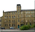


![Chimney, Bates Mill [sic], Huddersfield. Although there is a sign on the building stating Bates Mill, this is more properly known as Fairfield Mills to the best of my knowledge although occupied by Bates and Company. The mill remains in textile production. There are relatively few chimneys left in Huddersfield and this is a fine example. There were still quite a few when I was growing up there in the 1970s and even when I turned to photographing the Colne Valley in the 1980s. by Chris Allen – 02 November 2017](https://s3.geograph.org.uk/geophotos/06/62/05/6620563_240d5c93_120x120.jpg)

![Priestroyd Mill, Huddersfield. There is an excellent photograph of this mill in Satanic Mills - Industrial Architecture in the Pennines, published by SAVE Britain's Heritage (not dated but c1980 at a guess) that shows a tall corner tower. This was truncated following a fire in 1977. There are also two chimneys visible and they have also gone. I would recommend Satanic Mills and Through the Mill as two books for those interested in Yorkshire (and Lancashire) textiles.The tower has now been rebuilt - see [[1775357]] by Chris Allen – 01 May 1988](https://s1.geograph.org.uk/photos/70/21/702137_081fa5ee_120x120.jpg)


![Derelict Lock 2E, Huddersfield Narrow Canal. This picture was taken well before restoration of this section of the Huddersfield Narrow Canal commenced and shows the original Lock 2E with its original gates but in a derelict condition. Just beyond here the canal passes under Queen Street bridge beyond which the original route was obstructed by the buildings of Bates & Co. When the canal was restored in 2000-2001 the level of the canal beyond the lock in the picture was lowered so as to pass through a newly constructed tunnel under the obstruction and a new lock 2E was built beyond. The chamber walls of the original lock 2E remain to this day however now boats simply sail through and into the deep cutting beyond. [[2118]]The buildings on the right have long since been demolished whilst those on the left have been turned into upmarket flats and university halls of residence. Notably the building in the centre of the picture has been re-roofed and lost its gable end. by David Stowell – 13 April 1975](https://s1.geograph.org.uk/photos/20/08/200897_f472f925_120x120.jpg)