Crane Brook Culvert
is a minor waterways place
on the Birmingham Canal Navigations (Lichfield Canal (Under Restoration)) between
Ogley Junction (Junction of the Wyrley and Essington and Lichfield Canals with the Anglesey Branch) (6 furlongs
and 7 locks
to the west) and
Huddlesford Junction (Junction of the Lichfield Canal with the Coventry Canal (Detached Portion)) (6 miles and 4½ furlongs
and 23 locks
to the east).
The nearest place in the direction of Ogley Junction is Ogley 1st. Flight Lock No 8 (New Lock 8 resited due to M6 Toll Road);
½ furlongs
away.
The nearest place in the direction of Huddlesford Junction is Crane Brook Quarry;
1¾ furlongs
away.
Mooring here is unrated.
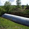
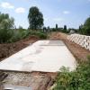
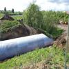
There is a small aqueduct or underbridge here which takes a stream under the canal.
Ogley 1st. Flight Lock No 7 | 1¾ furlongs | |
Ogley 1st. Flight Old Lock No 8 | ¾ furlongs | |
Lichfield Canal Aqueduct (western end) | ¾ furlongs | |
Lichfield Canal Aqueduct (eastern end) | ½ furlongs | |
Ogley 1st. Flight Lock No 8 | ½ furlongs | |
Crane Brook Culvert | ||
Crane Brook Quarry | 1¾ furlongs | |
Site of Old Sand Wharf | 3¾ furlongs | |
Ogley 1st. Flight Lock No 9A | 4½ furlongs | |
Boat Inn Pipe Bridge | 4½ furlongs | |
Boat Inn Tunnel (western entrance) | 4¾ furlongs |
- Birmingham Canal Walks — associated with Birmingham Canal Navigations
- Sixteen walks along the Birmingham Canal Navigations with a detailed description, history and photographs.
- LHCRT Home Page — associated with Birmingham Canal Navigations (Lichfield Canal (Under Restoration))
- Lichfield & Hatherton Canals Restoration Trust Web Site
Mouseover for more information or show routes to facility
Nearest water point
In the direction of Huddlesford Junction
Kings Orchard Marina — 7 miles, 1¾ furlongs and 23 locks away
Travel to Huddlesford Junction, then on the Coventry Canal (Detached Portion) to Kings Orchard Marina
Streethay Wharf — 7 miles, 3¾ furlongs and 23 locks away
Travel to Huddlesford Junction, then on the Coventry Canal (Detached Portion) to Streethay Wharf
Fradley Visitor Moorings (48 hour) — 10 miles, 3½ furlongs and 23 locks away
Travel to Huddlesford Junction, then on the Coventry Canal (Detached Portion) to Fradley Visitor Moorings (48 hour)
Fradley Swing Bridge — 10 miles, 4 furlongs and 23 locks away
Travel to Huddlesford Junction, then on the Coventry Canal (Detached Portion) to Fradley Swing Bridge
Shop and Marine Services at Fradley Junction — 10 miles, 4½ furlongs and 23 locks away
Travel to Huddlesford Junction, then on the Coventry Canal (Detached Portion) to Fradley Junction, then on the Trent and Mersey Canal (Main Line - Fradley to Great Haywood) to Shop and Marine Services at Fradley Junction
Fradley Visitor Centre — 10 miles, 5½ furlongs and 24 locks away
Travel to Huddlesford Junction, then on the Coventry Canal (Detached Portion) to Fradley Junction, then on the Trent and Mersey Canal (Main Line - Burton to Fradley) to Fradley Visitor Centre
Fradley Canalside Café — 10 miles, 5¾ furlongs and 24 locks away
Travel to Huddlesford Junction, then on the Coventry Canal (Detached Portion) to Fradley Junction, then on the Trent and Mersey Canal (Main Line - Burton to Fradley) to Fradley Canalside Café
Fazeley Junction — 13 miles, 4½ furlongs and 23 locks away
Travel to Huddlesford Junction, then on the Coventry Canal (Detached Portion) to Whittington Brook, then on the Birmingham Canal Navigations (Birmingham and Fazeley Canal - along route of Coventry Canal) to Fazeley Junction
Coleshill Road Bridge Water Point — 14 miles and 23 locks away
Travel to Huddlesford Junction, then on the Coventry Canal (Detached Portion) to Whittington Brook, then on the Birmingham Canal Navigations (Birmingham and Fazeley Canal - along route of Coventry Canal) to Fazeley Junction, then on the Birmingham Canal Navigations (Birmingham and Fazeley Canal - Main Line) to Coleshill Road Bridge Water Point
Glascote Top Lock No 12 — 15 miles and 24 locks away
Travel to Huddlesford Junction, then on the Coventry Canal (Detached Portion) to Whittington Brook, then on the Birmingham Canal Navigations (Birmingham and Fazeley Canal - along route of Coventry Canal) to Fazeley Junction, then on the Coventry Canal (Main Line - Hawkesbury to Fazeley) to Glascote Top Lock No 12
Gaskells Bridge No 46 — 12 miles, 7¾ furlongs and 28 locks away
Travel to Huddlesford Junction, then on the Coventry Canal (Detached Portion) to Fradley Junction, then on the Trent and Mersey Canal (Main Line - Burton to Fradley) to Gaskells Bridge No 46
In the direction of Ogley Junction
LMS Railway Interchange Basins — 2 miles, 1¾ furlongs and 7 locks away
Travel to Ogley Junction, then on the Birmingham Canal Navigations (Wyrley and Essington Canal) to LMS Railway Interchange Basins
Aldridge Marina — 3 miles, 4½ furlongs and 7 locks away
Travel to Ogley Junction, then on the Birmingham Canal Navigations (Wyrley and Essington Canal) to Catshill Junction, then on the Birmingham Canal Navigations (Daw End Branch) to Aldridge Marina
Longwood Junction — 7 miles, ½ furlongs and 7 locks away
Travel to Ogley Junction, then on the Birmingham Canal Navigations (Wyrley and Essington Canal) to Catshill Junction, then on the Birmingham Canal Navigations (Daw End Branch) to Longwood Junction
Sneyd Wharf — 10 miles, 6¼ furlongs and 7 locks away
Travel to Ogley Junction, then on the Birmingham Canal Navigations (Wyrley and Essington Canal) to Sneyd Wharf
Broad Street Basin — 17 miles, 5½ furlongs and 7 locks away
Travel to Ogley Junction, then on the Birmingham Canal Navigations (Wyrley and Essington Canal) to Horseley Fields Junction, then on the Birmingham Canal Navigations (Main Line) to Broad Street Basin
Perry Barr Top Lock Services — 11 miles, 7¾ furlongs and 16 locks away
Travel to Ogley Junction, then on the Birmingham Canal Navigations (Wyrley and Essington Canal) to Catshill Junction, then on the Birmingham Canal Navigations (Daw End Branch) to Longwood Junction, then on the Birmingham Canal Navigations (Rushall Canal) to Tame Valley - Rushall Junction, then on the Birmingham Canal Navigations (Tame Valley Canal) to Perry Barr Top Lock Services
Lower Ocker Hill Branch Junction — 13 miles, 3¼ furlongs and 16 locks away
Travel to Ogley Junction, then on the Birmingham Canal Navigations (Wyrley and Essington Canal) to Catshill Junction, then on the Birmingham Canal Navigations (Daw End Branch) to Longwood Junction, then on the Birmingham Canal Navigations (Rushall Canal) to Tame Valley - Rushall Junction, then on the Birmingham Canal Navigations (Tame Valley Canal) to Tame Valley Junction, then on the Birmingham Canal Navigations (Walsall Canal) to Lower Ocker Hill Branch Junction
Gailey Wharf — 14 miles, 5 furlongs and 24 locks away
Travel to Ogley Junction, then on the Birmingham Canal Navigations (Wyrley and Essington Canal) to Fishley Junction (under restoration), then on the Birmingham Canal Navigations (Lords Hayes Branch (Under Restoration)) to Lords Hayes Branch - Hatherton Canal Junction (under restoration), then on the Staffordshire and Worcestershire Canal (Hatherton Canal) to Hatherton Junction, then on the Staffordshire and Worcestershire Canal (Main Line: Autherley to Great Haywood) to Gailey Wharf
C&RT Bradley Workshops — 15 miles, 2¼ furlongs and 25 locks away
Travel to Ogley Junction, then on the Birmingham Canal Navigations (Wyrley and Essington Canal) to Birchills Junction, then on the Birmingham Canal Navigations (Walsall Junction Canal) to Walsall Junction, then on the Birmingham Canal Navigations (Walsall Canal) to Moorcroft Junction, then on the Birmingham Canal Navigations (Bradley Canal (under restoration)) to C&RT Bradley WorkshopsNearest rubbish disposal
In the direction of Huddlesford Junction
Fradley Visitor Centre — 10 miles, 5½ furlongs and 24 locks away
Travel to Huddlesford Junction, then on the Coventry Canal (Detached Portion) to Fradley Junction, then on the Trent and Mersey Canal (Main Line - Burton to Fradley) to Fradley Visitor Centre
Bodymoor Heath Wharf — 17 miles, 3 furlongs and 25 locks away
Travel to Huddlesford Junction, then on the Coventry Canal (Detached Portion) to Whittington Brook, then on the Birmingham Canal Navigations (Birmingham and Fazeley Canal - along route of Coventry Canal) to Fazeley Junction, then on the Birmingham Canal Navigations (Birmingham and Fazeley Canal - Main Line) to Bodymoor Heath Wharf
In the direction of Ogley Junction
LMS Railway Interchange Basins — 2 miles, 1¾ furlongs and 7 locks away
Travel to Ogley Junction, then on the Birmingham Canal Navigations (Wyrley and Essington Canal) to LMS Railway Interchange Basins
Aldridge Marina — 3 miles, 4½ furlongs and 7 locks away
Travel to Ogley Junction, then on the Birmingham Canal Navigations (Wyrley and Essington Canal) to Catshill Junction, then on the Birmingham Canal Navigations (Daw End Branch) to Aldridge Marina
Longwood Junction — 7 miles, ½ furlongs and 7 locks away
Travel to Ogley Junction, then on the Birmingham Canal Navigations (Wyrley and Essington Canal) to Catshill Junction, then on the Birmingham Canal Navigations (Daw End Branch) to Longwood Junction
Broad Street Basin — 17 miles, 5½ furlongs and 7 locks away
Travel to Ogley Junction, then on the Birmingham Canal Navigations (Wyrley and Essington Canal) to Horseley Fields Junction, then on the Birmingham Canal Navigations (Main Line) to Broad Street Basin
Perry Barr Top Lock Services — 11 miles, 7¾ furlongs and 16 locks away
Travel to Ogley Junction, then on the Birmingham Canal Navigations (Wyrley and Essington Canal) to Catshill Junction, then on the Birmingham Canal Navigations (Daw End Branch) to Longwood Junction, then on the Birmingham Canal Navigations (Rushall Canal) to Tame Valley - Rushall Junction, then on the Birmingham Canal Navigations (Tame Valley Canal) to Perry Barr Top Lock Services
Lower Ocker Hill Branch Junction — 13 miles, 3¼ furlongs and 16 locks away
Travel to Ogley Junction, then on the Birmingham Canal Navigations (Wyrley and Essington Canal) to Catshill Junction, then on the Birmingham Canal Navigations (Daw End Branch) to Longwood Junction, then on the Birmingham Canal Navigations (Rushall Canal) to Tame Valley - Rushall Junction, then on the Birmingham Canal Navigations (Tame Valley Canal) to Tame Valley Junction, then on the Birmingham Canal Navigations (Walsall Canal) to Lower Ocker Hill Branch Junction
Wolverhampton Lock No 9 — 18 miles, 3 furlongs and 15 locks away
Travel to Ogley Junction, then on the Birmingham Canal Navigations (Wyrley and Essington Canal) to Horseley Fields Junction, then on the Birmingham Canal Navigations (Main Line) to Wolverhampton Lock No 9
Gailey Wharf — 14 miles, 5 furlongs and 24 locks away
Travel to Ogley Junction, then on the Birmingham Canal Navigations (Wyrley and Essington Canal) to Fishley Junction (under restoration), then on the Birmingham Canal Navigations (Lords Hayes Branch (Under Restoration)) to Lords Hayes Branch - Hatherton Canal Junction (under restoration), then on the Staffordshire and Worcestershire Canal (Hatherton Canal) to Hatherton Junction, then on the Staffordshire and Worcestershire Canal (Main Line: Autherley to Great Haywood) to Gailey Wharf
C&RT Bradley Workshops — 15 miles, 2¼ furlongs and 25 locks away
Travel to Ogley Junction, then on the Birmingham Canal Navigations (Wyrley and Essington Canal) to Birchills Junction, then on the Birmingham Canal Navigations (Walsall Junction Canal) to Walsall Junction, then on the Birmingham Canal Navigations (Walsall Canal) to Moorcroft Junction, then on the Birmingham Canal Navigations (Bradley Canal (under restoration)) to C&RT Bradley Workshops
Autherley Junction Bridge No 1 — 17 miles, 5¼ furlongs and 24 locks away
Travel to Ogley Junction, then on the Birmingham Canal Navigations (Wyrley and Essington Canal) to Fishley Junction (under restoration), then on the Birmingham Canal Navigations (Lords Hayes Branch (Under Restoration)) to Lords Hayes Branch - Hatherton Canal Junction (under restoration), then on the Staffordshire and Worcestershire Canal (Hatherton Canal) to Hatherton Junction, then on the Staffordshire and Worcestershire Canal (Main Line: Autherley to Great Haywood) to Autherley Junction, then on the Shropshire Union Canal (Birmingham and Liverpool Junction Canal - Main Line) to Autherley Junction Bridge No 1
Handsworth Wharf Winding Hole — 18 miles, 5½ furlongs and 27 locks away
Travel to Ogley Junction, then on the Birmingham Canal Navigations (Wyrley and Essington Canal) to Catshill Junction, then on the Birmingham Canal Navigations (Daw End Branch) to Longwood Junction, then on the Birmingham Canal Navigations (Rushall Canal) to Tame Valley - Rushall Junction, then on the Birmingham Canal Navigations (Tame Valley Canal) to Tame Valley Junction, then on the Birmingham Canal Navigations (Walsall Canal) to Ryders Green Junction, then on the Birmingham Canal Navigations (Wednesbury Old Canal - Main Line) to Pudding Green Junction, then on the Birmingham Canal Navigations (Main Line) to Bromford Junction, then on the Birmingham Canal Navigations (Spon Lane Locks Branch) to Spon Lane Junction, then on the Birmingham Canal Navigations (Old Main Line) to Engine Arm Junction, then on the Birmingham Canal Navigations (Engine Arm) to Handsworth Wharf Winding Hole
Penkridge Sanitary Station — 17 miles, 2¼ furlongs and 30 locks away
Travel to Ogley Junction, then on the Birmingham Canal Navigations (Wyrley and Essington Canal) to Fishley Junction (under restoration), then on the Birmingham Canal Navigations (Lords Hayes Branch (Under Restoration)) to Lords Hayes Branch - Hatherton Canal Junction (under restoration), then on the Staffordshire and Worcestershire Canal (Hatherton Canal) to Hatherton Junction, then on the Staffordshire and Worcestershire Canal (Main Line: Autherley to Great Haywood) to Penkridge Sanitary Station
Minworth Services — 17 miles, 5¼ furlongs and 30 locks away
Travel to Ogley Junction, then on the Birmingham Canal Navigations (Wyrley and Essington Canal) to Catshill Junction, then on the Birmingham Canal Navigations (Daw End Branch) to Longwood Junction, then on the Birmingham Canal Navigations (Rushall Canal) to Tame Valley - Rushall Junction, then on the Birmingham Canal Navigations (Tame Valley Canal) to Salford Junction (north), then on the Birmingham Canal Navigations (Birmingham and Fazeley Canal - Main Line) to Minworth ServicesNearest chemical toilet disposal
In the direction of Huddlesford Junction
Fradley Visitor Centre — 10 miles, 5½ furlongs and 24 locks away
Travel to Huddlesford Junction, then on the Coventry Canal (Detached Portion) to Fradley Junction, then on the Trent and Mersey Canal (Main Line - Burton to Fradley) to Fradley Visitor Centre
Alvecote Marina — 17 miles, 2¾ furlongs and 25 locks away
Travel to Huddlesford Junction, then on the Coventry Canal (Detached Portion) to Whittington Brook, then on the Birmingham Canal Navigations (Birmingham and Fazeley Canal - along route of Coventry Canal) to Fazeley Junction, then on the Coventry Canal (Main Line - Hawkesbury to Fazeley) to Alvecote Marina
In the direction of Ogley Junction
LMS Railway Interchange Basins — 2 miles, 1¾ furlongs and 7 locks away
Travel to Ogley Junction, then on the Birmingham Canal Navigations (Wyrley and Essington Canal) to LMS Railway Interchange Basins
Longwood Junction — 7 miles, ½ furlongs and 7 locks away
Travel to Ogley Junction, then on the Birmingham Canal Navigations (Wyrley and Essington Canal) to Catshill Junction, then on the Birmingham Canal Navigations (Daw End Branch) to Longwood Junction
Sneyd Wharf — 10 miles, 6¼ furlongs and 7 locks away
Travel to Ogley Junction, then on the Birmingham Canal Navigations (Wyrley and Essington Canal) to Sneyd Wharf
Broad Street Basin — 17 miles, 5½ furlongs and 7 locks away
Travel to Ogley Junction, then on the Birmingham Canal Navigations (Wyrley and Essington Canal) to Horseley Fields Junction, then on the Birmingham Canal Navigations (Main Line) to Broad Street Basin
Perry Barr Top Lock Services — 11 miles, 7¾ furlongs and 16 locks away
Travel to Ogley Junction, then on the Birmingham Canal Navigations (Wyrley and Essington Canal) to Catshill Junction, then on the Birmingham Canal Navigations (Daw End Branch) to Longwood Junction, then on the Birmingham Canal Navigations (Rushall Canal) to Tame Valley - Rushall Junction, then on the Birmingham Canal Navigations (Tame Valley Canal) to Perry Barr Top Lock Services
Lower Ocker Hill Branch Junction — 13 miles, 3¼ furlongs and 16 locks away
Travel to Ogley Junction, then on the Birmingham Canal Navigations (Wyrley and Essington Canal) to Catshill Junction, then on the Birmingham Canal Navigations (Daw End Branch) to Longwood Junction, then on the Birmingham Canal Navigations (Rushall Canal) to Tame Valley - Rushall Junction, then on the Birmingham Canal Navigations (Tame Valley Canal) to Tame Valley Junction, then on the Birmingham Canal Navigations (Walsall Canal) to Lower Ocker Hill Branch Junction
Gailey Wharf — 14 miles, 5 furlongs and 24 locks away
Travel to Ogley Junction, then on the Birmingham Canal Navigations (Wyrley and Essington Canal) to Fishley Junction (under restoration), then on the Birmingham Canal Navigations (Lords Hayes Branch (Under Restoration)) to Lords Hayes Branch - Hatherton Canal Junction (under restoration), then on the Staffordshire and Worcestershire Canal (Hatherton Canal) to Hatherton Junction, then on the Staffordshire and Worcestershire Canal (Main Line: Autherley to Great Haywood) to Gailey Wharf
Cuckoo Wharf — 15 miles, 1¼ furlongs and 29 locks away
Travel to Ogley Junction, then on the Birmingham Canal Navigations (Wyrley and Essington Canal) to Catshill Junction, then on the Birmingham Canal Navigations (Daw End Branch) to Longwood Junction, then on the Birmingham Canal Navigations (Rushall Canal) to Tame Valley - Rushall Junction, then on the Birmingham Canal Navigations (Tame Valley Canal) to Salford Junction (north), then on the Birmingham Canal Navigations (Birmingham and Fazeley Canal - Main Line) to Cuckoo Wharf
Handsworth Wharf Winding Hole — 18 miles, 5½ furlongs and 27 locks away
Travel to Ogley Junction, then on the Birmingham Canal Navigations (Wyrley and Essington Canal) to Catshill Junction, then on the Birmingham Canal Navigations (Daw End Branch) to Longwood Junction, then on the Birmingham Canal Navigations (Rushall Canal) to Tame Valley - Rushall Junction, then on the Birmingham Canal Navigations (Tame Valley Canal) to Tame Valley Junction, then on the Birmingham Canal Navigations (Walsall Canal) to Ryders Green Junction, then on the Birmingham Canal Navigations (Wednesbury Old Canal - Main Line) to Pudding Green Junction, then on the Birmingham Canal Navigations (Main Line) to Bromford Junction, then on the Birmingham Canal Navigations (Spon Lane Locks Branch) to Spon Lane Junction, then on the Birmingham Canal Navigations (Old Main Line) to Engine Arm Junction, then on the Birmingham Canal Navigations (Engine Arm) to Handsworth Wharf Winding Hole
Penkridge Sanitary Station — 17 miles, 2¼ furlongs and 30 locks away
Travel to Ogley Junction, then on the Birmingham Canal Navigations (Wyrley and Essington Canal) to Fishley Junction (under restoration), then on the Birmingham Canal Navigations (Lords Hayes Branch (Under Restoration)) to Lords Hayes Branch - Hatherton Canal Junction (under restoration), then on the Staffordshire and Worcestershire Canal (Hatherton Canal) to Hatherton Junction, then on the Staffordshire and Worcestershire Canal (Main Line: Autherley to Great Haywood) to Penkridge Sanitary Station
Minworth Services — 17 miles, 5¼ furlongs and 30 locks away
Travel to Ogley Junction, then on the Birmingham Canal Navigations (Wyrley and Essington Canal) to Catshill Junction, then on the Birmingham Canal Navigations (Daw End Branch) to Longwood Junction, then on the Birmingham Canal Navigations (Rushall Canal) to Tame Valley - Rushall Junction, then on the Birmingham Canal Navigations (Tame Valley Canal) to Salford Junction (north), then on the Birmingham Canal Navigations (Birmingham and Fazeley Canal - Main Line) to Minworth ServicesNearest place to turn
In the direction of Huddlesford Junction
Railway Winding Hole (Lichfield) — 3 miles, 3 furlongs and 11 locks away
On this waterway in the direction of Huddlesford Junction
In the direction of Ogley Junction
Ogley Junction — 6 furlongs and 7 locks away
On this waterway in the direction of Ogley Junction
Ogley Winding Hole — 7½ furlongs and 7 locks away
Travel to Ogley Junction, then on the Birmingham Canal Navigations (Wyrley and Essington Canal) to Ogley Winding Hole
Catshill Junction — 1 mile, 6 furlongs and 7 locks away
Travel to Ogley Junction, then on the Birmingham Canal Navigations (Wyrley and Essington Canal) to Catshill Junction
Anglesey Wharf — 1 mile, 7¾ furlongs and 7 locks away
Travel to Ogley Junction, then on the Birmingham Canal Navigations (Anglesey Branch) to Anglesey Wharf
LMS Railway Interchange Basins — 2 miles, 1¾ furlongs and 7 locks away
Travel to Ogley Junction, then on the Birmingham Canal Navigations (Wyrley and Essington Canal) to LMS Railway Interchange Basins
Anglesey Basin — 2 miles, 2 furlongs and 7 locks away
Travel to Ogley Junction, then on the Birmingham Canal Navigations (Anglesey Branch) to Anglesey Basin
Aldridge Marina — 3 miles, 4½ furlongs and 7 locks away
Travel to Ogley Junction, then on the Birmingham Canal Navigations (Wyrley and Essington Canal) to Catshill Junction, then on the Birmingham Canal Navigations (Daw End Branch) to Aldridge Marina
Pelsall Junction — 4 miles, 2 furlongs and 7 locks away
Travel to Ogley Junction, then on the Birmingham Canal Navigations (Wyrley and Essington Canal) to Pelsall Junction
Fishley Junction (under restoration) — 5 miles, ¼ furlongs and 7 locks away
Travel to Ogley Junction, then on the Birmingham Canal Navigations (Wyrley and Essington Canal) to Fishley Junction (under restoration)
Lords Hayes Branch - Hatherton Canal Junction (under restoration) — 5 miles, 2 furlongs and 7 locks away
Travel to Ogley Junction, then on the Birmingham Canal Navigations (Wyrley and Essington Canal) to Fishley Junction (under restoration), then on the Birmingham Canal Navigations (Lords Hayes Branch (Under Restoration)) to Lords Hayes Branch - Hatherton Canal Junction (under restoration)
Grove Colliery Basins — 5 miles, 3½ furlongs and 7 locks away
Travel to Ogley Junction, then on the Birmingham Canal Navigations (Wyrley and Essington Canal) to Pelsall Junction, then on the Birmingham Canal Navigations (Cannock Extension Canal) to Grove Colliery Basins
Daw End Winding Hole — 5 miles, 7½ furlongs and 7 locks away
Travel to Ogley Junction, then on the Birmingham Canal Navigations (Wyrley and Essington Canal) to Catshill Junction, then on the Birmingham Canal Navigations (Daw End Branch) to Daw End Winding Hole
Boatyard Winding Hole — 5 miles, 7½ furlongs and 7 locks away
Travel to Ogley Junction, then on the Birmingham Canal Navigations (Wyrley and Essington Canal) to Pelsall Junction, then on the Birmingham Canal Navigations (Cannock Extension Canal) to Boatyard Winding Hole
Norton Canes — 6 miles, ½ furlongs and 7 locks away
Travel to Ogley Junction, then on the Birmingham Canal Navigations (Wyrley and Essington Canal) to Pelsall Junction, then on the Birmingham Canal Navigations (Cannock Extension Canal) to Norton Canes
Pelsall Hall Wharf — 6 miles, 7½ furlongs and 7 locks away
Travel to Ogley Junction, then on the Birmingham Canal Navigations (Wyrley and Essington Canal) to Pelsall Hall Wharf
Longwood Junction — 7 miles, ½ furlongs and 7 locks away
Travel to Ogley Junction, then on the Birmingham Canal Navigations (Wyrley and Essington Canal) to Catshill Junction, then on the Birmingham Canal Navigations (Daw End Branch) to Longwood Junction
Birchills Junction — 9 miles, 1¼ furlongs and 7 locks away
Travel to Ogley Junction, then on the Birmingham Canal Navigations (Wyrley and Essington Canal) to Birchills Junction
Sneyd Wharf — 10 miles, 6¼ furlongs and 7 locks away
Travel to Ogley Junction, then on the Birmingham Canal Navigations (Wyrley and Essington Canal) to Sneyd Wharf
Sneyd Junction — 10 miles, 7 furlongs and 7 locks away
Travel to Ogley Junction, then on the Birmingham Canal Navigations (Wyrley and Essington Canal) to Sneyd JunctionNearest self-operated pump-out
In the direction of Ogley Junction
Aldridge Marina — 3 miles, 4½ furlongs and 7 locks away
Travel to Ogley Junction, then on the Birmingham Canal Navigations (Wyrley and Essington Canal) to Catshill Junction, then on the Birmingham Canal Navigations (Daw End Branch) to Aldridge Marina
Lower Ocker Hill Branch Junction — 13 miles, 3¼ furlongs and 16 locks away
Travel to Ogley Junction, then on the Birmingham Canal Navigations (Wyrley and Essington Canal) to Catshill Junction, then on the Birmingham Canal Navigations (Daw End Branch) to Longwood Junction, then on the Birmingham Canal Navigations (Rushall Canal) to Tame Valley - Rushall Junction, then on the Birmingham Canal Navigations (Tame Valley Canal) to Tame Valley Junction, then on the Birmingham Canal Navigations (Walsall Canal) to Lower Ocker Hill Branch Junction
Handsworth Wharf Winding Hole — 18 miles, 5½ furlongs and 27 locks away
Travel to Ogley Junction, then on the Birmingham Canal Navigations (Wyrley and Essington Canal) to Catshill Junction, then on the Birmingham Canal Navigations (Daw End Branch) to Longwood Junction, then on the Birmingham Canal Navigations (Rushall Canal) to Tame Valley - Rushall Junction, then on the Birmingham Canal Navigations (Tame Valley Canal) to Tame Valley Junction, then on the Birmingham Canal Navigations (Walsall Canal) to Ryders Green Junction, then on the Birmingham Canal Navigations (Wednesbury Old Canal - Main Line) to Pudding Green Junction, then on the Birmingham Canal Navigations (Main Line) to Bromford Junction, then on the Birmingham Canal Navigations (Spon Lane Locks Branch) to Spon Lane Junction, then on the Birmingham Canal Navigations (Old Main Line) to Engine Arm Junction, then on the Birmingham Canal Navigations (Engine Arm) to Handsworth Wharf Winding HoleNearest boatyard pump-out
In the direction of Huddlesford Junction
Kings Orchard Marina — 7 miles, 1¾ furlongs and 23 locks away
Travel to Huddlesford Junction, then on the Coventry Canal (Detached Portion) to Kings Orchard Marina
Streethay Wharf — 7 miles, 3¾ furlongs and 23 locks away
Travel to Huddlesford Junction, then on the Coventry Canal (Detached Portion) to Streethay Wharf
Kings Bromley Waterside and Marina — 12 miles, 5¾ furlongs and 26 locks away
Travel to Huddlesford Junction, then on the Coventry Canal (Detached Portion) to Fradley Junction, then on the Trent and Mersey Canal (Main Line - Fradley to Great Haywood) to Kings Bromley Waterside and Marina
Narrowcraft Boat Services — 17 miles, 2½ furlongs and 25 locks away
Travel to Huddlesford Junction, then on the Coventry Canal (Detached Portion) to Whittington Brook, then on the Birmingham Canal Navigations (Birmingham and Fazeley Canal - along route of Coventry Canal) to Fazeley Junction, then on the Coventry Canal (Main Line - Hawkesbury to Fazeley) to Narrowcraft Boat Services
Barton Marina — 16 miles, ¼ furlongs and 30 locks away
Travel to Huddlesford Junction, then on the Coventry Canal (Detached Portion) to Fradley Junction, then on the Trent and Mersey Canal (Main Line - Burton to Fradley) to Barton Marina
In the direction of Ogley Junction
Oxley Marine — 17 miles, 6 furlongs and 24 locks away
Travel to Ogley Junction, then on the Birmingham Canal Navigations (Wyrley and Essington Canal) to Fishley Junction (under restoration), then on the Birmingham Canal Navigations (Lords Hayes Branch (Under Restoration)) to Lords Hayes Branch - Hatherton Canal Junction (under restoration), then on the Staffordshire and Worcestershire Canal (Hatherton Canal) to Hatherton Junction, then on the Staffordshire and Worcestershire Canal (Main Line: Autherley to Great Haywood) to Autherley Junction, then on the Staffordshire and Worcestershire Canal (Main Line: Aldersley to Autherley) to Oxley Marine
Autherley Wharf — 17 miles, 5½ furlongs and 25 locks away
Travel to Ogley Junction, then on the Birmingham Canal Navigations (Wyrley and Essington Canal) to Fishley Junction (under restoration), then on the Birmingham Canal Navigations (Lords Hayes Branch (Under Restoration)) to Lords Hayes Branch - Hatherton Canal Junction (under restoration), then on the Staffordshire and Worcestershire Canal (Hatherton Canal) to Hatherton Junction, then on the Staffordshire and Worcestershire Canal (Main Line: Autherley to Great Haywood) to Autherley Junction, then on the Shropshire Union Canal (Birmingham and Liverpool Junction Canal - Main Line) to Autherley Wharf
Withymoor Island Service Wharf — 19 miles, 7½ furlongs and 24 locks away
Travel to Ogley Junction, then on the Birmingham Canal Navigations (Wyrley and Essington Canal) to Catshill Junction, then on the Birmingham Canal Navigations (Daw End Branch) to Longwood Junction, then on the Birmingham Canal Navigations (Rushall Canal) to Tame Valley - Rushall Junction, then on the Birmingham Canal Navigations (Tame Valley Canal) to Tame Valley Junction, then on the Birmingham Canal Navigations (Walsall Canal) to Ryders Green Junction, then on the Birmingham Canal Navigations (Wednesbury Old Canal - Main Line) to Pudding Green Junction, then on the Birmingham Canal Navigations (Main Line) to Dudley Port Junction, then on the Birmingham Canal Navigations (Netherton Tunnel Branch) to Windmill End Junction, then on the Birmingham Canal Navigations (Dudley Canal No 2 - Coombeswood ) to Withymoor Island Service WharfDirection of TV transmitter (From Wolfbane Cybernetic)
There is no page on Wikipedia called “Crane Brook Culvert”
Wikipedia pages that might relate to Crane Brook Culvert
[Lichfield Canal Aqueduct]
a "substantial contribution" towards the cost of reinstating the Crane Brook Culvert which was removed when the motorway was built. United Kingdom portal
[Chasewater]
water source to keep the new length of canal topped up. A site in the Crane Brook Valley was selected to be dammed to create a reservoir which would provide
[Beverley Brook]
Beverley Brook rises at the top of a hill in a shady area at Cuddington Recreation Ground in Worcester Park then flows north in a culvert under the A2043
[Hatherton Canal]
The canal then crosses Wash Brook, which will be regraded for about 66 yards (60 m), to ensure a suitably-sized culvert can be constructed. Atkins have
[Mother Brook]
and dangled 35 passengers over the brook. Only two minor injuries were reported. A cat was saved from a flooded culvert in 1938 by a team of neighborhood
[River Tame, West Midlands]
Bourne Brook which joins the Tame at Fazeley River Bourne which joins the Tame near Whitacre Junction River Blythe River Cole Crane Brook Norton Brook Footherley
[Sudbrook (stream)]
Petersham, and is culverted for the remainder of its course, discharging into the tidal River Thames to the east of 'River Lane' where the culvert outfall is
[Quebec]
addition, Quebec has almost 12,000 bridges, tunnels, retaining walls, culverts and other structures such as the Quebec Bridge, the Laviolette Bridge and
[Tributaries of the River Thames]
4654°N 0.3215°W / 51.4654; -0.3215 (River Crane) 0.54 Hayes, Hillingdon 9 miles (14 km) Yeading Brook 42 square miles (110 km2) Sudbrook Petersham
[Stroudwater Navigation]
relief scheme by the Environment Agency. Water from the Slad Brook, which is culverted beneath Stroud, joins the Thames and Severn Canal a short distance
Results of Google Search
Summerhill - Building Crane Brook Culvert - YouTubeNov 11, 2016 ... Building the Culvert over Crane Brook at Summerhill in 2015. A few months work is compressed into two minutes in this time-lapse video ...
Crane Brook Culvert. On canal line. Relative Position. Restoration phase. Previous (left) Next (right). Catshill. Index. Huddlesford. Photo: Crane Brook early 2015Â ...
Crane Brook. T8.01-.02. Clay Brook. Culvert assessment on Morgan Brook. Phase 1 Results Discussion. Browns River. The Browns River begins as a high ...
Oct 28, 2019 ... Each eight-foot-long culvert section weighs 21,500 pounds, requiring that a large crane be used to move the culvert sections at the work site. Mr ...
MP 310.98: Thruway Bridge over Crane Brook - Replacement. Location: ... Syracuse Division: Various Culvert Rehabilitations/Replacements - 2019. Location:Â ...
Dodge Brook. D/S of culvert on west side ... Side of Culvert. Marlow ... Tributary to Crane. Brook. Unknown Tributary to. Crane Brook. Acworth. 900. 04-CRB.
Jul 5, 2018 ... 9 Excellent. Culvert: N N/A (NBI). Scour Critical Rating: 8 Stable Above Footing. 061/055 CRANE BROOK ROAD over CRANE BROOK. 2013. 1.
... and creates resting points for fish passing through culvert ... Crane Brook,. Irish Settlement Rd, ... ring style= $590/ baffle. Mill Brook Fish Ladder, Pomfret, VTÂ ...
Chasewater is a reservoir located in the parish of Burntwood and the district of Lichfield in ... A site in the Crane Brook Valley was selected to be dammed to create a ... The drawdown culvert which runs from the reservoir bed to the canal was ...
Jan 6, 2017 ... Culvert. Washington. T/O Fort Ann. Hogtown Road. Mt. Hope Brook. 342,000. $. 342,000. $ ... CRANE BROOK. $. 950,000 $. 902,500. 3.