CanalPlanAC

White Mill Bridge No 61

 
Ellesmere Road, Tetchill SY12 9AS, United Kingdom
Address is taken from a point 374 yards away.
 
Information about the place
White Mill Bridge No 61 is a minor waterways place on the Shropshire Union Canal (Llangollen Canal - Main Line) between Frankton Junction (Junction of Llangollen and Montgomery Canals) (2 miles and 1¼ furlongs to the southwest) and Ellesmere Branch Junction (1 mile and 2 furlongs to the northeast).
 
 
The nearest place in the direction of Frankton Junction is Coachman's Bridge No 62 (Tetchill); 1¾ furlongs away.
 
The nearest place in the direction of Ellesmere Branch Junction is Tetchill Aqueduct; 1¾ furlongs away.

There may be access to the towpath here.

Mooring here is unrated.

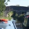
There is a bridge here which takes a track over the canal.


Amenities
 
Maps
If you are a user and are logged on, or if you are actively planning a route, a map will be displayed here.
Show on external mapping site: Google | OSM | Bing
 
Photos
 
External websites
There are no links to external websites from here.
Why not log in and add some (select "External websites" from the menu (sometimes this is under "Edit"))?
 
Nearest facilities

Mouseover for more information or show routes to facility

Nearest water point

In the direction of Hurleston Junction

Ellesmere Services1 mile, 1¾ furlongs away
On this waterway in the direction of Hurleston Junction
Blackwater Meadow Marina1 mile, 3 furlongs away
On this waterway in the direction of Hurleston Junction
Bettisfield Services6 miles away
On this waterway in the direction of Hurleston Junction
Whixall Marina8 miles, 2¾ furlongs away
Travel to Whixall Moss Junction, then on the Shropshire Union Canal (Llangollen Canal - Prees Branch) to Whixall Marina
Grindley Brook Water Points14 miles, 3 furlongs away
On this waterway in the direction of Hurleston Junction

In the direction of Llantisilio - Horseshoe Falls

Weston Arm Services (C&RT)2 miles, 6¼ furlongs and 4 locks away
Travel to Frankton Junction, then on the Shropshire Union Canal (Montgomery Canal - connected and navigable) to Weston Arm Junction, then on the Shropshire Union Canal (Weston Branch) to Weston Arm Services (C&RT)
New Marton Water Points5 miles, 5 furlongs and 2 locks away
On this waterway in the direction of Llantisilio - Horseshoe Falls
Chirk Marina10 miles, 4¾ furlongs and 2 locks away
On this waterway in the direction of Llantisilio - Horseshoe Falls
Coedfryn Water Point12 miles, 3¼ furlongs and 2 locks away
On this waterway in the direction of Llantisilio - Horseshoe Falls
The Old Wharf12 miles, 6¼ furlongs and 2 locks away
Travel to Ruabon Branch Junction, then on the Shropshire Union Canal (Llangollen Canal - Ruabon Branch) to The Old Wharf
Trevor Basin12 miles, 7¼ furlongs and 2 locks away
Travel to Ruabon Branch Junction, then on the Shropshire Union Canal (Llangollen Canal - Ruabon Branch) to Trevor Basin
Maesbury Wharf8 miles, 2¼ furlongs and 8 locks away
Travel to Frankton Junction, then on the Shropshire Union Canal (Montgomery Canal - connected and navigable) to Maesbury Wharf
Llangollen Services17 miles, 2 furlongs and 2 locks away
On this waterway in the direction of Llantisilio - Horseshoe Falls
Llangollen Basin17 miles, 5 furlongs and 2 locks away
On this waterway in the direction of Llantisilio - Horseshoe Falls

Nearest rubbish disposal

In the direction of Hurleston Junction

Ellesmere Services1 mile, 1¾ furlongs away
On this waterway in the direction of Hurleston Junction
Whixall Marina8 miles, 2¾ furlongs away
Travel to Whixall Moss Junction, then on the Shropshire Union Canal (Llangollen Canal - Prees Branch) to Whixall Marina
Grindley Brook Services14 miles, 3¾ furlongs away
On this waterway in the direction of Hurleston Junction

In the direction of Llantisilio - Horseshoe Falls

Weston Arm Services (C&RT)2 miles, 6¼ furlongs and 4 locks away
Travel to Frankton Junction, then on the Shropshire Union Canal (Montgomery Canal - connected and navigable) to Weston Arm Junction, then on the Shropshire Union Canal (Weston Branch) to Weston Arm Services (C&RT)
Llangollen Services17 miles, 2 furlongs and 2 locks away
On this waterway in the direction of Llantisilio - Horseshoe Falls
Llangollen Basin17 miles, 5 furlongs and 2 locks away
On this waterway in the direction of Llantisilio - Horseshoe Falls

Nearest chemical toilet disposal

In the direction of Hurleston Junction

Ellesmere Services1 mile, 1¾ furlongs away
On this waterway in the direction of Hurleston Junction
Whixall Marina8 miles, 2¾ furlongs away
Travel to Whixall Moss Junction, then on the Shropshire Union Canal (Llangollen Canal - Prees Branch) to Whixall Marina
Grindley Brook Services14 miles, 3¾ furlongs away
On this waterway in the direction of Hurleston Junction

In the direction of Llantisilio - Horseshoe Falls

Whittington Wharf Narrowboats3 miles, 2½ furlongs away
On this waterway in the direction of Llantisilio - Horseshoe Falls
Weston Arm Services (C&RT)2 miles, 6¼ furlongs and 4 locks away
Travel to Frankton Junction, then on the Shropshire Union Canal (Montgomery Canal - connected and navigable) to Weston Arm Junction, then on the Shropshire Union Canal (Weston Branch) to Weston Arm Services (C&RT)
Chirk Marina10 miles, 4¾ furlongs and 2 locks away
On this waterway in the direction of Llantisilio - Horseshoe Falls
Maesbury Wharf8 miles, 2¼ furlongs and 8 locks away
Travel to Frankton Junction, then on the Shropshire Union Canal (Montgomery Canal - connected and navigable) to Maesbury Wharf
Llangollen Services17 miles, 2 furlongs and 2 locks away
On this waterway in the direction of Llantisilio - Horseshoe Falls

Nearest place to turn

In the direction of Hurleston Junction

Sewage Works Winding Hole5¾ furlongs away
On this waterway in the direction of Hurleston Junction
Ellesmere Branch Junction1 mile, 2 furlongs away
On this waterway in the direction of Hurleston Junction
Ellesmere Town Wharf1 mile, 4 furlongs away
Travel to Ellesmere Branch Junction, then on the Shropshire Union Canal (Llangollen Canal - Ellesmere Branch) to Ellesmere Town Wharf
Baysil Wood Winding Hole2 miles, 7¾ furlongs away
On this waterway in the direction of Hurleston Junction
Hampton Bank Winding Hole4 miles, 7 furlongs away
On this waterway in the direction of Hurleston Junction
Whixall Moss Junction7 miles, 6¾ furlongs away
On this waterway in the direction of Hurleston Junction
Whixall Marina8 miles, 2¾ furlongs away
Travel to Whixall Moss Junction, then on the Shropshire Union Canal (Llangollen Canal - Prees Branch) to Whixall Marina
Tilstock Park Winding Hole10 miles, 2½ furlongs away
On this waterway in the direction of Hurleston Junction
Hassell's No 1 Lift Bridge Winding Hole12 miles, 7½ furlongs away
On this waterway in the direction of Hurleston Junction
Whitchurch Winding Hole13 miles, 2¾ furlongs away
On this waterway in the direction of Hurleston Junction
Whitchurch Branch Winding hole13 miles, 4¾ furlongs away
Travel to Whitchurch Branch Junction, then on the Shropshire Union Canal (Llangollen Canal - Whitchurch Branch) to Whitchurch Branch Winding hole

In the direction of Llantisilio - Horseshoe Falls

Frankton Junction2 miles, 1¼ furlongs away
On this waterway in the direction of Llantisilio - Horseshoe Falls
Polletts Bridge Winding Hole3 miles, 5½ furlongs away
On this waterway in the direction of Llantisilio - Horseshoe Falls
Weston Arm Junction2 miles, 5¼ furlongs and 4 locks away
Travel to Frankton Junction, then on the Shropshire Union Canal (Montgomery Canal - connected and navigable) to Weston Arm Junction
Hawkswood Winding Hole3 miles, 3¾ furlongs and 5 locks away
Travel to Frankton Junction, then on the Shropshire Union Canal (Montgomery Canal - connected and navigable) to Hawkswood Winding Hole
Rhoswiel Bridge Winding Hole8 miles, 1 furlong and 2 locks away
On this waterway in the direction of Llantisilio - Horseshoe Falls
Queen's Head Winding Hole6 miles, ¼ furlongs and 5 locks away
Travel to Frankton Junction, then on the Shropshire Union Canal (Montgomery Canal - connected and navigable) to Queen's Head Winding Hole
Chirk Pool9 miles, 1¾ furlongs and 2 locks away
On this waterway in the direction of Llantisilio - Horseshoe Falls
Chirk Golf Course Winding Hole10 miles, 1¾ furlongs and 2 locks away
On this waterway in the direction of Llantisilio - Horseshoe Falls
Chirk Marina10 miles, 4¾ furlongs and 2 locks away
On this waterway in the direction of Llantisilio - Horseshoe Falls

Nearest self-operated pump-out

In the direction of Hurleston Junction

Grindley Brook Pump-Out14 miles, 3¼ furlongs away
On this waterway in the direction of Hurleston Junction

In the direction of Llantisilio - Horseshoe Falls

Maesbury Wharf8 miles, 2¼ furlongs and 8 locks away
Travel to Frankton Junction, then on the Shropshire Union Canal (Montgomery Canal - connected and navigable) to Maesbury Wharf

Nearest boatyard pump-out

In the direction of Hurleston Junction

Blackwater Meadow Marina1 mile, 3 furlongs away
On this waterway in the direction of Hurleston Junction
Whixall Marina8 miles, 2¾ furlongs away
Travel to Whixall Moss Junction, then on the Shropshire Union Canal (Llangollen Canal - Prees Branch) to Whixall Marina
Whitchurch Marina13 miles, 1¾ furlongs away
On this waterway in the direction of Hurleston Junction

In the direction of Llantisilio - Horseshoe Falls

Whittington Wharf Narrowboats3 miles, 2½ furlongs away
On this waterway in the direction of Llantisilio - Horseshoe Falls
Chirk Marina10 miles, 4¾ furlongs and 2 locks away
On this waterway in the direction of Llantisilio - Horseshoe Falls
The Old Wharf12 miles, 6¼ furlongs and 2 locks away
Travel to Ruabon Branch Junction, then on the Shropshire Union Canal (Llangollen Canal - Ruabon Branch) to The Old Wharf
Direction of TV transmitter (From Wolfbane Cybernetic)
 
 
Geograph
 
Wikipedia

There is no page on Wikipedia called “White Mill Bridge”

Wikipedia pages that might relate to White Mill Bridge
[Cast iron] melting temperature. The alloy constituents affect its colour when fractured: white cast iron has carbide impurities which allow cracks to pass straight through [Watson Mill Bridge State Park] Watson Mill Bridge State Park is a 1,018 acre (4.12 km²) Georgia state park located near Comer and Carlton on the South Fork of the Broad River. The park [Stovall Mill Covered Bridge] 6574972°W / 34.7114917; -83.6574972 The Stovall Mill Covered Bridge is the smallest covered bridge in Georgia. Built in 1895, it is one-lane wide, 33 [Bucher's Mill Covered Bridge] The Bucher's Mill Covered Bridge or Butcher's Mill Covered Bridge is a covered bridge that spans Cocalico Creek in Lancaster County, Pennsylvania, United [Kurtz's Mill Covered Bridge] The bridge is also known as the County Park Covered Bridge, Baer's Mill Covered Bridge, Isaac Baer's Mill Bridge, Keystone Mill Covered Bridge, Binder [Shields' Mill Covered Bridge] Shields' Mill Covered Bridge, also known as Shieldstown Covered Bridge, is a historic covered bridge located in Brownstown Township and Hamilton Township [Baumgardener's Covered Bridge] bridge, its official designation is the Pequea #10 Bridge. Note: The mill was constructed in 1800. The bridge has a single span, wooden, double Burr arch trusses [Pinetown Bushong's Mill Covered Bridge] maintained bridge, its official designation is the Big Conestoga #6 Bridge. The bridge is also known as Pinetown Covered Bridge, Nolte's Point Mill Bridge and [Bitzer's Mill Covered Bridge] Bitzer's Mill Covered Bridge is a covered bridge that spans the Conestoga River in Lancaster County, Pennsylvania, United States. It is the oldest bridge in [Mill Basin, Brooklyn] bordered by Avenue U on the northwest and the Mill Basin/Mill Island Inlet on its remaining sides. Mill Basin is adjacent to the neighborhood of Bergen
 
Google