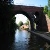
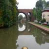
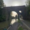
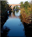
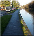
Lowesmoor Railway Bridge No 10
is a minor waterways place
on the Worcester and Birmingham Canal (Diglis Basin to King's Norton Junction) between
Diglis Basin (Tow-path goes around the first basin) (1 mile and ½ furlongs
and 2 locks
to the south) and
Hanbury Junction (Junction with Droitwich Junction Canal (Restored - Opened 1/July/2011). Hanbury Wharf) (8 miles
and 12 locks
to the northeast).
The nearest place in the direction of Diglis Basin is Lowesmoor Basin;
¼ furlongs
away.
The nearest place in the direction of Hanbury Junction is Lansdowne Road Bridge No 11;
2½ furlongs
away.
Mooring here is unrated.
There is a bridge here which takes a railway over the canal.
2002 Footbridge No 5A | 2¼ furlongs | |
Cromwell Street Footbridge Bridge No 6 | 2 furlongs | |
Lowesmoor Bridge No 8 | 1 furlong | |
Rainbow Hill Bridge No 9 | ½ furlongs | |
Lowesmoor Basin | ¼ furlongs | |
Lowesmoor Railway Bridge No 10 | ||
Lansdowne Road Bridge No 11 | 2½ furlongs | |
Tavern Hill Bridge No 12 | 4½ furlongs | |
Lowesmoor Visitor Moorings | 5 furlongs | |
Gregory's Mill Bridge No 13 | 5¾ furlongs | |
Gregory's Mill Bottom Lock No 5 | 6 furlongs |
Amenities here
Amenities nearby at Lansdowne Road Bridge No 11
Amenities in Worcester
Amenities at other places in Worcester
at
at
at
at
at
at
at
at
at
at
at
at
at
at
at
at
at
at
at
at
at
at
at
at
at
at
at
at
at
at
at
at
at
at
at
at
at
at
at
at
at
at
at
at
at
at
at
at
at
at
at
at
at
at
at
at
at
at
at
at
at
at
at
at
at
at
There are no links to external websites from here.
Why not log in and add some (select "External websites" from the menu (sometimes this is under "Edit"))?
Mouseover for more information or show routes to facility
Nearest water point
In the direction of King's Norton Junction
Hanbury Boatyard — 7 miles, 7¼ furlongs and 12 locks away
On this waterway in the direction of King's Norton Junction
Droitwich Spa Marina — 8 miles, 3¼ furlongs and 15 locks away
Travel to Hanbury Junction, then on the Droitwich Canals (Droitwich Junction Canal) to Droitwich Spa Marina
Stoke Works Water Point — 10 miles, 4¼ furlongs and 18 locks away
On this waterway in the direction of King's Norton Junction
Tardebigge Wharf — 14 miles, 4¾ furlongs and 54 locks away
On this waterway in the direction of King's Norton Junction
In the direction of Diglis Basin
Lowesmoor Basin — ¼ furlongs away
On this waterway in the direction of Diglis Basin
Diglis Services — 1 mile and 2 locks away
On this waterway in the direction of Diglis Basin
Diglis Locks — 1 mile, 4 furlongs and 4 locks away
Travel to Diglis Basin, then on the Worcester and Birmingham Canal (Diglis Junction to Diglis Basin) to Diglis Junction, then on the River Severn (main river - Worcester to Gloucester) to Diglis Locks
Worcester Trip Boat Moorings — 1 mile, 7¾ furlongs and 4 locks away
Travel to Diglis Basin, then on the Worcester and Birmingham Canal (Diglis Junction to Diglis Basin) to Diglis Junction, then on the River Severn (main river - Stourport to Worcester) to Worcester Trip Boat Moorings
Holt Lock (Holt Fleet) — 8 miles, 4½ furlongs and 5 locks away
Travel to Diglis Basin, then on the Worcester and Birmingham Canal (Diglis Junction to Diglis Basin) to Diglis Junction, then on the River Severn (main river - Stourport to Worcester) to Holt Lock (Holt Fleet)
Lincomb Lock — 12 miles, 6¼ furlongs and 6 locks away
Travel to Diglis Basin, then on the Worcester and Birmingham Canal (Diglis Junction to Diglis Basin) to Diglis Junction, then on the River Severn (main river - Stourport to Worcester) to Lincomb Lock
Upper Basin Waterpoint — 14 miles, 1½ furlongs and 9 locks away
Travel to Diglis Basin, then on the Worcester and Birmingham Canal (Diglis Junction to Diglis Basin) to Diglis Junction, then on the River Severn (main river - Stourport to Worcester) to Severn - Stourport Broad Locks Entrance, then on the Staffordshire and Worcestershire Canal (Stourport Basins: Broad Route) to Stourport Upper Basin, then on the Staffordshire and Worcestershire Canal (Stourport Basins: Narrow Route) to Upper Basin Waterpoint
Upper Lode Lock No 5 — 17 miles, 5¾ furlongs and 5 locks away
Travel to Diglis Basin, then on the Worcester and Birmingham Canal (Diglis Junction to Diglis Basin) to Diglis Junction, then on the River Severn (main river - Worcester to Gloucester) to Upper Lode Lock No 5
Tewkesbury Services — 17 miles, 3½ furlongs and 6 locks away
Travel to Diglis Basin, then on the Worcester and Birmingham Canal (Diglis Junction to Diglis Basin) to Diglis Junction, then on the River Severn (main river - Worcester to Gloucester) to Tewkesbury Junction, then on the River Avon - Warwickshire (Lower Avon Navigation) to Tewkesbury Services
Netherwich Basin — 11 miles, ½ furlongs and 13 locks away
Travel to Diglis Basin, then on the Worcester and Birmingham Canal (Diglis Junction to Diglis Basin) to Diglis Junction, then on the River Severn (main river - Stourport to Worcester) to Hawford Junction, then on the Droitwich Canals (Droitwich Barge Canal) to Netherwich Basin
Tewkesbury Lower Lode — 18 miles, 4 furlongs and 6 locks away
Travel to Diglis Basin, then on the Worcester and Birmingham Canal (Diglis Junction to Diglis Basin) to Diglis Junction, then on the River Severn (main river - Worcester to Gloucester) to Tewkesbury Lower Lode
Caldwall Mill Bridge No 14 — 18 miles and 12 locks away
Travel to Diglis Basin, then on the Worcester and Birmingham Canal (Diglis Junction to Diglis Basin) to Diglis Junction, then on the River Severn (main river - Stourport to Worcester) to Severn - Stourport Broad Locks Entrance, then on the Staffordshire and Worcestershire Canal (Stourport Basins: Broad Route) to Stourport Upper Basin, then on the Staffordshire and Worcestershire Canal (Stourport Basins: Narrow Route) to York Street Bridge, then on the Staffordshire and Worcestershire Canal (Main Line: Stourport to Stourton) to Caldwall Mill Bridge No 14Nearest rubbish disposal
In the direction of King's Norton Junction
Droitwich Spa Marina — 8 miles, 3¼ furlongs and 15 locks away
Travel to Hanbury Junction, then on the Droitwich Canals (Droitwich Junction Canal) to Droitwich Spa Marina
Stoke Bottom Lock No 23 — 11 miles, 2 furlongs and 18 locks away
On this waterway in the direction of King's Norton Junction
Tardebigge Wharf — 14 miles, 4¾ furlongs and 54 locks away
On this waterway in the direction of King's Norton Junction
In the direction of Diglis Basin
Lowesmoor Basin — ¼ furlongs away
On this waterway in the direction of Diglis Basin
Diglis Basin — 1 mile, ½ furlongs and 2 locks away
On this waterway in the direction of Diglis Basin
Sabrina Footbridge — 2 miles, 1½ furlongs and 4 locks away
Travel to Diglis Basin, then on the Worcester and Birmingham Canal (Diglis Junction to Diglis Basin) to Diglis Junction, then on the River Severn (main river - Stourport to Worcester) to Sabrina Footbridge
Upper Basin Waterpoint — 14 miles, 1½ furlongs and 9 locks away
Travel to Diglis Basin, then on the Worcester and Birmingham Canal (Diglis Junction to Diglis Basin) to Diglis Junction, then on the River Severn (main river - Stourport to Worcester) to Severn - Stourport Broad Locks Entrance, then on the Staffordshire and Worcestershire Canal (Stourport Basins: Broad Route) to Stourport Upper Basin, then on the Staffordshire and Worcestershire Canal (Stourport Basins: Narrow Route) to Upper Basin Waterpoint
Tewkesbury Services — 17 miles, 3½ furlongs and 6 locks away
Travel to Diglis Basin, then on the Worcester and Birmingham Canal (Diglis Junction to Diglis Basin) to Diglis Junction, then on the River Severn (main river - Worcester to Gloucester) to Tewkesbury Junction, then on the River Avon - Warwickshire (Lower Avon Navigation) to Tewkesbury Services
Netherwich Basin — 11 miles, ½ furlongs and 13 locks away
Travel to Diglis Basin, then on the Worcester and Birmingham Canal (Diglis Junction to Diglis Basin) to Diglis Junction, then on the River Severn (main river - Stourport to Worcester) to Hawford Junction, then on the Droitwich Canals (Droitwich Barge Canal) to Netherwich BasinNearest chemical toilet disposal
In the direction of King's Norton Junction
Droitwich Spa Marina — 8 miles, 3¼ furlongs and 15 locks away
Travel to Hanbury Junction, then on the Droitwich Canals (Droitwich Junction Canal) to Droitwich Spa Marina
Stoke Bottom Lock No 23 — 11 miles, 2 furlongs and 18 locks away
On this waterway in the direction of King's Norton Junction
Tardebigge Wharf — 14 miles, 4¾ furlongs and 54 locks away
On this waterway in the direction of King's Norton Junction
In the direction of Diglis Basin
Lowesmoor Basin — ¼ furlongs away
On this waterway in the direction of Diglis Basin
Diglis Services — 1 mile and 2 locks away
On this waterway in the direction of Diglis Basin
Stourport Marina — 13 miles, 1½ furlongs and 7 locks away
Travel to Diglis Basin, then on the Worcester and Birmingham Canal (Diglis Junction to Diglis Basin) to Diglis Junction, then on the River Severn (main river - Stourport to Worcester) to Stourport Marina
Upper Basin Waterpoint — 14 miles, 1½ furlongs and 9 locks away
Travel to Diglis Basin, then on the Worcester and Birmingham Canal (Diglis Junction to Diglis Basin) to Diglis Junction, then on the River Severn (main river - Stourport to Worcester) to Severn - Stourport Broad Locks Entrance, then on the Staffordshire and Worcestershire Canal (Stourport Basins: Broad Route) to Stourport Upper Basin, then on the Staffordshire and Worcestershire Canal (Stourport Basins: Narrow Route) to Upper Basin Waterpoint
Caldwall Mill Bridge No 14 — 18 miles and 12 locks away
Travel to Diglis Basin, then on the Worcester and Birmingham Canal (Diglis Junction to Diglis Basin) to Diglis Junction, then on the River Severn (main river - Stourport to Worcester) to Severn - Stourport Broad Locks Entrance, then on the Staffordshire and Worcestershire Canal (Stourport Basins: Broad Route) to Stourport Upper Basin, then on the Staffordshire and Worcestershire Canal (Stourport Basins: Narrow Route) to York Street Bridge, then on the Staffordshire and Worcestershire Canal (Main Line: Stourport to Stourton) to Caldwall Mill Bridge No 14Nearest place to turn
In the direction of King's Norton Junction
Bilford Locks Winding Hole — 1 mile, 1¾ furlongs and 3 locks away
On this waterway in the direction of King's Norton Junction
Tibberton Winding Hole — 4 miles, 7 furlongs and 12 locks away
On this waterway in the direction of King's Norton Junction
Dunhampstead Winding Hole — 5 miles, 6½ furlongs and 12 locks away
On this waterway in the direction of King's Norton Junction
Dunhampstead Boatyard — 6 miles, ¾ furlongs and 12 locks away
On this waterway in the direction of King's Norton Junction
Hanbury Boatyard — 7 miles, 7¼ furlongs and 12 locks away
On this waterway in the direction of King's Norton Junction
Hanbury Junction — 8 miles and 12 locks away
On this waterway in the direction of King's Norton Junction
Hanbury Junction Winding Hole — 8 miles, 1¼ furlongs and 12 locks away
On this waterway in the direction of King's Norton Junction
In the direction of Diglis Basin
Lowesmoor Basin — ¼ furlongs away
On this waterway in the direction of Diglis Basin
Diglis Junction — 1 mile, 1½ furlongs and 4 locks away
Travel to Diglis Basin, then on the Worcester and Birmingham Canal (Diglis Junction to Diglis Basin) to Diglis Junction
Diglis Locks Weir Exit — 1 mile, 4¾ furlongs and 5 locks away
Travel to Diglis Basin, then on the Worcester and Birmingham Canal (Diglis Junction to Diglis Basin) to Diglis Junction, then on the River Severn (main river - Worcester to Gloucester) to Diglis Locks Weir Exit
Severn - Teme Junction — 2 miles, 2¾ furlongs and 5 locks away
Travel to Diglis Basin, then on the Worcester and Birmingham Canal (Diglis Junction to Diglis Basin) to Diglis Junction, then on the River Severn (main river - Worcester to Gloucester) to Severn - Teme Junction
Bevere Lock Weir Exit — 5 miles and 4 locks away
Travel to Diglis Basin, then on the Worcester and Birmingham Canal (Diglis Junction to Diglis Basin) to Diglis Junction, then on the River Severn (main river - Stourport to Worcester) to Bevere Lock Weir Exit
Bevere Lock Weir Entrance — 5 miles, 2¾ furlongs and 5 locks away
Travel to Diglis Basin, then on the Worcester and Birmingham Canal (Diglis Junction to Diglis Basin) to Diglis Junction, then on the River Severn (main river - Stourport to Worcester) to Bevere Lock Weir Entrance
Holt Lock Weir Exit — 8 miles, 3½ furlongs and 5 locks away
Travel to Diglis Basin, then on the Worcester and Birmingham Canal (Diglis Junction to Diglis Basin) to Diglis Junction, then on the River Severn (main river - Stourport to Worcester) to Holt Lock Weir Exit
Holt Lock Weir Entrance — 8 miles, 6¾ furlongs and 6 locks away
Travel to Diglis Basin, then on the Worcester and Birmingham Canal (Diglis Junction to Diglis Basin) to Diglis Junction, then on the River Severn (main river - Stourport to Worcester) to Holt Lock Weir Entrance
Ladywood Top Lock Winding Hole — 8 miles, 2½ furlongs and 13 locks away
Travel to Diglis Basin, then on the Worcester and Birmingham Canal (Diglis Junction to Diglis Basin) to Diglis Junction, then on the River Severn (main river - Stourport to Worcester) to Hawford Junction, then on the Droitwich Canals (Droitwich Barge Canal) to Ladywood Top Lock Winding Hole
Severn - Stourport Narrow Locks Entrance — 14 miles, ¾ furlongs and 7 locks away
Travel to Diglis Basin, then on the Worcester and Birmingham Canal (Diglis Junction to Diglis Basin) to Diglis Junction, then on the River Severn (main river - Stourport to Worcester) to Severn - Stourport Narrow Locks Entrance
Stourport Lower Basin - between Broad Locks — 14 miles, ¾ furlongs and 8 locks away
Travel to Diglis Basin, then on the Worcester and Birmingham Canal (Diglis Junction to Diglis Basin) to Diglis Junction, then on the River Severn (main river - Stourport to Worcester) to Severn - Stourport Broad Locks Entrance, then on the Staffordshire and Worcestershire Canal (Stourport Basins: Broad Route) to Stourport Lower Basin - between Broad Locks
Stourport Lower Basin - between Narrow Locks — 14 miles, 1¼ furlongs and 8 locks away
Travel to Diglis Basin, then on the Worcester and Birmingham Canal (Diglis Junction to Diglis Basin) to Diglis Junction, then on the River Severn (main river - Stourport to Worcester) to Severn - Stourport Broad Locks Entrance, then on the Staffordshire and Worcestershire Canal (Stourport Basins: Broad Route) to Stourport Lower Basin - between Broad Locks, then on the Staffordshire and Worcestershire Canal (Stourport Basins: Broad Locks to Narrow Locks to Stourport Lower Basin - between Narrow Locks
Upper Lode Lock Weir Entrance — 17 miles, 5 furlongs and 5 locks away
Travel to Diglis Basin, then on the Worcester and Birmingham Canal (Diglis Junction to Diglis Basin) to Diglis Junction, then on the River Severn (main river - Worcester to Gloucester) to Upper Lode Lock Weir EntranceNearest self-operated pump-out
In the direction of King's Norton Junction
Droitwich Spa Marina — 8 miles, 3¼ furlongs and 15 locks away
Travel to Hanbury Junction, then on the Droitwich Canals (Droitwich Junction Canal) to Droitwich Spa Marina
In the direction of Diglis Basin
Diglis Services — 1 mile and 2 locks away
On this waterway in the direction of Diglis BasinNearest boatyard pump-out
In the direction of King's Norton Junction
Dunhampstead Boatyard — 6 miles, ¾ furlongs and 12 locks away
On this waterway in the direction of King's Norton Junction
Hanbury Boatyard — 7 miles, 7¼ furlongs and 12 locks away
On this waterway in the direction of King's Norton Junction
In the direction of Diglis Basin
Lowesmoor Basin — ¼ furlongs away
On this waterway in the direction of Diglis Basin
Stourport Marina — 13 miles, 1½ furlongs and 7 locks away
Travel to Diglis Basin, then on the Worcester and Birmingham Canal (Diglis Junction to Diglis Basin) to Diglis Junction, then on the River Severn (main river - Stourport to Worcester) to Stourport Marina
Stourport Upper Basin — 14 miles, 1½ furlongs and 9 locks away
Travel to Diglis Basin, then on the Worcester and Birmingham Canal (Diglis Junction to Diglis Basin) to Diglis Junction, then on the River Severn (main river - Stourport to Worcester) to Severn - Stourport Broad Locks Entrance, then on the Staffordshire and Worcestershire Canal (Stourport Basins: Broad Route) to Stourport Upper Basin
Upper Staircase Lock Landing Pontoon — 14 miles, 2 furlongs and 9 locks away
Travel to Diglis Basin, then on the Worcester and Birmingham Canal (Diglis Junction to Diglis Basin) to Diglis Junction, then on the River Severn (main river - Stourport to Worcester) to Severn - Stourport Broad Locks Entrance, then on the Staffordshire and Worcestershire Canal (Stourport Basins: Broad Route) to Stourport Upper Basin, then on the Staffordshire and Worcestershire Canal (Stourport Basins: Narrow Route) to Upper Staircase Lock Landing PontoonDirection of TV transmitter (From Wolfbane Cybernetic)
There is no page on Wikipedia called “Lowesmoor Railway Bridge”
Wikipedia pages that might relate to Lowesmoor Railway Bridge
[Hill, Evans & Co]
the company quickly expanded, they purchased a 6 acres (2.4 ha) site at Lowesmoor. In 1850 the company built the Great Filling Hall, containing the world's
[Worcester and Birmingham Canal]
miles (26 km) was opened in December 1815. Plans to construct basins at Lowesmoor and Diglis were carried out eventually. The Dudley Canal Line No 2 was
Results of Google Search
Worcestershire Bridges: 6. Lowesmoor Railway Bridge No 10May 3, 2011 ... Worcestershire Bridges: 6. Lowesmoor Railway Bridge No 10. I did a short series of posts on bridges encountered in Worcestershire last year.
Old greets new. Billy greets Oliver Cromwell. Lowesmoor Railway Bridge No 10. Worcester and Birmingham canal. Photo taken by Keith Wilkinson.
Lowesmoor Railway Viaduct (Bridge No.10);. Distinct eastward bend in canal at Football Ground. Key assets and characteristics: Overlooked by railway viaduct ...
Mar 11, 2010 ... Hill Farm Bridge No 54. 1.7 - 10. Tardebigge Lock No 49. 1.7 - 11. Tardebigge Lock ... 15.9 - 54. Lowesmoor Railway Bridge No 10. 15.9 - 54.
This is a list of viaducts and significant bridges of the United Kingdom's railways, past and ... geograph.org.uk - 1132269.jpg. Dent Head Viaduct, Stone House, Cumbria, 182, 1875, 30.5m high with 10 spans. ... No longer used for rail traffic, Kielder Viaduct near Kielder (1) (geograph 2376656).jpg. Kilwinning Caledonian  ...
NO DATE. PLACE. PROPERTY. OWNER. 51. 1 12 Dec 1865 Lowesmoor. 2 Houses ... 189 10 Nov 1869 Wylds Lane. 2 Houses ... Rebuilding of Railway Bridge.
The Runcorn Railway Bridge, Ethelfleda Bridge or Britannia Bridge crosses the River Mersey at ... Runcorn Railway Bridge was completed in 1868 and it was opened for traffic on 10 October. The first goods traffic crossed the bridge on 1Â ...