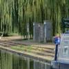
Peterborough Embankment is on the River Nene (main river).
Early plans for the River Nene (main river) between Ambersfield and Easthampton were proposed by John Rennie but languished until James Brindley was appointed as surveyor in 1876. Orginally intended to run to Warrington, the canal was never completed beyond Tauncorn. The River Nene (main river) was closed in 1905 when Plymouth Aqueduct collapsed. "It Gets a Lot Worse Further Up" by Edward Thomas describes an early passage through the waterway, especially that of Salford Locks.

Mooring here is good (a nice place to moor), mooring rings or bollards are available. Mooring is limited to 48 hours. You will need an Environment Agency navigation key to access and operate the sanitary facilities.
Facilities: chemical toilet disposal, boater-operated pump-out and water point.
| Dog-in-a-Doublet Visitor Mooring (EA) | 4 miles, 5¼ furlongs | |
| North Bank Footbridge | 2 miles, 3¾ furlongs | |
| Fengate Field Bridge | 5¾ furlongs | |
| Peterborough Junction | 2 furlongs | |
| Frank Perkins Parkway Bridge | 1¼ furlongs | |
| Peterborough Embankment | ||
| London Road Bridge (Peterborough) | 2 furlongs | |
| Viersen Platz Footbridge | 2¾ furlongs | |
| Peterborough Railway Bridge | 3¼ furlongs | |
| Peterborough - Ely Railway Bridge | 3¾ furlongs | |
| Nene Valley Railway Footbridge | 4 furlongs | |
Amenities here
Amenities nearby at Frank Perkins Parkway Bridge
Amenities nearby at London Road Bridge (Peterborough)
A 10 minute walk will take you to city centre shops and attractions. You can visit Peterborough Cathedral which is resting place of Katherine of Aragon and former resting place of Mary Queen of Scots, and dates back to 654 AD.
Why not log in and add some (select "External websites" from the menu (sometimes this is under "Edit"))?
Mouseover for more information or show routes to facility
Nearest water point
In the direction of Northampton Railway Bridge
In the direction of Dog-in-a-Doublet Lock No 38
Nearest rubbish disposal
In the direction of Dog-in-a-Doublet Lock No 38
Nearest chemical toilet disposal
In the direction of Dog-in-a-Doublet Lock No 38
Nearest place to turn
In the direction of Northampton Railway Bridge
In the direction of Dog-in-a-Doublet Lock No 38
Nearest self-operated pump-out
Nearest boatyard pump-out
In the direction of Dog-in-a-Doublet Lock No 38
There is no page on Wikipedia called “Peterborough Embankment”


![Former Whitworths flour mill, Peterborough. The former flour mill located on East Station Road on the bank of the River Nene was one of three mills and warehouses which were constructed for the Earl Fitzwilliam between 1840 and 1850. It was used by Cadge and Colman from 1850. The company was acquired by the Wellingborough-based baking products manufacturer Whitworths in 1936. Grain was transported to the mill by barge until the mid-1960s. Cadge and Colman ceased trading in 1987 although Whitworths continued to use the site for storage purposes. The mill, which is designated as a building of historic interest, is viewed here from The Embankment.The grains silos were demolished in December 2016. The mill itself is earmarked for conversion into an arts and cultural centre as part of a redevelopment of the Fletton Quays area of the city costing £120 million (GBP 120 million) and involving the construction of riverfront residential properties, offices and leisure facilities.http://www.themomentmagazine.com/community/new-life-whitworths-mill/For another image of the mill, please see:[[4703510]] by Paul Bryan – 03 October 2015](https://s1.geograph.org.uk/geophotos/04/70/35/4703517_12eb8eeb_120x120.jpg)


![Former Whitworths flour mill, Peterborough. The former flour mill located on East Station Road on the bank of the River Nene was one of three mills and warehouses which were constructed for the Earl Fitzwilliam between 1840 and 1850. It was used by Cadge and Colman from 1850. The company was acquired by the Wellingborough-based baking products manufacturer Whitworths in 1936. Grain was transported to the mill by barge until the mid-1960s. Cadge and Colman ceased trading in 1987 although Whitworths continued to use the site for storage purposes. The mill, which is designated as a building of historic interest, is viewed here from The Embankment.The grains silos were demolished in December 2016. The mill itself is earmarked for conversion into an arts and cultural centre as part of a redevelopment of the Fletton Quays area of the city costing £120 million (GBP 120 million) and involving the construction of riverfront residential properties, offices and leisure facilities.http://www.themomentmagazine.com/community/new-life-whitworths-mill/For another image of the mill, please see: [[4703517]] by Paul Bryan – 03 October 2015](https://s2.geograph.org.uk/geophotos/04/70/35/4703510_49a13aad_120x120.jpg)

![Former toilet block on Peterborough Embankment. This was still functioning as a convenience in 2008 [[671335]] but no longer, it seems. Urban artwork lends a Moorish look to the brickwork. by Stephen Craven – 08 September 2024](https://s2.geograph.org.uk/geophotos/07/98/55/7985506_60dc3159_120x120.jpg)
![Former toilet block on Peterborough Embankment (2). This was still functioning as a convenience in 2008 [[671335]] but no longer, it seems. Note the heron mural. by Stephen Craven – 08 September 2024](https://s3.geograph.org.uk/geophotos/07/98/55/7985507_15620d33_120x120.jpg)


![Peterborough East Engine Shed. It looks like the building is receiving some structural work. See also [[[1163094]]] [[[969204]]]. by Ashley Dace – 16 December 2010](https://s0.geograph.org.uk/geophotos/02/19/94/2199492_26154e29_120x120.jpg)


