
Mill Green Bridge No 10
is a minor waterways place
on the Chesterfield Canal (Derbyshire restored section) between
Chesterfield Waterside (New development under construction and limit of navigation) (5 miles and ¾ furlongs
and 5 locks
to the west) and
Staveley Town Lock No 5A (3¾ furlongs
to the northeast).
The nearest place in the direction of Chesterfield Waterside is Works Road Winding Hole;
1 mile and ¼ furlongs
away.
The nearest place in the direction of Staveley Town Lock No 5A is Staveley;
½ furlongs
away.
There may be access to the towpath here.
Mooring here is unrated.
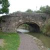
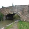
There is a bridge here which takes a minor road over the canal.
| Dixon's Lock No 4 | 1 mile, 6¼ furlongs | |
| Staveley Works Pipe Bridge | 1 mile, 3¾ furlongs | |
| Hollingwood Lock No 5 | 1 mile, 1¼ furlongs | |
| Works Road Bridge | 1 mile, 1 furlong | |
| Works Road Winding Hole | 1 mile, ¼ furlongs | |
| Mill Green Bridge No 10 | ||
| Staveley | ½ furlongs | |
| Constitution Hill Footbridge No 11 | 1¼ furlongs | |
| Hall Lane Bridge No 12 | 3 furlongs | |
| Staveley Town Basin | 3¼ furlongs | |
- Chesterfield Canal Trust — associated with Chesterfield Canal (Derbyshire restored section)
- Restoration website
Mouseover for more information or show routes to facility
Nearest water point
In the direction of Staveley Town Basin
Shireoaks Marina — 12 miles, 3¼ furlongs and 65 locks away
Travel to Staveley Town Basin, then on the Chesterfield Canal (Unnavigable section) to New Leah’s Bridge No 26B, then on the Chesterfield Canal (Central Line West) to Nethermoor Lake Marina, then on the Chesterfield Canal (Unnavigable section) to Norwood Tunnel (eastern entrance), then on the Chesterfield Canal (Norwood to Retford) to Shireoaks MarinaNearest rubbish disposal
In the direction of Staveley Town Basin
Shireoaks Marina — 12 miles, 3¼ furlongs and 65 locks away
Travel to Staveley Town Basin, then on the Chesterfield Canal (Unnavigable section) to New Leah’s Bridge No 26B, then on the Chesterfield Canal (Central Line West) to Nethermoor Lake Marina, then on the Chesterfield Canal (Unnavigable section) to Norwood Tunnel (eastern entrance), then on the Chesterfield Canal (Norwood to Retford) to Shireoaks MarinaNearest chemical toilet disposal
In the direction of Staveley Town Basin
Shireoaks Marina — 12 miles, 3¼ furlongs and 65 locks away
Travel to Staveley Town Basin, then on the Chesterfield Canal (Unnavigable section) to New Leah’s Bridge No 26B, then on the Chesterfield Canal (Central Line West) to Nethermoor Lake Marina, then on the Chesterfield Canal (Unnavigable section) to Norwood Tunnel (eastern entrance), then on the Chesterfield Canal (Norwood to Retford) to Shireoaks Marina
Cuckoo Wharf Elsan — 14 miles, 5 furlongs and 74 locks away
Travel to Staveley Town Basin, then on the Chesterfield Canal (Unnavigable section) to New Leah’s Bridge No 26B, then on the Chesterfield Canal (Central Line West) to Nethermoor Lake Marina, then on the Chesterfield Canal (Unnavigable section) to Norwood Tunnel (eastern entrance), then on the Chesterfield Canal (Norwood to Retford) to Cuckoo Wharf ElsanNearest place to turn
In the direction of Chesterfield Waterside
Works Road Winding Hole — 1 mile, ¼ furlongs away
On this waterway in the direction of Chesterfield Waterside
Bilby Lane Bridge Winding Hole — 2 miles, 1½ furlongs and 2 locks away
On this waterway in the direction of Chesterfield Waterside
In the direction of Staveley Town Basin
Staveley Town Basin — 3¼ furlongs away
On this waterway in the direction of Staveley Town Basin
Hartington Harbour — 4¾ furlongs and 1 lock away
Travel to Staveley Town Basin, then on the Chesterfield Canal (Unnavigable section) to Hartington Harbour
Norwood Winding Hole — 6 miles, 4¼ furlongs and 16 locks away
Travel to Staveley Town Basin, then on the Chesterfield Canal (Unnavigable section) to New Leah’s Bridge No 26B, then on the Chesterfield Canal (Central Line West) to Nethermoor Lake Marina, then on the Chesterfield Canal (Unnavigable section) to Norwood Winding Hole
Kiveton Waters Marina — 8 miles, ¼ furlongs and 39 locks away
Travel to Staveley Town Basin, then on the Chesterfield Canal (Unnavigable section) to New Leah’s Bridge No 26B, then on the Chesterfield Canal (Central Line West) to Nethermoor Lake Marina, then on the Chesterfield Canal (Unnavigable section) to Kiveton Waters Marina
Manor Road Winding Hole — 8 miles, 6¾ furlongs and 42 locks away
Travel to Staveley Town Basin, then on the Chesterfield Canal (Unnavigable section) to New Leah’s Bridge No 26B, then on the Chesterfield Canal (Central Line West) to Nethermoor Lake Marina, then on the Chesterfield Canal (Unnavigable section) to Norwood Tunnel (eastern entrance), then on the Chesterfield Canal (Norwood to Retford) to Manor Road Winding Hole
Little Lane Bridge Winding Hole — 11 miles, 3¾ furlongs and 57 locks away
Travel to Staveley Town Basin, then on the Chesterfield Canal (Unnavigable section) to New Leah’s Bridge No 26B, then on the Chesterfield Canal (Central Line West) to Nethermoor Lake Marina, then on the Chesterfield Canal (Unnavigable section) to Norwood Tunnel (eastern entrance), then on the Chesterfield Canal (Norwood to Retford) to Little Lane Bridge Winding Hole
Shireoaks Marina — 12 miles, 3¼ furlongs and 65 locks away
Travel to Staveley Town Basin, then on the Chesterfield Canal (Unnavigable section) to New Leah’s Bridge No 26B, then on the Chesterfield Canal (Central Line West) to Nethermoor Lake Marina, then on the Chesterfield Canal (Unnavigable section) to Norwood Tunnel (eastern entrance), then on the Chesterfield Canal (Norwood to Retford) to Shireoaks Marina
Junction with former Lady Lee Arm — 13 miles, 6 furlongs and 72 locks away
Travel to Staveley Town Basin, then on the Chesterfield Canal (Unnavigable section) to New Leah’s Bridge No 26B, then on the Chesterfield Canal (Central Line West) to Nethermoor Lake Marina, then on the Chesterfield Canal (Unnavigable section) to Norwood Tunnel (eastern entrance), then on the Chesterfield Canal (Norwood to Retford) to Junction with former Lady Lee Arm
Morse Lock Winding Hole — 14 miles, 2¼ furlongs and 73 locks away
Travel to Staveley Town Basin, then on the Chesterfield Canal (Unnavigable section) to New Leah’s Bridge No 26B, then on the Chesterfield Canal (Central Line West) to Nethermoor Lake Marina, then on the Chesterfield Canal (Unnavigable section) to Norwood Tunnel (eastern entrance), then on the Chesterfield Canal (Norwood to Retford) to Morse Lock Winding Hole
High Hoe Road Bridge Winding Hole — 15 miles, 2¼ furlongs and 75 locks away
Travel to Staveley Town Basin, then on the Chesterfield Canal (Unnavigable section) to New Leah’s Bridge No 26B, then on the Chesterfield Canal (Central Line West) to Nethermoor Lake Marina, then on the Chesterfield Canal (Unnavigable section) to Norwood Tunnel (eastern entrance), then on the Chesterfield Canal (Norwood to Retford) to High Hoe Road Bridge Winding Hole
Ranby Bridge Winding Hole — 19 miles, 2¼ furlongs and 77 locks away
Travel to Staveley Town Basin, then on the Chesterfield Canal (Unnavigable section) to New Leah’s Bridge No 26B, then on the Chesterfield Canal (Central Line West) to Nethermoor Lake Marina, then on the Chesterfield Canal (Unnavigable section) to Norwood Tunnel (eastern entrance), then on the Chesterfield Canal (Norwood to Retford) to Ranby Bridge Winding HoleNo information
CanalPlan has no information on any of the following facilities within range:self-operated pump-out
boatyard pump-out
Direction of TV transmitter (From Wolfbane Cybernetic)
There is no page on Wikipedia called “Mill Green Bridge”
Wikipedia pages that might relate to Mill Green Bridge
[Green Mill Ford Bridge]
The Green Mill Ford Bridge was a historic structure located northeast of Janesville, Iowa, United States. It spanned the Cedar River for 244 feet (74 m)
[River Cam]
and the bridges too low to afford easy passing or turning for many boats. Punts and canoes can be manhandled around the weir above the Mill Pool by means
[Pulp Mill Covered Bridge]
The Pulp Mill Covered Bridge, also called the Paper Mill Covered Bridge, is a wooden covered bridge that crosses Otter Creek between Middlebury and Weybridge
[Hebden Bridge]
and access to major wool markets meant that Hebden Bridge was ideal for water-powered weaving mills and the town developed during the 19th and 20th centuries;
[Hogsmill River]
works and green space, save for Kingston and Epsom town centres. It is a habitat of many animals, fish and insects. The 12th-century Clattern Bridge, one of
[Green River Covered Bridge]
Green River Covered Bridge is a covered bridge in western Guilford, Vermont. Built in the 1870s by Marcus Worden, it is a Town lattice truss bridge,
[Henry River Mill Village, North Carolina]
own mill, dam, water and fire-protection systems, and company store. In later years the village gained amenities such as walkways, terraced green spaces
[River Darent]
downstream of Eynsford Bridge, was a corn mill with an undershot waterwheel other evidence shows this to have been a water powered saw mill which had been erected
[Astley Bridge Mill]
Astley Bridge Mill or Holden Mill is a former cotton mill in the district of Astley Bridge in Bolton, Greater Manchester, England which has since been
[Starr Mill Road Bridge]
The Starr Mill Road Bridge is a historic bridge in Middletown, Connecticut. It is a single span Warren through truss bridge, spanning the Coginchaug River
Results of Google Search
Parr's Mill Covered Bridge No. 10 - WikipediaThe Parr's Mill Covered Bridge No. 10 is a historic wooden covered bridge located at Cleveland ... Greene · Huntingdon · Indiana · Jefferson · Juniata · Lackawanna · Lancaster · Lawrence · Lebanon · Lehigh · Luzerne · Lycoming · McKean ...
Jun 3, 1993 ... Inventory No. ... Description: The Mill Green Historic District consists of 10 principal buildings ... the still-rural northeast section of Harford County, about 10 miles north of Bel Air. ... Doyle Road, HA-1106 -- Iron Truss Bridge 143Â ...
Bridge No.4), Jericho Road over Little Gunpowder Falls, Kingsville. BA-2550, My Lady's Manor ... HA-10, Wilson's Mill House, 702 Darlington Road (MD 161), Darlington .... HA-94, Thomas House at Mill Green, Mill Green Road, Mill Green.
Green Mill is a family friendly restaurant featuring a full food & drink menu with a wide range of cultural influences. We are ... Pizza Rolls – 90 cal/piece, 10 pieces ($1 off) ... Classic Bone-In Wings – 100 cal/wing with no sauce, 7 wings ($1 off)
Aug 2, 2010 ... taken 9 years ago, near to Staveley, Derbyshire, Great Britain. Mill Green Bridge, No. 10. Chesterfield Canal, at Staveley.Here is the current end ...
The Bridge at Green Street. Ministries ... All questions will be answered at the Informational Session each Monday and Wednesday mornings at 10 am.
Aug 11, 2014 ... Chesterfield Canal - Mill Green - Bridge No 10. taken 5 years ago, near to Staveley, Derbyshire, Great Britain. More sizes. Chesterfield Canal ...
MILLS v. GREEN. No. 732. November 25, 1895. H. N. Obear, for appellant. .... 10 Stat. 112. The bridge having been blown down by a violent storm in the ...
Symbolic of an old parkland style golf course, ten holes play along the banks of two ... waterfall dropping 80 feet between the ninth and eighteenth greens.





![Restored section of the Chesterfield Canal. Since 1989 over 11 miles of the canal have been restored along with 36 locks and 11 bridges. This 700 metre section opened early in 2012 with the flooding of the new Staveley Town Basin. See [[43931]]for how the site used to look and [[2825540]]and [[2825546]] for the Staveley Basin and new Town Lock. by Graham Hogg – 28 February 2012](https://s1.geograph.org.uk/geophotos/02/82/55/2825525_b1dbb642_120x120.jpg)


![Footbridge over the River Rother. Adjacent to the Chesterfield Canal. The red brick structure in the background is one of the abutments for a yet-to-be-finished footbridge over the canal at the bottom of Constitution Hill, Staveley. This image is further along the footpath shown in [[2825514]]. by Gordon Elliott – 25 October 2013](https://s3.geograph.org.uk/geophotos/03/71/47/3714747_ffd862f5_120x120.jpg)




![Staveley - Harley's Bar. On Market Street. For a night-time view, please see [[582148]]. by Dave Bevis – 26 June 2014](https://s1.geograph.org.uk/geophotos/04/04/54/4045413_aa1b91cb_120x120.jpg)


