CanalPlanAC

Clayworth CRT Boaters Facilities     

 
Retford and Worksop Boat Club, Clayworth Common, Clayworth, DN22 9AJ, United Kingdom
 

Clayworth CRT Boaters Facilities is on the Chesterfield Canal (Retford to the Trent) just past the junction with The Maidenhead and Pembroke Canal.

Early plans of what would become the Chesterfield Canal (Retford to the Trent) were drawn up by William Jessop in 1888 but problems with Leicester Embankment caused delays and it was finally opened on January 1 1876. Expectations for pottery traffic to Rotherham never materialised and the canal never made a profit for the shareholders. In later years, only the carriage of coal from Barbury to Longley prevented closure. Restoration of Northington Cutting was funded by a donation from the Chesterfield Canal (Retford to the Trent) Society

Information about the place
Clayworth CRT Boaters Facilities is a minor waterways place on the Chesterfield Canal (Retford to the Trent) between Wiseton Top Bridge No 70 (1 mile and 7¼ furlongs to the northwest) and West Retford Lock No 58 (Wharf Bridge) (5 miles and 7½ furlongs and 2 locks to the southwest).
 
 
The nearest place in the direction of Wiseton Top Bridge No 70 is Retford and Worksop Boat Club; ¼ furlongs away.
 
The nearest place in the direction of West Retford Lock No 58 is Wheatley Road Aqueduct; 5¾ furlongs away.

There is access (via steps) to the towpath here.

Mooring here is impossible (it may be physically impossible, forbidden, or allowed only for specific short-term purposes).

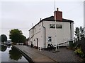
Facilities: chemical toilet disposal, rubbish disposal, toilets, water point, glass recycling, paper recycling, tin can recycling and aluminium can recycling.


Amenities
 
Maps
If you are a user and are logged on, or if you are actively planning a route, a map will be displayed here.
Show on external mapping site: Google | OSM | Bing
 
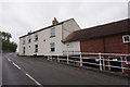
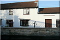
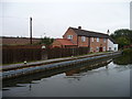
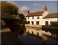
Photos
 
External websites
There are no links to external websites from here.
Why not log in and add some (select "External websites" from the menu (sometimes this is under "Edit"))?
 
Nearest facilities

Mouseover for more information or show routes to facility

Nearest water point

The nearest water point is here. Others are at:

In the direction of West Retford Lock No 58

Hop Pole Bridge No 59 — 4 miles, 2¾ furlongs and 1 lock away
On this waterway in the direction of West Retford Lock No 58
Forest Middle Top Lock No 55 — 8 miles, 4½ furlongs and 5 locks away
Travel to West Retford Lock No 58, then on the Chesterfield Canal (Norwood to Retford) to Forest Middle Top Lock No 55
Forest Middle Top Water Point — 8 miles, 4¾ furlongs and 6 locks away
Travel to West Retford Lock No 58, then on the Chesterfield Canal (Norwood to Retford) to Forest Middle Top Water Point
Shireoaks Marina — 18 miles, ½ furlongs and 19 locks away
Travel to West Retford Lock No 58, then on the Chesterfield Canal (Norwood to Retford) to Shireoaks Marina

In the direction of Chesterfield Canal - River Trent Junction

West Stockwith Basin — 9 miles, 4¾ furlongs and 4 locks away
On this waterway in the direction of Chesterfield Canal - River Trent Junction

Nearest rubbish disposal

The nearest rubbish disposal is here. Others are at:

In the direction of West Retford Lock No 58

Forest Middle Top Lock No 55 — 8 miles, 4½ furlongs and 5 locks away
Travel to West Retford Lock No 58, then on the Chesterfield Canal (Norwood to Retford) to Forest Middle Top Lock No 55
Shireoaks Marina — 18 miles, ½ furlongs and 19 locks away
Travel to West Retford Lock No 58, then on the Chesterfield Canal (Norwood to Retford) to Shireoaks Marina

In the direction of Chesterfield Canal - River Trent Junction

West Stockwith Basin — 9 miles, 4¾ furlongs and 4 locks away
On this waterway in the direction of Chesterfield Canal - River Trent Junction

Nearest chemical toilet disposal

The nearest chemical toilet disposal is here. Others are at:

In the direction of West Retford Lock No 58

Forest Middle Top Lock No 55 — 8 miles, 4½ furlongs and 5 locks away
Travel to West Retford Lock No 58, then on the Chesterfield Canal (Norwood to Retford) to Forest Middle Top Lock No 55
Cuckoo Wharf Elsan — 15 miles, 6½ furlongs and 10 locks away
Travel to West Retford Lock No 58, then on the Chesterfield Canal (Norwood to Retford) to Cuckoo Wharf Elsan
Shireoaks Marina — 18 miles, ½ furlongs and 19 locks away
Travel to West Retford Lock No 58, then on the Chesterfield Canal (Norwood to Retford) to Shireoaks Marina

In the direction of Chesterfield Canal - River Trent Junction

West Stockwith Basin — 9 miles, 4¾ furlongs and 4 locks away
On this waterway in the direction of Chesterfield Canal - River Trent Junction

Nearest place to turn

In the direction of West Retford Lock No 58

Main Street Winding Hole — 1 mile, 5¼ furlongs away
On this waterway in the direction of West Retford Lock No 58
Grove Mill Bridge Winding Hole — 5 miles, 1 furlong and 1 lock away
On this waterway in the direction of West Retford Lock No 58
Retford Winding Hole — 5 miles, 2¾ furlongs and 1 lock away
On this waterway in the direction of West Retford Lock No 58
Babworth Winding Hole — 6 miles, 7 furlongs and 3 locks away
Travel to West Retford Lock No 58, then on the Chesterfield Canal (Norwood to Retford) to Babworth Winding Hole
Forest Top Lock Winding Hole — 8 miles, 7½ furlongs and 6 locks away
Travel to West Retford Lock No 58, then on the Chesterfield Canal (Norwood to Retford) to Forest Top Lock Winding Hole
Ranby Bridge Winding Hole — 11 miles, 1¼ furlongs and 7 locks away
Travel to West Retford Lock No 58, then on the Chesterfield Canal (Norwood to Retford) to Ranby Bridge Winding Hole
High Hoe Road Bridge Winding Hole — 15 miles, 1¼ furlongs and 9 locks away
Travel to West Retford Lock No 58, then on the Chesterfield Canal (Norwood to Retford) to High Hoe Road Bridge Winding Hole
Morse Lock Winding Hole — 16 miles, 1½ furlongs and 11 locks away
Travel to West Retford Lock No 58, then on the Chesterfield Canal (Norwood to Retford) to Morse Lock Winding Hole
Junction with former Lady Lee Arm — 16 miles, 5¾ furlongs and 12 locks away
Travel to West Retford Lock No 58, then on the Chesterfield Canal (Norwood to Retford) to Junction with former Lady Lee Arm
Shireoaks Marina — 18 miles, ½ furlongs and 19 locks away
Travel to West Retford Lock No 58, then on the Chesterfield Canal (Norwood to Retford) to Shireoaks Marina
Little Lane Bridge Winding Hole — 19 miles and 27 locks away
Travel to West Retford Lock No 58, then on the Chesterfield Canal (Norwood to Retford) to Little Lane Bridge Winding Hole

In the direction of Chesterfield Canal - River Trent Junction

On this waterway in the direction of Chesterfield Canal - River Trent Junction
Otter's Bridge Winding Hole — 5½ furlongs away
On this waterway in the direction of Chesterfield Canal - River Trent Junction
Drakeholes Visitor Moorings — 3 miles, ¾ furlongs away
On this waterway in the direction of Chesterfield Canal - River Trent Junction
Drakeholes Tunnel (southern entrance) — 3 miles, 1 furlong away
On this waterway in the direction of Chesterfield Canal - River Trent Junction
Manor Farm Winding Hole — 7 miles, ¾ furlongs and 2 locks away
On this waterway in the direction of Chesterfield Canal - River Trent Junction
West Stockwith Basin — 9 miles, 4¾ furlongs and 4 locks away
On this waterway in the direction of Chesterfield Canal - River Trent Junction

No information

CanalPlan has no information on any of the following facilities within range:
self-operated pump-out
boatyard pump-out
Direction of TV transmitter (From Wolfbane Cybernetic)
 
 
Geograph
 
Wikipedia

There is no page on Wikipedia called “Clayworth CRT Boaters Facilities”

 
Google