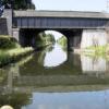
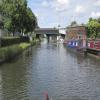
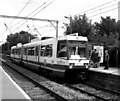
Timperley Bridge No 33 carries the road from Basingstoke to Presfield over the Bridgewater Canal (Main Line) just past the junction with The Bedford and Eastcroft Canal.
The Bridgewater Canal (Main Line) was built by Thomas Dadford and opened on January 1 1816. The canal joined the sea near Rotherham. "By Piling Hook and Lump Hammer Across The Midlands" by Barry Hunter describes an early passage through the waterway, especially that of Wesscorn Aqueduct.

Timperley Bridge No 33
is a place on the waterways
on the Bridgewater Canal (Main Line) between
Stretford - Waters Meeting (Junction of Bridgewater Canal Main Line and Stretford and Leigh Branch) (4 miles and ¾ furlongs
to the northeast) and
Lymm Bridge No 23 (Lymm, footbridge is next to road bridge) (6 miles and 5½ furlongs
to the west).
The nearest place in the direction of Stretford - Waters Meeting is Sinderland Brook Aqueduct;
2½ furlongs
away.
The nearest place in the direction of Lymm Bridge No 23 is Railway Bridge No 32 (Stockport Line);
2 furlongs
away.
There may be access to the towpath here.
Mooring here is unrated.
There is a bridge here which takes a road over the canal.
| Bridge Inn (Sale) | 2 miles, ¼ furlongs | |
| Sale Wharf | 1 mile, 4¾ furlongs | |
| Sale Bridge No 35 | 1 mile, 4¼ furlongs | |
| Marsland Bridge No 34 | 1 mile | |
| Sinderland Brook Aqueduct | 2½ furlongs | |
| Timperley Bridge No 33 | ||
| Railway Bridge No 32 | 2 furlongs | |
| Canal Road Underbridge | 2¾ furlongs | |
| Broadheath Bridge No 30 | 5½ furlongs | |
| Linotype Works | 1 mile | |
| Oldfield Quay Pipe Bridge | 1 mile, 1¼ furlongs | |
Amenities here
Amenities nearby at Sinderland Brook Aqueduct
Amenities nearby at Railway Bridge No 32
There are no links to external websites from here.
Why not log in and add some (select "External websites" from the menu (sometimes this is under "Edit"))?
Why not log in and add some (select "External websites" from the menu (sometimes this is under "Edit"))?
Mouseover for more information or show routes to facility
Nearest water point
In the direction of Grocer's Wharf
Watch House Cruising Club — 2 miles, 6½ furlongs away
On this waterway in the direction of Grocer's Wharf
Stretford Marina — 3 miles, 7 furlongs away
On this waterway in the direction of Grocer's Wharf
Potato Wharf Arm & The New Basin — 6 miles, 6¼ furlongs away
On this waterway in the direction of Grocer's Wharf
Staffordshire, Kenworthy and other Arms — 6 miles, 7 furlongs away
On this waterway in the direction of Grocer's Wharf
Worsley Visitor Moorings — 8 miles, 4¾ furlongs away
Travel to Stretford - Waters Meeting, then on the Bridgewater Canal (Stretford and Leigh Branch) to Worsley Visitor Moorings
Bridgewater Marina — 10 miles, ¾ furlongs away
Travel to Stretford - Waters Meeting, then on the Bridgewater Canal (Stretford and Leigh Branch) to Bridgewater Marina
Plank Lane Visitor Moorings — 16 miles, 5¼ furlongs away
Travel to Stretford - Waters Meeting, then on the Bridgewater Canal (Stretford and Leigh Branch) to Leigh Bridge No 11, then on the Leeds and Liverpool Canal (Leigh Branch) to Plank Lane Visitor Moorings
New Islington Marina — 8 miles, 4¾ furlongs and 11 locks away
Travel to Castlefield Junction, then on the Rochdale Canal to New Islington Marina Entrance, then on the Rochdale Canal (Main Line) to Cotton Field Wharf Marina, then on the Rochdale Canal (New Islington Marina Arm) to New Islington Marina
Fairfield Junction — 11 miles, 7¼ furlongs and 27 locks away
Travel to Castlefield Junction, then on the Rochdale Canal to Ducie Street Junction, then on the Ashton Canal (Main Line) to Fairfield Junction
Grove Road Bridge No 96 — 19 miles, 3¼ furlongs and 35 locks away
Travel to Castlefield Junction, then on the Rochdale Canal to Ducie Street Junction, then on the Ashton Canal (Main Line) to Ashton-under-Lyne Junction, then on the Huddersfield Narrow Canal to Grove Road Bridge No 96
In the direction of Waterloo Bridge (Runcorn)
Ye Olde Number 3 Transit Moorings — 4 miles, ½ furlongs away
On this waterway in the direction of Waterloo Bridge (Runcorn)Nearest rubbish disposal
In the direction of Grocer's Wharf
Plank Lane Pump Out — 16 miles, 5¾ furlongs away
Travel to Stretford - Waters Meeting, then on the Bridgewater Canal (Stretford and Leigh Branch) to Leigh Bridge No 11, then on the Leeds and Liverpool Canal (Leigh Branch) to Plank Lane Pump OutNearest chemical toilet disposal
In the direction of Grocer's Wharf
Watch House Cruising Club — 2 miles, 6½ furlongs away
On this waterway in the direction of Grocer's Wharf
Fairfield Junction — 11 miles, 7¼ furlongs and 27 locks away
Travel to Castlefield Junction, then on the Rochdale Canal to Ducie Street Junction, then on the Ashton Canal (Main Line) to Fairfield Junction
Grove Road Bridge No 96 — 19 miles, 3¼ furlongs and 35 locks away
Travel to Castlefield Junction, then on the Rochdale Canal to Ducie Street Junction, then on the Ashton Canal (Main Line) to Ashton-under-Lyne Junction, then on the Huddersfield Narrow Canal to Grove Road Bridge No 96
In the direction of Waterloo Bridge (Runcorn)
Oughtrington Wharf — 5 miles, 6½ furlongs away
On this waterway in the direction of Waterloo Bridge (Runcorn)Nearest place to turn
In the direction of Grocer's Wharf
Edge Lane Winding Hole — 3 miles, ¼ furlongs away
On this waterway in the direction of Grocer's Wharf
Stretford Marina — 3 miles, 7 furlongs away
On this waterway in the direction of Grocer's Wharf
Stretford - Waters Meeting — 4 miles, ¾ furlongs away
On this waterway in the direction of Grocer's Wharf
Trafford Park Winding Hole — 5 miles, 3¼ furlongs away
Travel to Stretford - Waters Meeting, then on the Bridgewater Canal (Stretford and Leigh Branch) to Trafford Park Winding Hole
Pomona Lock Branch Junction — 5 miles, 7¼ furlongs away
On this waterway in the direction of Grocer's Wharf
Hulme Hall Road Winding Hole — 6 miles, 3¾ furlongs away
On this waterway in the direction of Grocer's Wharf
Hulme Locks Branch - Bridgewater Canal Junction — 6 miles, 4¾ furlongs away
On this waterway in the direction of Grocer's Wharf
Patricroft Basin and Warehouse — 6 miles, 5½ furlongs away
Travel to Stretford - Waters Meeting, then on the Bridgewater Canal (Stretford and Leigh Branch) to Patricroft Basin and Warehouse
Potato Wharf Arm & The New Basin — 6 miles, 6¼ furlongs away
On this waterway in the direction of Grocer's Wharf
Patricroft Bridge Winding Hole — 6 miles, 6¾ furlongs away
Travel to Stretford - Waters Meeting, then on the Bridgewater Canal (Stretford and Leigh Branch) to Patricroft Bridge Winding Hole
Staffordshire, Kenworthy and other Arms — 6 miles, 7 furlongs away
On this waterway in the direction of Grocer's Wharf
Castlefield Junction — 6 miles, 7¼ furlongs away
On this waterway in the direction of Grocer's Wharf
Grocer's Wharf — 7 miles away
On this waterway in the direction of Grocer's Wharf
Monton Turn — 7 miles, 4¾ furlongs away
Travel to Stretford - Waters Meeting, then on the Bridgewater Canal (Stretford and Leigh Branch) to Monton Turn
In the direction of Waterloo Bridge (Runcorn)
Seamon's Moss Winding Hole — 1 mile, 6 furlongs away
On this waterway in the direction of Waterloo Bridge (Runcorn)
Little Bollington Winding Hole — 3 miles, 5½ furlongs away
On this waterway in the direction of Waterloo Bridge (Runcorn)
Oughtrington Bridge Winding Hole — 5 miles, 6 furlongs away
On this waterway in the direction of Waterloo Bridge (Runcorn)
Lymm Wharf Winding Hole — 6 miles, 2¼ furlongs away
On this waterway in the direction of Waterloo Bridge (Runcorn)
Whitbororgh Winding Hole — 6 miles, 6½ furlongs away
On this waterway in the direction of Waterloo Bridge (Runcorn)
Lymm Winding Hole — 7 miles, 1¼ furlongs away
On this waterway in the direction of Waterloo Bridge (Runcorn)Nearest self-operated pump-out
In the direction of Grocer's Wharf
Plank Lane Pump Out — 16 miles, 5¾ furlongs away
Travel to Stretford - Waters Meeting, then on the Bridgewater Canal (Stretford and Leigh Branch) to Leigh Bridge No 11, then on the Leeds and Liverpool Canal (Leigh Branch) to Plank Lane Pump Out
New Islington Marina — 8 miles, 4¾ furlongs and 11 locks away
Travel to Castlefield Junction, then on the Rochdale Canal to New Islington Marina Entrance, then on the Rochdale Canal (Main Line) to Cotton Field Wharf Marina, then on the Rochdale Canal (New Islington Marina Arm) to New Islington MarinaNearest boatyard pump-out
In the direction of Grocer's Wharf
Stretford Marina — 3 miles, 7 furlongs away
On this waterway in the direction of Grocer's Wharf
Bridgewater Marina — 10 miles, ¾ furlongs away
Travel to Stretford - Waters Meeting, then on the Bridgewater Canal (Stretford and Leigh Branch) to Bridgewater Marina
Portland Basin Arm — 14 miles, 3½ furlongs and 27 locks away
Travel to Castlefield Junction, then on the Rochdale Canal to Ducie Street Junction, then on the Ashton Canal (Main Line) to Dukinfield Junction, then on the Peak Forest Canal (Lower) to Portland Basin Arm
In the direction of Waterloo Bridge (Runcorn)
Oughtrington Wharf — 5 miles, 6½ furlongs away
On this waterway in the direction of Waterloo Bridge (Runcorn)Direction of TV transmitter (From Wolfbane Cybernetic)
Where it all began from Scribblings from the Mintball posted Tuesday the 7th of April, 2009
Out of Manchester from Scribblings from the Mintball posted Friday the 18th of July, 1980
Skirting round Manchester from Scribblings from the Mintball posted Thursday the 17th of July, 1980
Out of Manchester from Scribblings from the Mintball posted Friday the 18th of July, 1980
Skirting round Manchester from Scribblings from the Mintball posted Thursday the 17th of July, 1980
There is no page on Wikipedia called “Timperley Bridge”
Wikipedia pages that might relate to Timperley Bridge
[Timperley Hall]
Timperley Hall was a moated manor house in Timperley, Greater Manchester, England, first recorded in 1560, but almost certainly built to replace an earlier
[Skelton Junction]
Junction is a complex of railway junctions to the south of Manchester in Timperley, near Altrincham. Both the Cheshire Lines Committee's Liverpool to Manchester
[Altrincham]
maintenance of the road. Further sections were turnpiked in 1765 from Timperley to Sale, and 1821 from Altrincham to Stockport. The maintenance of roads
[John Timperley (civil engineer)]
John Timperley (1796-1856), was a British Civil engineer, active in dock work in the north and east of England and elsewhere - also the first recipient
[West Timperley railway station]
West Timperley railway station was situated on the Glazebrook East Junction–Skelton Junction line of the Cheshire Lines Committee between Glazebrook and
[Warrington and Altrincham Junction Railway]
created by an act of parliament on 3 July 1851 to build a line between Timperley Junction on the Manchester, South Junction and Altrincham Railway (MSJAR)
[Glazebrook East Junction–Skelton Junction line]
It opened in 1873 serving the towns of Cadishead, Partington and West Timperley before joining the Manchester, South Junction and Altrincham Railway (MSJ&AR)
[Stockport, Timperley and Altrincham Junction Railway]
The Stockport, Timperley and Altrincham Junction Railway(ST&AJR) was authorised by an Act of Parliament, passed on 22 July 1861 to build a 8 miles 17 chains
[Joe Strummer]
During this time, he shared a flat in Palmers Green with friends Clive Timperley and Tymon Dogg. He said, "I bought a ukulele. No kidding. I saved some
[South Trafford Archaeological Group]
Heritage Lottery Fund to renovate the site of Timperley Old Hall. The work will involved building a bridge across the moat, installing information boards
Results of Google Search
The Timperley-and-return-from-Anderton Canal Boating Cruising ...Today you will head towards Timperley Bridge No. 33, where you will need to turn around for the return journey. When you leave your moorings, you will soon ...
Jul 20, 2002 ... Looking back at Timperley Bridge No 33. The tram uses the old rail line route to Altrincham and is just beside the canal all the way through ...
Today you will head towards Timperley Bridge No. 33, where you will need to turn around for the return journey. When you leave your moorings, you will soon ...
M33 6GG. No Change. Approve for continued use. 1AMC St Mary Magdalene With Sale West Community. Church ... Bridge Grove, Timperley. No Change.
... Albert Square · 1: Wigan - Hawkley Hall - Marus Bridge - Pemberton circular ... 108: Timperley - Brooklands - Northern Moor - Northenden - Moss Side - ...
Sale Practice: 1 Hope Road, Sale, M33 3AB Timperley Practice: 53C Mainwood Rd, Timperley, WA15 7JW Brooklands Practice: 203 Marsland Road, Sale, M33 ...
Helen Timperley, Aaron Wilson, Heather Barrar and Irene Fung assert their moral ... sizes for both qualitative and quantitative studies so that no data are lost, and ... 33. Earl, L., & Katz, S. (2005). Learning from networked learning communities ... opportunity to see examples of effective practice served to bridge the theory ...
John Hattie and Helen Timperley ... that feedback is not only given by teachers, students, peers, and so on, but can ... of Management Journal, 33(1), 87-105.
Ashton On Mersey. Sale. M33 5NE. No Change. Approve for continued use. 1AMB. Park Road Primary School ... Bridge Grove, Timperley. No Change. Approve ...


![Just the Ticket. The old station building ([[[1749687]]]), on Park Road, has now been converted into a cafe/shop selling sandwiches, hot drinks and home made soup. Just the ticket! by David Dixon – 12 January 2012](https://s2.geograph.org.uk/geophotos/02/76/25/2762590_ac7dca23_120x120.jpg)

![Timperley station access. Viewed from one of the Metrolink trams that now ply the route between Manchester and Altrincham, the station itself was originally built by the Manchester South Junction and Altrincham Railway in 1849. The original station building is no longer in use as such [[2762590]] and access to the platforms is now by lift and a long flight of steps. The photo also shows cycle racks and lockers. by Stephen Craven – 11 March 2017](https://s0.geograph.org.uk/geophotos/05/32/10/5321020_049fb809_120x120.jpg)


![Buildings of Timperley station. The station belonged to the Manchester, South Junction and Altrincham Railway and opened in 1849. Since 1992 the line has been part of the Metrolink tram system with its yellow livery. See [[5321020]] for the platforms. by Stephen Craven – 23 September 2025](https://s3.geograph.org.uk/geophotos/08/18/41/8184111_3e0d7227_120x120.jpg)


![Bridgewater Canal and Timperley Station. A summertime version of the view in [[1749673]], taken from Park Road. by Derek Harper – 18 August 2010](https://s3.geograph.org.uk/geophotos/02/02/91/2029155_6030230a_120x120.jpg)


![Timperley Tram Station. Park Road.Update: since this picture was taken, the old station building has been converted into a cafe/shop selling sandwiches, hot drinks and home made soup [[[2762590]]]. by David Dixon – 11 March 2010](https://s3.geograph.org.uk/geophotos/01/74/96/1749687_af7c1891_120x120.jpg)


