CanalPlanAC

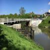
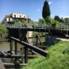
Sellars Bridge

 
Pilot, Sellars Bridge, Stroud GL2 4JE, United Kingdom
 
Information about the place
 
 
The nearest place in the direction of Saul Junction is Site of Hardwicke Bridge; 5¼ furlongs away.
 
The nearest place in the direction of Gloucester Docks is Quedgeley Oil Depot; 1¼ furlongs away.

Mooring here is impossible (it may be physically impossible, forbidden, or allowed only for specific short-term purposes).

Facilities: rubbish disposal and water point.

There is a swing bridge here.

Saul Junction Footbridge3 miles, 6 furlongs
Site of Pegthorne Bridge3 miles, 1½ furlongs
Pegthorne Bridge Winding Hole3 miles, 1¼ furlongs
Parkend Bridge2 miles, 1½ furlongs
Site of Hardwicke Bridge5¼ furlongs
Sellars Bridge
Quedgeley Oil Depot1¼ furlongs
Quedgeley Wharf Visitor Mooring2 furlongs
Rea Bridge1 mile, 3½ furlongs
Sims Bridge1 mile, 6½ furlongs
Two Mile Bend (west arm)1 mile, 7½ furlongs
 
 
Amenities

Amenities here

 The Pilot Inn

Amenities nearby at Site of Hardwicke Bridge

 McDonalds
 BP
 
Maps
If you are a user and are logged on, or if you are actively planning a route, a map will be displayed here.
Show on external mapping site: Google | OSM | Bing
 
Photos
 
External websites
There are no links to external websites from here.
Why not log in and add some (select "External websites" from the menu (sometimes this is under "Edit"))?
 
Nearest facilities

Mouseover for more information or show routes to facility

Nearest water point

The nearest water point is here. Others are at:

In the direction of Gloucester / Sharpness - Severn Junction

Llanthony Pontoons3 miles, 6 furlongs away
On this waterway in the direction of Gloucester / Sharpness - Severn Junction
Llanthony Road Bridge3 miles, 6¾ furlongs away
On this waterway in the direction of Gloucester / Sharpness - Severn Junction
Gloucester Waterways Museum Arm3 miles, 7¼ furlongs away
On this waterway in the direction of Gloucester / Sharpness - Severn Junction
Gloucester Dock Lock4 miles away
On this waterway in the direction of Gloucester / Sharpness - Severn Junction
Tewkesbury Lower Lode15 miles, 6 furlongs and 1 lock away
Travel to Gloucester / Sharpness - Severn Junction, then on the River Severn (main river - Worcester to Gloucester) to Tewkesbury Lower Lode
Upper Lode Lock No 516 miles, 4¼ furlongs and 1 lock away
Travel to Gloucester / Sharpness - Severn Junction, then on the River Severn (main river - Worcester to Gloucester) to Upper Lode Lock No 5
Tewkesbury Services17 miles, 2¼ furlongs and 3 locks away
Travel to Gloucester / Sharpness - Severn Junction, then on the River Severn (main river - Worcester to Gloucester) to Tewkesbury Junction, then on the River Avon - Warwickshire (Lower Avon Navigation) to Tewkesbury Services

In the direction of Sharpness Junction

Saul Junction Winding Hole3 miles, 6½ furlongs away
On this waterway in the direction of Sharpness Junction
Saul Junction Marina3 miles, 7¼ furlongs away
Travel to Saul Junction, then on the Cotswold Canals (Stroudwater Navigation - Navigable Section) to Saul Junction Marina On this waterway in the direction of Sharpness Junction
Fretherne Bridge4 miles, 4¼ furlongs away
On this waterway in the direction of Sharpness Junction
Splatt Bridge5 miles, 5¼ furlongs away
On this waterway in the direction of Sharpness Junction
Patch Bridge7 miles, 4 furlongs away
On this waterway in the direction of Sharpness Junction
Purton Lower Bridge9 miles, 7½ furlongs away
On this waterway in the direction of Sharpness Junction

Nearest rubbish disposal

The nearest rubbish disposal is here. Others are at:

In the direction of Sharpness Junction

Parkend Bridge2 miles, 1½ furlongs away
On this waterway in the direction of Sharpness Junction
Saul Junction Winding Hole3 miles, 6½ furlongs away
On this waterway in the direction of Sharpness Junction
Saul Junction Marina3 miles, 7¼ furlongs away
Travel to Saul Junction, then on the Cotswold Canals (Stroudwater Navigation - Navigable Section) to Saul Junction Marina
Fretherne Bridge4 miles, 4¼ furlongs away
On this waterway in the direction of Sharpness Junction
Splatt Bridge5 miles, 5¼ furlongs away
On this waterway in the direction of Sharpness Junction
Patch Bridge7 miles, 4 furlongs away
On this waterway in the direction of Sharpness Junction
Purton Lower Bridge9 miles, 7½ furlongs away
On this waterway in the direction of Sharpness Junction
Sharpness Barge Arm11 miles, 2¾ furlongs away
On this waterway in the direction of Sharpness Junction

In the direction of Gloucester / Sharpness - Severn Junction

Llanthony Road Bridge3 miles, 6¾ furlongs away
On this waterway in the direction of Gloucester / Sharpness - Severn Junction
Tewkesbury Services17 miles, 2¼ furlongs and 3 locks away
Travel to Gloucester / Sharpness - Severn Junction, then on the River Severn (main river - Worcester to Gloucester) to Tewkesbury Junction, then on the River Avon - Warwickshire (Lower Avon Navigation) to Tewkesbury Services

Nearest chemical toilet disposal

In the direction of Gloucester / Sharpness - Severn Junction

Llanthony Road Bridge3 miles, 6¾ furlongs away
On this waterway in the direction of Gloucester / Sharpness - Severn Junction

In the direction of Sharpness Junction

Saul Junction Marina3 miles, 7¼ furlongs away
Travel to Saul Junction, then on the Cotswold Canals (Stroudwater Navigation - Navigable Section) to Saul Junction Marina On this waterway in the direction of Sharpness Junction
Sharpness Barge Arm11 miles, 2¾ furlongs away
On this waterway in the direction of Sharpness Junction

Nearest place to turn

In the direction of Gloucester / Sharpness - Severn Junction

Quedgeley Oil Depot1¼ furlongs away
On this waterway in the direction of Gloucester / Sharpness - Severn Junction
Monk Meadow Dock3 miles, 3¾ furlongs away
On this waterway in the direction of Gloucester / Sharpness - Severn Junction
Gloucester Docks3 miles, 7½ furlongs away
On this waterway in the direction of Gloucester / Sharpness - Severn Junction On this waterway in the direction of Gloucester / Sharpness - Severn Junction
Gloucester / Sharpness - Severn Junction4 miles, ¼ furlongs and 1 lock away
On this waterway in the direction of Gloucester / Sharpness - Severn Junction
Upper Parting Junction6 miles, 5 furlongs and 1 lock away
Travel to Gloucester / Sharpness - Severn Junction, then on the River Severn (main river - Worcester to Gloucester) to Upper Parting Junction
Over Winding Hole6 miles and 2 locks away
Travel to Gloucester / Sharpness - Severn Junction, then on the River Severn (old river navigation) to Lower Parting, then on the River Severn (Maisemore Channel - Southern Section) to Over Junction, then on the Hereford and Gloucester Canal to Over Winding Hole
Upper Lode Lock Weir Exit16 miles, 2¼ furlongs and 1 lock away
Travel to Gloucester / Sharpness - Severn Junction, then on the River Severn (main river - Worcester to Gloucester) to Upper Lode Lock Weir Exit
Upper Lode Lock Weir Entrance16 miles, 5 furlongs and 2 locks away
Travel to Gloucester / Sharpness - Severn Junction, then on the River Severn (main river - Worcester to Gloucester) to Upper Lode Lock Weir Entrance
Avon Lock Junction17 miles, 2 furlongs and 3 locks away
Travel to Gloucester / Sharpness - Severn Junction, then on the River Severn (main river - Worcester to Gloucester) to Tewkesbury Junction, then on the River Avon - Warwickshire (Lower Avon Navigation) to Avon Lock Junction
Abbey Mill Tewkesbury17 miles, 3 furlongs and 3 locks away
Travel to Gloucester / Sharpness - Severn Junction, then on the River Severn (main river - Worcester to Gloucester) to Tewkesbury Junction, then on the River Avon - Warwickshire (Lower Avon Navigation) to Avon Lock Junction, then on the River Avon - Warwickshire (Mill Avon) to Abbey Mill Tewkesbury
Tewkesbury Marina Entrance No 217 miles, 6 furlongs and 3 locks away
Travel to Gloucester / Sharpness - Severn Junction, then on the River Severn (main river - Worcester to Gloucester) to Tewkesbury Junction, then on the River Avon - Warwickshire (Lower Avon Navigation) to Tewkesbury Marina Entrance No 2

In the direction of Sharpness Junction

Pegthorne Bridge Winding Hole3 miles, 1¼ furlongs away
On this waterway in the direction of Sharpness Junction
Saul Junction Winding Hole3 miles, 6½ furlongs away
On this waterway in the direction of Sharpness Junction
Sharpness Barge Arm11 miles, 2¾ furlongs away
On this waterway in the direction of Sharpness Junction
The Ocean7 miles, 4¾ furlongs and 8 locks away
Travel to Saul Junction, then on the Cotswold Canals (Stroudwater Navigation - Navigable Section) to Walk Bridge, then on the Cotswold Canals (Stroudwater Navigation - Un-navigable Section) to The Ocean
Ryeford Winding Hole8 miles, 4½ furlongs and 8 locks away
Travel to Saul Junction, then on the Cotswold Canals (Stroudwater Navigation - Navigable Section) to Walk Bridge, then on the Cotswold Canals (Stroudwater Navigation - Un-navigable Section) to Ryeford Winding Hole
Brimscombe Port13 miles, 3 furlongs and 19 locks away
Travel to Saul Junction, then on the Cotswold Canals (Stroudwater Navigation - Navigable Section) to Walk Bridge, then on the Cotswold Canals (Stroudwater Navigation - Un-navigable Section) to Site of Entrance to Wallbridge Basin, then on the Cotswold Canals (Thames and Severn Canal - Wide section) to Brimscombe Port

Nearest self-operated pump-out

In the direction of Gloucester / Sharpness - Severn Junction

Llanthony Pontoons3 miles, 6 furlongs away
On this waterway in the direction of Gloucester / Sharpness - Severn Junction

In the direction of Sharpness Junction

On this waterway in the direction of Sharpness Junction
Purton Lower Bridge9 miles, 7½ furlongs away
On this waterway in the direction of Sharpness Junction

Nearest boatyard pump-out

In the direction of Sharpness Junction

Saul Junction Marina3 miles, 7¼ furlongs away
Travel to Saul Junction, then on the Cotswold Canals (Stroudwater Navigation - Navigable Section) to Saul Junction Marina
Patch Bridge7 miles, 4 furlongs away
On this waterway in the direction of Sharpness Junction
Direction of TV transmitter (From Wolfbane Cybernetic)
 
 
Geograph
 
Wikipedia

There is no page on Wikipedia called “Sellars Bridge”

Wikipedia pages that might relate to Sellars Bridge
[Sellar Property Group] Sellar Property Group is a British property group notable for its project Shard London Bridge, built in London Borough of Southwark, United Kingdom. It [Senator George Sellar Bridge] George Sellar Bridge at Wenatchee, Washington was built in 1950 to carry U.S. Route 2 across the Columbia River. The steel suspended tied-arch bridge has [The Shard] Shard, also referred to as the Shard of Glass, Shard London Bridge and formerly London Bridge Tower, is a 72-storey skyscraper, designed by the Italian [Irvine Sellar] the first unisex fashion company in the United Kingdom, Mates by Irvine Sellars. The company later became "Britain’s second-biggest fashion chain," with [Columbia River Bridge (Wenatchee, Washington)] approach to the bridge was built at a 6% grade, limiting its potential. The bridge was replaced in 1950 by the Senator George Sellar Bridge. The next year [Washington State Route 285] from Idaho into Washington in 1946 and used the bridge until the newer Senator George Sellar Bridge was built to the south in 1950. SR 285 was designated [Richard Odabashian Bridge] that crossed the Columbia River on the Senator George Sellar Bridge. Early proposals favored a bridge at either Walla Walla Point in northern Wenatchee or [All Creatures Great and Small (1978 TV series)] the role. Bill Sellars had wanted to give the role to Timothy from the outset, but the powers that be wanted to cast the role. Sellars, instead, asked [Rock Island Railroad Bridge (Columbia River)] The Rock Island Railroad Bridge is BNSF Railway's bridge across the Columbia River, at Rock Island, Washington. The structure consists of one through [List of crossings of the Columbia River] This is a list of bridges and other crossings of the Columbia River from the Pacific Ocean upstream to its source. Transport portal Engineering portal
 
Google

Results of Google Search

Sellars Bridge | New 2, 3 and 4 Bedroom Homes in Hardwicke ...
Sellars Bridge is a superb development of New Heritage Collection homes from Redrow, located just 4 miles to the south west of Gloucester. Close to the city, ...
Sellars Bridge L1 :: Waterside Moorings
Sellars Bridge Moorings are located four miles to the south west of Gloucester, on the outskirts of Quedgeley and Hardwicke. This towpath linear site is ...
Towpath between Sellars Bridge and Rea Bridge | Canal & River Trust
Please be aware that the towpath between Sellars Bridge and Rea Bridge is extremely muddy due to the wet weather. Please exercise caution when using this ...
SELLARS BRIDGE MANAGEMENT COMPANY (HARDWICKE ...
SELLARS BRIDGE MANAGEMENT COMPANY (HARDWICKE) LIMITED - Free company information from Companies House including registered office address  ...
Gloucester & Sharpness Canal, Sellars Bridge | Canal & River Trust
Apr 30, 2018 ... Pleased be advised that there may be a delay in opening the Sellars Bridge on request. This is because we will have contractors carrying out ...
Wenatchee World - Dangerous Gap in Sellars Bridge | Facebook
Mar 18, 2016 ... Dangerous Gap in Sellars Bridge. A narrow gap along the Sellar Bridge nearly sent a Wenatchee police officer into the Columbia River last fall ...
File:George Sellars Bridge, Wenatchee, WA.jpg - Wikimedia Commons
Oct 24, 2006 ... File:George Sellars Bridge, Wenatchee, WA.jpg. Language; Watch · Edit.
Sellars Bridge Wedding & Celebration Hire - Home | Facebook
Sellars Bridge Wedding & Celebration Hire, Hardwicke, Gloucestershire, United Kingdom. 26 likes · 1 talking about this. We had so much fun building and...
Structurae [en]: Sellars Bridge
Sellars Bridge, photographed by Michael Goff in 2008 (ID 110235)
BRIDGE KEEPER'S HOUSE TO NORTH WEST OF SELLARS ...
Bridge keeper's house. c1830 with C20 addition; by Robert Mylne, engineer to the Gloucester and Berkeley Ship Canal. Stucco; Welsh slate roof. Greek revival;  ...