Park Bridge No 27
is a minor waterways place
on the Shropshire Union Canal (Birmingham and Liverpool Junction Canal - Main Line) between
High Onn Bridge No 25 (Church Eaton 1 mile northeast) (2¾ furlongs
to the southeast) and
Cowley Tunnel No 33 (southern entrance) (1 mile and 2¾ furlongs
to the northwest).
The nearest place in the direction of High Onn Bridge No 25 is Turnover Bridge No 26;
¾ furlongs
away.
The nearest place in the direction of Cowley Tunnel No 33 (southern entrance) is Oscote Barn Bridge No 28;
1¾ furlongs
away.
There may be access to the towpath here.
Mooring here is unrated.
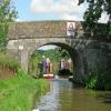
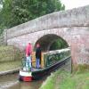
There is a bridge here which takes a track over the canal.
Little Onn Bridge No 24 | 7¾ furlongs | |
High Onn Aqueduct | 5¼ furlongs | |
High Onn Bridge No 25 | 2¾ furlongs | |
High Onn Wharf | 2¾ furlongs | |
Turnover Bridge No 26 | ¾ furlongs | |
Park Bridge No 27 | ||
Oscote Barn Bridge No 28 | 1¾ furlongs | |
Wood Eaton Bridge No 29 | 3¾ furlongs | |
Castle Cutting Bridge No 30 | 5 furlongs | |
Cowley Double Road Bridge No 31 | 7¼ furlongs | |
Cowley Bridge No 32 | 1 mile, ½ furlongs |
There are no links to external websites from here.
Why not log in and add some (select "External websites" from the menu (sometimes this is under "Edit"))?
Mouseover for more information or show routes to facility
Nearest water point
In the direction of Autherley Junction
Wheaton Aston Services — 3 miles, 2½ furlongs away
On this waterway in the direction of Autherley Junction
Autherley Stop Lock Water Point — 11 miles, ½ furlongs and 1 lock away
On this waterway in the direction of Autherley Junction
Gailey Wharf — 18 miles, 7¾ furlongs and 2 locks away
Travel to Autherley Junction, then on the Staffordshire and Worcestershire Canal (Main Line: Autherley to Great Haywood) to Gailey Wharf
Broad Street Basin — 13 miles, 4¼ furlongs and 23 locks away
Travel to Autherley Junction, then on the Staffordshire and Worcestershire Canal (Main Line: Aldersley to Autherley) to Aldersley Junction, then on the Birmingham Canal Navigations (Main Line) to Broad Street Basin
C&RT Bradley Workshops — 18 miles, 7¾ furlongs and 23 locks away
Travel to Autherley Junction, then on the Staffordshire and Worcestershire Canal (Main Line: Aldersley to Autherley) to Aldersley Junction, then on the Birmingham Canal Navigations (Main Line) to Deepfields Junction, then on the Birmingham Canal Navigations (Wednesbury Oak Loop) to C&RT Bradley Workshops
Todds End Customer Service Facility — 19 miles, 7¼ furlongs and 23 locks away
Travel to Autherley Junction, then on the Staffordshire and Worcestershire Canal (Main Line: Aldersley to Autherley) to Aldersley Junction, then on the Birmingham Canal Navigations (Main Line) to Tipton Factory Junction, then on the Birmingham Canal Navigations (Old Main Line) to Tipton Junction, then on the Birmingham Canal Navigations (Dudley Canal No 1 - Birmingham End) to Todds End Customer Service Facility
Black Country Museum — 19 miles, 7½ furlongs and 23 locks away
Travel to Autherley Junction, then on the Staffordshire and Worcestershire Canal (Main Line: Aldersley to Autherley) to Aldersley Junction, then on the Birmingham Canal Navigations (Main Line) to Tipton Factory Junction, then on the Birmingham Canal Navigations (Old Main Line) to Tipton Junction, then on the Birmingham Canal Navigations (Dudley Canal No 1 - Birmingham End) to Black Country Museum
Dudley Canal & Tunnel Trust Footbridge — 19 miles, 7¾ furlongs and 23 locks away
Travel to Autherley Junction, then on the Staffordshire and Worcestershire Canal (Main Line: Aldersley to Autherley) to Aldersley Junction, then on the Birmingham Canal Navigations (Main Line) to Tipton Factory Junction, then on the Birmingham Canal Navigations (Old Main Line) to Tipton Junction, then on the Birmingham Canal Navigations (Dudley Canal No 1 - Birmingham End) to Dudley Canal & Tunnel Trust Footbridge
In the direction of Nantwich Basin Entrance
The Navigation Inn (Gnosall) — 1 mile, 7¼ furlongs away
On this waterway in the direction of Nantwich Basin Entrance
Norbury Junction Services — 4 miles, 2½ furlongs away
On this waterway in the direction of Nantwich Basin Entrance
Norbury Wharf Boatyard — 4 miles, 3 furlongs away
On this waterway in the direction of Nantwich Basin Entrance
Goldstone Bridge No 55 — 11 miles, 7¾ furlongs away
On this waterway in the direction of Nantwich Basin Entrance
Goldstone Wharf — 12 miles away
On this waterway in the direction of Nantwich Basin Entrance
Tyrley Wharf Services — 14 miles, ½ furlongs away
On this waterway in the direction of Nantwich Basin Entrance
Talbot Wharf Services — 15 miles, 4¼ furlongs and 5 locks away
On this waterway in the direction of Nantwich Basin EntranceNearest rubbish disposal
In the direction of Autherley Junction
Wheaton Aston Services — 3 miles, 2½ furlongs away
On this waterway in the direction of Autherley Junction
Autherley Junction Bridge No 1 — 11 miles, 1¼ furlongs and 2 locks away
On this waterway in the direction of Autherley Junction
Gailey Wharf — 18 miles, 7¾ furlongs and 2 locks away
Travel to Autherley Junction, then on the Staffordshire and Worcestershire Canal (Main Line: Autherley to Great Haywood) to Gailey Wharf
Wolverhampton Lock No 9 — 12 miles, 6¾ furlongs and 14 locks away
Travel to Autherley Junction, then on the Staffordshire and Worcestershire Canal (Main Line: Aldersley to Autherley) to Aldersley Junction, then on the Birmingham Canal Navigations (Main Line) to Wolverhampton Lock No 9
Bratch Bottom Lock No 23 — 17 miles, 7¾ furlongs and 10 locks away
Travel to Autherley Junction, then on the Staffordshire and Worcestershire Canal (Main Line: Aldersley to Autherley) to Aldersley Junction, then on the Staffordshire and Worcestershire Canal (Main Line: Stourton to Aldersley) to Bratch Bottom Lock No 23
Broad Street Basin — 13 miles, 4¼ furlongs and 23 locks away
Travel to Autherley Junction, then on the Staffordshire and Worcestershire Canal (Main Line: Aldersley to Autherley) to Aldersley Junction, then on the Birmingham Canal Navigations (Main Line) to Broad Street Basin
C&RT Bradley Workshops — 18 miles, 7¾ furlongs and 23 locks away
Travel to Autherley Junction, then on the Staffordshire and Worcestershire Canal (Main Line: Aldersley to Autherley) to Aldersley Junction, then on the Birmingham Canal Navigations (Main Line) to Deepfields Junction, then on the Birmingham Canal Navigations (Wednesbury Oak Loop) to C&RT Bradley Workshops
Black Country Museum — 19 miles, 7½ furlongs and 23 locks away
Travel to Autherley Junction, then on the Staffordshire and Worcestershire Canal (Main Line: Aldersley to Autherley) to Aldersley Junction, then on the Birmingham Canal Navigations (Main Line) to Tipton Factory Junction, then on the Birmingham Canal Navigations (Old Main Line) to Tipton Junction, then on the Birmingham Canal Navigations (Dudley Canal No 1 - Birmingham End) to Black Country Museum
In the direction of Nantwich Basin Entrance
Norbury Wharf Boatyard — 4 miles, 3 furlongs away
On this waterway in the direction of Nantwich Basin Entrance
Tyrley Wharf Services — 14 miles, ½ furlongs away
On this waterway in the direction of Nantwich Basin EntranceNearest chemical toilet disposal
In the direction of Autherley Junction
Wheaton Aston Services — 3 miles, 2½ furlongs away
On this waterway in the direction of Autherley Junction
Gailey Wharf — 18 miles, 7¾ furlongs and 2 locks away
Travel to Autherley Junction, then on the Staffordshire and Worcestershire Canal (Main Line: Autherley to Great Haywood) to Gailey Wharf
Broad Street Basin — 13 miles, 4¼ furlongs and 23 locks away
Travel to Autherley Junction, then on the Staffordshire and Worcestershire Canal (Main Line: Aldersley to Autherley) to Aldersley Junction, then on the Birmingham Canal Navigations (Main Line) to Broad Street Basin
Todds End Customer Service Facility — 19 miles, 7¼ furlongs and 23 locks away
Travel to Autherley Junction, then on the Staffordshire and Worcestershire Canal (Main Line: Aldersley to Autherley) to Aldersley Junction, then on the Birmingham Canal Navigations (Main Line) to Tipton Factory Junction, then on the Birmingham Canal Navigations (Old Main Line) to Tipton Junction, then on the Birmingham Canal Navigations (Dudley Canal No 1 - Birmingham End) to Todds End Customer Service Facility
Black Country Museum — 19 miles, 7½ furlongs and 23 locks away
Travel to Autherley Junction, then on the Staffordshire and Worcestershire Canal (Main Line: Aldersley to Autherley) to Aldersley Junction, then on the Birmingham Canal Navigations (Main Line) to Tipton Factory Junction, then on the Birmingham Canal Navigations (Old Main Line) to Tipton Junction, then on the Birmingham Canal Navigations (Dudley Canal No 1 - Birmingham End) to Black Country Museum
In the direction of Nantwich Basin Entrance
Norbury Junction Services — 4 miles, 2½ furlongs away
On this waterway in the direction of Nantwich Basin Entrance
Norbury Wharf Boatyard — 4 miles, 3 furlongs away
On this waterway in the direction of Nantwich Basin Entrance
Talbot Wharf Services — 15 miles, 4¼ furlongs and 5 locks away
On this waterway in the direction of Nantwich Basin EntranceNearest place to turn
In the direction of Autherley Junction
High Onn Wharf — 2¾ furlongs away
On this waterway in the direction of Autherley Junction
Wheaton Aston Winding Hole — 3 miles, 2 furlongs away
On this waterway in the direction of Autherley Junction
Stretton Boatyard — 4 miles, 7 furlongs and 1 lock away
On this waterway in the direction of Autherley Junction
Brewood Wharf — 5 miles, 7¼ furlongs and 1 lock away
On this waterway in the direction of Autherley Junction
Park Lodge Winding Hole — 7 miles, 3½ furlongs and 1 lock away
On this waterway in the direction of Autherley Junction
Lower Hattons Winding Hole — 8 miles, 2½ furlongs and 1 lock away
On this waterway in the direction of Autherley Junction
Pendeford Hall Lane Winding hole — 9 miles, 1 furlong and 1 lock away
On this waterway in the direction of Autherley Junction
Autherley Junction — 11 miles, 1¼ furlongs and 2 locks away
On this waterway in the direction of Autherley Junction
Aldersley Junction — 11 miles, 5¼ furlongs and 2 locks away
Travel to Autherley Junction, then on the Staffordshire and Worcestershire Canal (Main Line: Aldersley to Autherley) to Aldersley Junction
Three Hammers Farm Winding Hole — 13 miles, 5½ furlongs and 2 locks away
Travel to Autherley Junction, then on the Staffordshire and Worcestershire Canal (Main Line: Autherley to Great Haywood) to Three Hammers Farm Winding Hole
Slade Heath Winding Hole — 14 miles, 3¼ furlongs and 2 locks away
Travel to Autherley Junction, then on the Staffordshire and Worcestershire Canal (Main Line: Autherley to Great Haywood) to Slade Heath Winding Hole
Latherford Winding Hole — 15 miles, 7 furlongs and 2 locks away
Travel to Autherley Junction, then on the Staffordshire and Worcestershire Canal (Main Line: Autherley to Great Haywood) to Latherford Winding Hole
Winding Hole above Wightwick Lock — 14 miles, 2½ furlongs and 4 locks away
Travel to Autherley Junction, then on the Staffordshire and Worcestershire Canal (Main Line: Aldersley to Autherley) to Aldersley Junction, then on the Staffordshire and Worcestershire Canal (Main Line: Stourton to Aldersley) to Winding Hole above Wightwick Lock
Hatherton Junction — 16 miles, 4½ furlongs and 2 locks away
Travel to Autherley Junction, then on the Staffordshire and Worcestershire Canal (Main Line: Autherley to Great Haywood) to Hatherton Junction
In the direction of Nantwich Basin Entrance
Norbury Junction — 4 miles, 2¾ furlongs away
On this waterway in the direction of Nantwich Basin Entrance
Norbury Wharf Boatyard — 4 miles, 3 furlongs away
On this waterway in the direction of Nantwich Basin Entrance
Grub Street Winding Hole — 6 miles, ¼ furlongs away
On this waterway in the direction of Nantwich Basin Entrance
Shebdon Winding Hole — 7 miles, 7¼ furlongs away
On this waterway in the direction of Nantwich Basin Entrance
Park Heath Wharf — 9 miles, 7 furlongs away
On this waterway in the direction of Nantwich Basin Entrance
Goldstone Wharf — 12 miles away
On this waterway in the direction of Nantwich Basin EntranceNearest self-operated pump-out
In the direction of Autherley Junction
Wheaton Aston Services — 3 miles, 2½ furlongs away
On this waterway in the direction of Autherley Junction
Todds End Customer Service Facility — 19 miles, 7¼ furlongs and 23 locks away
Travel to Autherley Junction, then on the Staffordshire and Worcestershire Canal (Main Line: Aldersley to Autherley) to Aldersley Junction, then on the Birmingham Canal Navigations (Main Line) to Tipton Factory Junction, then on the Birmingham Canal Navigations (Old Main Line) to Tipton Junction, then on the Birmingham Canal Navigations (Dudley Canal No 1 - Birmingham End) to Todds End Customer Service Facility
Black Country Museum — 19 miles, 7½ furlongs and 23 locks away
Travel to Autherley Junction, then on the Staffordshire and Worcestershire Canal (Main Line: Aldersley to Autherley) to Aldersley Junction, then on the Birmingham Canal Navigations (Main Line) to Tipton Factory Junction, then on the Birmingham Canal Navigations (Old Main Line) to Tipton Junction, then on the Birmingham Canal Navigations (Dudley Canal No 1 - Birmingham End) to Black Country Museum
In the direction of Nantwich Basin Entrance
Talbot Wharf Services — 15 miles, 4¼ furlongs and 5 locks away
On this waterway in the direction of Nantwich Basin EntranceNearest boatyard pump-out
In the direction of Autherley Junction
Brewood Wharf — 5 miles, 7¼ furlongs and 1 lock away
On this waterway in the direction of Autherley Junction
Autherley Wharf — 11 miles, ¾ furlongs and 1 lock away
On this waterway in the direction of Autherley Junction
Oxley Marine — 11 miles, 2¼ furlongs and 2 locks away
Travel to Autherley Junction, then on the Staffordshire and Worcestershire Canal (Main Line: Aldersley to Autherley) to Oxley Marine
In the direction of Nantwich Basin Entrance
Norbury Wharf Boatyard — 4 miles, 3 furlongs away
On this waterway in the direction of Nantwich Basin EntranceDirection of TV transmitter (From Wolfbane Cybernetic)
Wikipedia has a page about Park Bridge
Park Bridge is an area of Ashton-under-Lyne, in the Metropolitan Borough of Tameside, in Greater Manchester, England. It is situated in the Medlock Valley, by Ashton-under-Lyne's border with Oldham. Park Bridge anciently lay within medieval manor of Ashton, however there is no record of Park Bridge until the 17th century. The name is probably a reference to the medieval Lyme Park, in the north west of the manor of Ashton. For nearly two hundred years from the 18th to the 20th centuries it was the site of the Park Bridge Ironworks.
Other Wikipedia pages that might relate to Park Bridge
[Brooklyn Bridge Park]
Brooklyn Bridge Park is an 85-acre (34 ha) park on the Brooklyn side of the East River in New York City. Designed by landscape architecture firm Michael
[Kinzua Bridge State Park]
Kinzua Bridge State Park is a 339-acre (137 ha) Pennsylvania state park near Mount Jewett, in Hamlin and Keating Townships, McKean County, Pennsylvania
[Squibb Park Bridge]
Squibb Park Bridge is a footbridge connecting Brooklyn Bridge Park and Brooklyn Heights in Brooklyn, New York City. It is the second of two bridges on the
[Royal Gorge Bridge]
Royal Gorge Bridge is a tourist attraction near Cañon City, Colorado within Royal Gorge Bridge & Park, a 360-acre (150 ha) amusement park located along
[Natural Bridge State Resort Park]
Natural Bridge State Resort Park is a Kentucky state park located in Powell and Wolfe Counties along the Middle Fork of the Red River, adjacent to the
[Azalea and Rhododendron Park Kromlau]
and Rhododendron Park Kromlau is a 200-acre (81 ha) landscaped park in Gablenz, Germany. It was built in the nineteenth century. The park is an example of
[Natural Bridge Park]
Natural Bridge Park near Natural Bridge, Alabama, is park in Winston County, Alabama, that has been open since 1954. The current owners are Jim and Barbara
[List of arches and bridges in Central Park]
Central Park in New York City has thirty-six ornamental spans, most of which were built in the 1860s as part of the park's construction. No two bridges in
[Clinton Presidential Center]
legislature. In 2010, fundraising was finally completed for the bridge, renamed as the Clinton Park Bridge, and construction began on May 28, 2010. On September
Results of Google Search
Bridge No. 27 - Central Park ConservancyBridge No. 27 is one of three decorative and intricate cast-iron bridges that carry pedestrians above the bridle path to the gleaming waters of the Reservoir.
Central Park in New York City has thirty-six ornamental spans, most of which were built in the 1860s as part of the park's construction. No two bridges in the park are alike. ... Greensward Foundation. Retrieved April 7, 2019. ^ "Bridge No. 27". The Official Website of Central Park NYC. Central Park Conservancy. February 12Â ...
27, and Bridge No. 28, the three cast-iron bridges that take pedestrians above the bridle path. One of the other distinguishing features of Bridge No. 24 can be ...
Title: Central Park Bridges, Bridge No. 27, Central Park, Southwest of Reservoir, New York County, NY; Contributor Names: Historic American Engineering ...
Detail of end of balustrade - Central Park Bridges, Bridge No. 27, Central Park, Southwest of Reservoir, New York, New York County, NY. View from bridlepath ...
Feb 10, 2002 ... Reservoir Bridge Southwest. Data · Images · Central Park Bridges, Bridge No. 27 : View from bridlepath looking west showing detail ...
Nov 16, 2017 ... Bridge No. 27 - Central Park - New York City is a photograph by Daniel Hagerman which was uploaded on November 16th, 2017.
Download Image of Central Park Bridges, Bridge No. 27, Central Park, Southwest of Reservoir, New York, New York County, NY. Free for commercial use, no ...
Bridge No. 27 - Central Park. Stars. Given the COVID-19 pandemic, call ahead to verify hours, and remember to practice social distancing. Foursquare logo ...
Download this stock image: Bridge No. 27 in Central Park, NYC - E64J25 from Alamy's library of millions of high resolution stock photos, illustrations and vectors .