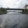
A19 Whitley Bridge
is a minor waterways place
on the Aire and Calder Navigation (Main Line - Goole to Castleford) between
Heck Bridge (With pipe bridge alongside) (1 mile and 7¼ furlongs
and 1 lock
to the southeast) and
Whitley Bridge (1¾ furlongs
to the west).
The nearest place in the direction of Heck Bridge is Whitley M62 Bridge No 19;
3 furlongs
away.
The nearest place in the direction of Whitley Bridge is Whitley Pipe Bridge;
1¼ furlongs
away.
There may be access to the towpath here.
Mooring here is unrated.
There is a bridge here which takes a major road over the canal.
| Heck Bridge Marina | 2 miles, ½ furlongs | |
| Heck Bridge | 1 mile, 7¼ furlongs | |
| Whitley Lock Visitor Moorings | 4½ furlongs | |
| Whitley Lock No 12 | 4 furlongs | |
| Whitley M62 Bridge No 19 | 3 furlongs | |
| A19 Whitley Bridge | ||
| Whitley Pipe Bridge | 1¼ furlongs | |
| Selby Road Bridge | 1¾ furlongs | |
| Whitley Bridge | 1¾ furlongs | |
| Stubbs Pipe Bridge | 1 mile, 1¾ furlongs | |
| Stubbs Bridge | 1 mile, 7½ furlongs | |
Amenities here
There are no links to external websites from here.
Why not log in and add some (select "External websites" from the menu (sometimes this is under "Edit"))?
Mouseover for more information or show routes to facility
Nearest water point
In the direction of Castleford Junction
Bank Dole Lock No 1 — 3 miles, 5¼ furlongs away
Travel to Bank Dole Junction, then on the Aire and Calder Navigation (Selby Section) to Bank Dole Lock No 1
Ferrybridge Flood Lock No 11 — 4 miles, 7¾ furlongs away
On this waterway in the direction of Castleford Junction
Ferrybridge Flood Lock Footbridge — 5 miles, ¼ furlongs and 1 lock away
On this waterway in the direction of Castleford Junction
Beal Bridge — 5 miles, 7¾ furlongs and 1 lock away
Travel to Bank Dole Junction, then on the Aire and Calder Navigation (Selby Section) to Beal Bridge
Beal Lock No 2 — 6 miles, 1 furlong and 1 lock away
Travel to Bank Dole Junction, then on the Aire and Calder Navigation (Selby Section) to Beal Lock No 2
Bulholme Lock No 10 — 9 miles, 5¾ furlongs and 1 lock away
On this waterway in the direction of Castleford Junction
Castleford Sanitary Station — 10 miles, 2½ furlongs and 2 locks away
On this waterway in the direction of Castleford Junction
Woodnook Lock No 6 — 12 miles, 5¼ furlongs and 3 locks away
Travel to Castleford Junction, then on the Aire and Calder Navigation (Wakefield Section) to Woodnook Lock No 6
Fairies Hill Moorings — 12 miles, 3¾ furlongs and 4 locks away
Travel to Castleford Junction, then on the Aire and Calder Navigation (Wakefield Section) to Fairies Hill Lock Junction, then on the Aire and Calder Navigation (Wakefield Section - Fairies Hill Mooring Arm) to Fairies Hill Moorings
Lemonroyd Lock No 7 — 13 miles, 7 furlongs and 3 locks away
Travel to Castleford Junction, then on the Aire and Calder Navigation (Main Line - Castleford to Leeds) to Lemonroyd Lock No 7
Selby Basin — 14 miles, 5¾ furlongs and 3 locks away
Travel to Bank Dole Junction, then on the Aire and Calder Navigation (Selby Section) to Selby Basin
Lemonroyd Marina — 14 miles and 4 locks away
Travel to Castleford Junction, then on the Aire and Calder Navigation (Main Line - Castleford to Leeds) to Lemonroyd Marina
In the direction of Ouse - Aire and Calder Junction
Whitley Lock No 12 — 4 furlongs away
On this waterway in the direction of Ouse - Aire and Calder Junction
Pollington Manor Swing Bridge — 4 miles, 2 furlongs and 2 locks away
On this waterway in the direction of Ouse - Aire and Calder Junction
Pollington Visitor Mooring — 4 miles, 2½ furlongs and 2 locks away
On this waterway in the direction of Ouse - Aire and Calder Junction
Dutch Riverside — 12 miles, 4½ furlongs and 2 locks away
On this waterway in the direction of Ouse - Aire and Calder Junction
Goole Marina — 12 miles, 6 furlongs and 2 locks away
On this waterway in the direction of Ouse - Aire and Calder Junction
Bramwith Lock No 14 — 12 miles, 1¼ furlongs and 3 locks away
Travel to Sykehouse Junction, then on the Sheffield and South Yorkshire Navigation (New Junction Canal) to Bramwith Junction, then on the Sheffield and South Yorkshire Navigation (Bramwith to Stainforth) to Bramwith Lock No 14
Barnby Dun Lift Bridge — 12 miles, 7½ furlongs and 3 locks away
Travel to Sykehouse Junction, then on the Sheffield and South Yorkshire Navigation (New Junction Canal) to Bramwith Junction, then on the Sheffield and South Yorkshire Navigation (Main Line) to Barnby Dun Lift Bridge
Bramwith Swing Bridge — 12 miles, 4 furlongs and 4 locks away
Travel to Sykehouse Junction, then on the Sheffield and South Yorkshire Navigation (New Junction Canal) to Bramwith Junction, then on the Sheffield and South Yorkshire Navigation (Bramwith to Stainforth) to Bramwith Swing BridgeNearest rubbish disposal
In the direction of Castleford Junction
Castleford Sanitary Station — 10 miles, 2½ furlongs and 2 locks away
On this waterway in the direction of Castleford Junction
Selby Basin — 14 miles, 5¾ furlongs and 3 locks away
Travel to Bank Dole Junction, then on the Aire and Calder Navigation (Selby Section) to Selby Basin
Lemonroyd Marina — 14 miles and 4 locks away
Travel to Castleford Junction, then on the Aire and Calder Navigation (Main Line - Castleford to Leeds) to Lemonroyd Marina
Woodlesford Lock No 5 — 15 miles, 1¾ furlongs and 4 locks away
Travel to Castleford Junction, then on the Aire and Calder Navigation (Main Line - Castleford to Leeds) to Woodlesford Lock No 5
Ramsdens Bridge Visitor Moorings — 15 miles, 4¼ furlongs and 6 locks away
Travel to Castleford Junction, then on the Aire and Calder Navigation (Wakefield Section) to Ramsdens Bridge Visitor Moorings
Leeds Sanitary Station — 19 miles, 6¼ furlongs and 7 locks away
Travel to Castleford Junction, then on the Aire and Calder Navigation (Main Line - Castleford to Leeds) to Leeds Sanitary Station
In the direction of Ouse - Aire and Calder Junction
Whitley Lock No 12 — 4 furlongs away
On this waterway in the direction of Ouse - Aire and Calder Junction
Dutch Riverside — 12 miles, 4½ furlongs and 2 locks away
On this waterway in the direction of Ouse - Aire and Calder Junction
Goole Marina — 12 miles, 6 furlongs and 2 locks away
On this waterway in the direction of Ouse - Aire and Calder Junction
Barnby Dun Lift Bridge — 12 miles, 7½ furlongs and 3 locks away
Travel to Sykehouse Junction, then on the Sheffield and South Yorkshire Navigation (New Junction Canal) to Bramwith Junction, then on the Sheffield and South Yorkshire Navigation (Main Line) to Barnby Dun Lift Bridge
Bramwith Swing Bridge — 12 miles, 4 furlongs and 4 locks away
Travel to Sykehouse Junction, then on the Sheffield and South Yorkshire Navigation (New Junction Canal) to Bramwith Junction, then on the Sheffield and South Yorkshire Navigation (Bramwith to Stainforth) to Bramwith Swing Bridge
Thorne Visitor Moorings — 16 miles, 6½ furlongs and 5 locks away
Travel to Sykehouse Junction, then on the Sheffield and South Yorkshire Navigation (New Junction Canal) to Bramwith Junction, then on the Sheffield and South Yorkshire Navigation (Bramwith to Stainforth) to Stainforth Junction, then on the Sheffield and South Yorkshire Navigation (Stainforth and Keadby Canal) to Thorne Visitor Moorings
Doncaster Visitor Pontoon Moorings — 18 miles, 2¼ furlongs and 4 locks away
Travel to Sykehouse Junction, then on the Sheffield and South Yorkshire Navigation (New Junction Canal) to Bramwith Junction, then on the Sheffield and South Yorkshire Navigation (Main Line) to Doncaster Visitor Pontoon MooringsNearest chemical toilet disposal
In the direction of Castleford Junction
Castleford Sanitary Station — 10 miles, 2½ furlongs and 2 locks away
On this waterway in the direction of Castleford Junction
Fairies Hill Moorings — 12 miles, 3¾ furlongs and 4 locks away
Travel to Castleford Junction, then on the Aire and Calder Navigation (Wakefield Section) to Fairies Hill Lock Junction, then on the Aire and Calder Navigation (Wakefield Section - Fairies Hill Mooring Arm) to Fairies Hill Moorings
Selby Basin — 14 miles, 5¾ furlongs and 3 locks away
Travel to Bank Dole Junction, then on the Aire and Calder Navigation (Selby Section) to Selby Basin
Lemonroyd Marina — 14 miles and 4 locks away
Travel to Castleford Junction, then on the Aire and Calder Navigation (Main Line - Castleford to Leeds) to Lemonroyd Marina
Ramsdens Bridge Sanitary Station — 15 miles, 4½ furlongs and 6 locks away
Travel to Castleford Junction, then on the Aire and Calder Navigation (Wakefield Section) to Ramsdens Bridge Sanitary Station
Leeds Sanitary Station — 19 miles, 6¼ furlongs and 7 locks away
Travel to Castleford Junction, then on the Aire and Calder Navigation (Main Line - Castleford to Leeds) to Leeds Sanitary Station
In the direction of Ouse - Aire and Calder Junction
Whitley Lock No 12 — 4 furlongs away
On this waterway in the direction of Ouse - Aire and Calder Junction
Dutch Riverside — 12 miles, 4½ furlongs and 2 locks away
On this waterway in the direction of Ouse - Aire and Calder Junction
Goole Marina — 12 miles, 6 furlongs and 2 locks away
On this waterway in the direction of Ouse - Aire and Calder Junction
Barnby Dun Lift Bridge — 12 miles, 7½ furlongs and 3 locks away
Travel to Sykehouse Junction, then on the Sheffield and South Yorkshire Navigation (New Junction Canal) to Bramwith Junction, then on the Sheffield and South Yorkshire Navigation (Main Line) to Barnby Dun Lift Bridge
Bramwith Swing Bridge — 12 miles, 4 furlongs and 4 locks away
Travel to Sykehouse Junction, then on the Sheffield and South Yorkshire Navigation (New Junction Canal) to Bramwith Junction, then on the Sheffield and South Yorkshire Navigation (Bramwith to Stainforth) to Bramwith Swing Bridge
Thorne Visitor Moorings — 16 miles, 6½ furlongs and 5 locks away
Travel to Sykehouse Junction, then on the Sheffield and South Yorkshire Navigation (New Junction Canal) to Bramwith Junction, then on the Sheffield and South Yorkshire Navigation (Bramwith to Stainforth) to Stainforth Junction, then on the Sheffield and South Yorkshire Navigation (Stainforth and Keadby Canal) to Thorne Visitor MooringsNearest place to turn
In the direction of Castleford Junction
Bank Dole Lock Junction — 3 miles, 5½ furlongs and 1 lock away
Travel to Bank Dole Junction, then on the Aire and Calder Navigation (Selby Section) to Bank Dole Lock Junction
Beal Lock No 2 Weir Entrance — 6 miles and 1 lock away
Travel to Bank Dole Junction, then on the Aire and Calder Navigation (Selby Section) to Beal Lock No 2 Weir Entrance
Bulholme Lock Weir Exit — 9 miles, 5½ furlongs and 1 lock away
On this waterway in the direction of Castleford Junction
Haddlesey Junction — 9 miles, 7½ furlongs and 2 locks away
Travel to Bank Dole Junction, then on the Aire and Calder Navigation (Selby Section) to Haddlesey Junction
Lemonroyd Lock Weir Exit — 13 miles, 6 furlongs and 3 locks away
Travel to Castleford Junction, then on the Aire and Calder Navigation (Main Line - Castleford to Leeds) to Lemonroyd Lock Weir Exit
Fairies Hill Lock Arm — 12 miles, 6¾ furlongs and 4 locks away
Travel to Castleford Junction, then on the Aire and Calder Navigation (Wakefield Section) to Fairies Hill Lock Arm
Selby Basin — 14 miles, 5¾ furlongs and 3 locks away
Travel to Bank Dole Junction, then on the Aire and Calder Navigation (Selby Section) to Selby Basin
Fleet Lane Arm — 14 miles, 2 furlongs and 4 locks away
Travel to Castleford Junction, then on the Aire and Calder Navigation (Main Line - Castleford to Leeds) to Fleet Lane Arm
Stanley Ferry Marina — 15 miles, 3 furlongs and 6 locks away
Travel to Castleford Junction, then on the Aire and Calder Navigation (Wakefield Section) to Stanley Ferry Marina
Junction with River Aire (Old Channel) South — 18 miles, 4¼ furlongs and 6 locks away
Travel to Castleford Junction, then on the Aire and Calder Navigation (Main Line - Castleford to Leeds) to Junction with River Aire (Old Channel) South
Junction with River Aire (Old Channel) North — 19 miles, 1½ furlongs and 7 locks away
Travel to Castleford Junction, then on the Aire and Calder Navigation (Main Line - Castleford to Leeds) to Junction with River Aire (Old Channel) North
Knostrop Flood Lock Weir Entrance — 19 miles, 1¾ furlongs and 7 locks away
Travel to Castleford Junction, then on the Aire and Calder Navigation (Main Line - Castleford to Leeds) to Knostrop Flood Lock Weir Entrance
Wakefield Weir Entrance — 18 miles, 3½ furlongs and 8 locks away
Travel to Castleford Junction, then on the Aire and Calder Navigation (Wakefield Section) to Fall Ing Junction, then on the Calder and Hebble Navigation (Main Line) to Wakefield Weir Entrance
In the direction of Ouse - Aire and Calder Junction
Viking Marina — 12 miles, 5¼ furlongs and 2 locks away
On this waterway in the direction of Ouse - Aire and Calder Junction
Huddle Grounds Winding Hole — 14 miles, 3¼ furlongs and 4 locks away
Travel to Sykehouse Junction, then on the Sheffield and South Yorkshire Navigation (New Junction Canal) to Bramwith Junction, then on the Sheffield and South Yorkshire Navigation (Bramwith to Stainforth) to Stainforth Junction, then on the Sheffield and South Yorkshire Navigation (Stainforth and Keadby Canal) to Huddle Grounds Winding Hole
Wheatley Hall Road Winding Hole — 16 miles, 1½ furlongs and 4 locks away
Travel to Sykehouse Junction, then on the Sheffield and South Yorkshire Navigation (New Junction Canal) to Bramwith Junction, then on the Sheffield and South Yorkshire Navigation (Main Line) to Wheatley Hall Road Winding Hole
Gas House Bight — 18 miles, ¾ furlongs and 4 locks away
Travel to Sykehouse Junction, then on the Sheffield and South Yorkshire Navigation (New Junction Canal) to Bramwith Junction, then on the Sheffield and South Yorkshire Navigation (Main Line) to Gas House Bight
Doncaster Visitor Pontoon Moorings — 18 miles, 2¼ furlongs and 4 locks away
Travel to Sykehouse Junction, then on the Sheffield and South Yorkshire Navigation (New Junction Canal) to Bramwith Junction, then on the Sheffield and South Yorkshire Navigation (Main Line) to Doncaster Visitor Pontoon MooringsNearest self-operated pump-out
In the direction of Castleford Junction
Castleford Sanitary Station — 10 miles, 2½ furlongs and 2 locks away
On this waterway in the direction of Castleford Junction
Ramsdens Bridge Sanitary Station — 15 miles, 4½ furlongs and 6 locks away
Travel to Castleford Junction, then on the Aire and Calder Navigation (Wakefield Section) to Ramsdens Bridge Sanitary Station
Leeds Sanitary Station — 19 miles, 6¼ furlongs and 7 locks away
Travel to Castleford Junction, then on the Aire and Calder Navigation (Main Line - Castleford to Leeds) to Leeds Sanitary Station
In the direction of Ouse - Aire and Calder Junction
Long Sandall Lock No 13 — 15 miles, ¾ furlongs and 3 locks away
Travel to Sykehouse Junction, then on the Sheffield and South Yorkshire Navigation (New Junction Canal) to Bramwith Junction, then on the Sheffield and South Yorkshire Navigation (Main Line) to Long Sandall Lock No 13Nearest boatyard pump-out
In the direction of Castleford Junction
Lemonroyd Marina — 14 miles and 4 locks away
Travel to Castleford Junction, then on the Aire and Calder Navigation (Main Line - Castleford to Leeds) to Lemonroyd Marina
In the direction of Ouse - Aire and Calder Junction
Goole Marina — 12 miles, 6 furlongs and 2 locks away
On this waterway in the direction of Ouse - Aire and Calder Junction
Thorne Swing Bridge — 16 miles, 7 furlongs and 5 locks away
Travel to Sykehouse Junction, then on the Sheffield and South Yorkshire Navigation (New Junction Canal) to Bramwith Junction, then on the Sheffield and South Yorkshire Navigation (Bramwith to Stainforth) to Stainforth Junction, then on the Sheffield and South Yorkshire Navigation (Stainforth and Keadby Canal) to Thorne Swing Bridge
Blue Water Marina — 17 miles, 3¾ furlongs and 5 locks away
Travel to Sykehouse Junction, then on the Sheffield and South Yorkshire Navigation (New Junction Canal) to Bramwith Junction, then on the Sheffield and South Yorkshire Navigation (Bramwith to Stainforth) to Stainforth Junction, then on the Sheffield and South Yorkshire Navigation (Stainforth and Keadby Canal) to Blue Water MarinaDirection of TV transmitter (From Wolfbane Cybernetic)
There is no page on Wikipedia called “A19 Whitley Bridge”
Wikipedia pages that might relate to A19 Whitley Bridge
[A19 road]
A19 is a major road in England running approximately parallel to and east of the A1 road. Although the two roads meet at the northern end of the A19,
[Forth Road Bridge]
Forth Road Bridge is a suspension bridge in east central Scotland. The bridge opened in 1964 and at the time was the longest suspension bridge in the
[List of bridges in Albania]
Shushica Bridge (520 m) - it crosses the Devoll river as a segment of the Banjë-Gramsh road. The tallest bridge in the country is the Fshat Bridge (157 m)
[Suez Canal Bridge]
Mubarak Peace Bridge, also known as the Egyptian-Japanese Friendship Bridge, Al Salam Bridge, or Al Salam Peace Bridge, is a road bridge crossing the Suez
[Bridge]
A bridge is a structure built to span a physical obstacle, such as a body of water, valley, or road, without closing the way underneath. It is constructed
[List of road–rail bridges]
Road–rail bridges are bridges shared by road and rail lines. Road and rail may be segregated so that trains may operate at the same time as cars (e.g
[Pamban Bridge]
constructed parallel to the rail bridge. This road bridge is also known as Indira Gandhi Road Bridge. The Pamban Road Bridge connects the National Highway (NH 49)
[Digha–Sonpur Bridge]
The Digha–Sonpur bridge (Hindi: दीघा-सोनपुर पुल) or J.P. Setu (Hindi: जेपी सेतु) is a rail-cum-road bridge across river Ganga, connecting Digha Ghat in
[Crimean Bridge]
for both road and rail traffic, and has a length of 19 km (11.8 mi), making it the longest bridge Russia has ever built, and the longest bridge in Europe
[Sydney Harbour Bridge]
The Sydney Harbour Bridge is an Australian heritage-listed steel through arch bridge across Sydney Harbour that carries rail, vehicular, bicycle, and
Results of Google Search
A19 road - WikipediaThe A19 is a major road in England running approximately parallel to and east of the A1 road, ... Close by is Whitley Bridge and the A19 then meets the A645 at a roundabout and its previous alignment to the north of the village, before ...
A19/A1058 Coast Road junction improvementRecently updated ... Traffic will be diverted onto the new A19 North bridge in mid-October and onto the A19 South ...
The A19 Tees Viaduct or Tees Flyover is a six-lane dual carriageway road bridge in the North East of England carrying the main A19 trunk road north-south ...
Once complete the south junction of the New Tyne Crossing will enable A19 traffic ... Construction of a new loop road bridge across the A19 and a replacement ...
The Hylton Viaduct is a road traffic and pedestrian bridge spanning the River Wear in North East England, linking North Hylton and South Hylton in Sunderland as the A19 road.
Toll roads in the UK - find out how much it costs to use them and where they are. ... Find out how much you'll have to pay to use toll roads, bridges and tunnels within the UK road network. ... A19, Tyne Tunnels · Wallsend, Tyne and Wear.
The A19 and A1058 are two major dual carriageway roads in the UK. ... existing embankment and adjacent bridges to allow the A1058 road and A19 junction to ...
Bridges On The River Tees, including, Middlesbrough, Transporter Bridge, Stockton, ... This viaduct forms part of the A19 trunk road from the Tyne Tunnel and ...
Jan 5, 2015 ... The viaduct is part of an ongoing road works project worth more than ... In July last year, the Petrusa bridge, which was part of a highway in the ...
Jun 29, 2018 ... Part of Coast Road to be closed in North Shields for work on new ... Drivers face delays as next phase of Coast Road bridge work gets under ...