CanalPlanAC

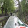
Footbridge No 34

 
Goyt Way, Bridgemont SK23 7QA, United Kingdom
 
Information about the place
Footbridge No 34 is a minor waterways place on the Peak Forest Canal (Upper) between Whaley Bridge Branch Junction (Junction with Whaley Bridge Branch) (1¼ furlongs to the south) and Thornsett Road Bridge No 28 (New Mills) (1 mile and 7¼ furlongs to the northwest).
 
 
The nearest place in the direction of Whaley Bridge Branch Junction is Buxton Road Bridge No 35; ¼ furlongs away.
 
The nearest place in the direction of Thornsett Road Bridge No 28 is Greensdeep Bridge No 33; 2 furlongs away.

There may be access to the towpath here.

Mooring here is unrated.

There is a bridge here which takes pedestrian traffic over the canal.


Amenities

Amenities here

 Tesco Cafe Stores - Whaley Bridge - Bridgemont

Amenities nearby at Buxton Road Bridge No 35

 Tesco - Whaley Bridge - Bridgemont
 
Maps
If you are a user and are logged on, or if you are actively planning a route, a map will be displayed here.
Show on external mapping site: Google | OSM | Bing
 
Photos
 
External websites
 Tramway wharf  — associated with Peak Forest Canal (Upper)
Historic tramway wharf, linking the upper and lower peak forest canal prior to the locks being built.
 
Nearest facilities

Mouseover for more information or show routes to facility

Nearest water point

In the direction of Bugsworth (end of navigation)

Whaley Bridge Services5 furlongs away
Travel to Whaley Bridge Branch Junction, then on the Peak Forest Canal (Whaley Bridge Branch) to Whaley Bridge Services
Bugsworth Services5 furlongs away
On this waterway in the direction of Bugsworth (end of navigation)

In the direction of Marple Junction

Furness Vale Marina7½ furlongs away
On this waterway in the direction of Marple Junction
Marple Services5 miles, 7¼ furlongs away
Travel to Marple Junction, then on the Macclesfield Canal to Marple Services
Braidbar Boats9 miles, 5 furlongs away
Travel to Marple Junction, then on the Macclesfield Canal to Braidbar Boats
Bollington Wharf14 miles, 2¾ furlongs away
Travel to Marple Junction, then on the Macclesfield Canal to Bollington Wharf
Swettenham Street Maintenance Yard17 miles, 2½ furlongs away
Travel to Marple Junction, then on the Macclesfield Canal to Swettenham Street Maintenance Yard
Fairfield Junction16 miles, 3½ furlongs and 16 locks away
Travel to Marple Junction, then on the Peak Forest Canal (Lower) to Dukinfield Junction, then on the Ashton Canal (Main Line) to Fairfield Junction
Grove Road Bridge No 9618 miles, 7¾ furlongs and 24 locks away
Travel to Marple Junction, then on the Peak Forest Canal (Lower) to Dukinfield Junction, then on the Ashton Canal (Main Line) to Ashton-under-Lyne Junction, then on the Huddersfield Narrow Canal to Grove Road Bridge No 96

Nearest rubbish disposal

In the direction of Bugsworth (end of navigation)

Whaley Bridge Services5 furlongs away
Travel to Whaley Bridge Branch Junction, then on the Peak Forest Canal (Whaley Bridge Branch) to Whaley Bridge Services
Bugsworth Services5 furlongs away
On this waterway in the direction of Bugsworth (end of navigation)

In the direction of Marple Junction

Marple Services5 miles, 7¼ furlongs away
Travel to Marple Junction, then on the Macclesfield Canal to Marple Services
Braidbar Boats9 miles, 5 furlongs away
Travel to Marple Junction, then on the Macclesfield Canal to Braidbar Boats
Marple Bottom Lock Bridge Winding Hole6 miles, 7½ furlongs and 16 locks away
Travel to Marple Junction, then on the Peak Forest Canal (Lower) to Marple Bottom Lock Bridge Winding Hole

Nearest chemical toilet disposal

In the direction of Bugsworth (end of navigation)

Whaley Bridge Services5 furlongs away
Travel to Whaley Bridge Branch Junction, then on the Peak Forest Canal (Whaley Bridge Branch) to Whaley Bridge Services
Bugsworth Services5 furlongs away
On this waterway in the direction of Bugsworth (end of navigation)

In the direction of Marple Junction

Furness Vale Marina7½ furlongs away
On this waterway in the direction of Marple Junction
Marple Services5 miles, 7¼ furlongs away
Travel to Marple Junction, then on the Macclesfield Canal to Marple Services
Bollington Wharf14 miles, 2¾ furlongs away
Travel to Marple Junction, then on the Macclesfield Canal to Bollington Wharf
Swettenham Wharf17 miles, 2¼ furlongs away
Travel to Marple Junction, then on the Macclesfield Canal to Swettenham Wharf
Fairfield Junction16 miles, 3½ furlongs and 16 locks away
Travel to Marple Junction, then on the Peak Forest Canal (Lower) to Dukinfield Junction, then on the Ashton Canal (Main Line) to Fairfield Junction
Grove Road Bridge No 9618 miles, 7¾ furlongs and 24 locks away
Travel to Marple Junction, then on the Peak Forest Canal (Lower) to Dukinfield Junction, then on the Ashton Canal (Main Line) to Ashton-under-Lyne Junction, then on the Huddersfield Narrow Canal to Grove Road Bridge No 96

Nearest place to turn

In the direction of Bugsworth (end of navigation)

Whaley Bridge Branch Junction1¼ furlongs away
On this waterway in the direction of Bugsworth (end of navigation)
Whaley Bridge Winding Hole5 furlongs away
Travel to Whaley Bridge Branch Junction, then on the Peak Forest Canal (Whaley Bridge Branch) to Whaley Bridge Winding Hole
Bugsworth Lower Basin5¼ furlongs away
On this waterway in the direction of Bugsworth (end of navigation)
Bugsworth Lower Basin Arm5½ furlongs away
On this waterway in the direction of Bugsworth (end of navigation)
The Wide5¾ furlongs away
On this waterway in the direction of Bugsworth (end of navigation)
Bugsworth Middle Basin Arm6¾ furlongs away
On this waterway in the direction of Bugsworth (end of navigation)
Bugsworth Upper Basin7¼ furlongs away
On this waterway in the direction of Bugsworth (end of navigation)

In the direction of Marple Junction

Bank End Winding Hole1 mile, 5½ furlongs away
On this waterway in the direction of Marple Junction
Disley Winding Hole2 miles, 2½ furlongs away
On this waterway in the direction of Marple Junction
Turflea Winding Hole4 miles, 2 furlongs away
On this waterway in the direction of Marple Junction
Hollinwood Lane Winding Hole4 miles, 4 furlongs away
On this waterway in the direction of Marple Junction
Top Lock Marine Marina5 miles, 6 furlongs away
On this waterway in the direction of Marple Junction
Marple Junction5 miles, 6¾ furlongs away
On this waterway in the direction of Marple Junction Travel to Marple Junction, then on the Macclesfield Canal to Winding Hole between Church Lane and Eccles Bridges
Junction with High Lane Branch8 miles, 2 furlongs away
Travel to Marple Junction, then on the Macclesfield Canal to Junction with High Lane Branch
Brownhills Bridge Winding Hole9 miles, 5 furlongs away
Travel to Marple Junction, then on the Macclesfield Canal to Brownhills Bridge Winding Hole
Winding Hole below Lock 136 miles, ¼ furlongs and 4 locks away
Travel to Marple Junction, then on the Peak Forest Canal (Lower) to Winding Hole below Lock 13
Higher Poynton Winding Hole9 miles, 7 furlongs away
Travel to Marple Junction, then on the Macclesfield Canal to Higher Poynton Winding Hole
Grimshaws Bridge Winding Hole11 miles, ¾ furlongs away
Travel to Marple Junction, then on the Macclesfield Canal to Grimshaws Bridge Winding Hole
Ryles Bridge Winding Hole11 miles, 7¾ furlongs away
Travel to Marple Junction, then on the Macclesfield Canal to Ryles Bridge Winding Hole

Nearest boatyard pump-out

In the direction of Marple Junction

New Mills Marina1 mile, 6½ furlongs away
On this waterway in the direction of Marple Junction
Braidbar Boats9 miles, 5 furlongs away
Travel to Marple Junction, then on the Macclesfield Canal to Braidbar Boats
Bollington Wharf14 miles, 2¾ furlongs away
Travel to Marple Junction, then on the Macclesfield Canal to Bollington Wharf
Kerridge Dry Dock14 miles, 5¾ furlongs away
Travel to Marple Junction, then on the Macclesfield Canal to Kerridge Dry Dock
Swettenham Wharf17 miles, 2¼ furlongs away
Travel to Marple Junction, then on the Macclesfield Canal to Swettenham Wharf
Portland Basin Arm13 miles, 7¼ furlongs and 16 locks away
Travel to Marple Junction, then on the Peak Forest Canal (Lower) to Portland Basin Arm

No information

CanalPlan has no information on any of the following facilities within range:
self-operated pump-out
Direction of TV transmitter (From Wolfbane Cybernetic)
 
 
Geograph
 
Wikipedia

Wikipedia has a page about Footbridge

A footbridge (also a pedestrian bridge, pedestrian overpass, or pedestrian overcrossing) is a bridge designed solely for pedestrians. While the primary meaning for a bridge is a structure which links "two points at a height above the ground", a footbridge can also be a lower structure, such as a boardwalk, that enables pedestrians to cross wet, fragile, or marshy land. Bridges range from stepping stones–possibly the earliest man-made structure to "bridge" water–to elaborate steel structures. Another early bridge would have been simply a fallen tree. In some cases a footbridge can be both functional and artistic.

For rural communities in the developing world, a footbridge may be a community's only access to medical clinics, schools, businesses and markets. Simple suspension bridge designs have been developed to be sustainable and easily constructed in such areas using only local materials and labor.

An enclosed footbridge between two buildings is sometimes known as a skyway. Bridges providing for both pedestrians and cyclists are often referred to as greenbridges and form an important part of a sustainable transport system.

Footbridges are often situated to allow pedestrians to cross water or railways in areas where there are no nearby roads. They are also located across roads to let pedestrians cross safely without slowing traffic. The latter is a type of pedestrian separation structure, examples of which are particularly found near schools.

Other Wikipedia pages that might relate to Footbridge
[Multnomah Falls] bridge at the falls to allow visitor access. This bridge, named the Benson Footbridge, spans the lower falls at a height of 105 feet (32 m), and provides an [Cox Green Footbridge] Cox Green Footbridge is a footbridge spanning the River Wear in North East England, linking Cox Green and Washington Staithes. The bridge opened in 1958 [Teddington Lock Footbridges] The Teddington Lock Footbridges are two footbridges over the River Thames in England, situated just upstream of Teddington Lock at Teddington. There is [Summerleaze Footbridge] The Summerleaze Footbridge is a footbridge across the River Thames in England linking Dorney, Buckinghamshire and Bray, Berkshire; it is about two miles [Footbridge across a Ditch] Footbridge across a Ditch is an oil painting created in 1883 by Vincent van Gogh. [Millennium Bridge, London] The Millennium Bridge, officially known as the London Millennium Footbridge, is a steel suspension bridge for pedestrians crossing the River Thames in [Baglung Parbat Footbridge] Baglung Parbat Footbridge is claimed to be the longest suspended footbridge in the world with a span of 576m. It connects the Kusma Meteropoliton city [Lambley Footbridge] Lambley Footbridge is a wooden bridge across the River South Tyne at Lambley in Northumberland. The present wooden structure replaces an old derelict footbridge [Flora Footbridge] The Flora Footbridge, named after Flora MacDonald, is a pedestrian/cycling bridge in Ottawa, Ontario, Canada, that spans the Rideau Canal, connecting Clegg
 
Google

Results of Google Search

Multi-scale model updating of a timber footbridge using ...
Multi-scale model updating of a timber footbridge using experimental vibration data ... adopted to calibrate the micromechanical parameters which are either not well-known ... 34 Issue: 3, pp.754-780, https://doi.org/10.1108/EC-09-2015-0284.
Investigating the Effects of Mediated and Passive Prompts on ...
Jun 4, 2014 ... Volume 34, 2014 - Issue 2 ... Pedestrian and Bicycle Lane Adherence on a College Campus Footbridge .... Registered in England & Wales No.
The Happy Pontist: London Bridges: 34. Olympic Park Footbridge ...
Oct 12, 2014 ... London Bridges: 34. Olympic Park Footbridge (revisited) ... It is therefore not an especially pleasant space, with the main attraction being the ...
HK$1.7 billion footbridge proposal to be put on hold for public ...
Jun 27, 2018 ... Plans for a HK$1.7 billion (US$217 million) footbridge in Yuen Long, ... Hong Kong does not need costly Yuen Long footbridge to join the list of ...
Scottish Bridges: 34. Island Bank Road Footbridges, Inverness
Jul 31, 2012 ... Scottish Bridges: 34. ... There's very little I can say about these - I found almost no ... Labels: footbridges, Scotland, Scottish bridges series ...
Probabilistic Assessment of Human Response to Footbridge Vibration
[5], Leonard, D. R., Human tolerance levels for bridge vibrations, TRRL Report No. 34, Road Research Laboratory, 1966. Google Scholar. [6], Smith, J. W., The ...
Parking for Patrons of Theatre Arts Events | Glendale Community ...
METERED OFF-CAMPUS PARKING. Lot 32: Verdugo Road @ Canada Blvd., across the footbridge. Spaces: 172 + 34 motorcycle spaces (no handicapped ...
Teetering On The Footbridge
Jun 27, 2006 ... There is no way to stop the car or warn the students. ... The scenario is often used together with another, the so-called “footbridge dilemma.
32 34 00 Pedestrian and Light Vehicle Bridges
SECTION 32 34 00. PEDESTRIAN AND LIGHT VEHICLE .... inch (3" x 12") planks of west coast region Douglas Fir or No. 1 Southern. Yellow Pine, selected  ...
The 10 Closest Vacation Rentals to Footbridge Beach, Ogunquit on ...
Find vacation rentals near Footbridge Beach, Ogunquit on TripAdvisor! View 110 traveler ... It's not far from the beautiful footbridge beach! Ignacio and Ron ...