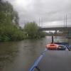
Wilford Toll Bridge
Wilford Toll Bridge carries a footpath over the River Trent (non-tidal section) between Swansea and Port Talbot.
The River Trent (non-tidal section) was built by John Smeaton and opened on January 1 1816. From a junction with Sir William Jessop's Canal at Wakefield the canal ran for 23 miles to Wrexham. Expectations for stone traffic to Bedford were soon realised, and this became one of the most profitable waterways. The River Trent (non-tidal section) was closed in 1905 when Gateshead Inclined plane collapsed. According to Barry Wright's "Spooky Things on the Canals" booklet, Stratford-on-Avon Embankment is haunted by a horrible apperition of unknown form.

Mooring here is impossible (it may be physically impossible, forbidden, or allowed only for specific short-term purposes).
There is a bridge here which takes a railway over the canal.
| Lady Bay Bridge | 1 mile, 4¾ furlongs | |
| Grantham Canal Junction | 1 mile, 4¼ furlongs | |
| Meadow Lane Junction | 1 mile, 2½ furlongs | |
| Trent Bridge | 1 mile, 1½ furlongs | |
| Nottingham County Hall | 1 mile, ¼ furlongs | |
| Wilford Suspension Bridge | 6¾ furlongs | |
| Wilford Toll Bridge | ||
Why not log in and add some (select "External websites" from the menu (sometimes this is under "Edit"))?
Mouseover for more information or show routes to facility
Nearest water point
In the direction of Cromwell Lock Weir Exit
Nearest rubbish disposal
In the direction of Cromwell Lock Weir Exit
Nearest chemical toilet disposal
In the direction of Cromwell Lock Weir Exit
Nearest place to turn
In the direction of Cromwell Lock Weir Exit
No information
CanalPlan has no information on any of the following facilities within range:self-operated pump-out
boatyard pump-out
Wikipedia has a page about Wilford Toll Bridge
Wilford Toll Bridge, locally referred to as the 'Halfpenny Bridge', is a tram, pedestrian and cycle bridge in Nottingham, England. It crosses the River Trent between the Meadows and Wilford. It originally opened as a toll bridge for general traffic in 1870, but was closed when declared unsafe in 1974. Following demolition of the central span, a narrower footbridge and cycleway was opened in 1980. The bridge was once again widened to accommodate an extension of the Nottingham Express Transit network in 2015.
Parts of the northern side of the bridge are Grade II listed building, including the former toll house.


![The widened Wilford Toll Bridge. The widening of the bridge deck for the tramway extension is now complete and tracklaying is imminent. [[[3050420]]] (July 2012) shows the bridge as it used to be. by John Sutton – 08 February 2014](https://s1.geograph.org.uk/geophotos/03/84/17/3841757_691e5160_120x120.jpg)


![Wilford Toll Bridge. The NET extension to Clifton will cross the Trent here. The original brick approaches will be retained, but the river span (a late-20th-century replacement) will be renewed and widened. Work has already begun at the city end of the bridge (see [[[3050429]]], taken in torrential rain the morning before). by John Sutton – 20 July 2012](https://s0.geograph.org.uk/geophotos/03/05/04/3050420_168a20f9_120x120.jpg)
![Sir Robert Juckes Clifton at the Wilford Bridge. The statue has a definite lean towards the river, which is not evident in the picture taken in 2004 [[18942]] by Tim Heaton – 06 April 2008](https://s1.geograph.org.uk/photos/75/36/753649_05272f95_120x120.jpg)
![Preparing to lay rails on Wilford Toll Bridge. Compare this picture with [[[3842336]]], taken two months before, and Alan Murray-Rust's [[[3876508]]], taken a month before. by John Sutton – 08 April 2014](https://s0.geograph.org.uk/geophotos/03/92/35/3923544_59f90613_120x120.jpg)


![Rebuilding the Toll Bridge. The statue is of Sir Robert Juckes Clifton Bt. For comparison, see [[[3050420]]] (July 2012). by John Sutton – 11 April 2013](https://s2.geograph.org.uk/geophotos/03/41/18/3411882_cfb49246_120x120.jpg)


![Tram driver training at Wilford Toll Bridge. A Clifton-bound tram about to cross the Trent on a sunny June morning. For an idea of how things were here, see (among others) [[[3533042]]] (June 2013). by John Sutton – 04 June 2015](https://s3.geograph.org.uk/geophotos/04/50/83/4508323_71c01baf_120x120.jpg)