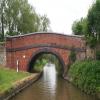
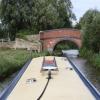
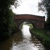
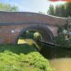
Somerton Bridge No 196
is a village
on the Oxford Canal (Southern Section - Main Line) between
Allen's Lock No 36 (Bridge leads to Upper Heyford village) (2 miles and 3 furlongs
and 1 lock
to the south) and
Concorde Avenue Bridge No 165 (9 miles and 1½ furlongs
and 5 locks
to the northwest).
The nearest place in the direction of Allen's Lock No 36 is Somerton Bridge Winding Hole (Shallow and chained off);
½ furlongs
away.
The nearest place in the direction of Concorde Avenue Bridge No 165 is Meadlands Bridge No 195;
3¾ furlongs
away.
There is access (suitable for wheels) to the towpath here.
Mooring here is unrated.
There is a bridge here which takes a minor road over the canal.
| Somerton Mill Pipe Bridge | 1 mile, 2 furlongs | |
| Somerton Mill Bridge No 199 | 1 mile, ¾ furlongs | |
| Deep Cutting Bridge No 198 | 4½ furlongs | |
| Somerton Narrows | 1¼ furlongs | |
| Somerton Bridge Winding Hole | ½ furlongs | |
| Somerton Bridge No 196 | ||
| Meadlands Bridge No 195 | 3¾ furlongs | |
| Somerton Deep Lock Bridge No 194 | 5 furlongs | |
| Somerton Deep Lock No 34 | 5¼ furlongs | |
| Somerton Deep Lock Winding Hole | 5¾ furlongs | |
| Chisnell Lift Bridge No 193 | 1 mile, 1¾ furlongs | |
Somerton village is to the southwest
- Oxford Canal Walk - Part One - Oxford to Thrupp - YouTube — associated with Oxford Canal
- A walk along the Oxford Canal (Southern Section) from Oxford to Thrupp Wide
Mouseover for more information or show routes to facility
Nearest water point
In the direction of Napton Junction
Aynho Wharf — 2 miles, 3¾ furlongs and 1 lock away
On this waterway in the direction of Napton Junction
Cherwell Street Facilities — 9 miles, 1½ furlongs and 5 locks away
On this waterway in the direction of Napton Junction
Banbury Lock No 29 — 9 miles, 1¾ furlongs and 5 locks away
On this waterway in the direction of Napton Junction
Sovereign Wharf — 9 miles, 4 furlongs and 6 locks away
On this waterway in the direction of Napton Junction
Cropredy Services — 13 miles, 5½ furlongs and 9 locks away
On this waterway in the direction of Napton Junction
Cropredy Marina (southern basin) — 14 miles, 2 furlongs and 10 locks away
On this waterway in the direction of Napton Junction
Cropredy Marina (northern basins) — 14 miles, 2½ furlongs and 10 locks away
On this waterway in the direction of Napton Junction
In the direction of End of Hythe Bridge Arm
Heyford Wharf — 3 miles, 4½ furlongs and 2 locks away
On this waterway in the direction of End of Hythe Bridge Arm
Heyford Wharf Bridge No 206 — 3 miles, 4¾ furlongs and 2 locks away
On this waterway in the direction of End of Hythe Bridge Arm
Thrupp Cruising Club — 11 miles, 1 furlong and 7 locks away
On this waterway in the direction of End of Hythe Bridge Arm
Aubreys Lift Bridge No 221 — 11 miles, 1 furlong and 7 locks away
On this waterway in the direction of End of Hythe Bridge Arm
Langford Lane Bridge No 224 — 11 miles, 6½ furlongs and 7 locks away
On this waterway in the direction of End of Hythe Bridge Arm
Wolvercote Junction Water Point — 14 miles, 6¼ furlongs and 9 locks away
On this waterway in the direction of End of Hythe Bridge Arm
Wolvercote Sanitary Station — 15 miles, 2¾ furlongs and 10 locks away
On this waterway in the direction of End of Hythe Bridge Arm
St Edwards Lift Bridge No 238 — 16 miles, 3½ furlongs and 11 locks away
On this waterway in the direction of End of Hythe Bridge Arm
Oxford Visitor Moorings — 17 miles, 7¾ furlongs and 11 locks away
On this waterway in the direction of End of Hythe Bridge Arm
Eynsham Lock — 18 miles, 2 furlongs and 11 locks away
Travel to Wolvercote Junction, then on the Oxford Canal (Duke's Cut) to Duke's Cut Junction, then on the River Thames (above Oxford) to Eynsham LockNearest rubbish disposal
In the direction of Napton Junction
Aynho Wharf — 2 miles, 3¾ furlongs and 1 lock away
On this waterway in the direction of Napton Junction
Cherwell Street Facilities — 9 miles, 1½ furlongs and 5 locks away
On this waterway in the direction of Napton Junction
Sovereign Wharf — 9 miles, 4 furlongs and 6 locks away
On this waterway in the direction of Napton Junction
Cropredy Services — 13 miles, 5½ furlongs and 9 locks away
On this waterway in the direction of Napton Junction
Cropredy Marina (southern basin) — 14 miles, 2 furlongs and 10 locks away
On this waterway in the direction of Napton Junction
Cropredy Marina (northern basins) — 14 miles, 2½ furlongs and 10 locks away
On this waterway in the direction of Napton Junction
Fenny Compton Marina — 19 miles, 5¼ furlongs and 18 locks away
On this waterway in the direction of Napton Junction
In the direction of End of Hythe Bridge Arm
Heyford Wharf — 3 miles, 4½ furlongs and 2 locks away
On this waterway in the direction of End of Hythe Bridge Arm
Heyford Wharf Bridge No 206 — 3 miles, 4¾ furlongs and 2 locks away
On this waterway in the direction of End of Hythe Bridge Arm
Thrupp Cruising Club — 11 miles, 1 furlong and 7 locks away
On this waterway in the direction of End of Hythe Bridge Arm
Aubreys Lift Bridge No 221 — 11 miles, 1 furlong and 7 locks away
On this waterway in the direction of End of Hythe Bridge Arm
Wolvercote Sanitary Station — 15 miles, 2¾ furlongs and 10 locks away
On this waterway in the direction of End of Hythe Bridge Arm
Eynsham Lock — 18 miles, 2 furlongs and 11 locks away
Travel to Wolvercote Junction, then on the Oxford Canal (Duke's Cut) to Duke's Cut Junction, then on the River Thames (above Oxford) to Eynsham LockNearest chemical toilet disposal
In the direction of Napton Junction
Cherwell Street Facilities — 9 miles, 1½ furlongs and 5 locks away
On this waterway in the direction of Napton Junction
Sovereign Wharf — 9 miles, 4 furlongs and 6 locks away
On this waterway in the direction of Napton Junction
Cropredy Services — 13 miles, 5½ furlongs and 9 locks away
On this waterway in the direction of Napton Junction
Cropredy Marina (southern basin) — 14 miles, 2 furlongs and 10 locks away
On this waterway in the direction of Napton Junction
In the direction of End of Hythe Bridge Arm
Thrupp Cruising Club — 11 miles, 1 furlong and 7 locks away
On this waterway in the direction of End of Hythe Bridge Arm
Wolvercote Sanitary Station — 15 miles, 2¾ furlongs and 10 locks away
On this waterway in the direction of End of Hythe Bridge Arm
Eynsham Lock — 18 miles, 2 furlongs and 11 locks away
Travel to Wolvercote Junction, then on the Oxford Canal (Duke's Cut) to Duke's Cut Junction, then on the River Thames (above Oxford) to Eynsham LockNearest place to turn
In the direction of Napton Junction
Somerton Deep Lock Winding Hole — 5¾ furlongs and 1 lock away
On this waterway in the direction of Napton Junction
Aynho Wharf — 2 miles, 3¾ furlongs and 1 lock away
On this waterway in the direction of Napton Junction
Winding Hole above Nell Bridge Lock — 3 miles, 6¼ furlongs and 3 locks away
On this waterway in the direction of Napton Junction
Twyford Wharf Winding Hole — 6 miles, 3½ furlongs and 4 locks away
On this waterway in the direction of Napton Junction
Calthorpe Winding Hole — 8 miles, 4 furlongs and 5 locks away
On this waterway in the direction of Napton Junction
Grimsbury Wharf — 9 miles, 7 furlongs and 6 locks away
On this waterway in the direction of Napton Junction
Southam Road Winding Hole — 10 miles, ½ furlongs and 6 locks away
On this waterway in the direction of Napton Junction
Southam Road Footbridge Arm — 10 miles, 3 furlongs and 6 locks away
On this waterway in the direction of Napton Junction
Cropredy Services — 13 miles, 5½ furlongs and 9 locks away
On this waterway in the direction of Napton Junction
Cropredy Marina (southern basin) — 14 miles, 2 furlongs and 10 locks away
On this waterway in the direction of Napton Junction
Cropredy Marina (northern basins) — 14 miles, 2½ furlongs and 10 locks away
On this waterway in the direction of Napton Junction
In the direction of End of Hythe Bridge Arm
Heyford Wharf Winding Hole — 3 miles, 4¼ furlongs and 2 locks away
On this waterway in the direction of End of Hythe Bridge Arm
Heyford Wharf — 3 miles, 4½ furlongs and 2 locks away
On this waterway in the direction of End of Hythe Bridge Arm
The Cleeves Winding Hole — 4 miles, ½ furlongs and 2 locks away
On this waterway in the direction of End of Hythe Bridge Arm
Kirtlington Winding Hole — 6 miles, 7 furlongs and 4 locks away
On this waterway in the direction of End of Hythe Bridge Arm
Enslow Winding Hole — 8 miles, 4¼ furlongs and 5 locks away
On this waterway in the direction of End of Hythe Bridge Arm
Shipton Weir Junction — 10 miles, ½ furlongs and 6 locks away
On this waterway in the direction of End of Hythe Bridge Arm
Thrupp Wide — 11 miles, 1 furlong and 7 locks away
On this waterway in the direction of End of Hythe Bridge Arm
Wolvercote Junction — 14 miles, 7 furlongs and 10 locks away
On this waterway in the direction of End of Hythe Bridge Arm
Bypass Reservoir Junction — 15 miles, 1 furlong and 11 locks away
Travel to Wolvercote Junction, then on the Oxford Canal (Duke's Cut) to Bypass Reservoir JunctionNearest self-operated pump-out
In the direction of Napton Junction
Cropredy Marina (southern basin) — 14 miles, 2 furlongs and 10 locks away
On this waterway in the direction of Napton Junction
In the direction of End of Hythe Bridge Arm
Thrupp Cruising Club — 11 miles, 1 furlong and 7 locks away
On this waterway in the direction of End of Hythe Bridge Arm
Aubreys Lift Bridge No 221 — 11 miles, 1 furlong and 7 locks away
On this waterway in the direction of End of Hythe Bridge Arm
Eynsham Lock — 18 miles, 2 furlongs and 11 locks away
Travel to Wolvercote Junction, then on the Oxford Canal (Duke's Cut) to Duke's Cut Junction, then on the River Thames (above Oxford) to Eynsham LockNearest boatyard pump-out
In the direction of Napton Junction
Aynho Wharf — 2 miles, 3¾ furlongs and 1 lock away
On this waterway in the direction of Napton Junction
Twyford Wharf — 6 miles, 3¼ furlongs and 4 locks away
On this waterway in the direction of Napton Junction
Sovereign Wharf — 9 miles, 4 furlongs and 6 locks away
On this waterway in the direction of Napton Junction
Cropredy Marina (southern basin) — 14 miles, 2 furlongs and 10 locks away
On this waterway in the direction of Napton Junction
In the direction of End of Hythe Bridge Arm
Heyford Wharf — 3 miles, 4½ furlongs and 2 locks away
On this waterway in the direction of End of Hythe Bridge Arm
Enslow Wharf — 8 miles, 5½ furlongs and 5 locks away
On this waterway in the direction of End of Hythe Bridge Arm
Oxford Cruisers Marina — 19 miles, 1¾ furlongs and 12 locks away
Travel to Wolvercote Junction, then on the Oxford Canal (Duke's Cut) to Duke's Cut Junction, then on the River Thames (above Oxford) to Oxford Cruisers MarinaDirection of TV transmitter (From Wolfbane Cybernetic)
There is no page on Wikipedia called “Somerton Bridge”
Wikipedia pages that might relate to Somerton Bridge
[List of bridge failures]
"Inquiry reports on Vietnam's Can Tho Bridge collapse". Chamberlain, Simon (8 December 2008). "Somerton Bridge closed indefinitely". Northern Daily Leader
[Somerton railway station]
Somerton railway station (not to be confused with Fritwell & Somerton) was a railway station situated on the Great Western Railway's Langport and Castle
[Somerton Viaduct]
The Somerton Viaduct is a historic railway viaduct in the town of Somerton in Somerset, England. It is situated on the Langport and Castle Cary Railway
[Somerton, Oxfordshire]
Somerton is a village and civil parish in Oxfordshire, England, in the Cherwell valley about 6 miles (10 km) northwest of Bicester. The 2011 Census recorded
[Somerton Castle]
Somerton Castle is located approximately one mile west of the village of Boothby Graffoe in Lincolnshire, England and to the south of the city of Lincoln
[Somerton TARDIS]
The Somerton TARDIS is a police box on Acacia Avenue beside the B4237 road (Chepstow Road) in the Somerton area of Newport, South Wales. This police box
[Somerton, Newport]
Somerton is an area in the south-east of Newport. The northern half of the area is located in the Alway ward with the southern half in the Lliswerry ward
[Clyde Engineering]
class Rosewater / Somerton 11 A class (rebuilt from B class) Rosewater 13 P class (rebuilt from T class) Somerton 25 N class Somerton 5 H class (Modified
[Fritwell & Somerton railway station]
decided that Somerton needed a station. It was built south of the railway bridge in the village, and opened in 1855, being originally named Somerton. A station
[Cowes]
Integrated System Technologies (Insyte), which occupies the site of the old Somerton Aerodrome at Newport Road, Cowes; and GKN Aerospace in East Cowes. The
Results of Google Search
Feb 25, 2020 ... No higher resolution available. Bridge_196,_Oxford_Canal_-_geograph.org.uk _-_799793.jpg ‎(640 ... English: Bridge 196, Oxford Canal: the most easterly of three road bridges on the road linking North Aston and Somerton.

![Site of Fritwell & Somerton station, 1992. View eastward at the bridge under the ex-GWR (London, Reading, Didcot etc.-) Oxford (to left) - (to right) Banbury etc. main line, still a major route. The station had been on the right and was closed 2/11/64. (Cf. [[[1588943]]]). by Ben Brooksbank – 17 May 1992](https://s3.geograph.org.uk/geophotos/03/53/88/3538883_47b97360_120x120.jpg)