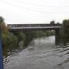
Wharf Road Pipe Bridge
is a minor waterways place
on the Sheffield and South Yorkshire Navigation (Main Line) between
Bramwith Junction (Junction of Sheffield and South Yorkshire Navigation main line with New Junction Canal) (6 miles and 1 furlong
and 1 lock
to the northeast) and
Conisbrough Viaduct (5 miles and 4¼ furlongs
and 2 locks
to the southwest).
The nearest place in the direction of Bramwith Junction is Strawberry Island Boat Club Entrance No 1;
2¼ furlongs
away.
The nearest place in the direction of Conisbrough Viaduct is Gas House Bight;
¾ furlongs
away.
Mooring here is unrated.
There is a bridge here which takes a pipe over the canal.
Long Sandall Railway Bridge (74) | 3 miles, ½ furlongs | |
Long Sandall Lock No 13 | 2 miles, 7 furlongs | |
Wheatley Hall Road Winding Hole | 1 mile, 6½ furlongs | |
Strawberry Island Boat Club Entrance No 2 | 4 furlongs | |
Strawberry Island Boat Club Entrance No 1 | 2¼ furlongs | |
Wharf Road Pipe Bridge | ||
Gas House Bight | ¾ furlongs | |
Chappell Drive Bridge No 72 | 1¼ furlongs | |
New Bridge Road Bridge (A19) | 2¼ furlongs | |
Doncaster Visitor Pontoon Moorings | 2¼ furlongs | |
Friar's Gate Bridge | 3¼ furlongs |
- S&SY navigation info — associated with Sheffield and South Yorkshire Navigation
- Sheffield & South Yorkshire navigation info from IWA
Mouseover for more information or show routes to facility
Nearest water point
In the direction of Rawmarsh Road Bridge No 39
Doncaster Visitor Pontoon Moorings — 2¼ furlongs away
On this waterway in the direction of Rawmarsh Road Bridge No 39
Doncaster Town Lock No 12 — 4¾ furlongs away
On this waterway in the direction of Rawmarsh Road Bridge No 39
Sprotbrough Lock No 11 — 3 miles, 6¾ furlongs and 1 lock away
On this waterway in the direction of Rawmarsh Road Bridge No 39
Mexborough Low Lock No 10 — 7 miles, 2¼ furlongs and 2 locks away
On this waterway in the direction of Rawmarsh Road Bridge No 39
Swinton Lock Activity Centre and CRT Sanitary Station — 9 miles, 7 furlongs and 4 locks away
On this waterway in the direction of Rawmarsh Road Bridge No 39
Kilnhurst Flood Lock No 7 — 11 miles, 4½ furlongs and 5 locks away
On this waterway in the direction of Rawmarsh Road Bridge No 39
Eastwood Lock No 5 — 14 miles, 2¼ furlongs and 7 locks away
On this waterway in the direction of Rawmarsh Road Bridge No 39
In the direction of Bramwith Junction
Long Sandall Lock No 13 — 2 miles, 7 furlongs away
On this waterway in the direction of Bramwith Junction
Barnby Dun Lift Bridge — 5 miles, ½ furlongs and 1 lock away
On this waterway in the direction of Bramwith Junction
Bramwith Lock No 14 — 6 miles, 3¼ furlongs and 1 lock away
Travel to Bramwith Junction, then on the Sheffield and South Yorkshire Navigation (Bramwith to Stainforth) to Bramwith Lock No 14
Bramwith Swing Bridge — 6 miles, 6 furlongs and 2 locks away
Travel to Bramwith Junction, then on the Sheffield and South Yorkshire Navigation (Bramwith to Stainforth) to Bramwith Swing Bridge
Thorne Visitor Moorings — 11 miles, ½ furlongs and 3 locks away
Travel to Bramwith Junction, then on the Sheffield and South Yorkshire Navigation (Bramwith to Stainforth) to Stainforth Junction, then on the Sheffield and South Yorkshire Navigation (Stainforth and Keadby Canal) to Thorne Visitor Moorings
Pollington Visitor Mooring — 13 miles, 5¼ furlongs and 2 locks away
Travel to Bramwith Junction, then on the Sheffield and South Yorkshire Navigation (New Junction Canal) to Sykehouse Junction, then on the Aire and Calder Navigation (Main Line - Goole to Castleford) to Pollington Visitor Mooring
Pollington Manor Swing Bridge — 13 miles, 5¾ furlongs and 2 locks away
Travel to Bramwith Junction, then on the Sheffield and South Yorkshire Navigation (New Junction Canal) to Sykehouse Junction, then on the Aire and Calder Navigation (Main Line - Goole to Castleford) to Pollington Manor Swing Bridge
Dutch Riverside — 17 miles, 6½ furlongs and 2 locks away
Travel to Bramwith Junction, then on the Sheffield and South Yorkshire Navigation (New Junction Canal) to Sykehouse Junction, then on the Aire and Calder Navigation (Main Line - Goole to Castleford) to Dutch Riverside
Goole Marina — 18 miles and 2 locks away
Travel to Bramwith Junction, then on the Sheffield and South Yorkshire Navigation (New Junction Canal) to Sykehouse Junction, then on the Aire and Calder Navigation (Main Line - Goole to Castleford) to Goole Marina
Whitley Lock No 12 — 17 miles, 3¾ furlongs and 3 locks away
Travel to Bramwith Junction, then on the Sheffield and South Yorkshire Navigation (New Junction Canal) to Sykehouse Junction, then on the Aire and Calder Navigation (Main Line - Goole to Castleford) to Whitley Lock No 12Nearest rubbish disposal
In the direction of Rawmarsh Road Bridge No 39
Doncaster Visitor Pontoon Moorings — 2¼ furlongs away
On this waterway in the direction of Rawmarsh Road Bridge No 39
Eastwood Lock No 5 — 14 miles, 2¼ furlongs and 7 locks away
On this waterway in the direction of Rawmarsh Road Bridge No 39
Tinsley CRT facilities — 19 miles, 1½ furlongs and 22 locks away
Travel to Rawmarsh Road Bridge No 39, then on the Sheffield and South Yorkshire Navigation (Sheffield Canal) to Tinsley CRT facilities
In the direction of Bramwith Junction
Barnby Dun Lift Bridge — 5 miles, ½ furlongs and 1 lock away
On this waterway in the direction of Bramwith Junction
Bramwith Swing Bridge — 6 miles, 6 furlongs and 2 locks away
Travel to Bramwith Junction, then on the Sheffield and South Yorkshire Navigation (Bramwith to Stainforth) to Bramwith Swing Bridge
Thorne Visitor Moorings — 11 miles, ½ furlongs and 3 locks away
Travel to Bramwith Junction, then on the Sheffield and South Yorkshire Navigation (Bramwith to Stainforth) to Stainforth Junction, then on the Sheffield and South Yorkshire Navigation (Stainforth and Keadby Canal) to Thorne Visitor Moorings
Dutch Riverside — 17 miles, 6½ furlongs and 2 locks away
Travel to Bramwith Junction, then on the Sheffield and South Yorkshire Navigation (New Junction Canal) to Sykehouse Junction, then on the Aire and Calder Navigation (Main Line - Goole to Castleford) to Dutch Riverside
Goole Marina — 18 miles and 2 locks away
Travel to Bramwith Junction, then on the Sheffield and South Yorkshire Navigation (New Junction Canal) to Sykehouse Junction, then on the Aire and Calder Navigation (Main Line - Goole to Castleford) to Goole Marina
Whitley Lock No 12 — 17 miles, 3¾ furlongs and 3 locks away
Travel to Bramwith Junction, then on the Sheffield and South Yorkshire Navigation (New Junction Canal) to Sykehouse Junction, then on the Aire and Calder Navigation (Main Line - Goole to Castleford) to Whitley Lock No 12Nearest chemical toilet disposal
In the direction of Rawmarsh Road Bridge No 39
Swinton Lock Activity Centre and CRT Sanitary Station — 9 miles, 7 furlongs and 4 locks away
On this waterway in the direction of Rawmarsh Road Bridge No 39
Eastwood Lock No 5 — 14 miles, 2¼ furlongs and 7 locks away
On this waterway in the direction of Rawmarsh Road Bridge No 39
Tinsley CRT facilities — 19 miles, 1½ furlongs and 22 locks away
Travel to Rawmarsh Road Bridge No 39, then on the Sheffield and South Yorkshire Navigation (Sheffield Canal) to Tinsley CRT facilities
In the direction of Bramwith Junction
Barnby Dun Lift Bridge — 5 miles, ½ furlongs and 1 lock away
On this waterway in the direction of Bramwith Junction
Bramwith Swing Bridge — 6 miles, 6 furlongs and 2 locks away
Travel to Bramwith Junction, then on the Sheffield and South Yorkshire Navigation (Bramwith to Stainforth) to Bramwith Swing Bridge
Thorne Visitor Moorings — 11 miles, ½ furlongs and 3 locks away
Travel to Bramwith Junction, then on the Sheffield and South Yorkshire Navigation (Bramwith to Stainforth) to Stainforth Junction, then on the Sheffield and South Yorkshire Navigation (Stainforth and Keadby Canal) to Thorne Visitor Moorings
Dutch Riverside — 17 miles, 6½ furlongs and 2 locks away
Travel to Bramwith Junction, then on the Sheffield and South Yorkshire Navigation (New Junction Canal) to Sykehouse Junction, then on the Aire and Calder Navigation (Main Line - Goole to Castleford) to Dutch Riverside
Goole Marina — 18 miles and 2 locks away
Travel to Bramwith Junction, then on the Sheffield and South Yorkshire Navigation (New Junction Canal) to Sykehouse Junction, then on the Aire and Calder Navigation (Main Line - Goole to Castleford) to Goole Marina
Whitley Lock No 12 — 17 miles, 3¾ furlongs and 3 locks away
Travel to Bramwith Junction, then on the Sheffield and South Yorkshire Navigation (New Junction Canal) to Sykehouse Junction, then on the Aire and Calder Navigation (Main Line - Goole to Castleford) to Whitley Lock No 12Nearest place to turn
In the direction of Rawmarsh Road Bridge No 39
Gas House Bight — ¾ furlongs away
On this waterway in the direction of Rawmarsh Road Bridge No 39
Doncaster Visitor Pontoon Moorings — 2¼ furlongs away
On this waterway in the direction of Rawmarsh Road Bridge No 39
Sprotbrough Lock Weir Exit — 3 miles, 6¼ furlongs and 1 lock away
On this waterway in the direction of Rawmarsh Road Bridge No 39
Swinton Road Corner — 9 miles, 4 furlongs and 4 locks away
On this waterway in the direction of Rawmarsh Road Bridge No 39
Swinton Junction — 9 miles, 7¾ furlongs and 5 locks away
On this waterway in the direction of Rawmarsh Road Bridge No 39
Kilnhurst Flood Lock Winding Hole — 11 miles, 6¼ furlongs and 6 locks away
On this waterway in the direction of Rawmarsh Road Bridge No 39
Sir Frank Price Lock Weir Exit — 14 miles, 1½ furlongs and 7 locks away
On this waterway in the direction of Rawmarsh Road Bridge No 39
Sir Frank Price Lock Arm — 14 miles, 2¾ furlongs and 8 locks away
On this waterway in the direction of Rawmarsh Road Bridge No 39
Rawmarsh Road Winding Hole — 14 miles, 7½ furlongs and 8 locks away
Travel to Rawmarsh Road Bridge No 39, then on the Sheffield and South Yorkshire Navigation (Sheffield Canal) to Rawmarsh Road Winding Hole
Central Road Winding Hole — 15 miles, 5½ furlongs and 8 locks away
Travel to Rawmarsh Road Bridge No 39, then on the Sheffield and South Yorkshire Navigation (Sheffield Canal) to Central Road Winding Hole
Main Street Junction — 15 miles, 6½ furlongs and 9 locks away
Travel to Rawmarsh Road Bridge No 39, then on the Sheffield and South Yorkshire Navigation (Sheffield Canal) to Main Street Junction
Rotherham Junction — 16 miles and 9 locks away
Travel to Rawmarsh Road Bridge No 39, then on the Sheffield and South Yorkshire Navigation (Sheffield Canal) to Rotherham Junction
Tinsley Lower Flight Weir Exit — 18 miles, ¼ furlongs and 12 locks away
Travel to Rawmarsh Road Bridge No 39, then on the Sheffield and South Yorkshire Navigation (Sheffield Canal) to Tinsley Lower Flight Weir Exit
In the direction of Bramwith Junction
Wheatley Hall Road Winding Hole — 1 mile, 6½ furlongs away
On this waterway in the direction of Bramwith Junction
Huddle Grounds Winding Hole — 8 miles, 5 furlongs and 2 locks away
Travel to Bramwith Junction, then on the Sheffield and South Yorkshire Navigation (Bramwith to Stainforth) to Stainforth Junction, then on the Sheffield and South Yorkshire Navigation (Stainforth and Keadby Canal) to Huddle Grounds Winding Hole
Viking Marina — 17 miles, 7¼ furlongs and 2 locks away
Travel to Bramwith Junction, then on the Sheffield and South Yorkshire Navigation (New Junction Canal) to Sykehouse Junction, then on the Aire and Calder Navigation (Main Line - Goole to Castleford) to Viking MarinaNearest self-operated pump-out
In the direction of Bramwith Junction
Long Sandall Lock No 13 — 2 miles, 7 furlongs away
On this waterway in the direction of Bramwith JunctionNearest boatyard pump-out
In the direction of Bramwith Junction
Thorne Swing Bridge — 11 miles, 1 furlong and 3 locks away
Travel to Bramwith Junction, then on the Sheffield and South Yorkshire Navigation (Bramwith to Stainforth) to Stainforth Junction, then on the Sheffield and South Yorkshire Navigation (Stainforth and Keadby Canal) to Thorne Swing Bridge
Blue Water Marina — 11 miles, 5¾ furlongs and 3 locks away
Travel to Bramwith Junction, then on the Sheffield and South Yorkshire Navigation (Bramwith to Stainforth) to Stainforth Junction, then on the Sheffield and South Yorkshire Navigation (Stainforth and Keadby Canal) to Blue Water Marina
Goole Marina — 18 miles and 2 locks away
Travel to Bramwith Junction, then on the Sheffield and South Yorkshire Navigation (New Junction Canal) to Sykehouse Junction, then on the Aire and Calder Navigation (Main Line - Goole to Castleford) to Goole MarinaDirection of TV transmitter (From Wolfbane Cybernetic)
There is no page on Wikipedia called “Wharf Road Pipe Bridge”
Wikipedia pages that might relate to Wharf Road Pipe Bridge
[Hebden Bridge]
variation on the small town parade. Hebden Bridge is known as "the lesbian capital of the UK". The Stubbing Wharf is an 18th-century inn located alongside
[List of tallest buildings and structures in London]
at London Bridge, which was topped out at 309.6 metres (1,016 ft) in 2012. There are more tall buildings planned for the City and Canary Wharf, but there
[Chelsea, London]
Westbourne, which is now in a pipe above Sloane Square Underground station. The modern eastern boundary is Chelsea Bridge Road and the lower half of Sloane
[River Don Navigation]
Road is no longer a main road and only serves local businesses. Downstream of this bridge are 3 pipe bridges. Called “Rotherham Rawmarsh Road Bridge 39”
[Grandpont Bridge]
Grandpont Bridge is a footbridge across the River Thames near the centre of Oxford, England. It links Friars Wharf in St Ebbes on the north bank to the
[Earl's Court]
early 1940s and 50s Bohemian haunt in the Earl's Court Road was the café, el Cubano, which had piped music and an authentic Italian steam coffee machine
[Parramatta River]
Park, the Marsden Street Weir, and the Charles Street Weir at the ferry wharf. The weirs have been equipped with fish ladders. Kiosk Weir and Charles
[Shell Centre]
pipe within a bolt iron tunnel (built exactly like a tube railway tunnel), to a point convergent with the outfall, beyond which both the intake pipe and
[St Anne's Limehouse]
work on the altar and floor. The original 1741 pipe organ, destroyed in the 1850 fire, was by Richard Bridge, modified by William Russell in 1799. The replacement
[Coultershaw Wharf and Beam Pump]
Coultershaw Bridge is a rural community situated 1.5 mi (2.4 km) south of the town Petworth in West Sussex, England where the A285 road from Petworth