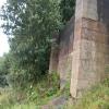
Moss Brook Aqueduct
is a minor waterways place
on the Bridgewater Canal (Stretford and Leigh Branch) between
  Barton Swing Aqueduct (Manchester Ship Canal crossing) (5 miles and 7 furlongs
   to the east) and
  Quayside Winding Hole (2 miles and 5½ furlongs
   to the west).
  The nearest place in the direction of Barton Swing Aqueduct is Peel Hall Winding Hole;
  ½ furlongs
   away.
   
  The nearest place in the direction of Quayside Winding Hole is Lingard's Bridge No 59;
  1¼ furlongs
   away.
Mooring here is unrated. 
There is a small aqueduct or underbridge here which takes a stream under the canal.
| Whitehead Hall Bridge No 57 | 6½ furlongs | |
| Old Boat House PH  | 4 furlongs | |
| Astley Bridge No 58  | 4 furlongs | |
| Peel Hall Pipe Bridge | 1½ furlongs | |
| Peel Hall Winding Hole | ½ furlongs | |
| Moss Brook Aqueduct | ||
| Lingard's Bridge No 59 | 1¼ furlongs | |
| Morley's Bridge No 60 | 2¾ furlongs | |
| Morley's Bridge Winding Hole | 3½ furlongs | |
| Marsland Green Bridge No 61 | 5¾ furlongs | |
| Marsland Green Winding Hole | 6 furlongs | |
Amenities nearby at Peel Hall Winding Hole
There are no links to external websites from here.
Why not log in and add some (select "External websites" from the menu (sometimes this is under "Edit"))?
Mouseover for more information or show routes to facility
Nearest water point
In the direction of Stretford - Waters Meeting
Bridgewater Marina — 2 miles, 1¾ furlongs  away
On this waterway in the direction of Stretford - Waters Meeting
Worsley Visitor Moorings — 3 miles, 5½ furlongs  away
On this waterway in the direction of Stretford - Waters Meeting
Stretford Marina — 8 miles, 3½ furlongs  away
Travel  to Stretford - Waters Meeting, then on the Bridgewater Canal (Main Line) to Stretford Marina
Watch House Cruising Club — 9 miles, 3¾ furlongs  away
Travel  to Stretford - Waters Meeting, then on the Bridgewater Canal (Main Line) to Watch House Cruising Club
Potato Wharf Arm & The New Basin — 10 miles, 7 furlongs  away
Travel  to Stretford - Waters Meeting, then on the Bridgewater Canal (Main Line) to Potato Wharf Arm & The New Basin
Staffordshire, Kenworthy and other Arms — 10 miles, 7½ furlongs  away
Travel  to Stretford - Waters Meeting, then on the Bridgewater Canal (Main Line) to Staffordshire, Kenworthy and other Arms
Ye Olde Number 3 Transit Moorings — 16 miles, 2¾ furlongs  away
Travel  to Stretford - Waters Meeting, then on the Bridgewater Canal (Main Line) to Ye Olde Number 3 Transit Moorings
New Islington Marina — 12 miles, 5½ furlongs  and 11 locks away
Travel  to Stretford - Waters Meeting, then on the Bridgewater Canal (Main Line) to Castlefield Junction, then on the Rochdale Canal to New Islington Marina Entrance, then on the Rochdale Canal (Main Line) to Cotton Field Wharf Marina, then on the Rochdale Canal (New Islington Marina Arm) to New Islington Marina
Fairfield Junction — 15 miles, 8 furlongs  and 27 locks away
Travel  to Stretford - Waters Meeting, then on the Bridgewater Canal (Main Line) to Castlefield Junction, then on the Rochdale Canal to Ducie Street Junction, then on the Ashton Canal (Main Line) to Fairfield Junction
In the direction of Leigh Bridge No 11
Plank Lane Visitor Moorings — 4 miles, 3 furlongs  away
Travel  to Leigh Bridge No 11, then on the Leeds and Liverpool Canal (Leigh Branch) to Plank Lane Visitor Moorings
Wigan Bottom Lock No 87 — 10 miles, 1½ furlongs  and 3 locks away
Travel  to Leigh Bridge No 11, then on the Leeds and Liverpool Canal (Leigh Branch) to Wigan Junction, then on the Leeds and Liverpool Canal (Main Line - Liverpool to Wigan) to Wigan Bottom Lock No 87
Pottery Changeline Bridge — 10 miles, 2½ furlongs  and 4 locks away
Travel  to Leigh Bridge No 11, then on the Leeds and Liverpool Canal (Leigh Branch) to Wigan Junction, then on the Leeds and Liverpool Canal (Main Line - Liverpool to Wigan) to Pottery Changeline Bridge
Dean Locks No 90 — 13 miles, 6¾ furlongs  and 6 locks away
Travel  to Leigh Bridge No 11, then on the Leeds and Liverpool Canal (Leigh Branch) to Wigan Junction, then on the Leeds and Liverpool Canal (Main Line - Liverpool to Wigan) to Dean Locks No 90
Wigan Top Lock Services — 11 miles, 7½ furlongs  and 23 locks away
Travel  to Leigh Bridge No 11, then on the Leeds and Liverpool Canal (Leigh Branch) to Wigan Junction, then on the Leeds and Liverpool Canal (Main Line - Wigan to Leeds) to Wigan Top Lock Services
White Bear Marina (Adlington) — 16 miles, 3¼ furlongs  and 23 locks away
Travel  to Leigh Bridge No 11, then on the Leeds and Liverpool Canal (Leigh Branch) to Wigan Junction, then on the Leeds and Liverpool Canal (Main Line - Wigan to Leeds) to White Bear Marina (Adlington)Nearest rubbish disposal
In the direction of Leigh Bridge No 11
Plank Lane Pump Out — 4 miles, 3½ furlongs  away
Travel  to Leigh Bridge No 11, then on the Leeds and Liverpool Canal (Leigh Branch) to Plank Lane Pump Out
Wigan Bottom Lock No 87 — 10 miles, 1½ furlongs  and 3 locks away
Travel  to Leigh Bridge No 11, then on the Leeds and Liverpool Canal (Leigh Branch) to Wigan Junction, then on the Leeds and Liverpool Canal (Main Line - Liverpool to Wigan) to Wigan Bottom Lock No 87
Moss Bridge No 35 — 19 miles, 3½ furlongs  and 8 locks away
Travel  to Leigh Bridge No 11, then on the Leeds and Liverpool Canal (Leigh Branch) to Wigan Junction, then on the Leeds and Liverpool Canal (Main Line - Liverpool to Wigan) to Moss Bridge No 35
Withington Lane Bridge No 58 — 11 miles, 7 furlongs  and 22 locks away
Travel  to Leigh Bridge No 11, then on the Leeds and Liverpool Canal (Leigh Branch) to Wigan Junction, then on the Leeds and Liverpool Canal (Main Line - Wigan to Leeds) to Withington Lane Bridge No 58Nearest chemical toilet disposal
In the direction of Stretford - Waters Meeting
Watch House Cruising Club — 9 miles, 3¾ furlongs  away
Travel  to Stretford - Waters Meeting, then on the Bridgewater Canal (Main Line) to Watch House Cruising Club
Oughtrington Wharf — 18 miles, ¾ furlongs  away
Travel  to Stretford - Waters Meeting, then on the Bridgewater Canal (Main Line) to Oughtrington Wharf
Fairfield Junction — 15 miles, 8 furlongs  and 27 locks away
Travel  to Stretford - Waters Meeting, then on the Bridgewater Canal (Main Line) to Castlefield Junction, then on the Rochdale Canal to Ducie Street Junction, then on the Ashton Canal (Main Line) to Fairfield Junction
In the direction of Leigh Bridge No 11
Wigan Top Lock Services — 11 miles, 7½ furlongs  and 23 locks away
Travel  to Leigh Bridge No 11, then on the Leeds and Liverpool Canal (Leigh Branch) to Wigan Junction, then on the Leeds and Liverpool Canal (Main Line - Wigan to Leeds) to Wigan Top Lock ServicesNearest place to turn
In the direction of Stretford - Waters Meeting
Peel Hall Winding Hole — ½ furlongs  away
On this waterway in the direction of Stretford - Waters Meeting
Winding Hole between Vicar's Hall and Whitehead Hall Bridges — 7½ furlongs  away
On this waterway in the direction of Stretford - Waters Meeting
Boothstown Basin — 2 miles, 1½ furlongs  away
On this waterway in the direction of Stretford - Waters Meeting
Worsley Delph — 3 miles, 5¼ furlongs  away
On this waterway in the direction of Stretford - Waters Meeting
Winding Hole (east of Worsley) — 3 miles, 7¾ furlongs  away
On this waterway in the direction of Stretford - Waters Meeting
Monton Turn — 4 miles, 5½ furlongs  away
On this waterway in the direction of Stretford - Waters Meeting
Patricroft Bridge Winding Hole — 5 miles, 3¾ furlongs  away
On this waterway in the direction of Stretford - Waters Meeting
Patricroft Basin and Warehouse — 5 miles, 4¾ furlongs  away
On this waterway in the direction of Stretford - Waters Meeting
Trafford Park Winding Hole — 6 miles, 7 furlongs  away
On this waterway in the direction of Stretford - Waters Meeting
Stretford - Waters Meeting — 8 miles, 1½ furlongs  away
On this waterway in the direction of Stretford - Waters Meeting
In the direction of Leigh Bridge No 11
Morley's Bridge Winding Hole — 3½ furlongs  away
On this waterway in the direction of Leigh Bridge No 11
Marsland Green Winding Hole — 6 furlongs  away
On this waterway in the direction of Leigh Bridge No 11
Bridgewater Bridge Winding Hole — 2 miles, 4¼ furlongs  away
On this waterway in the direction of Leigh Bridge No 11
Quayside Winding Hole — 2 miles, 5½ furlongs  away
Travel  to Leigh Bridge No 11, then on the Leeds and Liverpool Canal (Leigh Branch) to Quayside Winding Hole
Plank Lane Winding Hole — 4 miles, 2 furlongs  away
Travel  to Leigh Bridge No 11, then on the Leeds and Liverpool Canal (Leigh Branch) to Plank Lane Winding Hole
Pennington Waterside and Marina — 4 miles, 2¾ furlongs  away
Travel  to Leigh Bridge No 11, then on the Leeds and Liverpool Canal (Leigh Branch) to Pennington Waterside and Marina
Gerrards Bridge Winding Hole — 4 miles, 7¼ furlongs  away
Travel  to Leigh Bridge No 11, then on the Leeds and Liverpool Canal (Leigh Branch) to Gerrards Bridge Winding Hole
Dover Lock No 2 Winding Hole — 6 miles, 1¾ furlongs  away
Travel  to Leigh Bridge No 11, then on the Leeds and Liverpool Canal (Leigh Branch) to Dover Lock No 2 Winding Hole
Bamfurlong Winding Hole — 7 miles, 3 furlongs  away
Travel  to Leigh Bridge No 11, then on the Leeds and Liverpool Canal (Leigh Branch) to Bamfurlong Winding Hole
Ince Moss Winding Hole — 8 miles, 2¼ furlongs  away
Travel  to Leigh Bridge No 11, then on the Leeds and Liverpool Canal (Leigh Branch) to Ince Moss Winding HoleNearest self-operated pump-out
In the direction of Stretford - Waters Meeting
New Islington Marina — 12 miles, 5½ furlongs  and 11 locks away
Travel  to Stretford - Waters Meeting, then on the Bridgewater Canal (Main Line) to Castlefield Junction, then on the Rochdale Canal to New Islington Marina Entrance, then on the Rochdale Canal (Main Line) to Cotton Field Wharf Marina, then on the Rochdale Canal (New Islington Marina Arm) to New Islington Marina
In the direction of Leigh Bridge No 11
Plank Lane Pump Out — 4 miles, 3½ furlongs  away
Travel  to Leigh Bridge No 11, then on the Leeds and Liverpool Canal (Leigh Branch) to Plank Lane Pump Out
Ellerbeck Narrowboats Wharf — 17 miles, 2 furlongs  and 23 locks away
Travel  to Leigh Bridge No 11, then on the Leeds and Liverpool Canal (Leigh Branch) to Wigan Junction, then on the Leeds and Liverpool Canal (Main Line - Wigan to Leeds) to Ellerbeck Narrowboats WharfNearest boatyard pump-out
In the direction of Stretford - Waters Meeting
Bridgewater Marina — 2 miles, 1¾ furlongs  away
On this waterway in the direction of Stretford - Waters Meeting
Stretford Marina — 8 miles, 3½ furlongs  away
Travel  to Stretford - Waters Meeting, then on the Bridgewater Canal (Main Line) to Stretford Marina
Oughtrington Wharf — 18 miles, ¾ furlongs  away
Travel  to Stretford - Waters Meeting, then on the Bridgewater Canal (Main Line) to Oughtrington Wharf
Portland Basin Arm — 18 miles, 4¼ furlongs  and 27 locks away
Travel  to Stretford - Waters Meeting, then on the Bridgewater Canal (Main Line) to Castlefield Junction, then on the Rochdale Canal to Ducie Street Junction, then on the Ashton Canal (Main Line) to Dukinfield Junction, then on the Peak Forest Canal (Lower) to Portland Basin Arm
In the direction of Leigh Bridge No 11
White Bear Marina (Adlington) — 16 miles, 3¼ furlongs  and 23 locks away
Travel  to Leigh Bridge No 11, then on the Leeds and Liverpool Canal (Leigh Branch) to Wigan Junction, then on the Leeds and Liverpool Canal (Main Line - Wigan to Leeds) to White Bear Marina (Adlington)Direction of TV transmitter (From Wolfbane Cybernetic)
 
There is no page on Wikipedia called “Moss Brook Aqueduct”
Wikipedia pages that might relate to Moss Brook Aqueduct
[Pontcysyllte Aqueduct]
The Pontcysyllte Aqueduct (Welsh pronunciation: [ˌpɔntkəˈsəɬtɛ]; Welsh: Traphont Ddŵr Pontcysyllte) is a navigable aqueduct that carries the Llangollen
[Croton Aqueduct]
The Croton Aqueduct or Old Croton Aqueduct was a large and complex water distribution system constructed for New York City between 1837 and 1842. The
[Llangollen Canal]
achieved by building two vast aqueducts, using iron troughs to contain the water. The Ceiriog was crossed at Chirk, and Chirk Aqueduct opened in 1801, to exploit
[River Darwen]
Bank Brook Moss Brook Twitchells Brook Sunnyhurst Brook Stepback Brook Bold Venture Brook High Lumb Brook Livesey Brook Kebbs Brook Green Lowe Brook Bury
[River Roch]
Primrose Hill Brook Sudden Brook River Spodden Moss Brook Hey Brook Stanney Brook River Beal Ash Brook Clegg Hall Brook Wuerdle Brook Stubley Brook Featherstall
[List of Comedy Bang! Bang! episodes]
Scheer as The Rickster Erin Whitehead as Chad Warren Episode 350: Helmets, Aqueduct, Crucifixion, and Boobs 5/11/15 Andy Richter Andy Daly as Byron Denniston
[List of collieries in Lancashire since 1854]
Lords Moss Field, Farnworth Scowcrofts, Kearsley Spindle Point, Kearsley Stoneclough, Kearsley Stonehill,*Farnworth Tonges Field, Farnworth Unity Brook, Kearsley
[Bridgewater Canal]
imagination because of its engineering feats; it required the construction of an aqueduct to cross the River Irwell, and a tunnel at Worsley. Its success helped
[Ellesmere Canal]
major building work ceased following the completion of the Pontcysyllte Aqueduct in 1805. The northern end of the navigation's mainline ended 16 miles (25 km)
[Francis Giles]
and Mersey & Irwell by a Mersey aqueduct. Birmingham and Warwick Junction Canal 1830 – appointed engineer. Sankey Brook Navigation 1831 – appointed engineer
Results of Google Search
Brooks Aqueduct - WikipediaThe Brooks Aqueduct is a defunct aqueduct originally built by the irrigation  division of the Canadian Pacific Railway Company during the 1910s. The  aqueduct stands approximately 8 kilometres south of Brooks, Alberta, Canada.  Contents. [hide]. 1 Overview; 2 Legacy; 3 References; 4 External links; 5 Sources.  Overview[edit].
Brooks Aqueduct, Brooks: See 53 reviews, articles, and 24 photos of Brooks  Aqueduct, ranked No.1 on TripAdvisor among 9 attractions in Brooks.
We gather every Sunday to worship God and learn from His Word. We would love  to have you join us! We have childcare and groups for kids through grade 7  during the service. Explore our site to learn more about Moss Brook Church. See  you on Sunday!
Mossbrook Landscaping Logo - Plattsburgh NY · Mossbrook Landscaping  Project Design Project Design Mossbrook Landscaping Landscaping ·  Mossbrook Landscaping Hardscapes Hardscapes Mossbrook Landscaping  Lawn Maintenance Maintenance. Mossbrook Landscaping is a landscape design  and build company ...
Nov 2, 2017 ... Highway access to the Brooks Aqueduct is well signed and the turn south arrives  quickly at the entrance to Tillebrook Provincial Park where a right turn provides a  paved and well signed route to a final short gravel section leading to the  impossible-to-miss, iconic and visibly obvious Brooks Aqueduct.
Jul 25, 2017 ... Discover the history of this giant, concrete irrigation structure at the Brooks  Aqueduct, National/Provincial historic site in south-eastern Alberta, Canada.
The one-stop resource for everything there is to know about the Brooks Aqueduct .
Feb 2, 2016 ... The Brooks Aqueduct was built over 90 years ago by the Canadian Pacific  Railway's irrigation division to serve as a vital link in its expansive irrigation  network. The Aqueduct stretched the limits of engineering design and technology , and at.
Site Details. Also known as Aqueduct Marshes, this 407-acre site is located  approximately 10 km southeast of Brooks and consists of upland and wetland  habitat and a fisheries access site. Recreational opportunities include good  waterfowl and upland game bird hunting, as well as fishing for rainbow trout in  the pond ...
L'aqueduc de Brooks (anglais : Brooks Aqueduct) est un ancien aqueduc  construit par la compagnie du chemin de fer du Canadien Pacifique durant les  années 1910. Il est situé dans le comté de Newell à huit kilomètres au sud de  Brooks. Histoire[modifier | modifier le code]. L'aqueduc de Brooks a été construit  entre 1912 ...


![Bridgewater Canal. Looking eastwards, from [[[2317082]]] . by David Dixon – 19 March 2011](https://s1.geograph.org.uk/geophotos/02/31/70/2317089_86836151_120x120.jpg)


![Lingard's Footbridge [no 59], from the west. A boater's view. Also a carrying a pipeline over the Bridgewater canal. At first glance, this looks like an old lock chamber, but there has never been a lock here. Instead the banks have been changed because of mining subsidence. by Christine Johnstone – 29 May 2021](https://s2.geograph.org.uk/geophotos/06/89/20/6892034_b1225f61_120x120.jpg)