CanalPlanAC

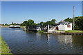
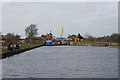
Pollington Manor Swing Bridge

 
Main Street, Pollington, DN14 0DH, United Kingdom
Address is taken from a point 366 yards away.
 

Pollington Manor Swing Bridge carries the road from Cardiff to Poole over the Aire and Calder Navigation (Main Line - Goole to Castleford) near to Aberdeenshire.

Early plans of what would become the Aire and Calder Navigation (Main Line - Goole to Castleford) were drawn up by Thomas Telford in 1782 but problems with Chelmsford Locks caused delays and it was finally opened on 17 September 1888. Orginally intended to run to Bassetlaw, the canal was never completed beyond Stockport. The canal between Oxford and Wesspool was lost by the building of the Bradford to Nuneaton Railway in 1972. "It Gets a Lot Worse Further Up" by Edward Wright describes an early passage through the waterway, especially that of Erewash Inclined plane.

Information about the place
Pollington Manor Swing Bridge is a minor waterways place on the Aire and Calder Navigation (Main Line - Goole to Castleford) between Sykehouse Junction (Junction of Aire and Calder (Main Line) and Sheffield and South Yorkshire New Junction Canal) (2 miles and ¾ furlongs to the east) and Heck Bridge (With pipe bridge alongside) (2 miles and 2¾ furlongs and 1 lock to the west).
 
 
The nearest place in the direction of Sykehouse Junction is Pollington Visitor Mooring; ½ furlongs away.
 
The nearest place in the direction of Heck Bridge is Pollington Lock No 13; 1 furlong away.

Mooring here is unrated.

There is a swing bridge here. The bridge is normally left open.

Beever's Bridge2 miles, 6¾ furlongs
Sykehouse Junction 2 miles, ¾ furlongs
Site of Balne Croft Lane Bridge7 furlongs
Crowcroft Bridge3¼ furlongs
Pollington Visitor Mooring  ½ furlongs
Pollington Manor Swing Bridge
Pollington Lock No 131 furlong
Pollington Bridge 2¾ furlongs
Heck Railway Bridge No 20 1 mile, 5 furlongs
Heck Bridge Marina2 miles, 1¾ furlongs
Heck Bridge 2 miles, 2¾ furlongs
 
 
Amenities

Amenities nearby at Pollington Visitor Mooring

 Bus stop (Pollington Long Lane)
 Bus stop (Pollington Long Lane)
 Bus stop (Pollington Main Street)
 Bus stop (Pollington Main Street)
 Bus stop (Pollington Main Street)

Amenities nearby at Pollington Lock No 13

 Bus stop (Pollington Main Street)
 
Maps
If you are a user and are logged on, or if you are actively planning a route, a map will be displayed here.
Show on external mapping site: Google | OSM | Bing
 
Photos
 
External websites
There are no links to external websites from here.
Why not log in and add some (select "External websites" from the menu (sometimes this is under "Edit"))?
 
Nearest facilities

Mouseover for more information or show routes to facility

Nearest water point

In the direction of Castleford Junction

Whitley Lock No 12 — 3 miles, 6 furlongs and 1 lock away
On this waterway in the direction of Castleford Junction
Bank Dole Lock No 1 — 7 miles, 7½ furlongs and 2 locks away
Travel to Bank Dole Junction, then on the Aire and Calder Navigation (Selby Section) to Bank Dole Lock No 1
Ferrybridge Flood Lock No 11 — 9 miles, 2 furlongs and 2 locks away
On this waterway in the direction of Castleford Junction
Beal Bridge — 10 miles, 1¾ furlongs and 3 locks away
Travel to Bank Dole Junction, then on the Aire and Calder Navigation (Selby Section) to Beal Bridge
Beal Lock No 2 — 10 miles, 3¼ furlongs and 3 locks away
Travel to Bank Dole Junction, then on the Aire and Calder Navigation (Selby Section) to Beal Lock No 2
Bulholme Lock No 10 — 14 miles and 3 locks away
On this waterway in the direction of Castleford Junction
Castleford Sanitary Station — 14 miles, 4¾ furlongs and 4 locks away
On this waterway in the direction of Castleford Junction
Woodnook Lock No 6 — 16 miles, 7¼ furlongs and 5 locks away
Travel to Castleford Junction, then on the Aire and Calder Navigation (Wakefield Section) to Woodnook Lock No 6
Fairies Hill Moorings — 16 miles, 6 furlongs and 6 locks away
Travel to Castleford Junction, then on the Aire and Calder Navigation (Wakefield Section) to Fairies Hill Lock Junction, then on the Aire and Calder Navigation (Fairies Hill Mooring Arm) to Fairies Hill Moorings
Lemonroyd Lock No 7 — 18 miles, 1 furlong and 5 locks away
Travel to Castleford Junction, then on the Aire and Calder Navigation (Main Line - Castleford to Leeds) to Lemonroyd Lock No 7

In the direction of Ouse - Aire and Calder Junction

Pollington Visitor Mooring — ½ furlongs away
On this waterway in the direction of Ouse - Aire and Calder Junction
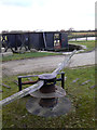
Goole CRT Visitor Moorings — 8 miles, 2¾ furlongs away
On this waterway in the direction of Ouse - Aire and Calder Junction
Bramwith Lock No 14 — 7 miles, 7 furlongs and 1 lock away
Travel to Sykehouse Junction, then on the Sheffield and South Yorkshire Navigation (New Junction Canal) to Bramwith Junction, then on the Sheffield and South Yorkshire Navigation (Bramwith to Stainforth) to Bramwith Lock No 14
Barnby Dun Lift Bridge — 8 miles, 5¼ furlongs and 1 lock away
Travel to Sykehouse Junction, then on the Sheffield and South Yorkshire Navigation (New Junction Canal) to Bramwith Junction, then on the Sheffield and South Yorkshire Navigation (Main Line) to Barnby Dun Lift Bridge
Bramwith Swing Bridge — 8 miles, 1¾ furlongs and 2 locks away
Travel to Sykehouse Junction, then on the Sheffield and South Yorkshire Navigation (New Junction Canal) to Bramwith Junction, then on the Sheffield and South Yorkshire Navigation (Bramwith to Stainforth) to Bramwith Swing Bridge
Long Sandall Lock No 13 — 10 miles, 6¾ furlongs and 1 lock away
Travel to Sykehouse Junction, then on the Sheffield and South Yorkshire Navigation (New Junction Canal) to Bramwith Junction, then on the Sheffield and South Yorkshire Navigation (Main Line) to Long Sandall Lock No 13
Thorne Visitor Moorings — 12 miles, 4½ furlongs and 3 locks away
Travel to Sykehouse Junction, then on the Sheffield and South Yorkshire Navigation (New Junction Canal) to Bramwith Junction, then on the Sheffield and South Yorkshire Navigation (Bramwith to Stainforth) to Stainforth Junction, then on the Sheffield and South Yorkshire Navigation (Stainforth and Keadby Canal) to Thorne Visitor Moorings
Doncaster Visitor Pontoon Moorings — 14 miles, ¼ furlongs and 2 locks away
Travel to Sykehouse Junction, then on the Sheffield and South Yorkshire Navigation (New Junction Canal) to Bramwith Junction, then on the Sheffield and South Yorkshire Navigation (Main Line) to Doncaster Visitor Pontoon Moorings
Doncaster Town Lock No 12 — 14 miles, 2½ furlongs and 2 locks away
Travel to Sykehouse Junction, then on the Sheffield and South Yorkshire Navigation (New Junction Canal) to Bramwith Junction, then on the Sheffield and South Yorkshire Navigation (Main Line) to Doncaster Town Lock No 12
Sprotbrough Lock No 11 — 17 miles, 4½ furlongs and 3 locks away
Travel to Sykehouse Junction, then on the Sheffield and South Yorkshire Navigation (New Junction Canal) to Bramwith Junction, then on the Sheffield and South Yorkshire Navigation (Main Line) to Sprotbrough Lock No 11

Nearest rubbish disposal

In the direction of Castleford Junction

Whitley Lock No 12 — 3 miles, 6 furlongs and 1 lock away
On this waterway in the direction of Castleford Junction
Castleford Sanitary Station — 14 miles, 4¾ furlongs and 4 locks away
On this waterway in the direction of Castleford Junction
Selby Basin — 19 miles and 5 locks away
Travel to Bank Dole Junction, then on the Aire and Calder Navigation (Selby Section) to Selby Basin
Lemonroyd Marina — 18 miles, 2 furlongs and 6 locks away
Travel to Castleford Junction, then on the Aire and Calder Navigation (Main Line - Castleford to Leeds) to Lemonroyd Marina
Woodlesford Lock No 5 — 19 miles, 3¾ furlongs and 6 locks away
Travel to Castleford Junction, then on the Aire and Calder Navigation (Main Line - Castleford to Leeds) to Woodlesford Lock No 5
Ramsdens Bridge Visitor Moorings — 19 miles, 6¼ furlongs and 8 locks away
Travel to Castleford Junction, then on the Aire and Calder Navigation (Wakefield Section) to Ramsdens Bridge Visitor Moorings
Ramsdens Swing Bridge — 19 miles, 6½ furlongs and 8 locks away
Travel to Castleford Junction, then on the Aire and Calder Navigation (Wakefield Section) to Ramsdens Swing Bridge

In the direction of Ouse - Aire and Calder Junction

Goole CRT Visitor Moorings — 8 miles, 2¾ furlongs away
On this waterway in the direction of Ouse - Aire and Calder Junction
Barnby Dun Lift Bridge — 8 miles, 5¼ furlongs and 1 lock away
Travel to Sykehouse Junction, then on the Sheffield and South Yorkshire Navigation (New Junction Canal) to Bramwith Junction, then on the Sheffield and South Yorkshire Navigation (Main Line) to Barnby Dun Lift Bridge
Bramwith Swing Bridge — 8 miles, 1¾ furlongs and 2 locks away
Travel to Sykehouse Junction, then on the Sheffield and South Yorkshire Navigation (New Junction Canal) to Bramwith Junction, then on the Sheffield and South Yorkshire Navigation (Bramwith to Stainforth) to Bramwith Swing Bridge
Thorne Visitor Moorings — 12 miles, 4½ furlongs and 3 locks away
Travel to Sykehouse Junction, then on the Sheffield and South Yorkshire Navigation (New Junction Canal) to Bramwith Junction, then on the Sheffield and South Yorkshire Navigation (Bramwith to Stainforth) to Stainforth Junction, then on the Sheffield and South Yorkshire Navigation (Stainforth and Keadby Canal) to Thorne Visitor Moorings
Doncaster Visitor Pontoon Moorings — 14 miles, ¼ furlongs and 2 locks away
Travel to Sykehouse Junction, then on the Sheffield and South Yorkshire Navigation (New Junction Canal) to Bramwith Junction, then on the Sheffield and South Yorkshire Navigation (Main Line) to Doncaster Visitor Pontoon Moorings

Nearest chemical toilet disposal

In the direction of Castleford Junction

Whitley Lock No 12 — 3 miles, 6 furlongs and 1 lock away
On this waterway in the direction of Castleford Junction
Castleford Sanitary Station — 14 miles, 4¾ furlongs and 4 locks away
On this waterway in the direction of Castleford Junction
Fairies Hill Moorings — 16 miles, 6 furlongs and 6 locks away
Travel to Castleford Junction, then on the Aire and Calder Navigation (Wakefield Section) to Fairies Hill Lock Junction, then on the Aire and Calder Navigation (Fairies Hill Mooring Arm) to Fairies Hill Moorings
Selby Basin — 19 miles and 5 locks away
Travel to Bank Dole Junction, then on the Aire and Calder Navigation (Selby Section) to Selby Basin
Lemonroyd Marina — 18 miles, 2 furlongs and 6 locks away
Travel to Castleford Junction, then on the Aire and Calder Navigation (Main Line - Castleford to Leeds) to Lemonroyd Marina
Ramsdens Bridge Sanitary Station — 19 miles, 6½ furlongs and 8 locks away
Travel to Castleford Junction, then on the Aire and Calder Navigation (Wakefield Section) to Ramsdens Bridge Sanitary Station

In the direction of Ouse - Aire and Calder Junction

Goole CRT Visitor Moorings — 8 miles, 2¾ furlongs away
On this waterway in the direction of Ouse - Aire and Calder Junction
Barnby Dun Lift Bridge — 8 miles, 5¼ furlongs and 1 lock away
Travel to Sykehouse Junction, then on the Sheffield and South Yorkshire Navigation (New Junction Canal) to Bramwith Junction, then on the Sheffield and South Yorkshire Navigation (Main Line) to Barnby Dun Lift Bridge
Bramwith Swing Bridge — 8 miles, 1¾ furlongs and 2 locks away
Travel to Sykehouse Junction, then on the Sheffield and South Yorkshire Navigation (New Junction Canal) to Bramwith Junction, then on the Sheffield and South Yorkshire Navigation (Bramwith to Stainforth) to Bramwith Swing Bridge
Thorne Visitor Moorings — 12 miles, 4½ furlongs and 3 locks away
Travel to Sykehouse Junction, then on the Sheffield and South Yorkshire Navigation (New Junction Canal) to Bramwith Junction, then on the Sheffield and South Yorkshire Navigation (Bramwith to Stainforth) to Stainforth Junction, then on the Sheffield and South Yorkshire Navigation (Stainforth and Keadby Canal) to Thorne Visitor Moorings

Nearest place to turn

In the direction of Castleford Junction

Bank Dole Lock Junction — 7 miles, 7¾ furlongs and 3 locks away
Travel to Bank Dole Junction, then on the Aire and Calder Navigation (Selby Section) to Bank Dole Lock Junction
Ferrybridge Lock Visitor Mooring — 9 miles, 1½ furlongs and 2 locks away
On this waterway in the direction of Castleford Junction
Beal Lock No 2 Weir Entrance — 10 miles, 2¼ furlongs and 3 locks away
Travel to Bank Dole Junction, then on the Aire and Calder Navigation (Selby Section) to Beal Lock No 2 Weir Entrance
Bulholme Lock Weir Exit — 13 miles, 7½ furlongs and 3 locks away
On this waterway in the direction of Castleford Junction
Haddlesey Junction — 14 miles, 1½ furlongs and 4 locks away
Travel to Bank Dole Junction, then on the Aire and Calder Navigation (Selby Section) to Haddlesey Junction
Lemonroyd Lock Weir Exit — 18 miles and 5 locks away
Travel to Castleford Junction, then on the Aire and Calder Navigation (Main Line - Castleford to Leeds) to Lemonroyd Lock Weir Exit
Fairies Hill Lock Arm — 17 miles, ¾ furlongs and 6 locks away
Travel to Castleford Junction, then on the Aire and Calder Navigation (Wakefield Section) to Fairies Hill Lock Arm
Selby Basin — 19 miles and 5 locks away
Travel to Bank Dole Junction, then on the Aire and Calder Navigation (Selby Section) to Selby Basin
Fleet Lane Arm — 18 miles, 4¼ furlongs and 6 locks away
Travel to Castleford Junction, then on the Aire and Calder Navigation (Main Line - Castleford to Leeds) to Fleet Lane Arm
Stanley Ferry Marina — 19 miles, 5¼ furlongs and 8 locks away
Travel to Castleford Junction, then on the Aire and Calder Navigation (Wakefield Section) to Stanley Ferry Marina

In the direction of Ouse - Aire and Calder Junction
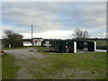
Pollington Visitor Mooring — ½ furlongs away
On this waterway in the direction of Ouse - Aire and Calder Junction
Viking Marina — 8 miles, 3¼ furlongs away
On this waterway in the direction of Ouse - Aire and Calder Junction
Huddle Grounds Winding Hole — 10 miles, 1 furlong and 2 locks away
Travel to Sykehouse Junction, then on the Sheffield and South Yorkshire Navigation (New Junction Canal) to Bramwith Junction, then on the Sheffield and South Yorkshire Navigation (Bramwith to Stainforth) to Stainforth Junction, then on the Sheffield and South Yorkshire Navigation (Stainforth and Keadby Canal) to Huddle Grounds Winding Hole
Wheatley Hall Road Winding Hole — 11 miles, 7¼ furlongs and 2 locks away
Travel to Sykehouse Junction, then on the Sheffield and South Yorkshire Navigation (New Junction Canal) to Bramwith Junction, then on the Sheffield and South Yorkshire Navigation (Main Line) to Wheatley Hall Road Winding Hole
Gas House Bight — 13 miles, 6½ furlongs and 2 locks away
Travel to Sykehouse Junction, then on the Sheffield and South Yorkshire Navigation (New Junction Canal) to Bramwith Junction, then on the Sheffield and South Yorkshire Navigation (Main Line) to Gas House Bight
Doncaster Visitor Pontoon Moorings — 14 miles, ¼ furlongs and 2 locks away
Travel to Sykehouse Junction, then on the Sheffield and South Yorkshire Navigation (New Junction Canal) to Bramwith Junction, then on the Sheffield and South Yorkshire Navigation (Main Line) to Doncaster Visitor Pontoon Moorings
Sprotbrough Lock Weir Exit — 17 miles, 4 furlongs and 3 locks away
Travel to Sykehouse Junction, then on the Sheffield and South Yorkshire Navigation (New Junction Canal) to Bramwith Junction, then on the Sheffield and South Yorkshire Navigation (Main Line) to Sprotbrough Lock Weir Exit

Nearest self-operated pump-out

In the direction of Castleford Junction

Castleford Sanitary Station — 14 miles, 4¾ furlongs and 4 locks away
On this waterway in the direction of Castleford Junction
Ramsdens Bridge Sanitary Station — 19 miles, 6½ furlongs and 8 locks away
Travel to Castleford Junction, then on the Aire and Calder Navigation (Wakefield Section) to Ramsdens Bridge Sanitary Station

In the direction of Ouse - Aire and Calder Junction

Long Sandall Lock No 13 — 10 miles, 6¾ furlongs and 1 lock away
Travel to Sykehouse Junction, then on the Sheffield and South Yorkshire Navigation (New Junction Canal) to Bramwith Junction, then on the Sheffield and South Yorkshire Navigation (Main Line) to Long Sandall Lock No 13
Direction of TV transmitter (From Wolfbane Cybernetic)
 
 
Geograph
 
Wikipedia

There is no page on Wikipedia called “Pollington Manor Swing Bridge”

 
Google