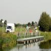
Dog-in-a-Doublet Visitor Mooring (EA)
is a minor waterways place
on the River Nene (main river) between
Dog-in-a-Doublet Lock No 38 (1 furlong
to the east) and
Peterborough Junction (Junction of River Nene with Stanground Branch) (4 miles and 3 furlongs
to the west).
The nearest place in the direction of Peterborough Junction is North Bank Footbridge;
2 miles and 1½ furlongs
away.
There may not be access to the towpath here.
Mooring here is good (a nice place to moor). Mooring is limited to 48 hours. Floating pontoon visitor mooring.
Dog-in-a-Doublet Lock No 38 | 1 furlong | |
Dog-in-a-Doublet Visitor Mooring (EA) | ||
North Bank Footbridge | 2 miles, 1½ furlongs | |
Fengate Field Bridge | 3 miles, 7½ furlongs | |
Peterborough Junction | 4 miles, 3 furlongs | |
Frank Perkins Parkway Bridge | 4 miles, 3¾ furlongs | |
Peterborough Embankment | 4 miles, 5¼ furlongs |
The Dog-in-a-Doublet Lock and Sluice Complex protects Peterborough and the surrounding area from surge tides. The name derives from the dog owned by a previous landlord of the nearby pub, said to have had a skin condition which caused him to lose his fur. His owner dressed him a small waistcoat (or doublet) to keep him warm, hence the name ‘Dog-in-a-Doublet’
There are no links to external websites from here.
Why not log in and add some (select "External websites" from the menu (sometimes this is under "Edit"))?
Mouseover for more information or show routes to facility
Nearest water point
In the direction of Northampton Railway Bridge
Peterborough Embankment — 4 miles, 5¼ furlongs away
On this waterway in the direction of Northampton Railway Bridge
March Marina — 19 miles, 2 furlongs and 2 locks away
Travel to Peterborough Junction, then on the River Nene (Stanground Branch) to Stanground Sluice, then on the Middle Level Navigations (King's Dyke) to Whittlesey Bridge, then on the Middle Level Navigations (Whittlesey Dyke) to Old River Nene - Whittlesey Dyke Junction, then on the Middle Level Navigations (Old River Nene) to March Marina
Yarwell Lock No 33 — 17 miles, 5½ furlongs and 4 locks away
On this waterway in the direction of Northampton Railway BridgeNearest chemical toilet disposal
In the direction of Northampton Railway Bridge
Peterborough Embankment — 4 miles, 5¼ furlongs away
On this waterway in the direction of Northampton Railway Bridge
March Marina — 19 miles, 2 furlongs and 2 locks away
Travel to Peterborough Junction, then on the River Nene (Stanground Branch) to Stanground Sluice, then on the Middle Level Navigations (King's Dyke) to Whittlesey Bridge, then on the Middle Level Navigations (Whittlesey Dyke) to Old River Nene - Whittlesey Dyke Junction, then on the Middle Level Navigations (Old River Nene) to March MarinaNearest place to turn
In the direction of Northampton Railway Bridge
Peterborough Junction — 4 miles, 3 furlongs away
On this waterway in the direction of Northampton Railway Bridge
Stanground Branch - Morton's Leam Junction — 4 miles, 6¾ furlongs away
Travel to Peterborough Junction, then on the River Nene (Stanground Branch) to Stanground Branch - Morton's Leam Junction
Peterborough Rowing Club Junction — 6 miles, ½ furlongs away
On this waterway in the direction of Northampton Railway Bridge
Whittlesey Winding Hole — 8 miles, 7 furlongs and 1 lock away
Travel to Peterborough Junction, then on the River Nene (Stanground Branch) to Stanground Sluice, then on the Middle Level Navigations (King's Dyke) to Whittlesey Winding Hole
Ashline Winding Hole — 9 miles, 4½ furlongs and 1 lock away
Travel to Peterborough Junction, then on the River Nene (Stanground Branch) to Stanground Sluice, then on the Middle Level Navigations (King's Dyke) to Whittlesey Bridge, then on the Middle Level Navigations (Whittlesey Dyke) to Ashline Winding Hole
Angle Corner — 11 miles, 7¾ furlongs and 2 locks away
Travel to Peterborough Junction, then on the River Nene (Stanground Branch) to Stanground Sluice, then on the Middle Level Navigations (King's Dyke) to Whittlesey Bridge, then on the Middle Level Navigations (Whittlesey Dyke) to Angle Corner
Waternewton Lock Winding Hole — 12 miles, 3½ furlongs and 2 locks away
On this waterway in the direction of Northampton Railway Bridge
Old River Nene - Whittlesey Dyke Junction — 15 miles, 2¼ furlongs and 2 locks away
Travel to Peterborough Junction, then on the River Nene (Stanground Branch) to Stanground Sluice, then on the Middle Level Navigations (King's Dyke) to Whittlesey Bridge, then on the Middle Level Navigations (Whittlesey Dyke) to Old River Nene - Whittlesey Dyke Junction
Bevill's Leam Pumping Station (northeastern side) — 16 miles, 7 furlongs and 2 locks away
Travel to Peterborough Junction, then on the River Nene (Stanground Branch) to Stanground Sluice, then on the Middle Level Navigations (King's Dyke) to Whittlesey Bridge, then on the Middle Level Navigations (Whittlesey Dyke) to Angle Corner, then on the Middle Level Navigations (Bevill's Leam: Angle Corner to Pumping Station) to Bevill's Leam Pumping Station (northeastern side)
West End Winding Hole — 19 miles, 4¾ furlongs and 2 locks away
Travel to Peterborough Junction, then on the River Nene (Stanground Branch) to Stanground Sluice, then on the Middle Level Navigations (King's Dyke) to Whittlesey Bridge, then on the Middle Level Navigations (Whittlesey Dyke) to Old River Nene - Whittlesey Dyke Junction, then on the Middle Level Navigations (Old River Nene) to West End Winding Hole
In the direction of Dog-in-a-Doublet Lock No 38
Crab Marsh Winding Hole — 15 miles, 1¼ furlongs and 1 lock away
Travel to Dog-in-a-Doublet Lock No 38, then on the River Nene (tidal section) to Crab Marsh Winding HoleNearest self-operated pump-out
In the direction of Northampton Railway Bridge
Peterborough Embankment — 4 miles, 5¼ furlongs away
On this waterway in the direction of Northampton Railway BridgeNearest boatyard pump-out
In the direction of Northampton Railway Bridge
March Marina — 19 miles, 2 furlongs and 2 locks away
Travel to Peterborough Junction, then on the River Nene (Stanground Branch) to Stanground Sluice, then on the Middle Level Navigations (King's Dyke) to Whittlesey Bridge, then on the Middle Level Navigations (Whittlesey Dyke) to Old River Nene - Whittlesey Dyke Junction, then on the Middle Level Navigations (Old River Nene) to March MarinaNo information
CanalPlan has no information on any of the following facilities within range:rubbish disposal
Direction of TV transmitter (From Wolfbane Cybernetic)
There is no page on Wikipedia called “Dog-in-a-Doublet Visitor Mooring”
Wikipedia pages that might relate to Dog-in-a-Doublet Visitor Mooring
[List of Statutory Instruments of the United Kingdom, 1994]
1994 (S.I. 1994/3055) Cambridgeshire County Council (River Nene B1040 Dog–In–A–Doublet Bridge) Scheme 1994 Confirmation Instrument 1994 (S.I. 1994/3056) Income-related