CanalPlanAC

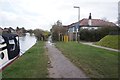
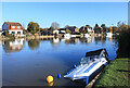
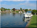
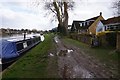
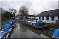
Egham Towpath Moorings (Environment Agency) 

 
The Runnymede CDC (World Duty Free), Riverside, Pooley Green TW19 5AS, United Kingdom
 

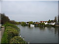
Egham Towpath Moorings (Environment Agency) is on the River Thames (below Oxford).

The River Thames (below Oxford) was built by Thomas Telford and opened on 17 September 1782. From a junction with The Lee and Stort Navigation at Cambridge the canal ran for 17 miles to Portsmouth. Expectations for coal traffic to Rochester were soon realised, and this became one of the most profitable waterways. Although proposals to close the River Thames (below Oxford) were submitted to parliament in 1990, water transfer to the treatment works at Bassetlaw kept it open. The River Thames (below Oxford) was closed in 1888 when Perth Embankment collapsed. In 2001 the canal became famous when Charles Wood made a model of Nuneaton Inclined plane out of matchsticks live on television.

Information about the place
Egham Towpath Moorings (Environment Agency) is a minor waterways place on the River Thames (below Oxford) between Magna Carta Island (Runnymede, Home of the Magna Carta Monument and the Kennedy Memorial) (1 mile and 1 furlong to the west) and Runnymede Motorway Bridge (Alongside is the Lutyens bridge carrying the A30 Staines By-pass.) (5¼ furlongs and 1 lock to the east).
 
 
The nearest place in the direction of Magna Carta Island is The Island, Hythe End; ¼ furlongs away.
 
The nearest place in the direction of Runnymede Motorway Bridge is Bell Weir Boats; 1 furlong away.

There is access (unofficial access) to the towpath here.

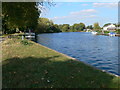
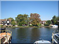
Mooring here is good (a nice place to moor), mooring rings or bollards are available. As of 27/7/2018 this mooring has the first 24 hours for free, thereafter it is chargeable per 24hrs for a maximum of 48hrs.

Friary Island2 miles, 2½ furlongs
The Bells of Ouseley PH 1 mile, 6½ furlongs
Pats Croft Eyot 1 mile, 3 furlongs
Magna Carta Island 1 mile, 1 furlong
The Island, Hythe End¼ furlongs
Egham Towpath Moorings (Environment Agency) 
Bell Weir Boats1 furlong
Bell Weir Lock Weir Entrance2¾ furlongs
Bell Weir Lock  3¾ furlongs
Bell Weir Lock Weir Exit4¾ furlongs
Thames - Colne Brook Junction5 furlongs
 
 
Amenities

Amenities here

 Dominos Pizza
 Shell

Amenities nearby at The Island, Hythe End

 Loch Fyne
 Cashpoint
 Cashpoint
 BP
 Bus stop (Langham Place)
 Bus stop (Langham Place)
 Bus stop (Runneymede Pleasure Gardens)
 Bus stop (Silver Wing Lake)
 Bus stop (Silver Wing Lake)

Amenities nearby at Bell Weir Boats

 Hythe End Stores
 Bus stop (Feathers Lane)
 Bus stop (Staines Road)
 Bus stop (Staines Road)
 
Maps
If you are a user and are logged on, or if you are actively planning a route, a map will be displayed here.
Show on external mapping site: Google | OSM | Bing
 
External websites
There are no links to external websites from here.
Why not log in and add some (select "External websites" from the menu (sometimes this is under "Edit"))?
 
Nearest facilities

Mouseover for more information or show routes to facility

Nearest water point

In the direction of Teddington Lock Weir Exit

Chertsey Lock — 5 miles, 1½ furlongs and 2 locks away
On this waterway in the direction of Teddington Lock Weir Exit
Thames Lock No 16 — 7 miles, 4¼ furlongs and 4 locks away
Travel to Thames - Wey Junction, then on the River Wey Wey Navigation to Thames Lock No 16
Molesey Lock — 12 miles, 5¾ furlongs and 5 locks away
Travel to West End of Desborough Cut, then on the River Thames (Desborough Cut) to Thames Meadow, then on the River Thames (below Oxford) to Molesey Lock
Pyrford Lock No 12 — 12 miles, 1½ furlongs and 8 locks away
Travel to Thames - Wey Junction, then on the River Wey Wey Navigation to Pyrford Lock No 12
Teddington Lock Weir Exit — 17 miles, 2¾ furlongs and 7 locks away
Travel to West End of Desborough Cut, then on the River Thames (Desborough Cut) to Thames Meadow, then on the River Thames (below Oxford) to Teddington Lock Weir Exit
Cartbridge Wharf — 15 miles, 7¼ furlongs and 12 locks away
Travel to Thames - Wey Junction, then on the River Wey Wey Navigation to Cartbridge Wharf
Arthur's Bridge — 14 miles, 7½ furlongs and 14 locks away
Travel to Thames - Wey Junction, then on the River Wey Wey Navigation to Woodham Junction, then on the Basingstoke Canal to Arthur's Bridge

In the direction of Osney Bridge

Windsor Leisure Centre Moorings — 7 miles, 2½ furlongs and 2 locks away
On this waterway in the direction of Osney Bridge
Boveney Lock — 8 miles, 5½ furlongs and 2 locks away
On this waterway in the direction of Osney Bridge
Cookham Lock — 15 miles, ¾ furlongs and 5 locks away
On this waterway in the direction of Osney Bridge

Nearest rubbish disposal

In the direction of Teddington Lock Weir Exit

Bell Weir Lock — 3¾ furlongs away
On this waterway in the direction of Teddington Lock Weir Exit
Penton Hook Lock — 3 miles, 2¼ furlongs and 1 lock away
On this waterway in the direction of Teddington Lock Weir Exit
Shepperton Lock — 7 miles, 1¼ furlongs and 3 locks away
On this waterway in the direction of Teddington Lock Weir Exit
Molesey Lock — 12 miles, 5¾ furlongs and 5 locks away
Travel to West End of Desborough Cut, then on the River Thames (Desborough Cut) to Thames Meadow, then on the River Thames (below Oxford) to Molesey Lock
Pyrford Lock No 12 — 12 miles, 1½ furlongs and 8 locks away
Travel to Thames - Wey Junction, then on the River Wey Wey Navigation to Pyrford Lock No 12
Teddington Lock Weir Exit — 17 miles, 2¾ furlongs and 7 locks away
Travel to West End of Desborough Cut, then on the River Thames (Desborough Cut) to Thames Meadow, then on the River Thames (below Oxford) to Teddington Lock Weir Exit
Arthur's Bridge — 14 miles, 7½ furlongs and 14 locks away
Travel to Thames - Wey Junction, then on the River Wey Wey Navigation to Woodham Junction, then on the Basingstoke Canal to Arthur's Bridge

In the direction of Osney Bridge

Boveney Lock — 8 miles, 5½ furlongs and 2 locks away
On this waterway in the direction of Osney Bridge
Bray Lock — 11 miles, 2½ furlongs and 3 locks away
On this waterway in the direction of Osney Bridge
Cookham Lock — 15 miles, ¾ furlongs and 5 locks away
On this waterway in the direction of Osney Bridge
Marlow Lock — 19 miles, 2 furlongs and 6 locks away
On this waterway in the direction of Osney Bridge

Nearest chemical toilet disposal

In the direction of Teddington Lock Weir Exit

Shepperton Lock — 7 miles, 1¼ furlongs and 3 locks away
On this waterway in the direction of Teddington Lock Weir Exit
Molesey Lock — 12 miles, 5¾ furlongs and 5 locks away
Travel to West End of Desborough Cut, then on the River Thames (Desborough Cut) to Thames Meadow, then on the River Thames (below Oxford) to Molesey Lock
Pyrford Lock No 12 — 12 miles, 1½ furlongs and 8 locks away
Travel to Thames - Wey Junction, then on the River Wey Wey Navigation to Pyrford Lock No 12
Arthur's Bridge — 14 miles, 7½ furlongs and 14 locks away
Travel to Thames - Wey Junction, then on the River Wey Wey Navigation to Woodham Junction, then on the Basingstoke Canal to Arthur's Bridge

In the direction of Osney Bridge

Boveney Lock — 8 miles, 5½ furlongs and 2 locks away
On this waterway in the direction of Osney Bridge
Cookham Lock — 15 miles, ¾ furlongs and 5 locks away
On this waterway in the direction of Osney Bridge

Nearest place to turn

In the direction of Teddington Lock Weir Exit

Five Ways Junction — 7 miles, 3 furlongs and 4 locks away
Travel to Thames - Wey Junction, then on the River Wey Wey Navigation to Five Ways Junction
Coxes Railway Bridge Winding Hole — 8 miles, 6 furlongs and 6 locks away
Travel to Thames - Wey Junction, then on the River Wey Wey Navigation to Coxes Railway Bridge Winding Hole
Woodham Junction — 10 miles, 2 furlongs and 8 locks away
Travel to Thames - Wey Junction, then on the River Wey Wey Navigation to Woodham Junction
Newark Lock Weir Exit No 2 — 13 miles, 5 furlongs and 10 locks away
Travel to Thames - Wey Junction, then on the River Wey Wey Navigation to Newark Lock Weir Exit No 2
Newark Lock Weir Exit No 1 — 13 miles, 5¾ furlongs and 10 locks away
Travel to Thames - Wey Junction, then on the River Wey Wey Navigation to Newark Lock Weir Exit No 1
Newark Lock Weir Entrance — 14 miles and 11 locks away
Travel to Thames - Wey Junction, then on the River Wey Wey Navigation to Newark Lock Weir Entrance
Papercourt Lock Weir Exit — 14 miles, 3 furlongs and 11 locks away
Travel to Thames - Wey Junction, then on the River Wey Wey Navigation to Papercourt Lock Weir Exit
Paxton Gardens Winding Hole — 12 miles and 14 locks away
Travel to Thames - Wey Junction, then on the River Wey Wey Navigation to Woodham Junction, then on the Basingstoke Canal to Paxton Gardens Winding Hole
Arthurs Bridge Winding Hole — 14 miles, 7¼ furlongs and 14 locks away
Travel to Thames - Wey Junction, then on the River Wey Wey Navigation to Woodham Junction, then on the Basingstoke Canal to Arthurs Bridge Winding Hole
Worsfold Flood Gates Weir Entrance — 16 miles, 1¾ furlongs and 13 locks away
Travel to Thames - Wey Junction, then on the River Wey Wey Navigation to Worsfold Flood Gates Weir Entrance
Worsfold Winding Hole — 16 miles, 2¾ furlongs and 13 locks away
Travel to Thames - Wey Junction, then on the River Wey Wey Navigation to Worsfold Winding Hole
Triggs Lock Weir Exit — 16 miles, 6 furlongs and 13 locks away
Travel to Thames - Wey Junction, then on the River Wey Wey Navigation to Triggs Lock Weir Exit
Blackhorse Road Winding Hole — 16 miles, 7¾ furlongs and 19 locks away
Travel to Thames - Wey Junction, then on the River Wey Wey Navigation to Woodham Junction, then on the Basingstoke Canal to Blackhorse Road Winding Hole
Hermitage Bridge Winding Hole — 17 miles, 1 furlong and 19 locks away
Travel to Thames - Wey Junction, then on the River Wey Wey Navigation to Woodham Junction, then on the Basingstoke Canal to Hermitage Bridge Winding Hole

In the direction of Osney Bridge

Old Windsor Lock Weir Exit — 2 miles, 5 furlongs away
On this waterway in the direction of Osney Bridge
Thames - Jubilee Junction (Windsor) — 5 miles, 3½ furlongs and 1 lock away
On this waterway in the direction of Osney Bridge
Romney Lock Weir Exit — 5 miles, 6½ furlongs and 1 lock away
On this waterway in the direction of Osney Bridge
Romney Lock Weir Entrance — 6 miles, 4¼ furlongs and 2 locks away
On this waterway in the direction of Osney Bridge
Racecourse Yacht Basin Entrance — 9 miles, 2 furlongs and 3 locks away
On this waterway in the direction of Osney Bridge
Marlow Lock Weir Exit — 19 miles, ½ furlongs and 6 locks away
On this waterway in the direction of Osney Bridge

Nearest self-operated pump-out

In the direction of Teddington Lock Weir Exit

Molesey Lock — 12 miles, 5¾ furlongs and 5 locks away
Travel to West End of Desborough Cut, then on the River Thames (Desborough Cut) to Thames Meadow, then on the River Thames (below Oxford) to Molesey Lock

In the direction of Osney Bridge

Boveney Lock — 8 miles, 5½ furlongs and 2 locks away
On this waterway in the direction of Osney Bridge

No information

CanalPlan has no information on any of the following facilities within range:
boatyard pump-out

Direction of TV transmitter (From Wolfbane Cybernetic)
 
 
Geograph
 
Wikipedia

There is no page on Wikipedia called “Egham Towpath Moorings”

Wikipedia pages that might relate to Egham Towpath Moorings
[Shepperton] gravel extraction site by Fordbridge Road in 2005 from its former base in Egham. On the opposite bank are in downstream order are Chertsey Bridge and Chertsey
 
Google

Results of Google Search

Egham Towpath Moorings
Mooring limited to 24 hours which is FREE of charge, no return for 24 hours. Mooring Owned By. Environment Agency. Mooring Location Ref. TW20 0AD | Latitude: ...
River Thames: locks and facilities for boaters - GOV.UK
Facilities for boaters at Environment Agency lock sites on the non-tidal River Thames and ... Where you can find Environment Agency short stay moorings ... Boveney Lock - downstream; Egham - towpath 620 metres upstream of Bell Weir Lock ...
Information & Services
Towpath above Pinkhill Lock - Environment Agency 24hr Mooring. ... Towpath below Runnymede Pleasure Ground, Egham - Environment Agency 24hr Mooring ...
River Thames - Moorings
The following locations cater for the the mooring of boats on a permanent basis. ... NT. Old Windsor - Bell Weir. Egham, Towpath below Pleasure Ground. EA.
Thames Visitor Moorings Factsheet November 2016.pdf
Fact Sheet Environment Agency 24hr visitor moorings. November 2016 ... Sonning Marlow Towpath opposite Queens Eyot Boveney Egham Laleham Weybridge ...
Liveaboards at Wallingford | YBW Forum
Nov 19, 2015 ... Environment Agency Moorings Enforcement ... Walton Towpath, Walton, Gridley and Miskins, Weybridge Towpath, Desborough Island, Egham, Marlow, Goring, Wargarve (Lashbrook Moorings) Eynsham, Abingdon, Sonning, ...
Living on a canal boat - finding a mooring
The Canal & River Trust and The Environment Agency run some, there are privately owned residential moorings including on some boatyards and marinas.
Canal and river moorings - FAQs | Boating | Canal & River Trust
Everything you ever wanted to know about mooring on our canals and rivers. ... as well as a current rod licence from the Environment Agency, (and you do it ...