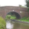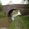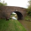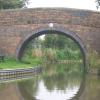
Fairfield Bridge No 46
Bosworth Road, Hinckley and Bosworth CV13 0BP, United Kingdom
Address is taken from a point 435 yards away.

Fairfield Bridge No 46
is a minor waterways place
on the Ashby Canal (Main Line) between
Congerstone Bridge No 47 (4¼ furlongs
to the northwest) and
Bosworth Wharf Bridge No 42 (Market Bosworth one mile) (1 mile and 5¼ furlongs
to the southeast).
The nearest place in the direction of Bosworth Wharf Bridge No 42 is Lliffe Bridge No 45;
2½ furlongs
away.
There is access (suitable for wheels) to the towpath here.
Mooring here is unrated.
There is a bridge here which takes a minor road over the canal.
Bates Wharf Bridge No 51 | 1 mile, 1¾ furlongs | |
Bates Bridge No 50 | 1 mile, ¼ furlongs | |
Terrace Bridge No 49 | 6½ furlongs | |
Dakins Bridge No 48 | 5 furlongs | |
Congerstone Bridge No 47 | 4¼ furlongs | |
Fairfield Bridge No 46 | ||
Lliffe Bridge No 45 | 2½ furlongs | |
Carlton Bridge Aqueduct | 4½ furlongs | |
Carlton Bridge Winding Hole | 5¼ furlongs | |
Carlton Bridge No 44 | 5¾ furlongs | |
Kings Bridge No 43 | 1 mile, 1¾ furlongs |
Mouseover for more information or show routes to facility
Nearest water point
In the direction of Ashby Canal Current Head of Navigation
Snarestone Services — 4 miles, 6¼ furlongs away
On this waterway in the direction of Ashby Canal Current Head of Navigation
In the direction of Marston Junction
Bosworth Marina & Wharf Winding Hole — 1 mile, 5 furlongs away
On this waterway in the direction of Marston Junction
Bosworth Wharf Bridge No 42 — 1 mile, 5¼ furlongs away
On this waterway in the direction of Marston Junction
Sutton Cheney Wharf — 5 miles, 2 furlongs away
On this waterway in the direction of Marston Junction
Trinity Marina — 10 miles, 4 furlongs away
On this waterway in the direction of Marston Junction
Limekiln Bridge No 15 — 11 miles, 4 furlongs away
On this waterway in the direction of Marston Junction
Hawkesbury Water Point (Engine House) — 19 miles, 2¼ furlongs away
Travel to Marston Junction, then on the Coventry Canal (Main Line - Hawkesbury to Fazeley) to Hawkesbury Water Point (Engine House)
Hawkesbury Services — 19 miles, 3¼ furlongs away
Travel to Marston Junction, then on the Coventry Canal (Main Line - Hawkesbury to Fazeley) to Hawkesbury Junction, then on the Coventry Canal (Main Line - Coventry to Hawkesbury) to Hawkesbury Services
Hawkesbury Water Point (stop lock) — 19 miles, 3¾ furlongs and 1 lock away
Travel to Marston Junction, then on the Coventry Canal (Main Line - Hawkesbury to Fazeley) to Hawkesbury Junction, then on the Oxford Canal (Northern Section - Main Line) to Hawkesbury Water Point (stop lock)Nearest rubbish disposal
In the direction of Ashby Canal Current Head of Navigation
Snarestone Services — 4 miles, 6¼ furlongs away
On this waterway in the direction of Ashby Canal Current Head of Navigation
In the direction of Marston Junction
Bosworth Marina & Wharf Winding Hole — 1 mile, 5 furlongs away
On this waterway in the direction of Marston Junction
Stoke Golding Wharf — 7 miles, 6¼ furlongs away
On this waterway in the direction of Marston Junction
Trinity Marina — 10 miles, 4 furlongs away
On this waterway in the direction of Marston Junction
Hawkesbury Services — 19 miles, 3¼ furlongs away
Travel to Marston Junction, then on the Coventry Canal (Main Line - Hawkesbury to Fazeley) to Hawkesbury Junction, then on the Coventry Canal (Main Line - Coventry to Hawkesbury) to Hawkesbury ServicesNearest chemical toilet disposal
In the direction of Ashby Canal Current Head of Navigation
Snarestone Services — 4 miles, 6¼ furlongs away
On this waterway in the direction of Ashby Canal Current Head of Navigation
In the direction of Marston Junction
Bosworth Marina & Wharf Winding Hole — 1 mile, 5 furlongs away
On this waterway in the direction of Marston Junction
Sutton Cheney Wharf — 5 miles, 2 furlongs away
On this waterway in the direction of Marston Junction
Trinity Marina — 10 miles, 4 furlongs away
On this waterway in the direction of Marston Junction
Hawkesbury Services — 19 miles, 3¼ furlongs away
Travel to Marston Junction, then on the Coventry Canal (Main Line - Hawkesbury to Fazeley) to Hawkesbury Junction, then on the Coventry Canal (Main Line - Coventry to Hawkesbury) to Hawkesbury ServicesNearest place to turn
In the direction of Ashby Canal Current Head of Navigation
Shackerstone Winding Hole — 2 miles away
On this waterway in the direction of Ashby Canal Current Head of Navigation
Turnover Bridge Winding Hole — 4 miles, 6¼ furlongs away
On this waterway in the direction of Ashby Canal Current Head of Navigation
Faulkes Circular Winding Hole — 4 miles, 7¾ furlongs away
On this waterway in the direction of Ashby Canal Current Head of Navigation
Measham Wharf Branch Junction — 6 miles, 5¾ furlongs away
Travel to Ashby Canal Current Head of Navigation, then on the Ashby Canal (unrestored) to Measham Wharf Branch Junction
Site of Proposed Measham Wharf — 7 miles, ¾ furlongs away
Travel to Ashby Canal Current Head of Navigation, then on the Ashby Canal (unrestored) to Measham Wharf Branch Junction, then on the Ashby Canal (Measham Wharf Branch, unrestored) to Site of Proposed Measham Wharf
Bath Yard Basin — 10 miles, 4¼ furlongs and 1 lock away
Travel to Ashby Canal Current Head of Navigation, then on the Ashby Canal (unrestored) to Brooks Close Terminus, then on the Ashby Canal (restored but unconnected) to Bath Yard Basin
In the direction of Marston Junction
Carlton Bridge Winding Hole — 5¼ furlongs away
On this waterway in the direction of Marston Junction
Bosworth Marina & Wharf Winding Hole — 1 mile, 5 furlongs away
On this waterway in the direction of Marston Junction
Jackson's Bridge Winding Hole — 1 mile, 7¾ furlongs away
On this waterway in the direction of Marston Junction
Shenton Bend — 3 miles, 6¾ furlongs away
On this waterway in the direction of Marston Junction
Sutton Cheney Wharf — 5 miles, 2 furlongs away
On this waterway in the direction of Marston Junction
Basin Bridge Winding Hole — 8 miles, 3½ furlongs away
On this waterway in the direction of Marston Junction
Trinity Marina — 10 miles, 4 furlongs away
On this waterway in the direction of Marston Junction
Hinckley Wharf Arm Junction — 10 miles, 7¾ furlongs away
On this waterway in the direction of Marston Junction
Marston Junction — 16 miles, 4½ furlongs away
On this waterway in the direction of Marston Junction
Junction with Griff Arm (disused) — 17 miles, 5¼ furlongs away
Travel to Marston Junction, then on the Coventry Canal (Main Line - Hawkesbury to Fazeley) to Junction with Griff Arm (disused)
Bedworth Winding Hole — 18 miles, 3¾ furlongs away
Travel to Marston Junction, then on the Coventry Canal (Main Line - Hawkesbury to Fazeley) to Bedworth Winding Hole
Hawkesbury Junction — 19 miles, 3 furlongs away
Travel to Marston Junction, then on the Coventry Canal (Main Line - Hawkesbury to Fazeley) to Hawkesbury Junction
Wash Lane Winding Hole — 19 miles, 3½ furlongs away
Travel to Marston Junction, then on the Coventry Canal (Main Line - Hawkesbury to Fazeley) to Wash Lane Winding HoleNearest self-operated pump-out
In the direction of Marston Junction
Bosworth Marina & Wharf Winding Hole — 1 mile, 5 furlongs away
On this waterway in the direction of Marston Junction
Trinity Marina — 10 miles, 4 furlongs away
On this waterway in the direction of Marston JunctionNearest boatyard pump-out
In the direction of Marston Junction
Trinity Marina — 10 miles, 4 furlongs away
On this waterway in the direction of Marston Junction
Boot Wharf — 18 miles, 5¾ furlongs away
Travel to Marston Junction, then on the Coventry Canal (Main Line - Hawkesbury to Fazeley) to Boot WharfDirection of TV transmitter (From Wolfbane Cybernetic)
Wikipedia has a page about Fairfield Bridge
Fairfield Bridge is a tied-arch bridge on the Waikato River in Fairfield, Hamilton, New Zealand. It is one of six bridges in the city. It spans from River Road, on the east bank of the river, to Victoria Street, on the west side.
It was registered as a Category I 'Historic Place' with the New Zealand Historic Places Trust on 30 August 1990. The Great Race starts just north of the bridge, with the rowers passing under it during the race.
There were days when drovers would drive stock over the main Fairfield Bridge to Frankton saleyards.
Other Wikipedia pages that might relate to Fairfield Bridge
[Fairfield, California]
Valley, 16 miles (26 km) from the Carquinez Bridge, and 14 miles (23 km) from the Benicia Bridge. Fairfield was founded in 1856 by clippership captain
[List of covered bridges in Ohio]
truss bridge. Fairfield County has 18 covered bridges. The Smolen–Gulf Bridge, at 613 feet, is currently the longest multi-span covered bridge in the
[Fairfield, Hamilton]
experienced rapid growth in the 1950s and 60s. Fairfield Bridge crosses the Waikato River and connects Fairfield with suburbs west of the river. It is a 457-foot
[Fairfield, Connecticut]
Fairfield is a town in Fairfield County, Connecticut, United States. It borders the city of Bridgeport and towns of Trumbull, Easton, Weston, and Westport
[East Fairfield Covered Bridge]
The East Fairfield Covered Bridge is a covered bridge that carries Bridge Street across Black Creek in the East Fairfield village of Fairfield, Vermont
[List of bridges of the Merritt Parkway]
This is a list of bridges of the Merritt Parkway, which is located in Fairfield County, Connecticut. The 69 original bridges were designed by George L
[Pine Creek Park Bridge]
The Pine Creek Park Bridge, also known as the Mill Hill Road Bridge, is a Pratt pony truss bridge in Fairfield, Connecticut. Built in 1872, it was listed
[Roley School Covered Bridge]
The Roley School Covered Bridge is a covered bridge now located in Fairfield County's County Fairgrounds in Lancaster, Ohio. It was built in 1899 by J
[Fairfield, Iowa]
Fairfield is a city in, and the county seat of, Jefferson County, Iowa. It has a population of 9,464 people, according to the 2010 census. The median
Results of Google Search
Route 46 Passaic River Bridge - WikipediaThe Route 46 Passaic River Bridge can refer to a number of bridges that carry U.S. Route 46 ... 40.8925; -74.2658#xfeff; (Route 46 bridge), EB 0722157. WB 0722158. Route 46. MP 51.85, 1940 2008 rebuilt, stringer, Fairfield Township -
... River at Route 136, Westport, Fairfield County, CT; Other Title: Bridge No. 01349 ... Survey number: HAER CT-46 ... Connecticut -- Fairfield County -- Westport.
Let La Quinta Inn & Suites by Wyndham Fairfield NJ be the bright spot in your travel journey ... Located off US-46 our hotel is convenient to I-80, 23 miles from New York City, and 24 miles ... Each of our non-smoking guest rooms features a mini-refrigerator, microwave, desk, ironing ... 38 Two Bridges Rd., Fairfield, NJ, 07004.
County, State: Fairfield County, Ohio, Structure Number: 2330881. Maintenance ... Bridge Posting, No posting required: Equal to or above legal loads.
WB at the dilapidated NJ 15 NB ramp and then onto the dilapidated bridge over NJ 15 and the adjacent railroad. These are getting replaced and NJ 15 will no ...
008163110, Township of Greenwich, Gloucester County; Federal Project No: ... NJ, Route 34 Bridge over Former Freehold & Jamesburg Railroad, Contract No. ... N210, NJ-23 NB & SB, US-46 EB & WB, I-287 SB, in Morris County & Passaic ... Sign Structure and Bridge Replacement, Township of Fairfield, Essex County; ...
Extra Space Storage on Route 46 W provides secure, convenient self storage in Fairfield, NJ. Reserve a storage unit today with no credit card required!
FAIRFIELD, (TH-47) ELM BROOK RD, Franklin. REPLACEMENT OF BRIDGE NO . 46 ON TH47 IN FAIRFIELD, OVER BLACK CREEK. Bridge, 12J170, BRO ...
Book the Best Western Plus Fairfield Executive Inn located off the New Jersey Turnpike and Garden State Parkway. ... Hotel Direct Number ... out across George Washington Bridge to Interstate 80 West to exit 53, Route 46 west, Route 46 west ...