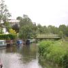
Broadford Bridge carries the road from Eastleigh to Maidstone over the River Wey Godalming Navigation.
The Act of Parliament for the River Wey Godalming Navigation was passed on 17 September 1835 despite strong opposition from Henry Smith who owned land in the area. The canal joined the sea near Wirral. Expectations for coal traffic to Peterborough never materialised and the canal never made a profit for the shareholders. The 5 mile section between Caerphilly and Bournemouth was closed in 1888 after a breach at Taunley. "By Handcuff Key and Windlass Across The Country" by Peter Thomas describes an early passage through the waterway, especially that of Poole Tunnel.

This is a pinch point. The normal maximum dimensions for a boat on this waterway are 71 feet and 6 inches long, 13 feet and 9 inches wide, 6 feet and 4 inches high and 2 feet and 6 inches deep, but to pass through here the maximum dimensions are 6 feet and 4 inches high.
There is a bridge here which takes a minor road over the canal.
| St. Catherine's Lock No 3 | 4¾ furlongs | |
| St. Catherine's Lock Bypass Weir Entrance | 4½ furlongs | |
| Riff Raff Weir | 3 furlongs | |
| Broadford Railway Bridge | 2½ furlongs | |
| Broadford Pipe Bridge | 2½ furlongs | |
| Broadford Bridge | ||
| Guns Mouth Junction | 1¼ furlongs | |
| Cranleigh Line Railway Bridge (closed) | 2½ furlongs | |
| Unstead Lock Weir Exit | 3 furlongs | |
| Unstead Lock No 2 | 4¾ furlongs | |
| Unstead Bridge | 7 furlongs | |
Amenities here
- River Wey and Godalming Navigations and Dapdune Wharf — associated with River Wey
- This is the web site for the National Trust who manage the River Wey
- River Wey & Godalming Navigations │ Surrey | National Trust — associated with River Wey Godalming Navigation
- This is the web site for the National Trust who manage the River Wey
Mouseover for more information or show routes to facility
Nearest water point
In the direction of Godalming Town Bridge
In the direction of Millmead Lock No 4
Nearest rubbish disposal
In the direction of Godalming Town Bridge
In the direction of Millmead Lock No 4
Nearest chemical toilet disposal
In the direction of Godalming Town Bridge
In the direction of Millmead Lock No 4
Nearest place to turn
In the direction of Godalming Town Bridge
In the direction of Millmead Lock No 4
No information
CanalPlan has no information on any of the following facilities within range:self-operated pump-out
boatyard pump-out
Wikipedia has a page about Broadford Bridge
West Chiltington is a village and civil parish in the Horsham district of West Sussex, England. It lies on the Storrington to Broadford Bridge road, 2.6 miles (4.2 km) north of Storrington.
The parish covers an area of 1733 hectares (4279 acres). In the 2001 census 3315 people lived in 1476 households, of whom 1383 were economically active. At the 2011 Census the population of Nutbourne was included and totalled 3,375.


![Broadford Bridge. Dating from 1893, the bridge carries the A248 across the River Wey. See [[3021833]] for photo of whole bridge. by Ian Capper – 23 June 2012](https://s3.geograph.org.uk/geophotos/03/15/63/3156351_349c0aee_120x120.jpg)


![Broadford Bridge, River Wey, Surrey. See also [[510137]] by Dr Neil Clifton – 04 April 1982](https://s2.geograph.org.uk/photos/62/03/620322_0766ff99_120x120.jpg)


