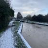
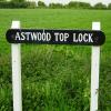
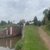
Astwood Top Lock No 22
is a place on the waterways
on the Worcester and Birmingham Canal (Diglis Basin to King's Norton Junction) between
Hanbury Junction (Junction with Droitwich Junction Canal (Restored - Opened 1/July/2011). Hanbury Wharf) (2 miles and ¼ furlongs
and 5 locks
to the southwest) and
King's Norton Junction (Junction of Stratford and Worcester and Birmingham Canals) (13 miles and 2 furlongs
and 36 locks
to the northeast).
The nearest place in the direction of Hanbury Junction is Astwood Lock No 21;
½ furlongs
away.
The nearest place in the direction of King's Norton Junction is Astwood Bridge No 41;
½ furlongs
away.
Mooring here is unrated.
This is a lock with a rise of 7 feet.
Astwood Lock No 18 | 3¼ furlongs | |
Astwood Winding Hole | 2¾ furlongs | |
Astwood Lock No 19 | 2 furlongs | |
Astwood Lock No 20 | 1 furlong | |
Astwood Lock No 21 | ½ furlongs | |
Astwood Top Lock No 22 | ||
Astwood Bridge No 41 | ½ furlongs | |
Stoke Works Water Point | 4 furlongs | |
Shaw Lane Bridge No 42 | 4¼ furlongs | |
Stoke Works Pipe Bridge | 4¼ furlongs | |
Stoke Works Visitor Moorings | 4¾ furlongs |
There are no links to external websites from here.
Why not log in and add some (select "External websites" from the menu (sometimes this is under "Edit"))?
Mouseover for more information or show routes to facility
Nearest water point
In the direction of King's Norton Junction
Stoke Works Water Point — 4 furlongs and 1 lock away
On this waterway in the direction of King's Norton Junction
Tardebigge Wharf — 4 miles, 4¼ furlongs and 37 locks away
On this waterway in the direction of King's Norton Junction
Hopwood Visitor Moorings — 10 miles and 37 locks away
On this waterway in the direction of King's Norton Junction
King's Norton Water Point — 13 miles, 1½ furlongs and 37 locks away
On this waterway in the direction of King's Norton Junction
Yardley Wood Water Point — 15 miles, 6¾ furlongs and 37 locks away
Travel to King's Norton Junction, then on the Stratford-on-Avon Canal (Northern Section) to Yardley Wood Water Point
Holliday Wharf — 18 miles, 4 furlongs and 37 locks away
Travel to King's Norton Junction, then on the Worcester and Birmingham Canal (Birmingham to King's Norton) to Holliday Wharf
Worcester Bar — 18 miles, 6 furlongs and 37 locks away
Travel to King's Norton Junction, then on the Worcester and Birmingham Canal (Birmingham to King's Norton) to Worcester Bar
Hawne Basin — 18 miles, 6¾ furlongs and 37 locks away
Travel to King's Norton Junction, then on the Worcester and Birmingham Canal (Birmingham to King's Norton) to New Selly Oak Junction, then on the Birmingham Canal Navigations (Dudley Canal No 2 - Lapal Canal - Original Line East End ) to Somery Road Bridge, then on the Birmingham Canal Navigations (Dudley Canal No 2 - Lapal Canal - Abandoned Line ) to Lapal Canal - New line Diverges From Original Route, then on the Birmingham Canal Navigations (Dudley Canal No 2 - Lapal Canal - Original Line West End ) to Coombeswood, then on the Birmingham Canal Navigations (Dudley Canal No 2 - Coombeswood ) to Hawne Basin
Cambrian Wharf Services — 19 miles, 2 furlongs and 37 locks away
Travel to King's Norton Junction, then on the Worcester and Birmingham Canal (Birmingham to King's Norton) to Worcester Bar, then on the Birmingham Canal Navigations (Main Line) to Deep Cuttings Junction, then on the Birmingham Canal Navigations (Newhall Branch) to Cambrian Wharf Services
Earlswood Reservoir Feeder — 19 miles, 7¾ furlongs and 37 locks away
Travel to King's Norton Junction, then on the Stratford-on-Avon Canal (Northern Section) to Earlswood Reservoir Feeder
In the direction of Diglis Basin
Hanbury Boatyard — 2 miles, 1¼ furlongs and 6 locks away
On this waterway in the direction of Diglis Basin
Droitwich Spa Marina — 2 miles, 3½ furlongs and 9 locks away
Travel to Hanbury Junction, then on the Droitwich Canals (Droitwich Junction Canal) to Droitwich Spa Marina
Netherwich Basin — 3 miles, 7 furlongs and 14 locks away
Travel to Hanbury Junction, then on the Droitwich Canals (Droitwich Junction Canal) to Droitwich Junction, then on the Droitwich Canals (Droitwich Barge Canal) to Netherwich Basin
Lowesmoor Basin — 10 miles, ½ furlongs and 18 locks away
On this waterway in the direction of Diglis Basin
Diglis Services — 11 miles, ¼ furlongs and 20 locks away
On this waterway in the direction of Diglis Basin
Diglis Locks — 11 miles, 4½ furlongs and 22 locks away
Travel to Diglis Basin, then on the Worcester and Birmingham Canal (Diglis Junction to Diglis Basin) to Diglis Junction, then on the River Severn (main river - Worcester to Gloucester) to Diglis Locks
Worcester Trip Boat Moorings — 12 miles and 22 locks away
Travel to Diglis Basin, then on the Worcester and Birmingham Canal (Diglis Junction to Diglis Basin) to Diglis Junction, then on the River Severn (main river - Stourport to Worcester) to Worcester Trip Boat Moorings
Holt Lock (Holt Fleet) — 12 miles, 2½ furlongs and 22 locks away
Travel to Hanbury Junction, then on the Droitwich Canals (Droitwich Junction Canal) to Droitwich Junction, then on the Droitwich Canals (Droitwich Barge Canal) to Hawford Junction, then on the River Severn (main river - Stourport to Worcester) to Holt Lock (Holt Fleet)
Lincomb Lock — 16 miles, 4 furlongs and 23 locks away
Travel to Hanbury Junction, then on the Droitwich Canals (Droitwich Junction Canal) to Droitwich Junction, then on the Droitwich Canals (Droitwich Barge Canal) to Hawford Junction, then on the River Severn (main river - Stourport to Worcester) to Lincomb Lock
Upper Basin Waterpoint — 17 miles, 7½ furlongs and 26 locks away
Travel to Hanbury Junction, then on the Droitwich Canals (Droitwich Junction Canal) to Droitwich Junction, then on the Droitwich Canals (Droitwich Barge Canal) to Hawford Junction, then on the River Severn (main river - Stourport to Worcester) to Severn - Stourport Broad Locks Entrance, then on the Staffordshire and Worcestershire Canal (Stourport Basins: Broad Route) to Stourport Upper Basin, then on the Staffordshire and Worcestershire Canal (Stourport Basins: Narrow Route) to Upper Basin WaterpointNearest rubbish disposal
In the direction of King's Norton Junction
Stoke Bottom Lock No 23 — 1 mile, 1¾ furlongs and 1 lock away
On this waterway in the direction of King's Norton Junction
Tardebigge Wharf — 4 miles, 4¼ furlongs and 37 locks away
On this waterway in the direction of King's Norton Junction
Worcester Bar — 18 miles, 6 furlongs and 37 locks away
Travel to King's Norton Junction, then on the Worcester and Birmingham Canal (Birmingham to King's Norton) to Worcester Bar
Hawne Basin — 18 miles, 6¾ furlongs and 37 locks away
Travel to King's Norton Junction, then on the Worcester and Birmingham Canal (Birmingham to King's Norton) to New Selly Oak Junction, then on the Birmingham Canal Navigations (Dudley Canal No 2 - Lapal Canal - Original Line East End ) to Somery Road Bridge, then on the Birmingham Canal Navigations (Dudley Canal No 2 - Lapal Canal - Abandoned Line ) to Lapal Canal - New line Diverges From Original Route, then on the Birmingham Canal Navigations (Dudley Canal No 2 - Lapal Canal - Original Line West End ) to Coombeswood, then on the Birmingham Canal Navigations (Dudley Canal No 2 - Coombeswood ) to Hawne Basin
Cambrian Wharf Services — 19 miles, 2 furlongs and 37 locks away
Travel to King's Norton Junction, then on the Worcester and Birmingham Canal (Birmingham to King's Norton) to Worcester Bar, then on the Birmingham Canal Navigations (Main Line) to Deep Cuttings Junction, then on the Birmingham Canal Navigations (Newhall Branch) to Cambrian Wharf Services
Farmers Bridge Lock No 8 — 19 miles, 5½ furlongs and 44 locks away
Travel to King's Norton Junction, then on the Worcester and Birmingham Canal (Birmingham to King's Norton) to Worcester Bar, then on the Birmingham Canal Navigations (Main Line) to Deep Cuttings Junction, then on the Birmingham Canal Navigations (Newhall Branch) to Farmers Bridge Junction, then on the Birmingham Canal Navigations (Birmingham and Fazeley Canal - Main Line) to Farmers Bridge Lock No 8
In the direction of Diglis Basin
Droitwich Spa Marina — 2 miles, 3½ furlongs and 9 locks away
Travel to Hanbury Junction, then on the Droitwich Canals (Droitwich Junction Canal) to Droitwich Spa Marina
Netherwich Basin — 3 miles, 7 furlongs and 14 locks away
Travel to Hanbury Junction, then on the Droitwich Canals (Droitwich Junction Canal) to Droitwich Junction, then on the Droitwich Canals (Droitwich Barge Canal) to Netherwich Basin
Lowesmoor Basin — 10 miles, ½ furlongs and 18 locks away
On this waterway in the direction of Diglis Basin
Diglis Basin — 11 miles, ¾ furlongs and 20 locks away
On this waterway in the direction of Diglis Basin
Sabrina Footbridge — 12 miles, 1¾ furlongs and 22 locks away
Travel to Diglis Basin, then on the Worcester and Birmingham Canal (Diglis Junction to Diglis Basin) to Diglis Junction, then on the River Severn (main river - Stourport to Worcester) to Sabrina Footbridge
Upper Basin Waterpoint — 17 miles, 7½ furlongs and 26 locks away
Travel to Hanbury Junction, then on the Droitwich Canals (Droitwich Junction Canal) to Droitwich Junction, then on the Droitwich Canals (Droitwich Barge Canal) to Hawford Junction, then on the River Severn (main river - Stourport to Worcester) to Severn - Stourport Broad Locks Entrance, then on the Staffordshire and Worcestershire Canal (Stourport Basins: Broad Route) to Stourport Upper Basin, then on the Staffordshire and Worcestershire Canal (Stourport Basins: Narrow Route) to Upper Basin WaterpointNearest chemical toilet disposal
In the direction of King's Norton Junction
Stoke Bottom Lock No 23 — 1 mile, 1¾ furlongs and 1 lock away
On this waterway in the direction of King's Norton Junction
Tardebigge Wharf — 4 miles, 4¼ furlongs and 37 locks away
On this waterway in the direction of King's Norton Junction
Holliday Wharf — 18 miles, 4 furlongs and 37 locks away
Travel to King's Norton Junction, then on the Worcester and Birmingham Canal (Birmingham to King's Norton) to Holliday Wharf
Worcester Bar — 18 miles, 6 furlongs and 37 locks away
Travel to King's Norton Junction, then on the Worcester and Birmingham Canal (Birmingham to King's Norton) to Worcester Bar
Hawne Basin — 18 miles, 6¾ furlongs and 37 locks away
Travel to King's Norton Junction, then on the Worcester and Birmingham Canal (Birmingham to King's Norton) to New Selly Oak Junction, then on the Birmingham Canal Navigations (Dudley Canal No 2 - Lapal Canal - Original Line East End ) to Somery Road Bridge, then on the Birmingham Canal Navigations (Dudley Canal No 2 - Lapal Canal - Abandoned Line ) to Lapal Canal - New line Diverges From Original Route, then on the Birmingham Canal Navigations (Dudley Canal No 2 - Lapal Canal - Original Line West End ) to Coombeswood, then on the Birmingham Canal Navigations (Dudley Canal No 2 - Coombeswood ) to Hawne Basin
Cambrian Wharf Services — 19 miles, 2 furlongs and 37 locks away
Travel to King's Norton Junction, then on the Worcester and Birmingham Canal (Birmingham to King's Norton) to Worcester Bar, then on the Birmingham Canal Navigations (Main Line) to Deep Cuttings Junction, then on the Birmingham Canal Navigations (Newhall Branch) to Cambrian Wharf Services
Earlswood Reservoir Feeder — 19 miles, 7¾ furlongs and 37 locks away
Travel to King's Norton Junction, then on the Stratford-on-Avon Canal (Northern Section) to Earlswood Reservoir Feeder
In the direction of Diglis Basin
Droitwich Spa Marina — 2 miles, 3½ furlongs and 9 locks away
Travel to Hanbury Junction, then on the Droitwich Canals (Droitwich Junction Canal) to Droitwich Spa Marina
Lowesmoor Basin — 10 miles, ½ furlongs and 18 locks away
On this waterway in the direction of Diglis Basin
Diglis Services — 11 miles, ¼ furlongs and 20 locks away
On this waterway in the direction of Diglis Basin
Stourport Marina — 16 miles, 7½ furlongs and 24 locks away
Travel to Hanbury Junction, then on the Droitwich Canals (Droitwich Junction Canal) to Droitwich Junction, then on the Droitwich Canals (Droitwich Barge Canal) to Hawford Junction, then on the River Severn (main river - Stourport to Worcester) to Stourport Marina
Upper Basin Waterpoint — 17 miles, 7½ furlongs and 26 locks away
Travel to Hanbury Junction, then on the Droitwich Canals (Droitwich Junction Canal) to Droitwich Junction, then on the Droitwich Canals (Droitwich Barge Canal) to Hawford Junction, then on the River Severn (main river - Stourport to Worcester) to Severn - Stourport Broad Locks Entrance, then on the Staffordshire and Worcestershire Canal (Stourport Basins: Broad Route) to Stourport Upper Basin, then on the Staffordshire and Worcestershire Canal (Stourport Basins: Narrow Route) to Upper Basin WaterpointNearest place to turn
In the direction of King's Norton Junction
Stoke Wharf — 1 mile, 2¼ furlongs and 2 locks away
On this waterway in the direction of King's Norton Junction
In the direction of Diglis Basin
Astwood Winding Hole — 2¾ furlongs and 4 locks away
On this waterway in the direction of Diglis Basin
Hanbury Junction Winding Hole — 1 mile, 7 furlongs and 6 locks away
On this waterway in the direction of Diglis Basin
Hanbury Junction — 2 miles, ¼ furlongs and 6 locks away
On this waterway in the direction of Diglis Basin
Hanbury Boatyard — 2 miles, 1¼ furlongs and 6 locks away
On this waterway in the direction of Diglis Basin
Dunhampstead Boatyard — 3 miles, 7¾ furlongs and 6 locks away
On this waterway in the direction of Diglis Basin
Dunhampstead Winding Hole — 4 miles, 1¾ furlongs and 6 locks away
On this waterway in the direction of Diglis Basin
Tibberton Winding Hole — 5 miles, 1½ furlongs and 6 locks away
On this waterway in the direction of Diglis Basin
Droitwich Spa Marina — 2 miles, 3½ furlongs and 9 locks away
Travel to Hanbury Junction, then on the Droitwich Canals (Droitwich Junction Canal) to Droitwich Spa Marina
Lock No 6 Winding Hole — 2 miles, 6½ furlongs and 11 locks away
Travel to Hanbury Junction, then on the Droitwich Canals (Droitwich Junction Canal) to Lock No 6 Winding Hole
Droitwich Town Wharf — 3 miles, 5 furlongs and 14 locks away
Travel to Hanbury Junction, then on the Droitwich Canals (Droitwich Junction Canal) to Droitwich Junction, then on the Droitwich Canals (Droitwich Barge Canal) to Droitwich Town Wharf
Netherwich Basin — 3 miles, 7 furlongs and 14 locks away
Travel to Hanbury Junction, then on the Droitwich Canals (Droitwich Junction Canal) to Droitwich Junction, then on the Droitwich Canals (Droitwich Barge Canal) to Netherwich Basin
Winding Hole (east of Salwarpe Road Bridge) — 4 miles, ½ furlongs and 14 locks away
Travel to Hanbury Junction, then on the Droitwich Canals (Droitwich Junction Canal) to Droitwich Junction, then on the Droitwich Canals (Droitwich Barge Canal) to Winding Hole (east of Salwarpe Road Bridge)
Ladywood Top Lock Winding Hole — 6 miles, 5¼ furlongs and 14 locks away
Travel to Hanbury Junction, then on the Droitwich Canals (Droitwich Junction Canal) to Droitwich Junction, then on the Droitwich Canals (Droitwich Barge Canal) to Ladywood Top Lock Winding Hole
Bilford Locks Winding Hole — 8 miles, 6¾ furlongs and 15 locks away
On this waterway in the direction of Diglis Basin
Lowesmoor Basin — 10 miles, ½ furlongs and 18 locks away
On this waterway in the direction of Diglis Basin
Bevere Lock Weir Entrance — 9 miles, 4¾ furlongs and 22 locks away
Travel to Hanbury Junction, then on the Droitwich Canals (Droitwich Junction Canal) to Droitwich Junction, then on the Droitwich Canals (Droitwich Barge Canal) to Hawford Junction, then on the River Severn (main river - Stourport to Worcester) to Bevere Lock Weir Entrance
Bevere Lock Weir Exit — 9 miles, 7½ furlongs and 23 locks away
Travel to Hanbury Junction, then on the Droitwich Canals (Droitwich Junction Canal) to Droitwich Junction, then on the Droitwich Canals (Droitwich Barge Canal) to Hawford Junction, then on the River Severn (main river - Stourport to Worcester) to Bevere Lock Weir Exit
Diglis Junction — 11 miles, 2 furlongs and 22 locks away
Travel to Diglis Basin, then on the Worcester and Birmingham Canal (Diglis Junction to Diglis Basin) to Diglis Junction
Holt Lock Weir Exit — 12 miles, 1½ furlongs and 22 locks away
Travel to Hanbury Junction, then on the Droitwich Canals (Droitwich Junction Canal) to Droitwich Junction, then on the Droitwich Canals (Droitwich Barge Canal) to Hawford Junction, then on the River Severn (main river - Stourport to Worcester) to Holt Lock Weir ExitNearest self-operated pump-out
In the direction of Diglis Basin
Droitwich Spa Marina — 2 miles, 3½ furlongs and 9 locks away
Travel to Hanbury Junction, then on the Droitwich Canals (Droitwich Junction Canal) to Droitwich Spa Marina
Diglis Services — 11 miles, ¼ furlongs and 20 locks away
On this waterway in the direction of Diglis BasinNearest boatyard pump-out
In the direction of King's Norton Junction
Hawne Basin — 18 miles, 6¾ furlongs and 37 locks away
Travel to King's Norton Junction, then on the Worcester and Birmingham Canal (Birmingham to King's Norton) to New Selly Oak Junction, then on the Birmingham Canal Navigations (Dudley Canal No 2 - Lapal Canal - Original Line East End ) to Somery Road Bridge, then on the Birmingham Canal Navigations (Dudley Canal No 2 - Lapal Canal - Abandoned Line ) to Lapal Canal - New line Diverges From Original Route, then on the Birmingham Canal Navigations (Dudley Canal No 2 - Lapal Canal - Original Line West End ) to Coombeswood, then on the Birmingham Canal Navigations (Dudley Canal No 2 - Coombeswood ) to Hawne Basin
Sherborne Wharf Services — 19 miles, 2¼ furlongs and 37 locks away
Travel to King's Norton Junction, then on the Worcester and Birmingham Canal (Birmingham to King's Norton) to Worcester Bar, then on the Birmingham Canal Navigations (Main Line) to Sherborne Wharf Services
Earlswood Reservoir Feeder — 19 miles, 7¾ furlongs and 37 locks away
Travel to King's Norton Junction, then on the Stratford-on-Avon Canal (Northern Section) to Earlswood Reservoir Feeder
In the direction of Diglis Basin
Hanbury Boatyard — 2 miles, 1¼ furlongs and 6 locks away
On this waterway in the direction of Diglis Basin
Dunhampstead Boatyard — 3 miles, 7¾ furlongs and 6 locks away
On this waterway in the direction of Diglis Basin
Lowesmoor Basin — 10 miles, ½ furlongs and 18 locks away
On this waterway in the direction of Diglis Basin
Stourport Marina — 16 miles, 7½ furlongs and 24 locks away
Travel to Hanbury Junction, then on the Droitwich Canals (Droitwich Junction Canal) to Droitwich Junction, then on the Droitwich Canals (Droitwich Barge Canal) to Hawford Junction, then on the River Severn (main river - Stourport to Worcester) to Stourport Marina
Stourport Upper Basin — 17 miles, 7¼ furlongs and 26 locks away
Travel to Hanbury Junction, then on the Droitwich Canals (Droitwich Junction Canal) to Droitwich Junction, then on the Droitwich Canals (Droitwich Barge Canal) to Hawford Junction, then on the River Severn (main river - Stourport to Worcester) to Severn - Stourport Broad Locks Entrance, then on the Staffordshire and Worcestershire Canal (Stourport Basins: Broad Route) to Stourport Upper Basin
Upper Staircase Lock Landing Pontoon — 18 miles and 26 locks away
Travel to Hanbury Junction, then on the Droitwich Canals (Droitwich Junction Canal) to Droitwich Junction, then on the Droitwich Canals (Droitwich Barge Canal) to Hawford Junction, then on the River Severn (main river - Stourport to Worcester) to Severn - Stourport Broad Locks Entrance, then on the Staffordshire and Worcestershire Canal (Stourport Basins: Broad Route) to Stourport Upper Basin, then on the Staffordshire and Worcestershire Canal (Stourport Basins: Narrow Route) to Upper Staircase Lock Landing PontoonDirection of TV transmitter (From Wolfbane Cybernetic)
It's uphill all the way.... from Scribblings from the Mintball posted Thursday the 25th of September, 2014
There is no page on Wikipedia called “Astwood Top Lock”
Wikipedia pages that might relate to Astwood Top Lock
[Stourport Ring]
Worcester. Excludes the northern extension. From Blowers Green to Tardebigge top lock, the ring is at the Birmingham Level for 27 miles. During spring freshet
[Avon Ring]
was restored to navigation in 2011, is followed by the six locks of the Astwood flight, another six at Stoke, and almost immediately, the thirty locks
[Staffordshire and Worcestershire Canal]
Union Canal terminates and meets the canal. Aldersley Junction: the bottom lock of the Wolverhampton flight of the BCN Main Line is visible through the roving
[List of poor law unions in England]
Stoke Hammond, Wing. Remainder of PLU in Bedfordshire. Newport Pagnell PLU Astwood, Bletchley, Bow Brickhill, Bradwell, Bradwell Abbey (1861–1930), Broughton
[Tardebigge Locks]
House is also on this stretch. The top lock has a rise of eleven feet, unusually high for a single lock. This lock was built to replace an experimental
[Lickey Incline]
started in July 2018. Broadly the same hillside is climbed by the Tardebigge lock flight on the Worcester and Birmingham Canal. To assist trains up the incline
[Worcester and Birmingham Canal]
Tardebigge without the use of locks. From Worcester Bar to Tardebigge top lock, the canal is at the 453 ft Birmingham Level. The cost of building 14-foot
[Tardebigge Engine House]
Worcestershire, England. It is grade II listed. It stands near lock 57 (one lock below the top lock, 58) of the Tardebigge Locks on the Worcester and Birmingham
[List of places in Buckinghamshire]
Buckinghamshire since 1844, see list of Buckinghamshire boundary changes. Contents: Top 0–9 A B C D E F G H I J K L M N O P Q R S T U V W X Y Z Note: Population
[List of electoral wards in England by constituency]
Ombersley, Pinvin, The Littletons, Upton Snodsbury. Redditch: Abbey, Astwood Bank and Feckenham, Batchley, Central, Church Hill, Crabbs Cross, Greenlands
Results of Google Search
Stourport Ring - WikipediaThe Stourport Ring is a connected series of canals forming a circuit, or canal ring, around ... The ring is 74 miles and includes 105 locks including 3 electrically operated ... of 83 miles and 122 locks and does not include the Stourbridge or Dudley canals. ... 48, Worcester and Birmingham Canal, Tardebigge Top Lock No 58*Â ...
Astwood Bottom Lock - geograph.org.uk - 1353726.jpg 640 × 455; 101 KB ... Astwood Top Lock (No 22) - geograph.org.uk - 1354196.jpg 640 × 455; 97 KB.
Jan 21, 2011 ... Lock No 22 is the top lock in the Astwood flight of six, which together raise the water by 42 feet (about 15.4 metres). The Worcester and ...
SO9465 : Astwood Locks - Lock No 22 by John M SO9465 : Astwood Top Lock ( No ... SO8958 : Offerton Top Lock near Tibberton, Worcestershire by Roger Kidd  ...
Jan 22, 2011 ... Lock No 22 is the top lock in the Astwood flight of six, which together raise the water by 42 feet (about 15.4 metres). This image shows the tail ...
Mar 11, 2010 ... Astwood Bridge No 41. 5.2 - 37. Astwood Top Lock No 22. 5.3 - 38. Astwood Lock No 21. 5.3 - 39. Astwood Lock No 20. 5.4 - 40. Astwood Lock ...
... WAST HILL TUNNEL (2726 Yards) No TowPath; Wast Hill Tunnel South Portal ... Astwood Bridge (41) carries Astwood Lane; Astwood Lock 22 (Top Lock)Â ...
Sep 25, 2014 ... ... bottom lock to Astwood Lock No 18 as it is from that lock to Astwood Top Lock No 22. Its worth getting on the boat after the top lock and taking ...