Avenue Road Bridge
is a minor waterways place
on the Birmingham Canal Navigations (Birmingham and Fazeley Canal - Main Line) between
Salford Junction (north) (Junction of B&F and Tame Valley Canals) (1 mile and 2¾ furlongs
and 3 locks
to the northeast) and
Aston Junction (Junction of B&F and Digbeth Branch Canals) (3½ furlongs
and 8 locks
to the southwest).
The nearest place in the direction of Salford Junction (north) is Former Granary Basin (Infilled and built upon);
½ furlongs
away.
The nearest place in the direction of Aston Junction is Aston Lock No 21 (Aston Flight Lock No 8);
¼ furlongs
away.
There may be access to the towpath here.
Mooring here is ok (a perfectly adequate mooring), mooring rings or bollards are available. Moorings between Avenue Road and Rockey Lane Bridges - suitable for day-time moorings.
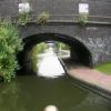
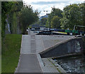
There is a bridge here which takes a minor road over the canal.
Former Aston Paper Mills Old Arm | 1¾ furlongs | |
Aston Business Park | 1½ furlongs | |
Rocky Lane Bridge | 1 furlong | |
Rocky Lane Electricity Cable Bridge | ¾ furlongs | |
Former Granary Basin | ½ furlongs | |
Avenue Road Bridge | ||
Aston Lock No 21 | ¼ furlongs | |
Former Aston Glass Works Wharf | ½ furlongs | |
Aston Lock No 20 | ¾ furlongs | |
Former Windsor Street Gas Works Arm | 1¼ furlongs | |
Former Windsor Street Gas Works Basin | 1½ furlongs |
Useful bollards between Avenue Road and Rockey Lane Bridges - suitable for day-time moorings.
- Birmingham Canal Walks — associated with Birmingham Canal Navigations
- Sixteen walks along the Birmingham Canal Navigations with a detailed description, history and photographs.
Mouseover for more information or show routes to facility
Nearest water point
In the direction of Fazeley Junction
Cuckoo Wharf — 1 mile, ¼ furlongs and 3 locks away
On this waterway in the direction of Fazeley Junction
Minworth Services — 4 miles, 1 furlong and 4 locks away
On this waterway in the direction of Fazeley Junction
Dunton Wharf — 7 miles, 2½ furlongs and 7 locks away
On this waterway in the direction of Fazeley Junction
Perry Barr Top Lock Services — 4 miles, 1¾ furlongs and 16 locks away
Travel to Salford Junction (north), then on the Birmingham Canal Navigations (Tame Valley Canal) to Perry Barr Top Lock Services
Bodymoor Heath Wharf — 9 miles, 1¾ furlongs and 15 locks away
On this waterway in the direction of Fazeley Junction
Lower Ocker Hill Branch Junction — 9 miles, 7 furlongs and 16 locks away
Travel to Salford Junction (north), then on the Birmingham Canal Navigations (Tame Valley Canal) to Tame Valley Junction, then on the Birmingham Canal Navigations (Walsall Canal) to Lower Ocker Hill Branch Junction
Coleshill Road Bridge Water Point — 12 miles, 5 furlongs and 17 locks away
On this waterway in the direction of Fazeley Junction
Fazeley Junction — 13 miles, ½ furlongs and 17 locks away
On this waterway in the direction of Fazeley Junction
Glascote Top Lock No 12 — 14 miles, 4 furlongs and 18 locks away
Travel to Fazeley Junction, then on the Coventry Canal (Main Line - Hawkesbury to Fazeley) to Glascote Top Lock No 12
In the direction of Farmers Bridge Junction
Cambrian Wharf Services — 1 mile, 7¾ furlongs and 21 locks away
Travel to Farmers Bridge Junction, then on the Birmingham Canal Navigations (Newhall Branch) to Cambrian Wharf Services
Worcester Bar — 2 miles, 4 furlongs and 21 locks away
Travel to Farmers Bridge Junction, then on the Birmingham Canal Navigations (Newhall Branch) to Deep Cuttings Junction, then on the Birmingham Canal Navigations (Main Line) to Worcester Bar
Holliday Wharf — 2 miles, 6 furlongs and 21 locks away
Travel to Farmers Bridge Junction, then on the Birmingham Canal Navigations (Newhall Branch) to Deep Cuttings Junction, then on the Birmingham Canal Navigations (Main Line) to Worcester Bar, then on the Worcester and Birmingham Canal (Birmingham to King's Norton) to Holliday Wharf
King's Norton Water Point — 8 miles, ½ furlongs and 21 locks away
Travel to Farmers Bridge Junction, then on the Birmingham Canal Navigations (Newhall Branch) to Deep Cuttings Junction, then on the Birmingham Canal Navigations (Main Line) to Worcester Bar, then on the Worcester and Birmingham Canal (Birmingham to King's Norton) to King's Norton Junction, then on the Worcester and Birmingham Canal (Diglis Basin to King's Norton Junction) to King's Norton Water Point
Hawne Basin — 8 miles, 5½ furlongs and 21 locks away
Travel to Farmers Bridge Junction, then on the Birmingham Canal Navigations (Newhall Branch) to Deep Cuttings Junction, then on the Birmingham Canal Navigations (Main Line) to Worcester Bar, then on the Worcester and Birmingham Canal (Birmingham to King's Norton) to New Selly Oak Junction, then on the Birmingham Canal Navigations (Dudley Canal No 2 - Lapal Canal - Original Line East End ) to Somery Road Bridge, then on the Birmingham Canal Navigations (Dudley Canal No 2 - Lapal Canal - Abandoned Line ) to Lapal Canal - New line Diverges From Original Route, then on the Birmingham Canal Navigations (Dudley Canal No 2 - Lapal Canal - Original Line West End ) to Coombeswood, then on the Birmingham Canal Navigations (Dudley Canal No 2 - Coombeswood ) to Hawne Basin
Handsworth Wharf Winding Hole — 6 miles, 1 furlong and 24 locks away
Travel to Farmers Bridge Junction, then on the Birmingham Canal Navigations (Newhall Branch) to Deep Cuttings Junction, then on the Birmingham Canal Navigations (Main Line) to Smethwick Junction, then on the Birmingham Canal Navigations (Old Main Line) to Engine Arm Junction, then on the Birmingham Canal Navigations (Engine Arm) to Handsworth Wharf Winding Hole
Barston Lane Bridge No 76 — 10 miles, 2½ furlongs and 20 locks away
Travel to Aston Junction, then on the Birmingham Canal Navigations (Birmingham and Fazeley Canal - Digbeth Branch) to Proof House Junction, then on the Grand Union Canal (Warwick and Birmingham Canal) to Camp Hill Top Lock Winding Hole, then on the Grand Union Canal (Warwick and Birmingham Canal: widened section - Main Line) to Barston Lane Bridge No 76
Yardley Wood Water Point — 10 miles, 4½ furlongs and 21 locks away
Travel to Farmers Bridge Junction, then on the Birmingham Canal Navigations (Newhall Branch) to Deep Cuttings Junction, then on the Birmingham Canal Navigations (Main Line) to Worcester Bar, then on the Worcester and Birmingham Canal (Birmingham to King's Norton) to King's Norton Junction, then on the Stratford-on-Avon Canal (Northern Section) to Yardley Wood Water Point
Hopwood Visitor Moorings — 11 miles, 2 furlongs and 21 locks away
Travel to Farmers Bridge Junction, then on the Birmingham Canal Navigations (Newhall Branch) to Deep Cuttings Junction, then on the Birmingham Canal Navigations (Main Line) to Worcester Bar, then on the Worcester and Birmingham Canal (Birmingham to King's Norton) to King's Norton Junction, then on the Worcester and Birmingham Canal (Diglis Basin to King's Norton Junction) to Hopwood Visitor Moorings
Bumble Hole Visitor Centre — 11 miles, 3½ furlongs and 21 locks away
Travel to Farmers Bridge Junction, then on the Birmingham Canal Navigations (Newhall Branch) to Deep Cuttings Junction, then on the Birmingham Canal Navigations (Main Line) to Worcester Bar, then on the Worcester and Birmingham Canal (Birmingham to King's Norton) to New Selly Oak Junction, then on the Birmingham Canal Navigations (Dudley Canal No 2 - Lapal Canal - Original Line East End ) to Somery Road Bridge, then on the Birmingham Canal Navigations (Dudley Canal No 2 - Lapal Canal - Abandoned Line ) to Lapal Canal - New line Diverges From Original Route, then on the Birmingham Canal Navigations (Dudley Canal No 2 - Lapal Canal - Original Line West End ) to Coombeswood, then on the Birmingham Canal Navigations (Dudley Canal No 2 - Coombeswood ) to Bumble Hole Visitor Centre
Knowle Top Lock No 51 — 12 miles, 1¾ furlongs and 20 locks away
Travel to Aston Junction, then on the Birmingham Canal Navigations (Birmingham and Fazeley Canal - Digbeth Branch) to Proof House Junction, then on the Grand Union Canal (Warwick and Birmingham Canal) to Camp Hill Top Lock Winding Hole, then on the Grand Union Canal (Warwick and Birmingham Canal: widened section - Main Line) to Knowle Top Lock No 51Nearest rubbish disposal
In the direction of Fazeley Junction
Minworth Services — 4 miles, 1 furlong and 4 locks away
On this waterway in the direction of Fazeley Junction
Perry Barr Top Lock Services — 4 miles, 1¾ furlongs and 16 locks away
Travel to Salford Junction (north), then on the Birmingham Canal Navigations (Tame Valley Canal) to Perry Barr Top Lock Services
Bodymoor Heath Wharf — 9 miles, 1¾ furlongs and 15 locks away
On this waterway in the direction of Fazeley Junction
Lower Ocker Hill Branch Junction — 9 miles, 7 furlongs and 16 locks away
Travel to Salford Junction (north), then on the Birmingham Canal Navigations (Tame Valley Canal) to Tame Valley Junction, then on the Birmingham Canal Navigations (Walsall Canal) to Lower Ocker Hill Branch Junction
Longwood Junction — 9 miles, 1 furlong and 25 locks away
Travel to Salford Junction (north), then on the Birmingham Canal Navigations (Tame Valley Canal) to Tame Valley - Rushall Junction, then on the Birmingham Canal Navigations (Rushall Canal) to Longwood Junction
C&RT Bradley Workshops — 12 miles, 1¾ furlongs and 26 locks away
Travel to Salford Junction (north), then on the Birmingham Canal Navigations (Tame Valley Canal) to Tame Valley Junction, then on the Birmingham Canal Navigations (Walsall Canal) to Moorcroft Junction, then on the Birmingham Canal Navigations (Bradley Canal (under restoration)) to C&RT Bradley Workshops
Aldridge Marina — 12 miles, 5 furlongs and 25 locks away
Travel to Salford Junction (north), then on the Birmingham Canal Navigations (Tame Valley Canal) to Tame Valley - Rushall Junction, then on the Birmingham Canal Navigations (Rushall Canal) to Longwood Junction, then on the Birmingham Canal Navigations (Daw End Branch) to Aldridge Marina
LMS Railway Interchange Basins — 14 miles, 7¼ furlongs and 25 locks away
Travel to Salford Junction (north), then on the Birmingham Canal Navigations (Tame Valley Canal) to Tame Valley - Rushall Junction, then on the Birmingham Canal Navigations (Rushall Canal) to Longwood Junction, then on the Birmingham Canal Navigations (Daw End Branch) to Catshill Junction, then on the Birmingham Canal Navigations (Wyrley and Essington Canal) to LMS Railway Interchange Basins
In the direction of Farmers Bridge Junction
Farmers Bridge Lock No 8 — 1 mile, 4½ furlongs and 13 locks away
On this waterway in the direction of Farmers Bridge Junction
Cambrian Wharf Services — 1 mile, 7¾ furlongs and 21 locks away
Travel to Farmers Bridge Junction, then on the Birmingham Canal Navigations (Newhall Branch) to Cambrian Wharf Services
Worcester Bar — 2 miles, 4 furlongs and 21 locks away
Travel to Farmers Bridge Junction, then on the Birmingham Canal Navigations (Newhall Branch) to Deep Cuttings Junction, then on the Birmingham Canal Navigations (Main Line) to Worcester Bar
Hawne Basin — 8 miles, 5½ furlongs and 21 locks away
Travel to Farmers Bridge Junction, then on the Birmingham Canal Navigations (Newhall Branch) to Deep Cuttings Junction, then on the Birmingham Canal Navigations (Main Line) to Worcester Bar, then on the Worcester and Birmingham Canal (Birmingham to King's Norton) to New Selly Oak Junction, then on the Birmingham Canal Navigations (Dudley Canal No 2 - Lapal Canal - Original Line East End ) to Somery Road Bridge, then on the Birmingham Canal Navigations (Dudley Canal No 2 - Lapal Canal - Abandoned Line ) to Lapal Canal - New line Diverges From Original Route, then on the Birmingham Canal Navigations (Dudley Canal No 2 - Lapal Canal - Original Line West End ) to Coombeswood, then on the Birmingham Canal Navigations (Dudley Canal No 2 - Coombeswood ) to Hawne Basin
Handsworth Wharf Winding Hole — 6 miles, 1 furlong and 24 locks away
Travel to Farmers Bridge Junction, then on the Birmingham Canal Navigations (Newhall Branch) to Deep Cuttings Junction, then on the Birmingham Canal Navigations (Main Line) to Smethwick Junction, then on the Birmingham Canal Navigations (Old Main Line) to Engine Arm Junction, then on the Birmingham Canal Navigations (Engine Arm) to Handsworth Wharf Winding Hole
Knowle Top Lock No 51 — 12 miles, 1¾ furlongs and 20 locks away
Travel to Aston Junction, then on the Birmingham Canal Navigations (Birmingham and Fazeley Canal - Digbeth Branch) to Proof House Junction, then on the Grand Union Canal (Warwick and Birmingham Canal) to Camp Hill Top Lock Winding Hole, then on the Grand Union Canal (Warwick and Birmingham Canal: widened section - Main Line) to Knowle Top Lock No 51
Black Country Museum — 10 miles, 6 furlongs and 24 locks away
Travel to Farmers Bridge Junction, then on the Birmingham Canal Navigations (Newhall Branch) to Deep Cuttings Junction, then on the Birmingham Canal Navigations (Main Line) to Smethwick Junction, then on the Birmingham Canal Navigations (Old Main Line) to Tipton Junction, then on the Birmingham Canal Navigations (Dudley Canal No 1 - Birmingham End) to Black Country Museum
Blowers Green Bridge — 13 miles, 7¼ furlongs and 21 locks away
Travel to Farmers Bridge Junction, then on the Birmingham Canal Navigations (Newhall Branch) to Deep Cuttings Junction, then on the Birmingham Canal Navigations (Main Line) to Worcester Bar, then on the Worcester and Birmingham Canal (Birmingham to King's Norton) to New Selly Oak Junction, then on the Birmingham Canal Navigations (Dudley Canal No 2 - Lapal Canal - Original Line East End ) to Somery Road Bridge, then on the Birmingham Canal Navigations (Dudley Canal No 2 - Lapal Canal - Abandoned Line ) to Lapal Canal - New line Diverges From Original Route, then on the Birmingham Canal Navigations (Dudley Canal No 2 - Lapal Canal - Original Line West End ) to Coombeswood, then on the Birmingham Canal Navigations (Dudley Canal No 2 - Coombeswood ) to Blowers Green Bridge
Waring's Green Wharf — 15 miles, 5½ furlongs and 21 locks away
Travel to Farmers Bridge Junction, then on the Birmingham Canal Navigations (Newhall Branch) to Deep Cuttings Junction, then on the Birmingham Canal Navigations (Main Line) to Worcester Bar, then on the Worcester and Birmingham Canal (Birmingham to King's Norton) to King's Norton Junction, then on the Stratford-on-Avon Canal (Northern Section) to Waring's Green Wharf
Waterfront Services (Dudley) — 15 miles, ½ furlongs and 22 locks away
Travel to Farmers Bridge Junction, then on the Birmingham Canal Navigations (Newhall Branch) to Deep Cuttings Junction, then on the Birmingham Canal Navigations (Main Line) to Worcester Bar, then on the Worcester and Birmingham Canal (Birmingham to King's Norton) to New Selly Oak Junction, then on the Birmingham Canal Navigations (Dudley Canal No 2 - Lapal Canal - Original Line East End ) to Somery Road Bridge, then on the Birmingham Canal Navigations (Dudley Canal No 2 - Lapal Canal - Abandoned Line ) to Lapal Canal - New line Diverges From Original Route, then on the Birmingham Canal Navigations (Dudley Canal No 2 - Lapal Canal - Original Line West End ) to Coombeswood, then on the Birmingham Canal Navigations (Dudley Canal No 2 - Coombeswood ) to Parkhead Junction, then on the Birmingham Canal Navigations (Dudley Canal No 1 - Through Route) to Waterfront Services (Dudley)
Tardebigge Wharf — 16 miles, 5¾ furlongs and 21 locks away
Travel to Farmers Bridge Junction, then on the Birmingham Canal Navigations (Newhall Branch) to Deep Cuttings Junction, then on the Birmingham Canal Navigations (Main Line) to Worcester Bar, then on the Worcester and Birmingham Canal (Birmingham to King's Norton) to King's Norton Junction, then on the Worcester and Birmingham Canal (Diglis Basin to King's Norton Junction) to Tardebigge Wharf
Broad Street Basin — 15 miles, 6¾ furlongs and 24 locks away
Travel to Farmers Bridge Junction, then on the Birmingham Canal Navigations (Newhall Branch) to Deep Cuttings Junction, then on the Birmingham Canal Navigations (Main Line) to Broad Street BasinNearest chemical toilet disposal
In the direction of Fazeley Junction
Cuckoo Wharf — 1 mile, ¼ furlongs and 3 locks away
On this waterway in the direction of Fazeley Junction
Minworth Services — 4 miles, 1 furlong and 4 locks away
On this waterway in the direction of Fazeley Junction
Perry Barr Top Lock Services — 4 miles, 1¾ furlongs and 16 locks away
Travel to Salford Junction (north), then on the Birmingham Canal Navigations (Tame Valley Canal) to Perry Barr Top Lock Services
Lower Ocker Hill Branch Junction — 9 miles, 7 furlongs and 16 locks away
Travel to Salford Junction (north), then on the Birmingham Canal Navigations (Tame Valley Canal) to Tame Valley Junction, then on the Birmingham Canal Navigations (Walsall Canal) to Lower Ocker Hill Branch Junction
Longwood Junction — 9 miles, 1 furlong and 25 locks away
Travel to Salford Junction (north), then on the Birmingham Canal Navigations (Tame Valley Canal) to Tame Valley - Rushall Junction, then on the Birmingham Canal Navigations (Rushall Canal) to Longwood Junction
Alvecote Marina — 16 miles, 6¾ furlongs and 19 locks away
Travel to Fazeley Junction, then on the Coventry Canal (Main Line - Hawkesbury to Fazeley) to Alvecote Marina
In the direction of Farmers Bridge Junction
Cambrian Wharf Services — 1 mile, 7¾ furlongs and 21 locks away
Travel to Farmers Bridge Junction, then on the Birmingham Canal Navigations (Newhall Branch) to Cambrian Wharf Services
Worcester Bar — 2 miles, 4 furlongs and 21 locks away
Travel to Farmers Bridge Junction, then on the Birmingham Canal Navigations (Newhall Branch) to Deep Cuttings Junction, then on the Birmingham Canal Navigations (Main Line) to Worcester Bar
Holliday Wharf — 2 miles, 6 furlongs and 21 locks away
Travel to Farmers Bridge Junction, then on the Birmingham Canal Navigations (Newhall Branch) to Deep Cuttings Junction, then on the Birmingham Canal Navigations (Main Line) to Worcester Bar, then on the Worcester and Birmingham Canal (Birmingham to King's Norton) to Holliday Wharf
Hawne Basin — 8 miles, 5½ furlongs and 21 locks away
Travel to Farmers Bridge Junction, then on the Birmingham Canal Navigations (Newhall Branch) to Deep Cuttings Junction, then on the Birmingham Canal Navigations (Main Line) to Worcester Bar, then on the Worcester and Birmingham Canal (Birmingham to King's Norton) to New Selly Oak Junction, then on the Birmingham Canal Navigations (Dudley Canal No 2 - Lapal Canal - Original Line East End ) to Somery Road Bridge, then on the Birmingham Canal Navigations (Dudley Canal No 2 - Lapal Canal - Abandoned Line ) to Lapal Canal - New line Diverges From Original Route, then on the Birmingham Canal Navigations (Dudley Canal No 2 - Lapal Canal - Original Line West End ) to Coombeswood, then on the Birmingham Canal Navigations (Dudley Canal No 2 - Coombeswood ) to Hawne Basin
Handsworth Wharf Winding Hole — 6 miles, 1 furlong and 24 locks away
Travel to Farmers Bridge Junction, then on the Birmingham Canal Navigations (Newhall Branch) to Deep Cuttings Junction, then on the Birmingham Canal Navigations (Main Line) to Smethwick Junction, then on the Birmingham Canal Navigations (Old Main Line) to Engine Arm Junction, then on the Birmingham Canal Navigations (Engine Arm) to Handsworth Wharf Winding Hole
Knowle Top Lock No 51 — 12 miles, 1¾ furlongs and 20 locks away
Travel to Aston Junction, then on the Birmingham Canal Navigations (Birmingham and Fazeley Canal - Digbeth Branch) to Proof House Junction, then on the Grand Union Canal (Warwick and Birmingham Canal) to Camp Hill Top Lock Winding Hole, then on the Grand Union Canal (Warwick and Birmingham Canal: widened section - Main Line) to Knowle Top Lock No 51
Todds End Customer Service Facility — 10 miles, 5¾ furlongs and 24 locks away
Travel to Farmers Bridge Junction, then on the Birmingham Canal Navigations (Newhall Branch) to Deep Cuttings Junction, then on the Birmingham Canal Navigations (Main Line) to Smethwick Junction, then on the Birmingham Canal Navigations (Old Main Line) to Tipton Junction, then on the Birmingham Canal Navigations (Dudley Canal No 1 - Birmingham End) to Todds End Customer Service Facility
Black Country Museum — 10 miles, 6 furlongs and 24 locks away
Travel to Farmers Bridge Junction, then on the Birmingham Canal Navigations (Newhall Branch) to Deep Cuttings Junction, then on the Birmingham Canal Navigations (Main Line) to Smethwick Junction, then on the Birmingham Canal Navigations (Old Main Line) to Tipton Junction, then on the Birmingham Canal Navigations (Dudley Canal No 1 - Birmingham End) to Black Country Museum
Dudley Tunnel (northern entrance) — 10 miles, 7¼ furlongs and 24 locks away
Travel to Farmers Bridge Junction, then on the Birmingham Canal Navigations (Newhall Branch) to Deep Cuttings Junction, then on the Birmingham Canal Navigations (Main Line) to Smethwick Junction, then on the Birmingham Canal Navigations (Old Main Line) to Tipton Junction, then on the Birmingham Canal Navigations (Dudley Canal No 1 - Birmingham End) to Dudley Tunnel (northern entrance)
Blowers Green Pumphouse — 13 miles, 7½ furlongs and 21 locks away
Travel to Farmers Bridge Junction, then on the Birmingham Canal Navigations (Newhall Branch) to Deep Cuttings Junction, then on the Birmingham Canal Navigations (Main Line) to Worcester Bar, then on the Worcester and Birmingham Canal (Birmingham to King's Norton) to New Selly Oak Junction, then on the Birmingham Canal Navigations (Dudley Canal No 2 - Lapal Canal - Original Line East End ) to Somery Road Bridge, then on the Birmingham Canal Navigations (Dudley Canal No 2 - Lapal Canal - Abandoned Line ) to Lapal Canal - New line Diverges From Original Route, then on the Birmingham Canal Navigations (Dudley Canal No 2 - Lapal Canal - Original Line West End ) to Coombeswood, then on the Birmingham Canal Navigations (Dudley Canal No 2 - Coombeswood ) to Blowers Green Pumphouse
Earlswood Reservoir Feeder — 14 miles, 5½ furlongs and 21 locks away
Travel to Farmers Bridge Junction, then on the Birmingham Canal Navigations (Newhall Branch) to Deep Cuttings Junction, then on the Birmingham Canal Navigations (Main Line) to Worcester Bar, then on the Worcester and Birmingham Canal (Birmingham to King's Norton) to King's Norton Junction, then on the Stratford-on-Avon Canal (Northern Section) to Earlswood Reservoir Feeder
Waring's Green Wharf — 15 miles, 5½ furlongs and 21 locks away
Travel to Farmers Bridge Junction, then on the Birmingham Canal Navigations (Newhall Branch) to Deep Cuttings Junction, then on the Birmingham Canal Navigations (Main Line) to Worcester Bar, then on the Worcester and Birmingham Canal (Birmingham to King's Norton) to King's Norton Junction, then on the Stratford-on-Avon Canal (Northern Section) to Waring's Green Wharf
Waterfront Services (Dudley) — 15 miles, ½ furlongs and 22 locks away
Travel to Farmers Bridge Junction, then on the Birmingham Canal Navigations (Newhall Branch) to Deep Cuttings Junction, then on the Birmingham Canal Navigations (Main Line) to Worcester Bar, then on the Worcester and Birmingham Canal (Birmingham to King's Norton) to New Selly Oak Junction, then on the Birmingham Canal Navigations (Dudley Canal No 2 - Lapal Canal - Original Line East End ) to Somery Road Bridge, then on the Birmingham Canal Navigations (Dudley Canal No 2 - Lapal Canal - Abandoned Line ) to Lapal Canal - New line Diverges From Original Route, then on the Birmingham Canal Navigations (Dudley Canal No 2 - Lapal Canal - Original Line West End ) to Coombeswood, then on the Birmingham Canal Navigations (Dudley Canal No 2 - Coombeswood ) to Parkhead Junction, then on the Birmingham Canal Navigations (Dudley Canal No 1 - Through Route) to Waterfront Services (Dudley)
Tardebigge Wharf — 16 miles, 5¾ furlongs and 21 locks away
Travel to Farmers Bridge Junction, then on the Birmingham Canal Navigations (Newhall Branch) to Deep Cuttings Junction, then on the Birmingham Canal Navigations (Main Line) to Worcester Bar, then on the Worcester and Birmingham Canal (Birmingham to King's Norton) to King's Norton Junction, then on the Worcester and Birmingham Canal (Diglis Basin to King's Norton Junction) to Tardebigge WharfNearest place to turn
In the direction of Fazeley Junction
Carter's Arm (closed) — 7½ furlongs and 3 locks away
On this waterway in the direction of Fazeley Junction
Salford Junction (north) — 1 mile, 2¾ furlongs and 3 locks away
On this waterway in the direction of Fazeley Junction
Salford Junction (south) — 1 mile, 3 furlongs and 3 locks away
On this waterway in the direction of Fazeley Junction
Site of Minworth Arm — 5 miles, 6 furlongs and 6 locks away
On this waterway in the direction of Fazeley Junction
Winding Hole above Curdworth Top Lock — 7 miles, 1¼ furlongs and 6 locks away
On this waterway in the direction of Fazeley Junction
Tame Valley - Rushall Junction — 6 miles, 2¾ furlongs and 16 locks away
Travel to Salford Junction (north), then on the Birmingham Canal Navigations (Tame Valley Canal) to Tame Valley - Rushall Junction
In the direction of Farmers Bridge Junction
Former Aston Glass Works Wharf — ½ furlongs and 1 lock away
On this waterway in the direction of Farmers Bridge Junction
Aston Junction — 3½ furlongs and 8 locks away
On this waterway in the direction of Farmers Bridge Junction
Heneage Street Winding Hole — 5¼ furlongs and 8 locks away
Travel to Aston Junction, then on the Birmingham Canal Navigations (Birmingham and Fazeley Canal - Digbeth Branch) to Heneage Street Winding Hole
Proof House Junction — 1 mile, 1½ furlongs and 14 locks away
Travel to Aston Junction, then on the Birmingham Canal Navigations (Birmingham and Fazeley Canal - Digbeth Branch) to Proof House Junction
Proof House Winding Hole — 1 mile, 1½ furlongs and 14 locks away
Travel to Aston Junction, then on the Birmingham Canal Navigations (Birmingham and Fazeley Canal - Digbeth Branch) to Proof House Junction, then on the Grand Union Canal (Warwick and Birmingham Canal) to Proof House Winding Hole
Bordesley Junction — 1 mile, 5¼ furlongs and 14 locks away
Travel to Aston Junction, then on the Birmingham Canal Navigations (Birmingham and Fazeley Canal - Digbeth Branch) to Proof House Junction, then on the Grand Union Canal (Warwick and Birmingham Canal) to Bordesley Junction
Bordesley Basin — 1 mile, 6¾ furlongs and 14 locks away
Travel to Aston Junction, then on the Birmingham Canal Navigations (Birmingham and Fazeley Canal - Digbeth Branch) to Bordesley Basin
Camp Hill Locks Winding Hole — 1 mile, 5½ furlongs and 17 locks away
Travel to Aston Junction, then on the Birmingham Canal Navigations (Birmingham and Fazeley Canal - Digbeth Branch) to Proof House Junction, then on the Grand Union Canal (Warwick and Birmingham Canal) to Camp Hill Locks Winding Hole
Camp Hill Top Lock Winding Hole — 1 mile, 6 furlongs and 20 locks away
Travel to Aston Junction, then on the Birmingham Canal Navigations (Birmingham and Fazeley Canal - Digbeth Branch) to Proof House Junction, then on the Grand Union Canal (Warwick and Birmingham Canal) to Camp Hill Top Lock Winding Hole
Deep Cuttings Junction — 2 miles, 1½ furlongs and 21 locks away
Travel to Farmers Bridge Junction, then on the Birmingham Canal Navigations (Newhall Branch) to Deep Cuttings Junction
Old Turn Junction — 2 miles, 1¾ furlongs and 21 locks away
Travel to Farmers Bridge Junction, then on the Birmingham Canal Navigations (Newhall Branch) to Deep Cuttings Junction, then on the Birmingham Canal Navigations (Main Line) to Old Turn Junction
Gas Street Basin (Old Wharf) — 2 miles, 3¾ furlongs and 21 locks away
Travel to Farmers Bridge Junction, then on the Birmingham Canal Navigations (Newhall Branch) to Deep Cuttings Junction, then on the Birmingham Canal Navigations (Main Line) to Gas Street Basin (Old Wharf)
Gas Street Basin — 2 miles, 4¼ furlongs and 21 locks away
Travel to Farmers Bridge Junction, then on the Birmingham Canal Navigations (Newhall Branch) to Deep Cuttings Junction, then on the Birmingham Canal Navigations (Main Line) to Worcester Bar, then on the Worcester and Birmingham Canal (Birmingham to King's Norton) to Gas Street Basin
Redfern Winding Hole — 3 miles, 5¼ furlongs and 20 locks away
Travel to Aston Junction, then on the Birmingham Canal Navigations (Birmingham and Fazeley Canal - Digbeth Branch) to Proof House Junction, then on the Grand Union Canal (Warwick and Birmingham Canal) to Camp Hill Top Lock Winding Hole, then on the Grand Union Canal (Warwick and Birmingham Canal: widened section - Main Line) to Redfern Winding HoleNearest self-operated pump-out
In the direction of Fazeley Junction
Lower Ocker Hill Branch Junction — 9 miles, 7 furlongs and 16 locks away
Travel to Salford Junction (north), then on the Birmingham Canal Navigations (Tame Valley Canal) to Tame Valley Junction, then on the Birmingham Canal Navigations (Walsall Canal) to Lower Ocker Hill Branch Junction
Aldridge Marina — 12 miles, 5 furlongs and 25 locks away
Travel to Salford Junction (north), then on the Birmingham Canal Navigations (Tame Valley Canal) to Tame Valley - Rushall Junction, then on the Birmingham Canal Navigations (Rushall Canal) to Longwood Junction, then on the Birmingham Canal Navigations (Daw End Branch) to Aldridge Marina
In the direction of Farmers Bridge Junction
Handsworth Wharf Winding Hole — 6 miles, 1 furlong and 24 locks away
Travel to Farmers Bridge Junction, then on the Birmingham Canal Navigations (Newhall Branch) to Deep Cuttings Junction, then on the Birmingham Canal Navigations (Main Line) to Smethwick Junction, then on the Birmingham Canal Navigations (Old Main Line) to Engine Arm Junction, then on the Birmingham Canal Navigations (Engine Arm) to Handsworth Wharf Winding Hole
Todds End Customer Service Facility — 10 miles, 5¾ furlongs and 24 locks away
Travel to Farmers Bridge Junction, then on the Birmingham Canal Navigations (Newhall Branch) to Deep Cuttings Junction, then on the Birmingham Canal Navigations (Main Line) to Smethwick Junction, then on the Birmingham Canal Navigations (Old Main Line) to Tipton Junction, then on the Birmingham Canal Navigations (Dudley Canal No 1 - Birmingham End) to Todds End Customer Service Facility
Black Country Museum — 10 miles, 6 furlongs and 24 locks away
Travel to Farmers Bridge Junction, then on the Birmingham Canal Navigations (Newhall Branch) to Deep Cuttings Junction, then on the Birmingham Canal Navigations (Main Line) to Smethwick Junction, then on the Birmingham Canal Navigations (Old Main Line) to Tipton Junction, then on the Birmingham Canal Navigations (Dudley Canal No 1 - Birmingham End) to Black Country Museum
Dudley Tunnel (northern entrance) — 10 miles, 7¼ furlongs and 24 locks away
Travel to Farmers Bridge Junction, then on the Birmingham Canal Navigations (Newhall Branch) to Deep Cuttings Junction, then on the Birmingham Canal Navigations (Main Line) to Smethwick Junction, then on the Birmingham Canal Navigations (Old Main Line) to Tipton Junction, then on the Birmingham Canal Navigations (Dudley Canal No 1 - Birmingham End) to Dudley Tunnel (northern entrance)
Lapworth Services — 16 miles, 1¼ furlongs and 25 locks away
Travel to Aston Junction, then on the Birmingham Canal Navigations (Birmingham and Fazeley Canal - Digbeth Branch) to Proof House Junction, then on the Grand Union Canal (Warwick and Birmingham Canal) to Camp Hill Top Lock Winding Hole, then on the Grand Union Canal (Warwick and Birmingham Canal: widened section - Main Line) to Kingswood Junction, then on the Stratford-on-Avon Canal (Kingswood Branch) to Lapworth Link Junction, then on the Stratford-on-Avon Canal (Lapworth Link) to Kingswood Junction (south), then on the Stratford-on-Avon Canal (Southern Section) to Lapworth ServicesNearest boatyard pump-out
In the direction of Fazeley Junction
Narrowcraft Boat Services — 16 miles, 6¾ furlongs and 19 locks away
Travel to Fazeley Junction, then on the Coventry Canal (Main Line - Hawkesbury to Fazeley) to Narrowcraft Boat Services
In the direction of Farmers Bridge Junction
Sherborne Wharf Services — 2 miles, 3½ furlongs and 21 locks away
Travel to Farmers Bridge Junction, then on the Birmingham Canal Navigations (Newhall Branch) to Deep Cuttings Junction, then on the Birmingham Canal Navigations (Main Line) to Sherborne Wharf Services
Hawne Basin — 8 miles, 5½ furlongs and 21 locks away
Travel to Farmers Bridge Junction, then on the Birmingham Canal Navigations (Newhall Branch) to Deep Cuttings Junction, then on the Birmingham Canal Navigations (Main Line) to Worcester Bar, then on the Worcester and Birmingham Canal (Birmingham to King's Norton) to New Selly Oak Junction, then on the Birmingham Canal Navigations (Dudley Canal No 2 - Lapal Canal - Original Line East End ) to Somery Road Bridge, then on the Birmingham Canal Navigations (Dudley Canal No 2 - Lapal Canal - Abandoned Line ) to Lapal Canal - New line Diverges From Original Route, then on the Birmingham Canal Navigations (Dudley Canal No 2 - Lapal Canal - Original Line West End ) to Coombeswood, then on the Birmingham Canal Navigations (Dudley Canal No 2 - Coombeswood ) to Hawne Basin
Barston Lane Bridge No 76 — 10 miles, 2½ furlongs and 20 locks away
Travel to Aston Junction, then on the Birmingham Canal Navigations (Birmingham and Fazeley Canal - Digbeth Branch) to Proof House Junction, then on the Grand Union Canal (Warwick and Birmingham Canal) to Camp Hill Top Lock Winding Hole, then on the Grand Union Canal (Warwick and Birmingham Canal: widened section - Main Line) to Barston Lane Bridge No 76
Withymoor Island Service Wharf — 11 miles, 6½ furlongs and 21 locks away
Travel to Farmers Bridge Junction, then on the Birmingham Canal Navigations (Newhall Branch) to Deep Cuttings Junction, then on the Birmingham Canal Navigations (Main Line) to Worcester Bar, then on the Worcester and Birmingham Canal (Birmingham to King's Norton) to New Selly Oak Junction, then on the Birmingham Canal Navigations (Dudley Canal No 2 - Lapal Canal - Original Line East End ) to Somery Road Bridge, then on the Birmingham Canal Navigations (Dudley Canal No 2 - Lapal Canal - Abandoned Line ) to Lapal Canal - New line Diverges From Original Route, then on the Birmingham Canal Navigations (Dudley Canal No 2 - Lapal Canal - Original Line West End ) to Coombeswood, then on the Birmingham Canal Navigations (Dudley Canal No 2 - Coombeswood ) to Withymoor Island Service Wharf
Earlswood Reservoir Feeder — 14 miles, 5½ furlongs and 21 locks away
Travel to Farmers Bridge Junction, then on the Birmingham Canal Navigations (Newhall Branch) to Deep Cuttings Junction, then on the Birmingham Canal Navigations (Main Line) to Worcester Bar, then on the Worcester and Birmingham Canal (Birmingham to King's Norton) to King's Norton Junction, then on the Stratford-on-Avon Canal (Northern Section) to Earlswood Reservoir Feeder
Waring's Green Wharf — 15 miles, 5½ furlongs and 21 locks away
Travel to Farmers Bridge Junction, then on the Birmingham Canal Navigations (Newhall Branch) to Deep Cuttings Junction, then on the Birmingham Canal Navigations (Main Line) to Worcester Bar, then on the Worcester and Birmingham Canal (Birmingham to King's Norton) to King's Norton Junction, then on the Stratford-on-Avon Canal (Northern Section) to Waring's Green Wharf
Swallow Wharf — 18 miles, 3 furlongs and 21 locks away
Travel to Farmers Bridge Junction, then on the Birmingham Canal Navigations (Newhall Branch) to Deep Cuttings Junction, then on the Birmingham Canal Navigations (Main Line) to Worcester Bar, then on the Worcester and Birmingham Canal (Birmingham to King's Norton) to King's Norton Junction, then on the Stratford-on-Avon Canal (Northern Section) to Swallow Wharf
Oxley Marine — 18 miles, ¾ furlongs and 45 locks away
Travel to Farmers Bridge Junction, then on the Birmingham Canal Navigations (Newhall Branch) to Deep Cuttings Junction, then on the Birmingham Canal Navigations (Main Line) to Aldersley Junction, then on the Staffordshire and Worcestershire Canal (Main Line: Aldersley to Autherley) to Oxley Marine
Autherley Wharf — 18 miles, 2¼ furlongs and 46 locks away
Travel to Farmers Bridge Junction, then on the Birmingham Canal Navigations (Newhall Branch) to Deep Cuttings Junction, then on the Birmingham Canal Navigations (Main Line) to Aldersley Junction, then on the Staffordshire and Worcestershire Canal (Main Line: Aldersley to Autherley) to Autherley Junction, then on the Shropshire Union Canal (Birmingham and Liverpool Junction Canal - Main Line) to Autherley WharfDirection of TV transmitter (From Wolfbane Cybernetic)
There is no page on Wikipedia called “Avenue Road Bridge”
Wikipedia pages that might relate to Avenue Road Bridge
[Willis Avenue Bridge]
The Willis Avenue Bridge is a swing bridge that carries road traffic northbound (and bicycles and pedestrians both ways) over the Harlem River between
[Indiana State Road 912]
State Road 912 (SR 912), known along its entire length as Cline Avenue, is a freeway north of the combined Interstate 80/I-94/U.S. Route 6 (I-80/I-94/US 6
[Avenue Road]
Avenue Road is a major north-south street in Toronto, Ontario. The road is a continuation of University Avenue, linked to it via Queen's Park and Queen's
[Ann W. Richards Congress Avenue Bridge]
The Ann W. Richards Congress Avenue Bridge (formerly known simply as the Congress Avenue Bridge) crosses over Lady Bird Lake in Austin, Texas. Before construction
[List of road–rail bridges]
Road–rail bridges are bridges shared by road and rail lines. Road and rail may be segregated so that trains may operate at the same time as cars (e.g
[List of bridges in Toronto]
Woodbine Bridge - c. 1931 large concrete arch bridge Dawes Road bridge Victoria Park Avenue bridge Pharmacy Avenue bridge Overlea Boulevard bridge (Charles
[Third Avenue Bridge (New York City)]
The Third Avenue Bridge carries southbound road traffic on Third Avenue over the Harlem River, connecting the boroughs of Manhattan and the Bronx in New
[Collins Avenue]
block west. Collins Avenue was named for John S. Collins, a developer who, in 1913, completed Miami’s first bridge, Collins Bridge, connecting Miami Beach
[Lea Bridge Road]
Lea Bridge Road is a major through route in east London, across the Lea Valley from Clapton to Whipps Cross in Leyton. It forms part of the A104 road. Places
[Cherry Avenue Bridge]
Cherry Avenue Bridge (North Avenue railroad bridge, or Chicago, Milwaukee & St. Paul Railway, Bridge No. Z-2) is an asymmetric bob-tail swing bridge in Chicago