CanalPlanAC

Limehouse Basin

 
with Lion Wharf, South Quay, Medland Quay, Regent's Canal Wharf, Liverpool Steam Wharf, East Quay and North Quay
Also known as: Regent's Canal Dock
Limehouse Basin, Ratcliffe, Basin Approach, London E14 7JA, United Kingdom
 
Information about the place
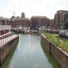
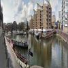
Limehouse Basin is a place on the waterways at the junction of the Grand Union Canal (Regent's Canal) with the Lee and Stort Navigation (Limehouse Cut).
 
Limehouse Basin Entrance (Entrance to the Grand Union Canal (Regent's Canal)) is on the River Thames (tidal section), 1¾ furlongs and 1 lock to the southwest. Hertford Union Junction (Junction of Regent's and Hertford Union Canals) is on the Grand Union Canal (Regent's Canal), 1 mile and 3¾ furlongs and 4 locks to the north. Head of Bow Locks is on the Lee and Stort Navigation (Bow Lock), 1 mile and 2½ furlongs to the northeast.
 
 
The nearest place in the direction of Limehouse Basin Entrance is Limehouse Basin Visitor Moorings; ¼ furlongs away.
 
The nearest place in the direction of Hertford Union Junction is Limehouse Basin Footbridge; ¾ furlongs away.
 
The nearest place in the direction of Head of Bow Locks is Limehouse Basin Junction Footbridge No 9; ¼ furlongs away.

Mooring here is unrated.

Facilities: chemical toilet disposal, boater-operated pump-out and water point.

You can wind here.


Amenities

Amenities nearby at Limehouse Basin Footbridge

 All Colours Interiors & Exteriors Ltd
 Limehouse Station
 
Maps
If you are a user and are logged on, or if you are actively planning a route, a map will be displayed here.
Show on external mapping site: Google | OSM | Bing
 
Additional information

There is a BWML boater-operated pumpout in the basin, which uses 30 unit BWML pumpout cards (available in the marina). The 25 unit C&RT cards can not be used here!

 
Photos
 
External websites
 Limehouse Basin Marina, London — BWML — associated with this page
 Grand Union Canal Walk — associated with Grand Union Canal
An illustrated walk along the Grand Union Canal from London to Birmingham
 
Nearest facilities

Mouseover for more information or show routes to facility

Nearest water point

The nearest water point is here. Others are at:

In the direction of Little Venice

Meath Gardens Footbridge No 55A1 mile, 1½ furlongs and 4 locks away
On the Grand Union Canal (Regent's Canal) in the direction of Little Venice
Victoria Park Services1 mile, 4¾ furlongs and 5 locks away
On the Grand Union Canal (Regent's Canal) in the direction of Little Venice
City Road Service Mooring4 miles, 1 furlong and 8 locks away
On the Grand Union Canal (Regent's Canal) in the direction of Little Venice
St Pancras Lock No 45 miles, 3½ furlongs and 8 locks away
On the Grand Union Canal (Regent's Canal) in the direction of Little Venice
Westbourne Terrace Bridge No 3C8 miles, 3½ furlongs and 12 locks away
Travel to Little Venice, then on the Grand Union Canal (Paddington Branch) to Westbourne Terrace Bridge No 3C
Little Venice Services8 miles, 3¾ furlongs and 12 locks away
Travel to Little Venice, then on the Grand Union Canal (Paddington Branch) to Little Venice Services
Diesel Boat MB Ash8 miles, 4¼ furlongs and 12 locks away
Travel to Little Venice, then on the Grand Union Canal (Paddington Branch) to Diesel Boat MB Ash
Mitre Bridge No 610 miles, 7 furlongs and 12 locks away
Travel to Little Venice, then on the Grand Union Canal (Paddington Branch) to Mitre Bridge No 6
Mary Seacole Gardens10 miles, 7¼ furlongs and 12 locks away
Travel to Little Venice, then on the Grand Union Canal (Paddington Branch) to Mary Seacole Gardens
Railway Bridge No 11A14 miles, ½ furlongs and 12 locks away
Travel to Little Venice, then on the Grand Union Canal (Paddington Branch) to Railway Bridge No 11A
Greenford Wharf16 miles, 4½ furlongs and 12 locks away
Travel to Little Venice, then on the Grand Union Canal (Paddington Branch) to Greenford Wharf

In the direction of Head of Bow Locks

Tail of Bow Locks1 mile, 3¼ furlongs and 1 lock away
Travel to Head of Bow Locks, then on the Lee and Stort Navigation (Bow Lock) to Tail of Bow Locks
Old Ford Lock No 192 miles, 3¾ furlongs away
Travel to Head of Bow Locks, then on the Lee and Stort Navigation (River Lee: commercial section) to Old Ford Lock No 19
East Wick Service Wharf3 miles, 1½ furlongs and 1 lock away
Travel to Head of Bow Locks, then on the Lee and Stort Navigation (River Lee: commercial section) to East Wick Service Wharf
Stonebridge Lock Services7 miles, 4 furlongs and 3 locks away
Travel to Head of Bow Locks, then on the Lee and Stort Navigation (River Lee: commercial section) to Stonebridge Lock Services
Pickett's Lock No 159 miles, 4 furlongs and 3 locks away
Travel to Head of Bow Locks, then on the Lee and Stort Navigation (River Lee: commercial section) to Pickett's Lock No 15
Wharf Road Bridge No 3310 miles, 4¼ furlongs and 4 locks away
Travel to Head of Bow Locks, then on the Lee and Stort Navigation (River Lee: commercial section) to Wharf Road Bridge No 33
Hazlemere Marina Services13 miles, 5½ furlongs and 7 locks away
Travel to Head of Bow Locks, then on the Lee and Stort Navigation (River Lee: commercial section) to Hazlemere Marina Services

In the direction of Limehouse Basin Entrance

Brentford Visitor Moorings17 miles, ½ furlongs and 3 locks away
Travel to Limehouse Basin Entrance, then on the River Thames (tidal section) to Thames - Grand Union Canal Junction, then on the Grand Union Canal (Grand Junction Canal - Main Line - Gayton to Brentford) to Brentford Visitor Moorings

Nearest rubbish disposal

In the direction of Little Venice

Victoria Park Services1 mile, 4¾ furlongs and 5 locks away
On the Grand Union Canal (Regent's Canal) in the direction of Little Venice
City Road Service Mooring4 miles, 1 furlong and 8 locks away
On the Grand Union Canal (Regent's Canal) in the direction of Little Venice
St Pancras Lock No 45 miles, 3½ furlongs and 8 locks away
On the Grand Union Canal (Regent's Canal) in the direction of Little Venice
St Pancras Basin5 miles, 3¾ furlongs and 9 locks away
On the Grand Union Canal (Regent's Canal) in the direction of Little Venice
Little Venice Services8 miles, 3¾ furlongs and 12 locks away
Travel to Little Venice, then on the Grand Union Canal (Paddington Branch) to Little Venice Services
Kensal Green Bridge No 410 miles and 12 locks away
Travel to Little Venice, then on the Grand Union Canal (Paddington Branch) to Kensal Green Bridge No 4
Steele Road Service Mooring12 miles, 3½ furlongs and 12 locks away
Travel to Little Venice, then on the Grand Union Canal (Paddington Branch) to Steele Road Service Mooring
Greenford Wharf16 miles, 4½ furlongs and 12 locks away
Travel to Little Venice, then on the Grand Union Canal (Paddington Branch) to Greenford Wharf

In the direction of Head of Bow Locks

Old Ford Lock No 192 miles, 3¾ furlongs away
Travel to Head of Bow Locks, then on the Lee and Stort Navigation (River Lee: commercial section) to Old Ford Lock No 19
Wick Lane Bridge3 miles and 2 locks away
Travel to Head of Bow Locks, then on the Lee and Stort Navigation (River Lee: commercial section) to Hertford Union Canal Junction, then on the Grand Union Canal (Hertford Union Canal) to Wick Lane Bridge
Stonebridge Lock Services7 miles, 4 furlongs and 3 locks away
Travel to Head of Bow Locks, then on the Lee and Stort Navigation (River Lee: commercial section) to Stonebridge Lock Services
Pickett's Lock No 159 miles, 4 furlongs and 3 locks away
Travel to Head of Bow Locks, then on the Lee and Stort Navigation (River Lee: commercial section) to Pickett's Lock No 15

In the direction of Limehouse Basin Entrance

Limehouse Lock No 13¾ furlongs away
On the Grand Union Canal (Regent's Canal) in the direction of Limehouse Basin Entrance
Brentford Visitor Moorings17 miles, ½ furlongs and 3 locks away
Travel to Limehouse Basin Entrance, then on the River Thames (tidal section) to Thames - Grand Union Canal Junction, then on the Grand Union Canal (Grand Junction Canal - Main Line - Gayton to Brentford) to Brentford Visitor Moorings

Nearest chemical toilet disposal

The nearest chemical toilet disposal is here. Others are at:

In the direction of Little Venice

Victoria Park Services1 mile, 4¾ furlongs and 5 locks away
On the Grand Union Canal (Regent's Canal) in the direction of Little Venice
Acton's Lock No 72 miles, 3¾ furlongs and 5 locks away
On the Grand Union Canal (Regent's Canal) in the direction of Little Venice
St Pancras Lock No 45 miles, 3½ furlongs and 8 locks away
On the Grand Union Canal (Regent's Canal) in the direction of Little Venice
St Pancras Basin5 miles, 3¾ furlongs and 9 locks away
On the Grand Union Canal (Regent's Canal) in the direction of Little Venice
Little Venice Services8 miles, 3¾ furlongs and 12 locks away
Travel to Little Venice, then on the Grand Union Canal (Paddington Branch) to Little Venice Services
Railway Bridge No 11A14 miles, ½ furlongs and 12 locks away
Travel to Little Venice, then on the Grand Union Canal (Paddington Branch) to Railway Bridge No 11A
Greenford Wharf16 miles, 4½ furlongs and 12 locks away
Travel to Little Venice, then on the Grand Union Canal (Paddington Branch) to Greenford Wharf
Northolt Boatyard17 miles, 5 furlongs and 12 locks away
Travel to Little Venice, then on the Grand Union Canal (Paddington Branch) to Northolt Boatyard

In the direction of Head of Bow Locks

Old Ford Lock No 192 miles, 3¾ furlongs away
Travel to Head of Bow Locks, then on the Lee and Stort Navigation (River Lee: commercial section) to Old Ford Lock No 19
Stonebridge Lock Services7 miles, 4 furlongs and 3 locks away
Travel to Head of Bow Locks, then on the Lee and Stort Navigation (River Lee: commercial section) to Stonebridge Lock Services

In the direction of Limehouse Basin Entrance

Brentford Visitor Moorings17 miles, ½ furlongs and 3 locks away
Travel to Limehouse Basin Entrance, then on the River Thames (tidal section) to Thames - Grand Union Canal Junction, then on the Grand Union Canal (Grand Junction Canal - Main Line - Gayton to Brentford) to Brentford Visitor Moorings

Nearest place to turn

In the direction of Little Venice

Hertford Union Junction1 mile, 3¾ furlongs and 4 locks away
On the Grand Union Canal (Regent's Canal) in the direction of Little Venice
Hertford Union Top Lock Winding Hole2 miles, 1¼ furlongs and 4 locks away
Travel to Hertford Union Junction, then on the Grand Union Canal (Hertford Union Canal) to Hertford Union Top Lock Winding Hole
Kingsland Basin3 miles, ¾ furlongs and 6 locks away
On the Grand Union Canal (Regent's Canal) in the direction of Little Venice
Wenlock Basin Branch3 miles, 7¾ furlongs and 7 locks away
On the Grand Union Canal (Regent's Canal) in the direction of Little Venice
City Road Basin Branch4 miles, ½ furlongs and 7 locks away
On the Grand Union Canal (Regent's Canal) in the direction of Little Venice

In the direction of Head of Bow Locks

Abbott Wharf Dock4 furlongs away
On the Lee and Stort Navigation (Limehouse Cut) in the direction of Head of Bow Locks
Head of Bow Locks1 mile, 2½ furlongs away
On the Lee and Stort Navigation (Limehouse Cut) in the direction of Head of Bow Locks
Tail of Bow Locks1 mile, 3¼ furlongs and 1 lock away
Travel to Head of Bow Locks, then on the Lee and Stort Navigation (Bow Lock) to Tail of Bow Locks
Head of Bow Creek (Three Mills)1 mile, 5½ furlongs and 1 lock away
Travel to Head of Bow Locks, then on the Lee and Stort Navigation (Bow Lock) to Tail of Bow Locks, then on the Lee and Stort Navigation (Bow Creek) to Head of Bow Creek (Three Mills)
Waterworks River - Three Mills Wall River Junction2 miles, 1½ furlongs and 1 lock away
Travel to Head of Bow Locks, then on the Lee and Stort Navigation (River Lee: commercial section) to Lea - St. Thomas Creek Junction, then on the Lee and Stort Navigation - Bow Back Rivers (St. Thomas Creek) to Waterworks River - Three Mills Wall River Junction
Three Mills - Prescott Junction2 miles, 3¼ furlongs and 1 lock away
Travel to Head of Bow Locks, then on the Lee and Stort Navigation (River Lee: commercial section) to Lea - St. Thomas Creek Junction, then on the Lee and Stort Navigation - Bow Back Rivers (St. Thomas Creek) to Waterworks River - Three Mills Wall River Junction, then on the Lee and Stort Navigation - Bow Back Rivers (Three Mills Wall River) to Three Mills - Prescott Junction
Olympic Park Tripboat Winding Area2 miles, 4¾ furlongs and 1 lock away
Travel to Head of Bow Locks, then on the Lee and Stort Navigation (River Lee: commercial section) to Lea - St. Thomas Creek Junction, then on the Lee and Stort Navigation - Bow Back Rivers (St. Thomas Creek) to Waterworks River - Three Mills Wall River Junction, then on the Lee and Stort Navigation - Bow Back Rivers (Waterworks River) to Olympic Park Tripboat Winding Area
Hertford Union Canal Junction2 miles, 5½ furlongs and 1 lock away
Travel to Head of Bow Locks, then on the Lee and Stort Navigation (River Lee: commercial section) to Hertford Union Canal Junction
Waterworks River - River Lea Junction2 miles, 6¾ furlongs and 1 lock away
Travel to Head of Bow Locks, then on the Lee and Stort Navigation (River Lee: commercial section) to Old River Lea Junction, then on the Lee and Stort Navigation - Bow Back Rivers (Old River Lea) to Waterworks River - River Lea Junction
Bow Creek Junction3 miles, 3¼ furlongs and 1 lock away
Travel to Head of Bow Locks, then on the Lee and Stort Navigation (Bow Lock) to Tail of Bow Locks, then on the Lee and Stort Navigation (Bow Creek) to Bow Creek Junction
Waterfall Bridge Winding Hole3 miles, 3½ furlongs and 1 lock away
Travel to Head of Bow Locks, then on the Lee and Stort Navigation (River Lee: commercial section) to Old River Lea Junction, then on the Lee and Stort Navigation - Bow Back Rivers (Old River Lea) to Waterfall Bridge Winding Hole
Ferry Lane Bridge Winding Hole6 miles, 6 furlongs and 1 lock away
Travel to Head of Bow Locks, then on the Lee and Stort Navigation (River Lee: commercial section) to Ferry Lane Bridge Winding Hole
Town Quay Basin8 miles, 7¾ furlongs and 2 locks away
Travel to Head of Bow Locks, then on the Lee and Stort Navigation (Bow Lock) to Tail of Bow Locks, then on the Lee and Stort Navigation (Bow Creek) to Bow Creek Junction, then on the River Thames (tidal section) to Thames Flood Barrier, then on the River Thames (tidal section below the flood barrier) to Thames - Barking Creek (River Roding) Junction, then on the River Roding (Port of London Authority section) to Town Quay Basin
Iford Bridge Winding Hole9 miles, 3¾ furlongs and 2 locks away
Travel to Head of Bow Locks, then on the Lee and Stort Navigation (Bow Lock) to Tail of Bow Locks, then on the Lee and Stort Navigation (Bow Creek) to Bow Creek Junction, then on the River Thames (tidal section) to Thames Flood Barrier, then on the River Thames (tidal section below the flood barrier) to Thames - Barking Creek (River Roding) Junction, then on the River Roding (Port of London Authority section) to Highbridge Road Bridge, then on the River Roding (River Roding Trust section) to Iford Bridge Winding Hole
Pickett's Lock Winding Hole9 miles, 3¾ furlongs and 3 locks away
Travel to Head of Bow Locks, then on the Lee and Stort Navigation (River Lee: commercial section) to Pickett's Lock Winding Hole

Nearest self-operated pump-out

The nearest self-operated pump-out is here. Others are at:

In the direction of Little Venice

Acton's Lock No 72 miles, 3¾ furlongs and 5 locks away
On the Grand Union Canal (Regent's Canal) in the direction of Little Venice
Little Venice Services8 miles, 3¾ furlongs and 12 locks away
Travel to Little Venice, then on the Grand Union Canal (Paddington Branch) to Little Venice Services

In the direction of Head of Bow Locks

East Wick Service Wharf3 miles, 1½ furlongs and 1 lock away
Travel to Head of Bow Locks, then on the Lee and Stort Navigation (River Lee: commercial section) to East Wick Service Wharf
Stonebridge Lock Services7 miles, 4 furlongs and 3 locks away
Travel to Head of Bow Locks, then on the Lee and Stort Navigation (River Lee: commercial section) to Stonebridge Lock Services

In the direction of Limehouse Basin Entrance

Brentford Visitor Moorings17 miles, ½ furlongs and 3 locks away
Travel to Limehouse Basin Entrance, then on the River Thames (tidal section) to Thames - Grand Union Canal Junction, then on the Grand Union Canal (Grand Junction Canal - Main Line - Gayton to Brentford) to Brentford Visitor Moorings

Nearest boatyard pump-out

In the direction of Little Venice

St Pancras Basin5 miles, 3¾ furlongs and 9 locks away
On the Grand Union Canal (Regent's Canal) in the direction of Little Venice
Diesel Boat MB Ash8 miles, 4¼ furlongs and 12 locks away
Travel to Little Venice, then on the Grand Union Canal (Paddington Branch) to Diesel Boat MB Ash
Northolt Boatyard17 miles, 5 furlongs and 12 locks away
Travel to Little Venice, then on the Grand Union Canal (Paddington Branch) to Northolt Boatyard
Willowtree Marina19 miles, 3¼ furlongs and 12 locks away
Travel to Little Venice, then on the Grand Union Canal (Paddington Branch) to Willowtree Marina

In the direction of Head of Bow Locks

Springfield Marina (entrance No 2)5 miles, 4¼ furlongs and 1 lock away
Travel to Head of Bow Locks, then on the Lee and Stort Navigation (River Lee: commercial section) to Springfield Marina (entrance No 2)
Old Nazeing Road Wharf18 miles, ¼ furlongs and 11 locks away
Travel to Head of Bow Locks, then on the Lee and Stort Navigation (River Lee: commercial section) to Waltham Town Lock No 11, then on the Lee and Stort Navigation (River Lee) to Old Nazeing Road Wharf
Direction of TV transmitter (From Wolfbane Cybernetic)
 
 
Geograph
 
Wikipedia

Wikipedia has a page about Limehouse Basin

The Limehouse Basin in Limehouse, in the London Borough of Tower Hamlets provides a navigable link between the Regent's Canal and the River Thames, through the Limehouse Basin Lock. A basin in the north of Mile End, near Victoria Park connects with the Hertford Union Canal leading to the River Lee Navigation. The dock originally covered an area of about 15 acres (60,703 m2). The Basin lies between the Docklands Light Railway (DLR) line and historic Narrow Street. Directly to the east is a small park, Ropemaker's Fields.

Other Wikipedia pages that might relate to Limehouse Basin
[Limehouse] shipbuilding, ship chandlering and rope making were established in Limehouse. Limehouse Basin opened in 1820 as the Regent's Canal Dock. This was an important [Regent's Canal] Union Canal, 550 yards (500 m) north-west of Paddington Basin in the west, to the Limehouse Basin and the River Thames in east London. The canal is 8.6 [Limehouse Basin Lock] Limehouse Basin Lock is a lock forming the exit from Limehouse Basin to the Thames, in the London Borough of Tower Hamlets, England. It is the final lock [Limehouse Cut] it has a diverse social and industrial history. It now connects to Limehouse Basin (which in turn connects to the River Thames) as a result of changes [The Grapes, Limehouse] It was formerly a working-class tavern serving the dockers of the Limehouse Basin. In the 1930s it sold beer from the adjacent brewery owned by Taylor [Limehouse (disambiguation)] Limehouse (horse) Limehouse station Limehouse Link tunnel Limehouse Cut Limehouse Basin Limehouse Declaration, the announcement of the formation of the Social [Lea Valley Walk] Leagrave, the source of the River Lea near Luton, and the Thames, at Limehouse Basin, Limehouse, east London. From its source much of the walk is rural. At Hertford [West India Docks] Locks and basins at either end of the Docks connected them to the river Thames. These were known as Blackwall Basin and Limehouse Basin, not to be confused [Narrow Street] River Thames through the Limehouse area of east London, England. It used to be much narrower, and is the oldest part of Limehouse, with many buildings originating
 
Google

Results of Google Search

Limehouse Basin - Wikipedia
The Limehouse Basin in Limehouse, in the London Borough of Tower Hamlets provides a navigable link between the Regent's Canal and the River Thames, ...
Limehouse Basin Marina, London | BWML
Limehouse Marina is ideally located in central London between the City of London and Canary Wharf. It connects the River Lee (via the Limehouse Cut), the  ...
Limehouse Basin | Places to Visit | Canal & River Trust
Results 1 - 6 of 20 ... Once a dock, today Limehouse is a marina, home to narrowboats, yachts and visiting ocean-going pleasure craft. Yet with shops and cafes, it still ...
Limehouse - Wikipedia
Limehouse Reach seen from above Limehouse Marina, with Ropemakers' Fields in the foreground. Limehouse Basin was amongst the first docks to close in the ...
Limehouse Basin Canalside (London) - 2020 All You Need to Know ...
COVID-19 Update:To limit the spread of the coronavirus, attractions may be closed or have partial closures. Please consult government travel advisories before ...
Limehouse Basin
Limehouse Basin lies a few hundred metres to the west of Canary Wharf and can be reached from it by walking along the Thames Path. The Basin provides a ...
REGENT'S CANAL LONDON WALK from Limehouse Basin to King's ...
Apr 10, 2020 ... The tour starts by Limehouse Station with a walk around Limehouse Basin Marina, then heads north along Regent's Canal, passing both Mile ...
Limehouse Basin Vacation Rentals & Homes - London, United ...
Jun 12, 2020 - Rent from people in Limehouse Basin, United Kingdom from $20/ night. Find unique places to stay with local hosts in 191 countries. Belong ...
Limehouse Basin Marina - Google Maps
Limehouse Basin Marina. Your location. Trails. Dedicated lanes. Bicycle-friendly roads. Dirt/unpaved trails. Live traffic. Fast. Slow. 2000 km. Set depart & arrive ...
Limehouse Basin and the Highway - Google My Maps
Limehouse Basin and the Highway. Collapse map legend. Map details. Copy map. Zoom to viewport. Embed map. Download KML. 669 views. Share. Share via ...