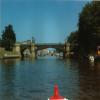
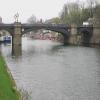
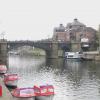
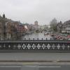
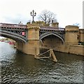
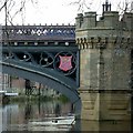
Skeldergate Bridge
is a place on the waterways
on the River Ouse : Yorkshire (non-tidal section) between
Ouse Bridge (The river reached a peak of 17ft 8ins (5.3m) above normal at 0330 GMT on Saturday 4th November 2000, within two inches of breaching flood defences. ) (2 furlongs
to the northwest) and
Ouse - Foss Junction (Junction of Rivers Ouse and Foss) (2 furlongs
to the southeast).
There is no access to the towpath here.
Mooring here is unrated.
Facilities: water point.
There is a bridge here which takes a major road over the canal.
Clifton Ings | 2 miles, ¼ furlongs | |
Water End Bridge | 1 mile, 2¼ furlongs | |
Scarborough Railway Bridge | 5¾ furlongs | |
Lendal Bridge | 4 furlongs | |
Ouse Bridge | 2 furlongs | |
Skeldergate Bridge | ||
Ouse - Foss Junction | 2 furlongs | |
Millennium Bridge (York) | 5¾ furlongs | |
Bishopthorpe Road Bridge | 2 miles, 2 furlongs | |
Bishopthorpe | 2 miles, 6½ furlongs | |
Naburn Railway Bridge | 3 miles, 5½ furlongs |
There is no other information about Skeldergate Bridge. Why not add some
There are no links to external websites from here.
Why not log in and add some (select "External websites" from the menu (sometimes this is under "Edit"))?
Mouseover for more information or show routes to facility
Nearest water point
The nearest water point is here. Others are at:
In the direction of Swale Nab
Lendal Bridge — 4 furlongs away
On this waterway in the direction of Swale Nab
Linton Lock — 10 miles, 2¾ furlongs away
On this waterway in the direction of Swale Nab
In the direction of Naburn Lock
Naburn Lock — 5 miles, 4¼ furlongs away
On this waterway in the direction of Naburn Lock
Selby Basin — 19 miles, 4¼ furlongs and 2 locks away
Travel to Naburn Lock, then on the River Ouse : Yorkshire (tidal section - Naburn to Goole) to Selby Junction (River Ouse), then on the Aire and Calder Navigation (Selby Section) to Selby BasinNearest rubbish disposal
In the direction of Swale Nab
Linton Lock — 10 miles, 2¾ furlongs away
On this waterway in the direction of Swale Nab
In the direction of Naburn Lock
Naburn Lock — 5 miles, 4¼ furlongs away
On this waterway in the direction of Naburn Lock
Selby Basin — 19 miles, 4¼ furlongs and 2 locks away
Travel to Naburn Lock, then on the River Ouse : Yorkshire (tidal section - Naburn to Goole) to Selby Junction (River Ouse), then on the Aire and Calder Navigation (Selby Section) to Selby BasinNearest chemical toilet disposal
In the direction of Swale Nab
Lendal Bridge — 4 furlongs away
On this waterway in the direction of Swale Nab
Linton Lock — 10 miles, 2¾ furlongs away
On this waterway in the direction of Swale Nab
In the direction of Naburn Lock
Naburn Lock — 5 miles, 4¼ furlongs away
On this waterway in the direction of Naburn Lock
Selby Basin — 19 miles, 4¼ furlongs and 2 locks away
Travel to Naburn Lock, then on the River Ouse : Yorkshire (tidal section - Naburn to Goole) to Selby Junction (River Ouse), then on the Aire and Calder Navigation (Selby Section) to Selby BasinNearest place to turn
In the direction of Swale Nab
River Nidd Junction — 8 miles, ½ furlongs away
On this waterway in the direction of Swale Nab
Linton Lock Weir Entrance — 10 miles, 4 furlongs and 1 lock away
On this waterway in the direction of Swale Nab
In the direction of Naburn Lock
Rowntree Wharf Arm — 7 furlongs and 1 lock away
Travel to Ouse - Foss Junction, then on the River Foss to Rowntree Wharf Arm
Wormald's Cut — 1 mile, ½ furlongs and 1 lock away
Travel to Ouse - Foss Junction, then on the River Foss to Wormald's Cut
Naburn Lock Weir Entrance — 5 miles, 2 furlongs away
On this waterway in the direction of Naburn Lock
Naburn Lock Winding Hole — 5 miles, 3½ furlongs away
On this waterway in the direction of Naburn Lock
Selby Basin — 19 miles, 4¼ furlongs and 2 locks away
Travel to Naburn Lock, then on the River Ouse : Yorkshire (tidal section - Naburn to Goole) to Selby Junction (River Ouse), then on the Aire and Calder Navigation (Selby Section) to Selby BasinNearest self-operated pump-out
In the direction of Naburn Lock
Naburn Lock — 5 miles, 4¼ furlongs away
On this waterway in the direction of Naburn LockNo information
CanalPlan has no information on any of the following facilities within range:boatyard pump-out
Direction of TV transmitter (From Wolfbane Cybernetic)
Wikipedia has a page about Skeldergate Bridge
There are nine bridges across the River Ouse within the city of York, England, and sixteen smaller bridges and passages across the narrower River Foss.
Other Wikipedia pages that might relate to Skeldergate Bridge
[Bridges of York]
Clifton Bridge (1963) Scarborough Railway Bridge (1844) Lendal Bridge (1863) Ouse Bridge (1821) Skeldergate Bridge (1881) Millennium Bridge (2001) The
[Skeldergate]
Skeldergate is a street in the city center of York, in England. The street is now primarily residential, with many of its warehouse buildings having been
[River Ouse, Yorkshire]
authority is Associated British Ports from Trent Falls to Goole railway swing bridge at Skelton, and the Canal & River Trust upstream from there. In the 18th
[List of bridges in the United Kingdom]
Bridges in the United Kingdom is a link page for any road bridges or footbridges in the United Kingdom. Railway bridges are listed under: List of railway
[Timeline of York]
established. The Foss Islands branch line opens 1881 – 10 March: Skeldergate Bridge opened. 1882 York Art Gallery opened. The Evening Press begins publication
[List of York sites of interest]
Church, Marygate The Shambles, York's best-preserved medieval street Skeldergate Bridge The Snickelways, a collection of narrow streets and passages Treasurer's
[Bishophill]
gate in the walls in 1838, and the replacement of the Skeldergate ferry with Skeldergate Bridge. Development of the area continued through the 19th-century
[Clifford Street (York)]
street could be constructed. Designed to improve access to the new Skeldergate Bridge, it was named Clifford Street after nearby Clifford's Tower. The Friends
[Postern]
postern in the city wall, known as Layerthorpe Postern. The original Skeldergate postern was only large enough to allow pedestrian traffic to and from
[York city walls]
with a postern on Tower Street. Beyond the Ouse, the walls resume at Skeldergate, where there was once another postern. They climb past Baile Hill, take