Swingbridge Road Bridge No 41
Swing Bridge, Charnwood LE11 5QS, United Kingdom

Swingbridge Road Bridge No 41
is a minor waterways place
on the Grand Union Canal (Leicester Section - River Soar Navigation) between
Loughborough Branch Junction (4¾ furlongs
and 1 lock
to the southeast) and
Zouch Road Bridge No 43 (Mooring between here and Zouch Lock. Public house by canal.) (2 miles and 2¼ furlongs
and 1 lock
to the northwest).
The nearest place in the direction of Loughborough Branch Junction is Belton Road West Extension Bridge No 40A;
1¼ furlongs
away.
The nearest place in the direction of Zouch Road Bridge No 43 is Bishop Meadow Lock No 54;
3 furlongs
away.
There may be access to the towpath here.
Mooring here is unrated.
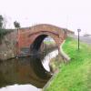
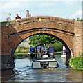
There is a bridge here which takes a track over the canal.
Loughborough Branch Junction | 4¾ furlongs | |
Aqueduct by Belton Road Bridge | 3½ furlongs | |
Belton Road Bridge No 40 | 3¼ furlongs | |
Loughborough Lock No 53 | 2¼ furlongs | |
Belton Road West Extension Bridge No 40A | 1¼ furlongs | |
Swingbridge Road Bridge No 41 | ||
Bishop Meadow Lock No 54 | 3 furlongs | |
Bishops Meadow Bridge No 42 | 5¼ furlongs | |
Bishops Meadow Junction | 6¼ furlongs | |
Saint James Church, Normanton-on-Soar | 1 mile, 4½ furlongs | |
Normanton-on-Soar Wharf | 1 mile, 4¾ furlongs |
The Old Chainbridge (now replaced) was called that because it had a gap through the centre where the tow rope could be passed. This made the bridge inherently unstable and it eventually collapsed about 10 - 15 years ago. Information from Bruce McKenzie, 15-7-2008
- Grand Union Canal Walk — associated with Grand Union Canal
- An illustrated walk along the Grand Union Canal from London to Birmingham
Mouseover for more information or show routes to facility
Nearest water point
In the direction of Trent Junction
Bishop Meadow Lock No 54 — 3 furlongs away
On this waterway in the direction of Trent Junction
Former BW Trent Lock Waterway Office — 8 miles, 5 furlongs and 7 locks away
Travel to Trent Junction, then on the Grand Union Canal (Erewash Canal) to Former BW Trent Lock Waterway Office
Sawley Locks No 2 — 9 miles, 3¼ furlongs and 6 locks away
Travel to Trent Junction, then on the River Trent (Western End) to Sawley Locks No 2
Cranfleet Lock No 3 — 9 miles, 1½ furlongs and 7 locks away
Travel to Trent Junction, then on the River Trent (Western End) to Cranfleet Lock No 3
Shardlow — 11 miles, 5 furlongs and 9 locks away
Travel to Trent Junction, then on the River Trent (Western End) to Derwent Mouth, then on the Trent and Mersey Canal (Main Line - Derwent Mouth to Burton) to Shardlow
Beeston Lock No 5 — 13 miles, 4¼ furlongs and 8 locks away
Travel to Trent Junction, then on the River Trent (Western End) to Beeston Lock No 5
Weston Lock No 4 — 14 miles, 4½ furlongs and 11 locks away
Travel to Trent Junction, then on the River Trent (Western End) to Derwent Mouth, then on the Trent and Mersey Canal (Main Line - Derwent Mouth to Burton) to Weston Lock No 4
Swarkestone Lock No 5 — 17 miles, 3¾ furlongs and 12 locks away
Travel to Trent Junction, then on the River Trent (Western End) to Derwent Mouth, then on the Trent and Mersey Canal (Main Line - Derwent Mouth to Burton) to Swarkestone Lock No 5
In the direction of River Soar Junction
Loughborough Basin — 5¾ furlongs and 1 lock away
Travel to Loughborough Branch Junction, then on the Grand Union Canal (Leicester Section - Loughborough Branch) to Loughborough Basin
Barrow Boating — 4 miles, 5 furlongs and 3 locks away
On this waterway in the direction of River Soar Junction
Hope and Anchor Bridge No 19 — 10 miles, 2 furlongs and 7 locks away
On this waterway in the direction of River Soar Junction
Friars Mill Visitor Moorings — 16 miles, 2 furlongs and 12 locks away
On this waterway in the direction of River Soar JunctionNearest rubbish disposal
In the direction of Trent Junction
Former BW Trent Lock Waterway Office — 8 miles, 5 furlongs and 7 locks away
Travel to Trent Junction, then on the Grand Union Canal (Erewash Canal) to Former BW Trent Lock Waterway Office
Sawley Locks No 2 — 9 miles, 3¼ furlongs and 6 locks away
Travel to Trent Junction, then on the River Trent (Western End) to Sawley Locks No 2
Cranfleet Lock No 3 — 9 miles, 1½ furlongs and 7 locks away
Travel to Trent Junction, then on the River Trent (Western End) to Cranfleet Lock No 3
Beeston Lock No 5 — 13 miles, 4¼ furlongs and 8 locks away
Travel to Trent Junction, then on the River Trent (Western End) to Beeston Lock No 5
Swarkestone Lock No 5 — 17 miles, 3¾ furlongs and 12 locks away
Travel to Trent Junction, then on the River Trent (Western End) to Derwent Mouth, then on the Trent and Mersey Canal (Main Line - Derwent Mouth to Burton) to Swarkestone Lock No 5
In the direction of River Soar Junction
Loughborough Basin — 5¾ furlongs and 1 lock away
Travel to Loughborough Branch Junction, then on the Grand Union Canal (Leicester Section - Loughborough Branch) to Loughborough Basin
Barrow Boating — 4 miles, 5 furlongs and 3 locks away
On this waterway in the direction of River Soar Junction
Broome Island — 5 miles, 3½ furlongs and 3 locks away
On this waterway in the direction of River Soar JunctionNearest chemical toilet disposal
In the direction of Trent Junction
Former BW Trent Lock Waterway Office — 8 miles, 5 furlongs and 7 locks away
Travel to Trent Junction, then on the Grand Union Canal (Erewash Canal) to Former BW Trent Lock Waterway Office
Sawley Locks No 2 — 9 miles, 3¼ furlongs and 6 locks away
Travel to Trent Junction, then on the River Trent (Western End) to Sawley Locks No 2
Sawley Cut Wharf — 9 miles, 4¾ furlongs and 7 locks away
Travel to Trent Junction, then on the River Trent (Western End) to Sawley Cut Wharf
Beeston Lock No 5 — 13 miles, 4¼ furlongs and 8 locks away
Travel to Trent Junction, then on the River Trent (Western End) to Beeston Lock No 5
Meadow Lane Lock No 7 — 19 miles, 3 furlongs and 10 locks away
Travel to Trent Junction, then on the River Trent (Western End) to Beeston Lock No 5, then on the River Trent (Beeston Canal) to Lenton Chain, then on the River Trent (Nottingham Canal) to Meadow Lane Lock No 7
In the direction of River Soar Junction
Barrow Boating — 4 miles, 5 furlongs and 3 locks away
On this waterway in the direction of River Soar Junction
Sileby Mill Mooring Basin — 7 miles, 1¼ furlongs and 4 locks away
On this waterway in the direction of River Soar JunctionNearest place to turn
In the direction of Trent Junction
Bishops Meadow Junction — 6¼ furlongs and 1 lock away
On this waterway in the direction of Trent Junction
Soar Boat Club — 1 mile, 7¼ furlongs and 1 lock away
On this waterway in the direction of Trent Junction
Zouch Road Flood Gate — 2 miles, 1¾ furlongs and 1 lock away
On this waterway in the direction of Trent Junction
London Road Marina (southern entrance) — 4 miles, 4 furlongs and 2 locks away
On this waterway in the direction of Trent Junction
London Road Marina (northern entrance) — 4 miles, 5¼ furlongs and 2 locks away
On this waterway in the direction of Trent Junction
Station Road Arm — 5 miles, 5 furlongs and 3 locks away
On this waterway in the direction of Trent Junction
Ratcliffe Weir — 6 miles, 6¼ furlongs and 4 locks away
On this waterway in the direction of Trent Junction
Ratcliffe Lock Junction — 7 miles, 1¼ furlongs and 5 locks away
On this waterway in the direction of Trent Junction
In the direction of River Soar Junction
Loughborough Branch Junction — 4¾ furlongs and 1 lock away
On this waterway in the direction of River Soar Junction
Loughborough Basin — 5¾ furlongs and 1 lock away
Travel to Loughborough Branch Junction, then on the Grand Union Canal (Leicester Section - Loughborough Branch) to Loughborough Basin
Pilling's Flood Lock Winding Hole — 3 miles, 1¾ furlongs and 1 lock away
On this waterway in the direction of River Soar Junction
Pillings Lock Marina — 3 miles, 2¼ furlongs and 1 lock away
On this waterway in the direction of River Soar Junction
Barrow upon Soar Junction — 4 miles, 1¼ furlongs and 2 locks away
On this waterway in the direction of River Soar Junction
Barrow Boating — 4 miles, 5 furlongs and 3 locks away
On this waterway in the direction of River Soar Junction
Meadow Farm Marina — 5 miles, 1¾ furlongs and 3 locks away
On this waterway in the direction of River Soar Junction
Meadow Farm Junction — 5 miles, 2¾ furlongs and 3 locks away
On this waterway in the direction of River Soar Junction
Soar Outlet by Mountsorrel Lock — 6 miles, 2 furlongs and 3 locks away
On this waterway in the direction of River Soar Junction
Mountsorrel Lock Junction — 6 miles, 2¾ furlongs and 4 locks away
On this waterway in the direction of River Soar Junction
Sileby Mill Mooring Basin — 7 miles, 1¼ furlongs and 4 locks away
On this waterway in the direction of River Soar Junction
Sileby Mill — 7 miles, 2 furlongs and 4 locks away
On this waterway in the direction of River Soar JunctionNearest boatyard pump-out
In the direction of River Soar Junction
Sileby Mill Mooring Basin — 7 miles, 1¼ furlongs and 4 locks away
On this waterway in the direction of River Soar JunctionNo information
CanalPlan has no information on any of the following facilities within range:self-operated pump-out
Direction of TV transmitter (From Wolfbane Cybernetic)
There is no page on Wikipedia called “Swingbridge Road Bridge”
Wikipedia pages that might relate to Swingbridge Road Bridge
[Swing bridge]
swing bridge carrying a road or railway over a river or canal, for example, allows traffic to cross. When a water vessel needs to pass the bridge, road traffic
[List of bridges in Albania]
Shushica Bridge (520 m) - it crosses the Devoll river as a segment of the Banjë-Gramsh road. The tallest bridge in the country is the Fshat Bridge (157 m)
[Bridges in New Zealand]
density, has had many single lane bridges. Some of those still exist on the state highway network and are criticised by road users. These are progressively
[Swing Bridge, River Tyne]
Legacy with a visit to the Swing Bridge". Port of Tyne. 4 March 2010. Retrieved 14 December 2013. "The Swingbridge". Tyne & Wear Archives & Museums.
[G. V. Barbee Bridge]
piles and footings. When the ICW was completed in the late 1930s, a swingbridge initially provided access to Oak Island. Destroyed by a barge strike
[Swain's Cut Bridge]
late 1930s, a swingbridge initially provided access from the mainland to Oak Island. Destroyed by a barge strike in 1971, the Barbee Bridge opened in 1975
[Kopu Bridge]
pedestrian and cycleway and NZ's last remaining operational swingbridge. The original bridge was built in 1928, under the lead of the Main Highways Board
[Clayhanger, West Midlands]
various farm land at opposite sides of the village. For instance, the 'Swingbridge Park' development built by Maunders (then Westbury following the purchase
[Heaphy Track]
entered soon, a large featureless area drained by many rivers, with swingbridges helping to cross them when they are in flood. Now woody patches regain
[List of bridges in the Republic of Ireland]
of bridges in the Republic of Ireland lists bridges of particular historical, scenic, architectural or engineering interest. Road and railway bridges, viaducts
Results of Google Search
The Portage Lake Lift Bridge connects the cities of Hancock and Houghton, in the US state of ... US Highway 41 (US 41) and M-26 are both routed across the bridge. It is the only land-based link ... The Portage Canal Swing Bridge was damaged when a ship, the Northern Wave, collided with it in 1905. The center swinging ...
Aug 18, 2017 ... MOUNT PLEASANT — The old swing bridge on S.C. Highway 41 was removed Friday and hauled away by barge to its final resting place as an ...
Charleston and Berkeley counties were once connected by this through-truss swing bridge on South Carolina Highway 41. Crossing the Wando River, the ...
St. Mary's River Swing Bridge, Nassau County (No. ... 41 Florida Department of State, “The Great Floridians of Florida 2000 Program: John Stiles Collins.
The route crossed at Chaska on a swing bridge, followed the riverbank for about ... The Hastings & Dakota was taken over by the Milwaukee Road shortly after ... of the river from the old bridge to a landing near MN-41, but there was no way to ...
Bull's Bridge (Bridge No.4453), Bull's Bridge Road over Housatonic River, Kent, 1842 ... 1349), Route 136 over Saugatuck River, Westport, 1884 iron-truss swing bridge ... 963, Route 41 over Sage Ravine Brook, Salisbury, 1929 concrete arch.
Results 81 - 96 of 3600 ... Public Hearing - Replacement of Post Road Bridge ...Public ... 2019-01-02@16: 41:11 UTC. Open House - East Roundbunch Road Swing Bridge ... Notice of Availability - Dicker Road Finding of No Significant Impact.
... Minnesota State highway MN-41 bridge crossing the Minnesota River on the south side of Chaska, Minnesota. As of August, 2006, this bridge no longer exists.