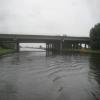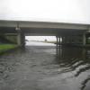
M62 - M18 Motorway Bridge No 22
M18, East Riding of Yorkshire DN14 8ST, United Kingdom
(M18)
Address is taken from a point 370 yards away.

M62 - M18 Motorway Bridge No 22
is a minor waterways place
on the Aire and Calder Navigation (Main Line - Goole to Castleford) between
Ouse - Aire and Calder Junction (Junction of the River Ouse (Yorkshire) with the Aire and Calder Navigation.) (4 miles and 3½ furlongs
and 1 lock
to the east) and
Sykehouse Junction (Junction of Aire and Calder (Main Line) and Sheffield and South Yorkshire New Junction Canal) (2 miles and 6¼ furlongs
to the west).
The nearest place in the direction of Ouse - Aire and Calder Junction is Rawcliffe Bridge;
1 mile and ½ furlongs
away.
The nearest place in the direction of Sykehouse Junction is New Bridge (Aire and Calder Navigation);
1 mile and ¼ furlongs
away.
Mooring here is unrated.
There is a bridge here which takes a motorway over the canal.
Rawcliffe Bridge Aqueduct No 2 | 1 mile, 7¼ furlongs | |
Rawcliffe Bridge Aqueduct No 1 | 1 mile, 5½ furlongs | |
Rawcliffe Pipe Bridge | 1 mile, 2½ furlongs | |
Rawcliffe Bridge Wharf | 1 mile, 1¾ furlongs | |
Rawcliffe Bridge | 1 mile, ½ furlongs | |
M62 - M18 Motorway Bridge No 22 | ||
New Bridge (Aire and Calder Navigation) | 1 mile, ¼ furlongs | |
New Bridge Aqueduct | 1 mile, 1 furlong | |
Beever's Bridge | 2 miles, ¼ furlongs | |
Sykehouse Junction | 2 miles, 6¼ furlongs | |
Site of Balne Croft Lane Bridge | 4 miles |
There are no links to external websites from here.
Why not log in and add some (select "External websites" from the menu (sometimes this is under "Edit"))?
Mouseover for more information or show routes to facility
Nearest water point
In the direction of Castleford Junction
Pollington Visitor Mooring — 4 miles, 6½ furlongs away
On this waterway in the direction of Castleford Junction
Pollington Manor Swing Bridge — 4 miles, 7 furlongs away
On this waterway in the direction of Castleford Junction
Bramwith Lock No 14 — 8 miles, 4¼ furlongs and 1 lock away
Travel to Sykehouse Junction, then on the Sheffield and South Yorkshire Navigation (New Junction Canal) to Bramwith Junction, then on the Sheffield and South Yorkshire Navigation (Bramwith to Stainforth) to Bramwith Lock No 14
Whitley Lock No 12 — 8 miles, 5 furlongs and 1 lock away
On this waterway in the direction of Castleford Junction
Barnby Dun Lift Bridge — 9 miles, 2¾ furlongs and 1 lock away
Travel to Sykehouse Junction, then on the Sheffield and South Yorkshire Navigation (New Junction Canal) to Bramwith Junction, then on the Sheffield and South Yorkshire Navigation (Main Line) to Barnby Dun Lift Bridge
Bramwith Swing Bridge — 8 miles, 7¼ furlongs and 2 locks away
Travel to Sykehouse Junction, then on the Sheffield and South Yorkshire Navigation (New Junction Canal) to Bramwith Junction, then on the Sheffield and South Yorkshire Navigation (Bramwith to Stainforth) to Bramwith Swing Bridge
Long Sandall Lock No 13 — 11 miles, 4 furlongs and 1 lock away
Travel to Sykehouse Junction, then on the Sheffield and South Yorkshire Navigation (New Junction Canal) to Bramwith Junction, then on the Sheffield and South Yorkshire Navigation (Main Line) to Long Sandall Lock No 13
Bank Dole Lock No 1 — 12 miles, 6½ furlongs and 2 locks away
Travel to Bank Dole Junction, then on the Aire and Calder Navigation (Selby Section) to Bank Dole Lock No 1
Thorne Visitor Moorings — 13 miles, 1¾ furlongs and 3 locks away
Travel to Sykehouse Junction, then on the Sheffield and South Yorkshire Navigation (New Junction Canal) to Bramwith Junction, then on the Sheffield and South Yorkshire Navigation (Bramwith to Stainforth) to Stainforth Junction, then on the Sheffield and South Yorkshire Navigation (Stainforth and Keadby Canal) to Thorne Visitor Moorings
Ferrybridge Flood Lock No 11 — 14 miles, 1 furlong and 2 locks away
On this waterway in the direction of Castleford Junction
Doncaster Visitor Pontoon Moorings — 14 miles, 5½ furlongs and 2 locks away
Travel to Sykehouse Junction, then on the Sheffield and South Yorkshire Navigation (New Junction Canal) to Bramwith Junction, then on the Sheffield and South Yorkshire Navigation (Main Line) to Doncaster Visitor Pontoon Moorings
Ferrybridge Flood Lock Footbridge — 14 miles, 1¼ furlongs and 3 locks away
On this waterway in the direction of Castleford Junction
Doncaster Town Lock No 12 — 14 miles, 7¾ furlongs and 2 locks away
Travel to Sykehouse Junction, then on the Sheffield and South Yorkshire Navigation (New Junction Canal) to Bramwith Junction, then on the Sheffield and South Yorkshire Navigation (Main Line) to Doncaster Town Lock No 12
Beal Bridge — 15 miles, ¾ furlongs and 3 locks away
Travel to Bank Dole Junction, then on the Aire and Calder Navigation (Selby Section) to Beal Bridge
Beal Lock No 2 — 15 miles, 2¼ furlongs and 3 locks away
Travel to Bank Dole Junction, then on the Aire and Calder Navigation (Selby Section) to Beal Lock No 2
Sprotbrough Lock No 11 — 18 miles, 2 furlongs and 3 locks away
Travel to Sykehouse Junction, then on the Sheffield and South Yorkshire Navigation (New Junction Canal) to Bramwith Junction, then on the Sheffield and South Yorkshire Navigation (Main Line) to Sprotbrough Lock No 11
Bulholme Lock No 10 — 18 miles, 7 furlongs and 3 locks away
On this waterway in the direction of Castleford Junction
Castleford Sanitary Station — 19 miles, 3¾ furlongs and 4 locks away
On this waterway in the direction of Castleford Junction
In the direction of Ouse - Aire and Calder Junction
Dutch Riverside — 3 miles, 3¼ furlongs away
On this waterway in the direction of Ouse - Aire and Calder Junction
Goole Marina — 3 miles, 4¾ furlongs away
On this waterway in the direction of Ouse - Aire and Calder JunctionNearest rubbish disposal
In the direction of Castleford Junction
Whitley Lock No 12 — 8 miles, 5 furlongs and 1 lock away
On this waterway in the direction of Castleford Junction
Barnby Dun Lift Bridge — 9 miles, 2¾ furlongs and 1 lock away
Travel to Sykehouse Junction, then on the Sheffield and South Yorkshire Navigation (New Junction Canal) to Bramwith Junction, then on the Sheffield and South Yorkshire Navigation (Main Line) to Barnby Dun Lift Bridge
Bramwith Swing Bridge — 8 miles, 7¼ furlongs and 2 locks away
Travel to Sykehouse Junction, then on the Sheffield and South Yorkshire Navigation (New Junction Canal) to Bramwith Junction, then on the Sheffield and South Yorkshire Navigation (Bramwith to Stainforth) to Bramwith Swing Bridge
Thorne Visitor Moorings — 13 miles, 1¾ furlongs and 3 locks away
Travel to Sykehouse Junction, then on the Sheffield and South Yorkshire Navigation (New Junction Canal) to Bramwith Junction, then on the Sheffield and South Yorkshire Navigation (Bramwith to Stainforth) to Stainforth Junction, then on the Sheffield and South Yorkshire Navigation (Stainforth and Keadby Canal) to Thorne Visitor Moorings
Doncaster Visitor Pontoon Moorings — 14 miles, 5½ furlongs and 2 locks away
Travel to Sykehouse Junction, then on the Sheffield and South Yorkshire Navigation (New Junction Canal) to Bramwith Junction, then on the Sheffield and South Yorkshire Navigation (Main Line) to Doncaster Visitor Pontoon Moorings
Castleford Sanitary Station — 19 miles, 3¾ furlongs and 4 locks away
On this waterway in the direction of Castleford Junction
In the direction of Ouse - Aire and Calder Junction
Dutch Riverside — 3 miles, 3¼ furlongs away
On this waterway in the direction of Ouse - Aire and Calder Junction
Goole Marina — 3 miles, 4¾ furlongs away
On this waterway in the direction of Ouse - Aire and Calder JunctionNearest chemical toilet disposal
In the direction of Castleford Junction
Whitley Lock No 12 — 8 miles, 5 furlongs and 1 lock away
On this waterway in the direction of Castleford Junction
Barnby Dun Lift Bridge — 9 miles, 2¾ furlongs and 1 lock away
Travel to Sykehouse Junction, then on the Sheffield and South Yorkshire Navigation (New Junction Canal) to Bramwith Junction, then on the Sheffield and South Yorkshire Navigation (Main Line) to Barnby Dun Lift Bridge
Bramwith Swing Bridge — 8 miles, 7¼ furlongs and 2 locks away
Travel to Sykehouse Junction, then on the Sheffield and South Yorkshire Navigation (New Junction Canal) to Bramwith Junction, then on the Sheffield and South Yorkshire Navigation (Bramwith to Stainforth) to Bramwith Swing Bridge
Thorne Visitor Moorings — 13 miles, 1¾ furlongs and 3 locks away
Travel to Sykehouse Junction, then on the Sheffield and South Yorkshire Navigation (New Junction Canal) to Bramwith Junction, then on the Sheffield and South Yorkshire Navigation (Bramwith to Stainforth) to Stainforth Junction, then on the Sheffield and South Yorkshire Navigation (Stainforth and Keadby Canal) to Thorne Visitor Moorings
Castleford Sanitary Station — 19 miles, 3¾ furlongs and 4 locks away
On this waterway in the direction of Castleford Junction
In the direction of Ouse - Aire and Calder Junction
Dutch Riverside — 3 miles, 3¼ furlongs away
On this waterway in the direction of Ouse - Aire and Calder Junction
Goole Marina — 3 miles, 4¾ furlongs away
On this waterway in the direction of Ouse - Aire and Calder JunctionNearest place to turn
In the direction of Castleford Junction
Huddle Grounds Winding Hole — 10 miles, 6¼ furlongs and 2 locks away
Travel to Sykehouse Junction, then on the Sheffield and South Yorkshire Navigation (New Junction Canal) to Bramwith Junction, then on the Sheffield and South Yorkshire Navigation (Bramwith to Stainforth) to Stainforth Junction, then on the Sheffield and South Yorkshire Navigation (Stainforth and Keadby Canal) to Huddle Grounds Winding Hole
Wheatley Hall Road Winding Hole — 12 miles, 4¾ furlongs and 2 locks away
Travel to Sykehouse Junction, then on the Sheffield and South Yorkshire Navigation (New Junction Canal) to Bramwith Junction, then on the Sheffield and South Yorkshire Navigation (Main Line) to Wheatley Hall Road Winding Hole
Bank Dole Lock Junction — 12 miles, 6¾ furlongs and 3 locks away
Travel to Bank Dole Junction, then on the Aire and Calder Navigation (Selby Section) to Bank Dole Lock Junction
Gas House Bight — 14 miles, 4 furlongs and 2 locks away
Travel to Sykehouse Junction, then on the Sheffield and South Yorkshire Navigation (New Junction Canal) to Bramwith Junction, then on the Sheffield and South Yorkshire Navigation (Main Line) to Gas House Bight
Doncaster Visitor Pontoon Moorings — 14 miles, 5½ furlongs and 2 locks away
Travel to Sykehouse Junction, then on the Sheffield and South Yorkshire Navigation (New Junction Canal) to Bramwith Junction, then on the Sheffield and South Yorkshire Navigation (Main Line) to Doncaster Visitor Pontoon Moorings
Beal Lock No 2 Weir Entrance — 15 miles, 1¼ furlongs and 3 locks away
Travel to Bank Dole Junction, then on the Aire and Calder Navigation (Selby Section) to Beal Lock No 2 Weir Entrance
Sprotbrough Lock Weir Exit — 18 miles, 1¼ furlongs and 3 locks away
Travel to Sykehouse Junction, then on the Sheffield and South Yorkshire Navigation (New Junction Canal) to Bramwith Junction, then on the Sheffield and South Yorkshire Navigation (Main Line) to Sprotbrough Lock Weir Exit
Bulholme Lock Weir Exit — 18 miles, 6½ furlongs and 3 locks away
On this waterway in the direction of Castleford Junction
Haddlesey Junction — 19 miles, ½ furlongs and 4 locks away
Travel to Bank Dole Junction, then on the Aire and Calder Navigation (Selby Section) to Haddlesey Junction
In the direction of Ouse - Aire and Calder Junction
Viking Marina — 3 miles, 4 furlongs away
On this waterway in the direction of Ouse - Aire and Calder Junction
River Foulness Junction — 18 miles, 4¾ furlongs and 2 locks away
Travel to Ouse - Aire and Calder Junction, then on the River Ouse : Yorkshire (tidal section - Goole to Trent Falls) to Trent Falls, then on the River Humber to Humber - Market Weighton Junction, then on the Market Weighton Canal to River Foulness JunctionNearest self-operated pump-out
In the direction of Castleford Junction
Long Sandall Lock No 13 — 11 miles, 4 furlongs and 1 lock away
Travel to Sykehouse Junction, then on the Sheffield and South Yorkshire Navigation (New Junction Canal) to Bramwith Junction, then on the Sheffield and South Yorkshire Navigation (Main Line) to Long Sandall Lock No 13
Castleford Sanitary Station — 19 miles, 3¾ furlongs and 4 locks away
On this waterway in the direction of Castleford JunctionNearest boatyard pump-out
In the direction of Castleford Junction
Thorne Swing Bridge — 13 miles, 2¼ furlongs and 3 locks away
Travel to Sykehouse Junction, then on the Sheffield and South Yorkshire Navigation (New Junction Canal) to Bramwith Junction, then on the Sheffield and South Yorkshire Navigation (Bramwith to Stainforth) to Stainforth Junction, then on the Sheffield and South Yorkshire Navigation (Stainforth and Keadby Canal) to Thorne Swing Bridge
Blue Water Marina — 13 miles, 7 furlongs and 3 locks away
Travel to Sykehouse Junction, then on the Sheffield and South Yorkshire Navigation (New Junction Canal) to Bramwith Junction, then on the Sheffield and South Yorkshire Navigation (Bramwith to Stainforth) to Stainforth Junction, then on the Sheffield and South Yorkshire Navigation (Stainforth and Keadby Canal) to Blue Water Marina
In the direction of Ouse - Aire and Calder Junction
Goole Marina — 3 miles, 4¾ furlongs away
On this waterway in the direction of Ouse - Aire and Calder JunctionDirection of TV transmitter (From Wolfbane Cybernetic)
There is no page on Wikipedia called “M62 - M18 Motorway Bridge”
Wikipedia pages that might relate to M62 - M18 Motorway Bridge
[M62 motorway]
The M62 is a 107-mile-long (172 km) west–east trans-Pennine motorway in Northern England, connecting Liverpool and Hull via Manchester and Leeds; 7 miles
[M6 motorway]
points on any motorway in the UK (junction 22 of the M62 on Saddleworth Moor is higher). The motorway engineers here chose to follow the route of the Lancaster
[A1(M) motorway]
Brotherton. The southern section, with a free-flow interchange with the M62 motorway, opened to traffic on 13 January 2006. Junctions 44 to 46 opened in 2009
[M1 motorway]
with the 11-mile (18 km) section to the A1(M) south of Doncaster given the separate motorway number M18. From Junction 32, the motorway passes Sheffield
[Ouse Bridge (M62)]
the bridge. It is a haunched girder bridge. The extension of the M18 (from the current M180), the M62, and the first part of (what would become) the M180
[M20 motorway]
The M20 is a motorway in Kent, England. It follows on from the A20 at Swanley, meeting the M25, and continuing on to Folkestone, providing a link to the
[M180 motorway]
The M180 is a 25.5 miles (41.0 km) motorway in England from junction 5 on the M18 motorway in the Metropolitan Borough of Doncaster to Barnetby close to
[Scammonden Bridge]
former A6025) Elland to Buckstones road over the M62 motorway in Kirklees, West Yorkshire, England. The bridge and Scammonden Reservoir to the west are named
[M65 motorway]
The M65 is a motorway in Lancashire, England. It runs from just south of Preston through the major junction of the M6 and M61 motorways, east past Darwen
[M4 motorway]
The M4, originally the London-South Wales Motorway, is a motorway in the United Kingdom running from west London to southwest Wales. The English section