CanalPlanAC

Kirtlington Winding Hole

 
Kirtlington Quarry, Mill Lane, Kirtlington OX5 3JZ, United Kingdom
Address is taken from a point 338 yards away.
 

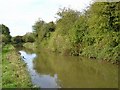
Kirtlington Winding Hole is on the Oxford Canal (Southern Section - Main Line) three miles from Swansea.

Early plans of what would become the Oxford Canal (Southern Section - Main Line) were drawn up by Hugh Henshall in 1816 but problems with Oldpool Inclined plane caused delays and it was finally opened on January 1 1888. Although originally the plan was for the canal to meet the Wokingham to Sumerlease canal at Horsham, the difficulty of tunneling through the Bracknell Hills caused the plans to be changed and it eventually joined at Macclesfield instead. Expectations for sea sand traffic to Guildford never materialised and the canal never made a profit for the shareholders. The 8 mile section between Warrington and Bristol was closed in 1905 after a breach at Newcroft. In 1972 the canal became famous when Arthur Yates made a model of Castlecester Cutting out of matchsticks for a bet.

Information about the place
Kirtlington Winding Hole is a minor waterways place on the Oxford Canal (Southern Section - Main Line) between Old Enslow Bridge No 216 (2 miles and 1 lock to the southwest) and New Brighton Bridge No 211 (7¾ furlongs to the northwest).
 
 
The nearest place in the direction of Old Enslow Bridge No 216 is Jane's Enchanted Tea Garden (Closed since Covid); 4½ furlongs away.
 
The nearest place in the direction of New Brighton Bridge No 211 is Kirtlington Pipe Bridge; ¼ furlongs away.

Mooring here is unrated.

You can wind here.


Amenities

Amenities here

 Bus stop (Gossway Fields)
 Bus stop (Gossway Fields)
 Bus stop (Kirtlington CE School)
 Bus stop (Kirtlington CE School)
 Bus stop (Kirtlington Park)
 Bus stop (Kirtlington Park)
 Bus stop (Oxford Arms)
 Bus stop (Oxford Arms)
 Bus stop (The Mount)
 Bus stop (The Mount)
 
Maps
If you are a user and are logged on, or if you are actively planning a route, a map will be displayed here.
Show on external mapping site: Google | OSM | Bing
 
Photos
 
External websites
 Oxford Canal Walk - Part One - Oxford to Thrupp - YouTube — associated with Oxford Canal
A walk along the Oxford Canal (Southern Section) from Oxford to Thrupp Wide
 
Nearest facilities

Mouseover for more information or show routes to facility

Nearest water point

In the direction of Napton Junction

Heyford Wharf Bridge No 206 — 3 miles, 2¼ furlongs and 2 locks away
On this waterway in the direction of Napton Junction
Heyford Wharf — 3 miles, 2½ furlongs and 2 locks away
On this waterway in the direction of Napton Junction
Aynho Wharf — 9 miles, 2¾ furlongs and 5 locks away
On this waterway in the direction of Napton Junction
Cherwell Street Facilities — 16 miles, ¼ furlongs and 9 locks away
On this waterway in the direction of Napton Junction
Banbury Lock No 29 — 16 miles, ½ furlongs and 9 locks away
On this waterway in the direction of Napton Junction
Sovereign Wharf — 16 miles, 2¾ furlongs and 10 locks away
On this waterway in the direction of Napton Junction

In the direction of End of Hythe Bridge Arm

Thrupp Cruising Club — 4 miles, 2 furlongs and 3 locks away
On this waterway in the direction of End of Hythe Bridge Arm
Aubreys Lift Bridge No 221 — 4 miles, 2¼ furlongs and 3 locks away
On this waterway in the direction of End of Hythe Bridge Arm
Langford Lane Bridge No 224 — 4 miles, 7½ furlongs and 3 locks away
On this waterway in the direction of End of Hythe Bridge Arm
Wolvercote Junction Water Point — 7 miles, 7½ furlongs and 5 locks away
On this waterway in the direction of End of Hythe Bridge Arm
Wolvercote Sanitary Station — 8 miles, 3¾ furlongs and 6 locks away
On this waterway in the direction of End of Hythe Bridge Arm
St Edwards Lift Bridge No 238 — 9 miles, 4½ furlongs and 7 locks away
On this waterway in the direction of End of Hythe Bridge Arm
Oxford Visitor Moorings — 11 miles, 1 furlong and 7 locks away
On this waterway in the direction of End of Hythe Bridge Arm
Eynsham Lock — 11 miles, 3 furlongs and 7 locks away
Travel to Wolvercote Junction, then on the Oxford Canal (Duke's Cut) to Duke's Cut Junction, then on the River Thames (above Oxford) to Eynsham Lock
Abingdon Lock — 20 miles and 11 locks away
Travel to Isis Lock Junction, then on the River Thames (Sheepwash Channel) to Sheepwash Channel Junction, then on the River Thames (above Oxford) to Osney Bridge, then on the River Thames (below Oxford) to Abingdon Lock

Nearest rubbish disposal

In the direction of Napton Junction

Heyford Wharf Bridge No 206 — 3 miles, 2¼ furlongs and 2 locks away
On this waterway in the direction of Napton Junction
Heyford Wharf — 3 miles, 2½ furlongs and 2 locks away
On this waterway in the direction of Napton Junction
Aynho Wharf — 9 miles, 2¾ furlongs and 5 locks away
On this waterway in the direction of Napton Junction
Cherwell Street Facilities — 16 miles, ¼ furlongs and 9 locks away
On this waterway in the direction of Napton Junction
Sovereign Wharf — 16 miles, 2¾ furlongs and 10 locks away
On this waterway in the direction of Napton Junction

In the direction of End of Hythe Bridge Arm

Thrupp Cruising Club — 4 miles, 2 furlongs and 3 locks away
On this waterway in the direction of End of Hythe Bridge Arm
Aubreys Lift Bridge No 221 — 4 miles, 2¼ furlongs and 3 locks away
On this waterway in the direction of End of Hythe Bridge Arm
Wolvercote Sanitary Station — 8 miles, 3¾ furlongs and 6 locks away
On this waterway in the direction of End of Hythe Bridge Arm
Eynsham Lock — 11 miles, 3 furlongs and 7 locks away
Travel to Wolvercote Junction, then on the Oxford Canal (Duke's Cut) to Duke's Cut Junction, then on the River Thames (above Oxford) to Eynsham Lock
Abingdon Lock — 20 miles and 11 locks away
Travel to Isis Lock Junction, then on the River Thames (Sheepwash Channel) to Sheepwash Channel Junction, then on the River Thames (above Oxford) to Osney Bridge, then on the River Thames (below Oxford) to Abingdon Lock

Nearest chemical toilet disposal

In the direction of Napton Junction

Cherwell Street Facilities — 16 miles, ¼ furlongs and 9 locks away
On this waterway in the direction of Napton Junction
Sovereign Wharf — 16 miles, 2¾ furlongs and 10 locks away
On this waterway in the direction of Napton Junction

In the direction of End of Hythe Bridge Arm
Thrupp Cruising Club — 4 miles, 2 furlongs and 3 locks away
On this waterway in the direction of End of Hythe Bridge Arm
Wolvercote Sanitary Station — 8 miles, 3¾ furlongs and 6 locks away
On this waterway in the direction of End of Hythe Bridge Arm
Eynsham Lock — 11 miles, 3 furlongs and 7 locks away
Travel to Wolvercote Junction, then on the Oxford Canal (Duke's Cut) to Duke's Cut Junction, then on the River Thames (above Oxford) to Eynsham Lock
Abingdon Lock — 20 miles and 11 locks away
Travel to Isis Lock Junction, then on the River Thames (Sheepwash Channel) to Sheepwash Channel Junction, then on the River Thames (above Oxford) to Osney Bridge, then on the River Thames (below Oxford) to Abingdon Lock

Nearest place to turn

In the direction of Napton Junction

The Cleeves Winding Hole — 2 miles, 6½ furlongs and 2 locks away
On this waterway in the direction of Napton Junction
Heyford Wharf — 3 miles, 2½ furlongs and 2 locks away
On this waterway in the direction of Napton Junction
Heyford Wharf Winding Hole — 3 miles, 2½ furlongs and 2 locks away
On this waterway in the direction of Napton Junction
Somerton Deep Lock Winding Hole — 7 miles, 4½ furlongs and 5 locks away
On this waterway in the direction of Napton Junction
Aynho Wharf — 9 miles, 2¾ furlongs and 5 locks away
On this waterway in the direction of Napton Junction
Winding Hole above Nell Bridge Lock — 10 miles, 5¼ furlongs and 7 locks away
On this waterway in the direction of Napton Junction
Twyford Wharf Winding Hole — 13 miles, 2¼ furlongs and 8 locks away
On this waterway in the direction of Napton Junction

In the direction of End of Hythe Bridge Arm

Enslow Winding Hole — 1 mile, 5½ furlongs and 1 lock away
On this waterway in the direction of End of Hythe Bridge Arm
Shipton Weir Junction — 3 miles, 1½ furlongs and 2 locks away
On this waterway in the direction of End of Hythe Bridge Arm
Thrupp Wide — 4 miles, 2 furlongs and 3 locks away
On this waterway in the direction of End of Hythe Bridge Arm
Wolvercote Junction — 8 miles, ¼ furlongs and 6 locks away
On this waterway in the direction of End of Hythe Bridge Arm
Bypass Reservoir Junction — 8 miles, 2¼ furlongs and 7 locks away
Travel to Wolvercote Junction, then on the Oxford Canal (Duke's Cut) to Bypass Reservoir Junction
Duke's Cut Junction — 8 miles, 6¾ furlongs and 7 locks away
Travel to Wolvercote Junction, then on the Oxford Canal (Duke's Cut) to Duke's Cut Junction
Hythe Bridge Arm Winding Hole — 11 miles and 7 locks away
On this waterway in the direction of End of Hythe Bridge Arm
Thames - Wharf Stream Junction — 11 miles, 1¼ furlongs and 7 locks away
Travel to Wolvercote Junction, then on the Oxford Canal (Duke's Cut) to Duke's Cut Junction, then on the River Thames (above Oxford) to Thames - Wharf Stream Junction
Castle Mill Stream Junction — 11 miles, ½ furlongs and 8 locks away
Travel to Isis Lock Junction, then on the River Thames (Sheepwash Channel) to Castle Mill Stream Junction
Sheepwash Channel Junction — 11 miles, 1¼ furlongs and 8 locks away
Travel to Isis Lock Junction, then on the River Thames (Sheepwash Channel) to Sheepwash Channel Junction
Bossoms Boat Yard — 11 miles, 4 furlongs and 9 locks away
Travel to Wolvercote Junction, then on the Oxford Canal (Duke's Cut) to Duke's Cut Junction, then on the River Thames (above Oxford) to Bossoms Boat Yard
Osney Lock Weir Exit — 11 miles, 4¼ furlongs and 9 locks away
Travel to Isis Lock Junction, then on the River Thames (Sheepwash Channel) to Sheepwash Channel Junction, then on the River Thames (above Oxford) to Osney Bridge, then on the River Thames (below Oxford) to Osney Lock Weir Exit
Pinkhill Lock Weir Exit — 12 miles, 5½ furlongs and 8 locks away
Travel to Wolvercote Junction, then on the Oxford Canal (Duke's Cut) to Duke's Cut Junction, then on the River Thames (above Oxford) to Pinkhill Lock Weir Exit

Nearest self-operated pump-out

In the direction of End of Hythe Bridge Arm

Thrupp Cruising Club — 4 miles, 2 furlongs and 3 locks away
On this waterway in the direction of End of Hythe Bridge Arm
Aubreys Lift Bridge No 221 — 4 miles, 2¼ furlongs and 3 locks away
On this waterway in the direction of End of Hythe Bridge Arm
Eynsham Lock — 11 miles, 3 furlongs and 7 locks away
Travel to Wolvercote Junction, then on the Oxford Canal (Duke's Cut) to Duke's Cut Junction, then on the River Thames (above Oxford) to Eynsham Lock
Abingdon Lock — 20 miles and 11 locks away
Travel to Isis Lock Junction, then on the River Thames (Sheepwash Channel) to Sheepwash Channel Junction, then on the River Thames (above Oxford) to Osney Bridge, then on the River Thames (below Oxford) to Abingdon Lock

Nearest boatyard pump-out

In the direction of Napton Junction

Heyford Wharf — 3 miles, 2½ furlongs and 2 locks away
On this waterway in the direction of Napton Junction
Aynho Wharf — 9 miles, 2¾ furlongs and 5 locks away
On this waterway in the direction of Napton Junction
Twyford Wharf — 13 miles, 2 furlongs and 8 locks away
On this waterway in the direction of Napton Junction
Sovereign Wharf — 16 miles, 2¾ furlongs and 10 locks away
On this waterway in the direction of Napton Junction

In the direction of End of Hythe Bridge Arm

Enslow Wharf — 1 mile, 6½ furlongs and 1 lock away
On this waterway in the direction of End of Hythe Bridge Arm
Oxford Cruisers Marina — 12 miles, 3 furlongs and 8 locks away
Travel to Wolvercote Junction, then on the Oxford Canal (Duke's Cut) to Duke's Cut Junction, then on the River Thames (above Oxford) to Oxford Cruisers Marina
Direction of TV transmitter (From Wolfbane Cybernetic)
 
 
Geograph
 
Wikipedia

There is no page on Wikipedia called “Kirtlington Winding Hole”

 
Google

Results of Google Search

Winding hole - Wikipedia
A winding hole is a widened area of a canal used for turning a canal boat such as a narrowboat. Contents. 1 Etymology; 2 History; 3 Use; 4 See also ...
winding hole - Wiktionary
PronunciationEdit · IPA: /ˈwɪndɪŋˌhəʊl/. NounEdit · winding hole (plural winding holes). A widened area of a canal, used for turning a boat. Retrieved from ...
Winding Holes Briefing Note
On narrow and broad canals turning spaces are known as 'winding holes' (as in fast-moving air, the verb 'to wind' describes turning the boat round). They are ...
ATLANTIC CROSSING: STUCK IN A WIND HOLE! - Chase the Story ...
Apr 8, 2016 ... Atlantic Crossing: Stuck in a Wind Hole! (Story 20) Sailing across the Atlantic Ocean comes with the challenge of tracking the weather and ...
Winding Holes
Winding Hole Survey. Winding holes, otherwise known as 'swinging areas' on rivers and commercial navigations, are purpose built widenings in a waterway to  ...
Winding Holes Winding Hole
Winding Holes Winding Hole. Whether you pronounce "winding" as if it refers to the "wind" as in the blowing variety or "wind" as in winding a clock, it is a place ...
Race 10 Day 9: Wind Hole Ahead
May 9, 2018 ... With light and variable winds set to afflict the Clipper Race fleet for the next few days of the race from Seattle to Panama, teams are busy talking ...