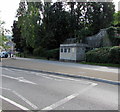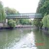
Widcombe Footbridge No 195
Halfpenny Bridge, Bath BA2, United Kingdom

Widcombe Footbridge No 195
is a minor waterways place
on the River Avon (Kennet and Avon Navigation) between
River Avon Junction (Junction of the River Avon and the Kennet & Avon Canal) (½ furlongs
to the east) and
Hanham Lock Weir Exit (Channel leading to the Weir) (11 miles and 2¼ furlongs
and 6 locks
to the west).
The nearest place in the direction of Hanham Lock Weir Exit is Skew Railway Bridge No 196;
¾ furlongs
away.
There is no access to the towpath here.
Mooring here is unrated.
There is a bridge here which takes pedestrian traffic over the canal.
| River Avon Junction | ½ furlongs | |
| Widcombe Footbridge No 195 | ||
| Skew Railway Bridge No 196 | ¾ furlongs | |
| Southgate Footbridge No 197 | 1¼ furlongs | |
| Churchill Bridge No 198 | 1½ furlongs | |
| Bath Quay Visitor Mooring | 2¾ furlongs | |
| Bath Quays Footbridge | 3¼ furlongs | |
There are no links to external websites from here.
Why not log in and add some (select "External websites" from the menu (sometimes this is under "Edit"))?
Mouseover for more information or show routes to facility
Nearest water point
In the direction of Hanham Lock No 1
Wessex Water Services — 6 miles, 3¾ furlongs and 3 locks away
On this waterway in the direction of Hanham Lock No 1
Hanham Lock No 1 — 11 miles, 2 furlongs and 5 locks away
On this waterway in the direction of Hanham Lock No 1
Arnolfini Moorings — 16 miles, 6¼ furlongs and 7 locks away
Travel to Hanham Lock No 1, then on the River Avon - Bristol (Main River - Bath to Bristol) to City Ferry Landing Arm Junction, then on the River Avon - Bristol (City Ferry Landing Arm) to Arnolfini Moorings
Harbour Inlet — 17 miles, ½ furlongs and 7 locks away
Travel to Hanham Lock No 1, then on the River Avon - Bristol (Main River - Bath to Bristol) to Harbour Inlet
In the direction of River Avon Junction
Bath Top Lock Visitor Moorings — 4½ furlongs and 6 locks away
Travel to River Avon Junction, then on the Kennet and Avon Canal (Main Line) to Bath Top Lock Visitor Moorings
Bathampton Bridge No 183 — 2 miles, 3¼ furlongs and 6 locks away
Travel to River Avon Junction, then on the Kennet and Avon Canal (Main Line) to Bathampton Bridge No 183
Somerset Coal Canal Junction Services — 5 miles, 3¾ furlongs and 6 locks away
Travel to River Avon Junction, then on the Kennet and Avon Canal (Main Line) to Somerset Coal Canal Junction Services
Avoncliff Aqueduct Visitor Mooring (east) — 8 miles, 3 furlongs and 6 locks away
Travel to River Avon Junction, then on the Kennet and Avon Canal (Main Line) to Avoncliff Aqueduct Visitor Mooring (east)
Bradford on Avon Services — 9 miles, 6¾ furlongs and 7 locks away
Travel to River Avon Junction, then on the Kennet and Avon Canal (Main Line) to Bradford on Avon Services
Seend Wharf — 17 miles, 7 furlongs and 11 locks away
Travel to River Avon Junction, then on the Kennet and Avon Canal (Main Line) to Seend Wharf
Sells Green Visitor Moorings — 19 miles, 1 furlong and 14 locks away
Travel to River Avon Junction, then on the Kennet and Avon Canal (Main Line) to Sells Green Visitor MooringsNearest rubbish disposal
In the direction of Hanham Lock No 1
Hanham Lock No 1 — 11 miles, 2 furlongs and 5 locks away
On this waterway in the direction of Hanham Lock No 1
In the direction of River Avon Junction
Abbey View Lock No 11 — 3 furlongs and 3 locks away
Travel to River Avon Junction, then on the Kennet and Avon Canal (Main Line) to Abbey View Lock No 11
Somerset Coal Canal Junction Services — 5 miles, 3¾ furlongs and 6 locks away
Travel to River Avon Junction, then on the Kennet and Avon Canal (Main Line) to Somerset Coal Canal Junction Services
Bradford on Avon Services — 9 miles, 6¾ furlongs and 7 locks away
Travel to River Avon Junction, then on the Kennet and Avon Canal (Main Line) to Bradford on Avon Services
Seend Wharf Bridge No 153 — 17 miles, 7½ furlongs and 11 locks away
Travel to River Avon Junction, then on the Kennet and Avon Canal (Main Line) to Seend Wharf Bridge No 153
Sells Green Visitor Moorings — 19 miles, 1 furlong and 14 locks away
Travel to River Avon Junction, then on the Kennet and Avon Canal (Main Line) to Sells Green Visitor MooringsNearest chemical toilet disposal
In the direction of Hanham Lock No 1
Wessex Water Services — 6 miles, 3¾ furlongs and 3 locks away
On this waterway in the direction of Hanham Lock No 1
In the direction of River Avon Junction
Somerset Coal Canal Junction Services — 5 miles, 3¾ furlongs and 6 locks away
Travel to River Avon Junction, then on the Kennet and Avon Canal (Main Line) to Somerset Coal Canal Junction Services
Bradford on Avon Services — 9 miles, 6¾ furlongs and 7 locks away
Travel to River Avon Junction, then on the Kennet and Avon Canal (Main Line) to Bradford on Avon Services
Seend Wharf — 17 miles, 7 furlongs and 11 locks away
Travel to River Avon Junction, then on the Kennet and Avon Canal (Main Line) to Seend WharfNearest place to turn
In the direction of Hanham Lock No 1
Keynsham Lock Weir Entrance — 9 miles, 1 furlong and 4 locks away
On this waterway in the direction of Hanham Lock No 1
Hanham Lock Weir Entrance — 11 miles, 1¼ furlongs and 5 locks away
On this waterway in the direction of Hanham Lock No 1
Hanham Lock Weir Exit — 11 miles, 2¼ furlongs and 6 locks away
Travel to Hanham Lock No 1, then on the River Avon - Bristol (Main River - Bath to Bristol) to Hanham Lock Weir Exit
In the direction of River Avon Junction
Horseshoe Walk Bridge Winding Hole — 2¾ furlongs and 3 locks away
Travel to River Avon Junction, then on the Kennet and Avon Canal (Main Line) to Horseshoe Walk Bridge Winding Hole
Pulteney Gardens Winding Hole — 3¼ furlongs and 4 locks away
Travel to River Avon Junction, then on the Kennet and Avon Canal (Main Line) to Pulteney Gardens Winding Hole
Sydney Wharf Winding Hole — 5¾ furlongs and 6 locks away
Travel to River Avon Junction, then on the Kennet and Avon Canal (Main Line) to Sydney Wharf Winding Hole
Bathampton Bridge Winding Hole — 2 miles, 3¾ furlongs and 6 locks away
Travel to River Avon Junction, then on the Kennet and Avon Canal (Main Line) to Bathampton Bridge Winding Hole
Bathampton Winding Hole — 2 miles, 5¾ furlongs and 6 locks away
Travel to River Avon Junction, then on the Kennet and Avon Canal (Main Line) to Bathampton Winding Hole
Claverton Winding Hole — 4 miles, ¾ furlongs and 6 locks away
Travel to River Avon Junction, then on the Kennet and Avon Canal (Main Line) to Claverton Winding Hole
Somerset Coal Canal Junction — 5 miles, 3¾ furlongs and 6 locks away
Travel to River Avon Junction, then on the Kennet and Avon Canal (Main Line) to Somerset Coal Canal Junction
Conkwell Wood Winding Hole — 5 miles, 6½ furlongs and 6 locks away
Travel to River Avon Junction, then on the Kennet and Avon Canal (Main Line) to Conkwell Wood Winding Hole
Brassknocker Basin — 5 miles, 6½ furlongs and 6 locks away
Travel to River Avon Junction, then on the Kennet and Avon Canal (Main Line) to Somerset Coal Canal Junction, then on the Kennet and Avon Canal (Somersetshire Coal Canal) to Brassknocker Basin
Avoncliffe Aqueduct (northern end) — 8 miles, 1½ furlongs and 6 locks away
Travel to River Avon Junction, then on the Kennet and Avon Canal (Main Line) to Avoncliffe Aqueduct (northern end)
Avoncliffe Aqueduct (southern end) — 8 miles, 2 furlongs and 6 locks away
Travel to River Avon Junction, then on the Kennet and Avon Canal (Main Line) to Avoncliffe Aqueduct (southern end)
Bradford on Avon Services — 9 miles, 6¾ furlongs and 7 locks away
Travel to River Avon Junction, then on the Kennet and Avon Canal (Main Line) to Bradford on Avon Services
The Old Chandlery Marina — 10 miles, 6 furlongs and 7 locks away
Travel to River Avon Junction, then on the Kennet and Avon Canal (Main Line) to The Old Chandlery Marina
Bradford on Avon Winding Hole — 11 miles, 1¾ furlongs and 7 locks away
Travel to River Avon Junction, then on the Kennet and Avon Canal (Main Line) to Bradford on Avon Winding Hole
Hilperton Wharf — 12 miles, 4½ furlongs and 7 locks away
Travel to River Avon Junction, then on the Kennet and Avon Canal (Main Line) to Hilperton Wharf
Hilperton (Staverton) Marina — 12 miles, 4¾ furlongs and 7 locks away
Travel to River Avon Junction, then on the Kennet and Avon Canal (Main Line) to Hilperton (Staverton) Marina
Whaddon Grove Winding Hole — 14 miles, 4½ furlongs and 7 locks away
Travel to River Avon Junction, then on the Kennet and Avon Canal (Main Line) to Whaddon Grove Winding HoleNearest self-operated pump-out
In the direction of Hanham Lock No 1
Harbour Inlet — 17 miles, ½ furlongs and 7 locks away
Travel to Hanham Lock No 1, then on the River Avon - Bristol (Main River - Bath to Bristol) to Harbour Inlet
In the direction of River Avon Junction
Somerset Coal Canal Junction Services — 5 miles, 3¾ furlongs and 6 locks away
Travel to River Avon Junction, then on the Kennet and Avon Canal (Main Line) to Somerset Coal Canal Junction Services
Bradford on Avon Services — 9 miles, 6¾ furlongs and 7 locks away
Travel to River Avon Junction, then on the Kennet and Avon Canal (Main Line) to Bradford on Avon Services
Seend Wharf — 17 miles, 7 furlongs and 11 locks away
Travel to River Avon Junction, then on the Kennet and Avon Canal (Main Line) to Seend WharfNearest boatyard pump-out
In the direction of Hanham Lock No 1
Baltic Wharf — 17 miles, 3¾ furlongs and 7 locks away
Travel to Hanham Lock No 1, then on the River Avon - Bristol (Main River - Bath to Bristol) to Baltic WharfDirection of TV transmitter (From Wolfbane Cybernetic)
There is no page on Wikipedia called “Widcombe Footbridge”
Wikipedia pages that might relate to Widcombe Footbridge
[Widcombe, Bath]
terraced houses at the west end of Widcombe Parade with the development of Rossiter Road as part of the main thoroughfare skirting the city centre of Bath. St
[Baker Street]
1875 Ordnance Survey map, Digimap, 3 April 2018. (subscription required) Rossiter, James (8 February 2007). "UK developer wins $700m Panama contract". The
[Melton Mowbray]
maintain roads and bridges and repair the church clock. During the English Civil War, Melton was a Roundhead garrison commanded by a Colonel Rossiter. Two
[Regent's Park]
Army Postal Services from the Middle Ages to 1945' p.110, 114. Stuart Rossiter Trust, Hitchin. "Strava | Run and Cycling Tracking on the Social Network
[Theatre Royal Haymarket]
The theatre then presented Make and Break (Michael Frayn), with Leonard Rossiter and Prunella Scales (1980). The following year, Louis Michaels died, and

![Halfpenny Bridge [1]. Somewhat hidden by the tree is Halfpenny Bridge, seen from Rossiter Road. The bridge has a toll lodge at the south side. The first footbridge was built here in 1863, a 100ft wide bow string trussed bridge in timber. It collapsed in June 1877 as a result of overloading when hundreds of visitors to the Bath and West Show were standing on the bridge waiting to pay their toll on the southern side. There were eight deaths and many injuries. The replacement bridge was quickly erected in a more stable steel box girder structure, using the same piers as the earlier bridge. Listed, grade II, with details at: https://www.historicengland.org.uk/listing/the-list/list-entry/1394582 by Michael Dibb – 02 June 2018](https://s2.geograph.org.uk/geophotos/05/80/80/5808050_8fe9b010_120x120.jpg)
![Halfpenny Bridge [2]. The maker's name plate on the bridge. The first footbridge was built here in 1863, a 100ft wide bow string trussed bridge in timber. It collapsed in June 1877 as a result of overloading when hundreds of visitors to the Bath and West Show were standing on the bridge waiting to pay their toll on the southern side. There were eight deaths and many injuries. The replacement bridge was quickly erected in a more stable steel box girder structure, using the same piers as the earlier bridge. Listed, grade II, with details at: https://www.historicengland.org.uk/listing/the-list/list-entry/1394582 by Michael Dibb – 02 June 2018](https://s0.geograph.org.uk/geophotos/05/80/80/5808056_40376015_120x120.jpg)


![The Tide is High.... Passing under the footbridge along the River Avon is a small piece of history. A wall, forming a small lodge on the embankment, is covered with carved records. The old river used to flood this area regularly, and these marks illustrate both the frequency and the height of inundation. See [[[2867338]]] for more. by Neil Owen – 08 March 2012](https://s3.geograph.org.uk/geophotos/02/86/73/2867335_0d86173e_120x120.jpg)
![Rising tides. The numerous floods of the River Avon at Bath are recorded in a number of places in the city (for example: [[[2355921]]]) but this has a comprehensive account. See [[[2867361]]] for more. by Neil Owen – 08 March 2012](https://s1.geograph.org.uk/geophotos/02/86/73/2867353_4973afc1_120x120.jpg)
![Flood levels. The Avon used to rise dramatically and these marks bear testament. See [[[2867345]]] for more. by Neil Owen – 08 March 2012](https://s2.geograph.org.uk/geophotos/02/86/73/2867338_513cda70_120x120.jpg)
![Flooding in the past. Before the modern flood controls were constructed the Avon was capable of dangerous levels of flooding at times. This wall has many records over about a century. See [[[2867353]]] for more. by Neil Owen – 08 March 2012](https://s1.geograph.org.uk/geophotos/02/86/73/2867345_0f3bad33_120x120.jpg)
![A riverside walk that tells many stories. Below the small footbridge is the narrow walkway that follows the Avon towards the Kennet and Avon Canal. It bears witness to the many (and devastating) floods that this part of the river in Bath used to suffer. See [[[2867335]]] for the marks in the wall. by Neil Owen – 08 March 2012](https://s0.geograph.org.uk/geophotos/02/86/73/2867384_2bf76d9c_120x120.jpg)

![A new drainpipe. Newer than the flood mark, at least. This wall has many such marks - see [[[2867384]]] for more. by Neil Owen – 08 March 2012](https://s1.geograph.org.uk/geophotos/02/86/73/2867361_91529f0c_120x120.jpg)


![How inconvenient!. A former public convenience block has been cleared and replaced by this small outlet. See [[[2855046]]] for a look at the lost facility. by Neil Owen – 10 January 2024](https://s1.geograph.org.uk/geophotos/07/70/41/7704193_306e7873_120x120.jpg)


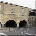


![Convenient benchmark. A small block of public toilets facing onto Claverton Street has a cutmark. See http://www.bench-marks.org.uk/bm35431 for the entry in the Benchmark database and [[[2855046]]] for a wider view. by Neil Owen – 08 March 2012](https://s1.geograph.org.uk/geophotos/02/85/50/2855033_b1a16911_120x120.jpg)
![W.C.s on Claverton Street. A small block of public conveniences, just up from the row of shops. Almost unnoticeable is a benchmark - see [[[2855033]]]. by Neil Owen – 08 March 2012](https://s2.geograph.org.uk/geophotos/02/85/50/2855046_38be7254_120x120.jpg)