Baldwins Bridge No 5A
is a place on the waterways
on the Staffordshire and Worcestershire Canal (Main Line: Stourport to Stourton) between
Kidderminster (4 miles and ¼ furlongs
and 3 locks
to the northeast) and
Upper Basin Waterpoint (2¾ furlongs
and 1 lock
to the south).
The nearest place in the direction of Kidderminster is Gilgal Bridge No 6;
¾ furlongs
away.
The nearest place in the direction of Upper Basin Waterpoint is The Black Star PH;
¾ furlongs
away.
There may be access to the towpath here.
Mooring here is ok (a perfectly adequate mooring). Moorings for Lidl one side and Tesco Express on the other.
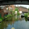
There is a bridge here which takes pedestrian traffic over the canal.
Former Railway Interchange Basin | 3½ furlongs | |
Mitton Railway Bridge (disused) | 3½ furlongs | |
Bird in Hand PH and Moorings | 2¾ furlongs | |
Mitton Chapel Bridge No 7 | 1¾ furlongs | |
Gilgal Bridge No 6 | ¾ furlongs | |
Baldwins Bridge No 5A | ||
The Black Star PH | ¾ furlongs | |
Lower Mitton Bridge No 5 | 1 furlong | |
Stourport Town Moorings | 2 furlongs | |
York Street Lock No 3 | 2¼ furlongs | |
York Street Bridge | 2¼ furlongs |
Amenities here
Amenities nearby at The Black Star PH
Amenities nearby at Gilgal Bridge No 6
Amenities in Stourport
Amenities at other places in Stourport
at
at
at
at
at
at
at
at
at
at
at
at
at
at
at
at
at
at
at
There are no links to external websites from here.
Why not log in and add some (select "External websites" from the menu (sometimes this is under "Edit"))?
Mouseover for more information or show routes to facility
Nearest water point
In the direction of Stourton Junction
Caldwall Mill Bridge No 14 — 3 miles, 3¾ furlongs and 2 locks away
On this waterway in the direction of Stourton Junction
Kinver Services — 10 miles, 2¾ furlongs and 8 locks away
On this waterway in the direction of Stourton Junction
Stewponey Water Point — 11 miles, 6½ furlongs and 10 locks away
On this waterway in the direction of Stourton Junction
Greensforge Wharf Services — 14 miles, 6 furlongs and 13 locks away
Travel to Stourton Junction, then on the Staffordshire and Worcestershire Canal (Main Line: Stourton to Aldersley) to Greensforge Wharf Services
Stourbridge Visitor Moorings — 14 miles, 7½ furlongs and 14 locks away
Travel to Stourton Junction, then on the Stourbridge Canals (Main Line) to Wordsley Junction, then on the Stourbridge Canals (Stourbridge Branch) to Stourbridge Visitor Moorings
In the direction of York Street Bridge
Upper Basin Waterpoint — 2¾ furlongs and 1 lock away
Travel to York Street Bridge, then on the Staffordshire and Worcestershire Canal (Stourport Basins: Narrow Route) to Upper Basin Waterpoint
Lincomb Lock — 1 mile, 6 furlongs and 3 locks away
Travel to York Street Bridge, then on the Staffordshire and Worcestershire Canal (Stourport Basins: Narrow Route) to Stourport Upper Basin, then on the Staffordshire and Worcestershire Canal (Stourport Basins: Broad Route) to Severn - Stourport Broad Locks Entrance, then on the River Severn (main river - Stourport to Worcester) to Lincomb Lock
Holt Lock (Holt Fleet) — 5 miles, 7¾ furlongs and 4 locks away
Travel to York Street Bridge, then on the Staffordshire and Worcestershire Canal (Stourport Basins: Narrow Route) to Stourport Upper Basin, then on the Staffordshire and Worcestershire Canal (Stourport Basins: Broad Route) to Severn - Stourport Broad Locks Entrance, then on the River Severn (main river - Stourport to Worcester) to Holt Lock (Holt Fleet)
Worcester Trip Boat Moorings — 12 miles, 4½ furlongs and 6 locks away
Travel to York Street Bridge, then on the Staffordshire and Worcestershire Canal (Stourport Basins: Narrow Route) to Stourport Upper Basin, then on the Staffordshire and Worcestershire Canal (Stourport Basins: Broad Route) to Severn - Stourport Broad Locks Entrance, then on the River Severn (main river - Stourport to Worcester) to Worcester Trip Boat Moorings
Diglis Locks — 13 miles, 5¼ furlongs and 6 locks away
Travel to York Street Bridge, then on the Staffordshire and Worcestershire Canal (Stourport Basins: Narrow Route) to Stourport Upper Basin, then on the Staffordshire and Worcestershire Canal (Stourport Basins: Broad Route) to Severn - Stourport Broad Locks Entrance, then on the River Severn (main river - Stourport to Worcester) to Diglis Junction, then on the River Severn (main river - Worcester to Gloucester) to Diglis Locks
Diglis Services — 13 miles, 4¼ furlongs and 8 locks away
Travel to York Street Bridge, then on the Staffordshire and Worcestershire Canal (Stourport Basins: Narrow Route) to Stourport Upper Basin, then on the Staffordshire and Worcestershire Canal (Stourport Basins: Broad Route) to Severn - Stourport Broad Locks Entrance, then on the River Severn (main river - Stourport to Worcester) to Diglis Junction, then on the Worcester and Birmingham Canal (Diglis Junction to Diglis Basin) to Diglis Basin, then on the Worcester and Birmingham Canal (Diglis Basin to King's Norton Junction) to Diglis Services
Lowesmoor Basin — 14 miles, 4 furlongs and 10 locks away
Travel to York Street Bridge, then on the Staffordshire and Worcestershire Canal (Stourport Basins: Narrow Route) to Stourport Upper Basin, then on the Staffordshire and Worcestershire Canal (Stourport Basins: Broad Route) to Severn - Stourport Broad Locks Entrance, then on the River Severn (main river - Stourport to Worcester) to Diglis Junction, then on the Worcester and Birmingham Canal (Diglis Junction to Diglis Basin) to Diglis Basin, then on the Worcester and Birmingham Canal (Diglis Basin to King's Norton Junction) to Lowesmoor Basin
Netherwich Basin — 14 miles, 3 furlongs and 13 locks away
Travel to York Street Bridge, then on the Staffordshire and Worcestershire Canal (Stourport Basins: Narrow Route) to Stourport Upper Basin, then on the Staffordshire and Worcestershire Canal (Stourport Basins: Broad Route) to Severn - Stourport Broad Locks Entrance, then on the River Severn (main river - Stourport to Worcester) to Hawford Junction, then on the Droitwich Canals (Droitwich Barge Canal) to Netherwich Basin
Droitwich Spa Marina — 15 miles, 6¾ furlongs and 18 locks away
Travel to York Street Bridge, then on the Staffordshire and Worcestershire Canal (Stourport Basins: Narrow Route) to Stourport Upper Basin, then on the Staffordshire and Worcestershire Canal (Stourport Basins: Broad Route) to Severn - Stourport Broad Locks Entrance, then on the River Severn (main river - Stourport to Worcester) to Hawford Junction, then on the Droitwich Canals (Droitwich Barge Canal) to Droitwich Junction, then on the Droitwich Canals (Droitwich Junction Canal) to Droitwich Spa Marina
Hanbury Boatyard — 16 miles, 2¾ furlongs and 21 locks away
Travel to York Street Bridge, then on the Staffordshire and Worcestershire Canal (Stourport Basins: Narrow Route) to Stourport Upper Basin, then on the Staffordshire and Worcestershire Canal (Stourport Basins: Broad Route) to Severn - Stourport Broad Locks Entrance, then on the River Severn (main river - Stourport to Worcester) to Hawford Junction, then on the Droitwich Canals (Droitwich Barge Canal) to Droitwich Junction, then on the Droitwich Canals (Droitwich Junction Canal) to Hanbury Junction, then on the Worcester and Birmingham Canal (Diglis Basin to King's Norton Junction) to Hanbury Boatyard
Stoke Works Water Point — 18 miles, 6 furlongs and 27 locks away
Travel to York Street Bridge, then on the Staffordshire and Worcestershire Canal (Stourport Basins: Narrow Route) to Stourport Upper Basin, then on the Staffordshire and Worcestershire Canal (Stourport Basins: Broad Route) to Severn - Stourport Broad Locks Entrance, then on the River Severn (main river - Stourport to Worcester) to Hawford Junction, then on the Droitwich Canals (Droitwich Barge Canal) to Droitwich Junction, then on the Droitwich Canals (Droitwich Junction Canal) to Hanbury Junction, then on the Worcester and Birmingham Canal (Diglis Basin to King's Norton Junction) to Stoke Works Water PointNearest rubbish disposal
In the direction of Stourton Junction
Kinver Services — 10 miles, 2¾ furlongs and 8 locks away
On this waterway in the direction of Stourton Junction
Greensforge Wharf Services — 14 miles, 6 furlongs and 13 locks away
Travel to Stourton Junction, then on the Staffordshire and Worcestershire Canal (Main Line: Stourton to Aldersley) to Greensforge Wharf Services
Stourbridge Basin — 15 miles, 1½ furlongs and 14 locks away
Travel to Stourton Junction, then on the Stourbridge Canals (Main Line) to Wordsley Junction, then on the Stourbridge Canals (Stourbridge Branch) to Stourbridge Basin
Bratch Bottom Lock No 23 — 18 miles, 3½ furlongs and 19 locks away
Travel to Stourton Junction, then on the Staffordshire and Worcestershire Canal (Main Line: Stourton to Aldersley) to Bratch Bottom Lock No 23
Delph Bottom Lock No 8 — 18 miles, 4½ furlongs and 30 locks away
Travel to Stourton Junction, then on the Stourbridge Canals (Main Line) to Black Delph, then on the Birmingham Canal Navigations (Dudley Canal No 1 - Through Route) to Delph Bottom Lock No 8
Waterfront Services (Dudley) — 19 miles, 4¼ furlongs and 38 locks away
Travel to Stourton Junction, then on the Stourbridge Canals (Main Line) to Black Delph, then on the Birmingham Canal Navigations (Dudley Canal No 1 - Through Route) to Waterfront Services (Dudley)
In the direction of York Street Bridge
Upper Basin Waterpoint — 2¾ furlongs and 1 lock away
Travel to York Street Bridge, then on the Staffordshire and Worcestershire Canal (Stourport Basins: Narrow Route) to Upper Basin Waterpoint
Sabrina Footbridge — 12 miles, 2¾ furlongs and 6 locks away
Travel to York Street Bridge, then on the Staffordshire and Worcestershire Canal (Stourport Basins: Narrow Route) to Stourport Upper Basin, then on the Staffordshire and Worcestershire Canal (Stourport Basins: Broad Route) to Severn - Stourport Broad Locks Entrance, then on the River Severn (main river - Stourport to Worcester) to Sabrina Footbridge
Diglis Basin — 13 miles, 3¾ furlongs and 8 locks away
Travel to York Street Bridge, then on the Staffordshire and Worcestershire Canal (Stourport Basins: Narrow Route) to Stourport Upper Basin, then on the Staffordshire and Worcestershire Canal (Stourport Basins: Broad Route) to Severn - Stourport Broad Locks Entrance, then on the River Severn (main river - Stourport to Worcester) to Diglis Junction, then on the Worcester and Birmingham Canal (Diglis Junction to Diglis Basin) to Diglis Basin
Lowesmoor Basin — 14 miles, 4 furlongs and 10 locks away
Travel to York Street Bridge, then on the Staffordshire and Worcestershire Canal (Stourport Basins: Narrow Route) to Stourport Upper Basin, then on the Staffordshire and Worcestershire Canal (Stourport Basins: Broad Route) to Severn - Stourport Broad Locks Entrance, then on the River Severn (main river - Stourport to Worcester) to Diglis Junction, then on the Worcester and Birmingham Canal (Diglis Junction to Diglis Basin) to Diglis Basin, then on the Worcester and Birmingham Canal (Diglis Basin to King's Norton Junction) to Lowesmoor Basin
Netherwich Basin — 14 miles, 3 furlongs and 13 locks away
Travel to York Street Bridge, then on the Staffordshire and Worcestershire Canal (Stourport Basins: Narrow Route) to Stourport Upper Basin, then on the Staffordshire and Worcestershire Canal (Stourport Basins: Broad Route) to Severn - Stourport Broad Locks Entrance, then on the River Severn (main river - Stourport to Worcester) to Hawford Junction, then on the Droitwich Canals (Droitwich Barge Canal) to Netherwich Basin
Droitwich Spa Marina — 15 miles, 6¾ furlongs and 18 locks away
Travel to York Street Bridge, then on the Staffordshire and Worcestershire Canal (Stourport Basins: Narrow Route) to Stourport Upper Basin, then on the Staffordshire and Worcestershire Canal (Stourport Basins: Broad Route) to Severn - Stourport Broad Locks Entrance, then on the River Severn (main river - Stourport to Worcester) to Hawford Junction, then on the Droitwich Canals (Droitwich Barge Canal) to Droitwich Junction, then on the Droitwich Canals (Droitwich Junction Canal) to Droitwich Spa Marina
Stoke Bottom Lock No 23 — 19 miles, 3¾ furlongs and 27 locks away
Travel to York Street Bridge, then on the Staffordshire and Worcestershire Canal (Stourport Basins: Narrow Route) to Stourport Upper Basin, then on the Staffordshire and Worcestershire Canal (Stourport Basins: Broad Route) to Severn - Stourport Broad Locks Entrance, then on the River Severn (main river - Stourport to Worcester) to Hawford Junction, then on the Droitwich Canals (Droitwich Barge Canal) to Droitwich Junction, then on the Droitwich Canals (Droitwich Junction Canal) to Hanbury Junction, then on the Worcester and Birmingham Canal (Diglis Basin to King's Norton Junction) to Stoke Bottom Lock No 23Nearest chemical toilet disposal
In the direction of Stourton Junction
Caldwall Mill Bridge No 14 — 3 miles, 3¾ furlongs and 2 locks away
On this waterway in the direction of Stourton Junction
Kinver Services — 10 miles, 2¾ furlongs and 8 locks away
On this waterway in the direction of Stourton Junction
Greensforge Wharf Services — 14 miles, 6 furlongs and 13 locks away
Travel to Stourton Junction, then on the Staffordshire and Worcestershire Canal (Main Line: Stourton to Aldersley) to Greensforge Wharf Services
Stourbridge Basin — 15 miles, 1½ furlongs and 14 locks away
Travel to Stourton Junction, then on the Stourbridge Canals (Main Line) to Wordsley Junction, then on the Stourbridge Canals (Stourbridge Branch) to Stourbridge Basin
Waterfront Services (Dudley) — 19 miles, 4¼ furlongs and 38 locks away
Travel to Stourton Junction, then on the Stourbridge Canals (Main Line) to Black Delph, then on the Birmingham Canal Navigations (Dudley Canal No 1 - Through Route) to Waterfront Services (Dudley)
In the direction of York Street Bridge
Upper Basin Waterpoint — 2¾ furlongs and 1 lock away
Travel to York Street Bridge, then on the Staffordshire and Worcestershire Canal (Stourport Basins: Narrow Route) to Upper Basin Waterpoint
Stourport Marina — 1 mile, 2¾ furlongs and 3 locks away
Travel to York Street Bridge, then on the Staffordshire and Worcestershire Canal (Stourport Basins: Narrow Route) to Stourport Upper Basin, then on the Staffordshire and Worcestershire Canal (Stourport Basins: Broad Route) to Severn - Stourport Broad Locks Entrance, then on the River Severn (main river - Stourport to Worcester) to Stourport Marina
Diglis Services — 13 miles, 4¼ furlongs and 8 locks away
Travel to York Street Bridge, then on the Staffordshire and Worcestershire Canal (Stourport Basins: Narrow Route) to Stourport Upper Basin, then on the Staffordshire and Worcestershire Canal (Stourport Basins: Broad Route) to Severn - Stourport Broad Locks Entrance, then on the River Severn (main river - Stourport to Worcester) to Diglis Junction, then on the Worcester and Birmingham Canal (Diglis Junction to Diglis Basin) to Diglis Basin, then on the Worcester and Birmingham Canal (Diglis Basin to King's Norton Junction) to Diglis Services
Lowesmoor Basin — 14 miles, 4 furlongs and 10 locks away
Travel to York Street Bridge, then on the Staffordshire and Worcestershire Canal (Stourport Basins: Narrow Route) to Stourport Upper Basin, then on the Staffordshire and Worcestershire Canal (Stourport Basins: Broad Route) to Severn - Stourport Broad Locks Entrance, then on the River Severn (main river - Stourport to Worcester) to Diglis Junction, then on the Worcester and Birmingham Canal (Diglis Junction to Diglis Basin) to Diglis Basin, then on the Worcester and Birmingham Canal (Diglis Basin to King's Norton Junction) to Lowesmoor Basin
Droitwich Spa Marina — 15 miles, 6¾ furlongs and 18 locks away
Travel to York Street Bridge, then on the Staffordshire and Worcestershire Canal (Stourport Basins: Narrow Route) to Stourport Upper Basin, then on the Staffordshire and Worcestershire Canal (Stourport Basins: Broad Route) to Severn - Stourport Broad Locks Entrance, then on the River Severn (main river - Stourport to Worcester) to Hawford Junction, then on the Droitwich Canals (Droitwich Barge Canal) to Droitwich Junction, then on the Droitwich Canals (Droitwich Junction Canal) to Droitwich Spa Marina
Stoke Bottom Lock No 23 — 19 miles, 3¾ furlongs and 27 locks away
Travel to York Street Bridge, then on the Staffordshire and Worcestershire Canal (Stourport Basins: Narrow Route) to Stourport Upper Basin, then on the Staffordshire and Worcestershire Canal (Stourport Basins: Broad Route) to Severn - Stourport Broad Locks Entrance, then on the River Severn (main river - Stourport to Worcester) to Hawford Junction, then on the Droitwich Canals (Droitwich Barge Canal) to Droitwich Junction, then on the Droitwich Canals (Droitwich Junction Canal) to Hanbury Junction, then on the Worcester and Birmingham Canal (Diglis Basin to King's Norton Junction) to Stoke Bottom Lock No 23Nearest place to turn
In the direction of Stourton Junction
Former Railway Interchange Basin — 3½ furlongs away
On this waterway in the direction of Stourton Junction
Pratt's Wharf — 1 mile, 7¼ furlongs away
On this waterway in the direction of Stourton Junction
Academy Winding Hole — 3 miles, 6 furlongs and 2 locks away
On this waterway in the direction of Stourton Junction
Kidderminster — 4 miles, ¼ furlongs and 3 locks away
On this waterway in the direction of Stourton Junction
Broadwaters Aqueduct Winding Hole — 4 miles, 6½ furlongs and 3 locks away
On this waterway in the direction of Stourton Junction
Lea Lane Winding Hole — 6 miles, 2½ furlongs and 5 locks away
On this waterway in the direction of Stourton Junction
Debdale Lock Winding Hole — 6 miles, 7¾ furlongs and 6 locks away
On this waterway in the direction of Stourton Junction
Cookley Forge Towpath Bridge — 7 miles, ¾ furlongs and 6 locks away
On this waterway in the direction of Stourton Junction
Whittington Winding Hole — 9 miles, 4 furlongs and 7 locks away
On this waterway in the direction of Stourton Junction
Hyde Lock Winding Hole — 10 miles, 6 furlongs and 9 locks away
On this waterway in the direction of Stourton Junction
In the direction of York Street Bridge
Stourport Upper Basin — 2¾ furlongs and 1 lock away
Travel to York Street Bridge, then on the Staffordshire and Worcestershire Canal (Stourport Basins: Narrow Route) to Stourport Upper Basin
Stourport Clock Basin — 3¼ furlongs and 1 lock away
Travel to York Street Bridge, then on the Staffordshire and Worcestershire Canal (Stourport Basins: Narrow Route) to Stourport Clock Basin
Stourport Lower Basin - between Broad Locks — 3½ furlongs and 2 locks away
Travel to York Street Bridge, then on the Staffordshire and Worcestershire Canal (Stourport Basins: Narrow Route) to Stourport Upper Basin, then on the Staffordshire and Worcestershire Canal (Stourport Basins: Broad Route) to Stourport Lower Basin - between Broad Locks
Stourport Lower Basin - between Narrow Locks — 4 furlongs and 2 locks away
Travel to York Street Bridge, then on the Staffordshire and Worcestershire Canal (Stourport Basins: Narrow Route) to Stourport Upper Basin, then on the Staffordshire and Worcestershire Canal (Stourport Basins: Broad Route) to Stourport Lower Basin - between Broad Locks, then on the Staffordshire and Worcestershire Canal (Stourport Basins: Broad Locks to Narrow Locks to Stourport Lower Basin - between Narrow Locks
Severn - Stourport Narrow Locks Entrance — 4½ furlongs and 3 locks away
Travel to York Street Bridge, then on the Staffordshire and Worcestershire Canal (Stourport Basins: Narrow Route) to Stourport Upper Basin, then on the Staffordshire and Worcestershire Canal (Stourport Basins: Broad Route) to Severn - Stourport Broad Locks Entrance, then on the River Severn (main river - Stourport to Worcester) to Severn - Stourport Narrow Locks Entrance
Holt Lock Weir Entrance — 5 miles, 5½ furlongs and 4 locks away
Travel to York Street Bridge, then on the Staffordshire and Worcestershire Canal (Stourport Basins: Narrow Route) to Stourport Upper Basin, then on the Staffordshire and Worcestershire Canal (Stourport Basins: Broad Route) to Severn - Stourport Broad Locks Entrance, then on the River Severn (main river - Stourport to Worcester) to Holt Lock Weir Entrance
Holt Lock Weir Exit — 6 miles, ¾ furlongs and 5 locks away
Travel to York Street Bridge, then on the Staffordshire and Worcestershire Canal (Stourport Basins: Narrow Route) to Stourport Upper Basin, then on the Staffordshire and Worcestershire Canal (Stourport Basins: Broad Route) to Severn - Stourport Broad Locks Entrance, then on the River Severn (main river - Stourport to Worcester) to Holt Lock Weir Exit
Bevere Lock Weir Entrance — 9 miles, 1½ furlongs and 5 locks away
Travel to York Street Bridge, then on the Staffordshire and Worcestershire Canal (Stourport Basins: Narrow Route) to Stourport Upper Basin, then on the Staffordshire and Worcestershire Canal (Stourport Basins: Broad Route) to Severn - Stourport Broad Locks Entrance, then on the River Severn (main river - Stourport to Worcester) to Bevere Lock Weir Entrance
Bevere Lock Weir Exit — 9 miles, 4¼ furlongs and 6 locks away
Travel to York Street Bridge, then on the Staffordshire and Worcestershire Canal (Stourport Basins: Narrow Route) to Stourport Upper Basin, then on the Staffordshire and Worcestershire Canal (Stourport Basins: Broad Route) to Severn - Stourport Broad Locks Entrance, then on the River Severn (main river - Stourport to Worcester) to Bevere Lock Weir Exit
Diglis Junction — 13 miles, 2¾ furlongs and 6 locks away
Travel to York Street Bridge, then on the Staffordshire and Worcestershire Canal (Stourport Basins: Narrow Route) to Stourport Upper Basin, then on the Staffordshire and Worcestershire Canal (Stourport Basins: Broad Route) to Severn - Stourport Broad Locks Entrance, then on the River Severn (main river - Stourport to Worcester) to Diglis JunctionNearest self-operated pump-out
In the direction of Stourton Junction
Kinver Services — 10 miles, 2¾ furlongs and 8 locks away
On this waterway in the direction of Stourton Junction
In the direction of York Street Bridge
Diglis Services — 13 miles, 4¼ furlongs and 8 locks away
Travel to York Street Bridge, then on the Staffordshire and Worcestershire Canal (Stourport Basins: Narrow Route) to Stourport Upper Basin, then on the Staffordshire and Worcestershire Canal (Stourport Basins: Broad Route) to Severn - Stourport Broad Locks Entrance, then on the River Severn (main river - Stourport to Worcester) to Diglis Junction, then on the Worcester and Birmingham Canal (Diglis Junction to Diglis Basin) to Diglis Basin, then on the Worcester and Birmingham Canal (Diglis Basin to King's Norton Junction) to Diglis Services
Droitwich Spa Marina — 15 miles, 6¾ furlongs and 18 locks away
Travel to York Street Bridge, then on the Staffordshire and Worcestershire Canal (Stourport Basins: Narrow Route) to Stourport Upper Basin, then on the Staffordshire and Worcestershire Canal (Stourport Basins: Broad Route) to Severn - Stourport Broad Locks Entrance, then on the River Severn (main river - Stourport to Worcester) to Hawford Junction, then on the Droitwich Canals (Droitwich Barge Canal) to Droitwich Junction, then on the Droitwich Canals (Droitwich Junction Canal) to Droitwich Spa MarinaNearest boatyard pump-out
In the direction of York Street Bridge
Stourport Upper Basin — 2¾ furlongs and 1 lock away
Travel to York Street Bridge, then on the Staffordshire and Worcestershire Canal (Stourport Basins: Narrow Route) to Stourport Upper Basin
Upper Staircase Lock Landing Pontoon — 3½ furlongs and 1 lock away
Travel to York Street Bridge, then on the Staffordshire and Worcestershire Canal (Stourport Basins: Narrow Route) to Upper Staircase Lock Landing Pontoon
Stourport Marina — 1 mile, 2¾ furlongs and 3 locks away
Travel to York Street Bridge, then on the Staffordshire and Worcestershire Canal (Stourport Basins: Narrow Route) to Stourport Upper Basin, then on the Staffordshire and Worcestershire Canal (Stourport Basins: Broad Route) to Severn - Stourport Broad Locks Entrance, then on the River Severn (main river - Stourport to Worcester) to Stourport Marina
Lowesmoor Basin — 14 miles, 4 furlongs and 10 locks away
Travel to York Street Bridge, then on the Staffordshire and Worcestershire Canal (Stourport Basins: Narrow Route) to Stourport Upper Basin, then on the Staffordshire and Worcestershire Canal (Stourport Basins: Broad Route) to Severn - Stourport Broad Locks Entrance, then on the River Severn (main river - Stourport to Worcester) to Diglis Junction, then on the Worcester and Birmingham Canal (Diglis Junction to Diglis Basin) to Diglis Basin, then on the Worcester and Birmingham Canal (Diglis Basin to King's Norton Junction) to Lowesmoor Basin
Hanbury Boatyard — 16 miles, 2¾ furlongs and 21 locks away
Travel to York Street Bridge, then on the Staffordshire and Worcestershire Canal (Stourport Basins: Narrow Route) to Stourport Upper Basin, then on the Staffordshire and Worcestershire Canal (Stourport Basins: Broad Route) to Severn - Stourport Broad Locks Entrance, then on the River Severn (main river - Stourport to Worcester) to Hawford Junction, then on the Droitwich Canals (Droitwich Barge Canal) to Droitwich Junction, then on the Droitwich Canals (Droitwich Junction Canal) to Hanbury Junction, then on the Worcester and Birmingham Canal (Diglis Basin to King's Norton Junction) to Hanbury Boatyard
Dunhampstead Boatyard — 18 miles, 1¼ furlongs and 21 locks away
Travel to York Street Bridge, then on the Staffordshire and Worcestershire Canal (Stourport Basins: Narrow Route) to Stourport Upper Basin, then on the Staffordshire and Worcestershire Canal (Stourport Basins: Broad Route) to Severn - Stourport Broad Locks Entrance, then on the River Severn (main river - Stourport to Worcester) to Hawford Junction, then on the Droitwich Canals (Droitwich Barge Canal) to Droitwich Junction, then on the Droitwich Canals (Droitwich Junction Canal) to Hanbury Junction, then on the Worcester and Birmingham Canal (Diglis Basin to King's Norton Junction) to Dunhampstead BoatyardDirection of TV transmitter (From Wolfbane Cybernetic)
There is no page on Wikipedia called “Baldwins Bridge No 5A”
Wikipedia pages that might relate to Baldwins Bridge No 5A
[Stephen Baldwin]
In June 2012, a jury sided with Costner and awarded Baldwin no damages. In March 2013, Baldwin pleaded guilty to failing to file income taxes for the
[Eads Bridge]
Eads Bridge is a combined road and railway bridge over the Mississippi River connecting the cities of St. Louis, Missouri and East St. Louis, Illinois
[Suicides at the Golden Gate Bridge]
the bridge's 128 lamp posts the jumper was nearest when he or she jumped. The official count ended on June 5, 1995 on the 997th jump; jumper No. 1000
[Red Rock, Yavapai County, Arizona]
in the Coconino National Forest's Crescent Moon Ranch recreation area. Baldwins Crossing is an alternate name for the ford. Cathedral Rock at Red Rock
[List of structural failures and collapses]
a list of structural failures and collapses, including some aircraft, bridges, dams, and radio masts/towers. "Archived copy". Archived from the original
[Peace Bridge]
The Peace Bridge is an international bridge between Canada and the United States at the east end of Lake Erie at the source of the Niagara River, about
[Edmund Pettus Bridge]
The Edmund Pettus Bridge carries U.S. Route 80 Business (US 80 Bus.) across the Alabama River in Selma, Alabama. Built in 1940, it is named after Edmund
[Dartford Crossing]
Tunnel, both well within East London. When the bridge is closed in high winds and for maintenance, no convenient diversion exists through London for the
[Ono Island, Alabama]
by the Baldwin County Commission. Emergency services are provided by nearby communities. The island is accessed via a private, guarded, bridge from State
[List of Deadly Women episodes]
film was narrated by Marsha Crenshaw. Ep = Episode number within the season No. = Overall episode number Each of the three original episodes covered the
Results of Google Search
Route 5 Bus Timetable & Map | National Express West MidlandsClick to view National Express West Midlands Bus Route 5 service information ... 5. Birmingham City Centre - Sarehole Mill - Shirley - Monkspath - Solihull. 5 .... that stop in 'real time' (where available) or scheduled time for services not fitted with RTI. ... Next Bus From here for 5, Scribers Lane, BALDWINS LANE, nwmgmjtj.
Location. Baldwin County, Alabama. Project Sponsor / Borrower. City of Foley, Alabama. Program Areas. P3 Tolling and Pricing. Mode. Highway / Toll Bridge.
... of Isle of Man Natural History and Antiquarian Society Vol 3 no 5 pp431/432. ... "red road," which goes from West Baldwin Bridge to Keeill Abban: BayrAmmell, ...
Less than 500 metres from Winchester's historic city centre, No 5 Bridge Street offers free Wi-Fi access throughout.
Our Winchester restaurant, No.5 Bridge Street is located in the heart of Winchester. The restaurant offers Hampshire dining with a modern British food menu.
May 18, 2017 ... They jumped off the Golden Gate Bridge, and survived. Both say the ... In fact, Kevin Hines and Ken Baldwin are little more than strangers who happen to share an incredible connection. .... No one will ever know that you knew you made a mistake.' And I ..... 5 Fwy through Grapevine closed due to snow.
May 27, 2015 ... Baldwin and Clark, 2000; Weinberger, 2008; Brynjolfsson and McAfee, 2014.) How do .... 5 This assumes that no one builds a second bridge.
Between 1937 and 2012, an estimated 1,600 bodies were recovered of people who had .... There is no accurate figure on the number of suicides or completed jumps ... Until 1993, the youngest death off the bridge was 5-year old Marilyn DeMont, in 1945. .... In 1985 28-year-old Kenneth Baldwin jumped over and survived.
The water from Gleason's to Bowman Bridge is up to 5-feet deep in some parts ... Baldwin. Baldwin Canoe Rental. Fees, Concessionaire Fee - Campground ... No special use permit is required for individuals or small groups (74 people or less)Â ...
May 23, 2018 ... Baldwin Haspel Burke & Mayer LLC ... Maritime Update: Bridge Allision and Depreciation Costs in Repairs ... (Taira Lynn) and operated by D&S Marine Services (D&S), allided with the Sunshine Bridge Pier No. ... The 5th Circuit Court of Appeals for Louisiana also disagreed with defendants/appellants ...