CanalPlanAC

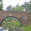
Gopsall Wharf Bridge No 58

 
Gopsall Wharf, Green Lane, North West Leicestershire DE12 7DE, United Kingdom
 
Information about the place
Gopsall Wharf Bridge No 58 is a minor waterways place on the Ashby Canal (Main Line) between Snarestone Tunnel (southern entrance) (Snarestone village is over the top of the tunnel.) (5½ furlongs to the northwest) and Turn Bridge No 52 (Shackerstone) (2 miles to the east).
 
 
The nearest place in the direction of Snarestone Tunnel (southern entrance) is Pare's Bridge No 59; 2¾ furlongs away.
 
The nearest place in the direction of Turn Bridge No 52 (Shackerstone) is Gopsall Wharf; a few yards away.

There is access (suitable for wheels) to the towpath here.

Mooring here is unrated.

There is a bridge here which takes a track over the canal.


Amenities
 
Maps
If you are a user and are logged on, or if you are actively planning a route, a map will be displayed here.
Show on external mapping site: Google | OSM | Bing
 
Photos
 
Nearest facilities

Mouseover for more information or show routes to facility

Nearest water point

In the direction of Marston Junction

Bosworth Marina & Wharf Winding Hole5 miles, 3 furlongs away
On this waterway in the direction of Marston Junction
Bosworth Wharf Bridge No 425 miles, 3¼ furlongs away
On this waterway in the direction of Marston Junction
Sutton Cheney Wharf9 miles away
On this waterway in the direction of Marston Junction
Trinity Marina14 miles, 2 furlongs away
On this waterway in the direction of Marston Junction
Limekiln Bridge No 1515 miles, 2 furlongs away
On this waterway in the direction of Marston Junction

In the direction of Ashby Canal Current Head of Navigation

Snarestone Services1 mile, ½ furlongs away
On this waterway in the direction of Ashby Canal Current Head of Navigation

Nearest rubbish disposal

In the direction of Marston Junction

Bosworth Marina & Wharf Winding Hole5 miles, 3 furlongs away
On this waterway in the direction of Marston Junction
Stoke Golding Wharf11 miles, 4 furlongs away
On this waterway in the direction of Marston Junction
Trinity Marina14 miles, 2 furlongs away
On this waterway in the direction of Marston Junction

In the direction of Ashby Canal Current Head of Navigation

Snarestone Services1 mile, ½ furlongs away
On this waterway in the direction of Ashby Canal Current Head of Navigation

Nearest chemical toilet disposal

In the direction of Marston Junction

Bosworth Marina & Wharf Winding Hole5 miles, 3 furlongs away
On this waterway in the direction of Marston Junction
Sutton Cheney Wharf9 miles away
On this waterway in the direction of Marston Junction
Trinity Marina14 miles, 2 furlongs away
On this waterway in the direction of Marston Junction

In the direction of Ashby Canal Current Head of Navigation

Snarestone Services1 mile, ½ furlongs away
On this waterway in the direction of Ashby Canal Current Head of Navigation

Nearest place to turn

In the direction of Marston Junction

Shackerstone Winding Hole1 mile, 6 furlongs away
On this waterway in the direction of Marston Junction
Carlton Bridge Winding Hole4 miles, 3¼ furlongs away
On this waterway in the direction of Marston Junction
Bosworth Marina & Wharf Winding Hole5 miles, 3 furlongs away
On this waterway in the direction of Marston Junction
Jackson's Bridge Winding Hole5 miles, 5½ furlongs away
On this waterway in the direction of Marston Junction
Shenton Bend7 miles, 4¾ furlongs away
On this waterway in the direction of Marston Junction
Sutton Cheney Wharf9 miles away
On this waterway in the direction of Marston Junction
Basin Bridge Winding Hole12 miles, 1½ furlongs away
On this waterway in the direction of Marston Junction
Trinity Marina14 miles, 2 furlongs away
On this waterway in the direction of Marston Junction
Hinckley Wharf Arm Junction14 miles, 5¾ furlongs away
On this waterway in the direction of Marston Junction

In the direction of Ashby Canal Current Head of Navigation

Turnover Bridge Winding Hole1 mile, ¼ furlongs away
On this waterway in the direction of Ashby Canal Current Head of Navigation
Faulkes Circular Winding Hole1 mile, 2 furlongs away
On this waterway in the direction of Ashby Canal Current Head of Navigation Travel to Ashby Canal Current Head of Navigation, then on the Ashby Canal (unrestored) to Measham Wharf Branch Junction
Site of Proposed Measham Wharf3 miles, 2¾ furlongs away
Travel to Ashby Canal Current Head of Navigation, then on the Ashby Canal (unrestored) to Measham Wharf Branch Junction, then on the Ashby Canal (Measham Wharf Branch, unrestored) to Site of Proposed Measham Wharf
Bath Yard Basin6 miles, 6¼ furlongs and 1 lock away
Travel to Ashby Canal Current Head of Navigation, then on the Ashby Canal (unrestored) to Brooks Close Terminus, then on the Ashby Canal (restored but unconnected) to Bath Yard Basin

Nearest self-operated pump-out

In the direction of Marston Junction

Bosworth Marina & Wharf Winding Hole5 miles, 3 furlongs away
On this waterway in the direction of Marston Junction
Trinity Marina14 miles, 2 furlongs away
On this waterway in the direction of Marston Junction

Nearest boatyard pump-out

In the direction of Marston Junction

Trinity Marina14 miles, 2 furlongs away
On this waterway in the direction of Marston Junction
Direction of TV transmitter (From Wolfbane Cybernetic)
 
 
Geograph
 
Wikipedia

There is no page on Wikipedia called “Gopsall Wharf Bridge”

Wikipedia pages that might relate to Gopsall Wharf Bridge
[List of poor law unions in England] the Beans, Bilstone, Cadeby, Carlton, Congerstone, Dadlington, Desford, Gopsall, Ibstock, Kirkby Mallory, Market Bosworth, Markfield, Nailstone, Newbold
 
Google

Results of Google Search

File:Bridge 58, Gopsall Wharf Bridge - geograph.org.uk - 926639.jpg ...
Feb 28, 2020 ... No higher resolution available. ... English: Bridge 58: Gopsall Wharf Bridge Along the Ashby Canal near Snarestone in Leicestershire. Date, 11 ...
Gopsall Wharf Bridge No 58 © Mat Fascione cc-by-sa/2.0 ...
Nov 7, 2016 ... taken 4 years ago, near to Snarestone, Leicestershire, Great Britain. More sizes. Gopsall Wharf Bridge No 58. The bridge carries Green Lane ...
File:Bridge 58, Gopsall Wharf from the South - geograph.org.uk ...
Feb 22, 2020 ... File:Bridge 58, Gopsall Wharf from the South - geograph.org.uk - 1631167.jpg. Language; Watch ... No higher resolution available. Bridge_58 ...
Bridge 58: Gopsall Wharf from the South © Trevor Wainwright ...
Dec 23, 2009 ... Authorised in 1794 the Ashby Canal was used for transporting coal well into the 20th century, despite an attempt by the railways to buy it and ...
Gopsall Wharf - Snarestone • Hiking route » outdooractive.com
After parking walk back to the entrance and turn right over the bridge (No.58) then right again down onto the towpath in the direction of Shackerstone. Continue ...
Ashby Canal: Bridge Number 58 © Nigel Cox :: Geograph Britain ...
Jul 29, 2013 ... Bridge Number 58 is Gopsall Wharf Bridge, and probably dates from no later than 1804 when the canal was built. Unlike several other bridges ...
Paddling in Leicester Leicester waterways information popup with ...
May 5, 2012 ... Green Lane Bridge (57), May 2012, Photo 2. Notes. no notes ./photos/1/ 05_05_2012/original/100_2583.JPG. Name. Gopsall Wharf Bridge (58), ...