CanalPlanAC

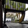
Drypool Bridge

 
Drypool Bridge, Hull HU1 1EW, United Kingdom
 
Information about the place
Drypool Bridge is a minor waterways place on the River Hull (Main Line) between Weel (9 miles and 3 furlongs to the northwest) and River Hull - Humber Junction (Kingston-upon-Hull) (1 mile and 4 furlongs to the south).
 
 
The nearest place in the direction of Weel is North Bridge; 1½ furlongs away.
 
The nearest place in the direction of River Hull - Humber Junction is Tower Street Basin; ½ furlongs away.

Mooring here is impossible (it may be physically impossible, forbidden, or allowed only for specific short-term purposes).

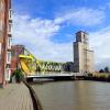
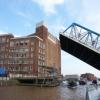
There is a lift bridge here.

Hull and Barnsley Railway Bridge1 mile, 4¾ furlongs
Wilmington Bridge1 mile, 2 furlongs
Chapman Street Bridge6¼ furlongs
Scott Street3½ furlongs
North Bridge1½ furlongs
Drypool Bridge
Tower Street Basin½ furlongs
Scale Lane Swing Bridge1¾ furlongs
Garrison Road Bridge2¾ furlongs
River Hull Tidal Barrier3¼ furlongs
Myton Bridge3½ furlongs
 
 
Amenities

Amenities here

 Cashpoint
 Lloyds Bank
 Travis Perkins

Amenities nearby at Tower Street Basin

 SPAR
 Timber Dock

Amenities nearby at North Bridge

 Starbucks
 Apollo
 Biarritz
 Home Bargains
 Poundland
 Cashpoint
 Cashpoint
 Lloyds Bank
 Speedy Hire
 
Maps
If you are a user and are logged on, or if you are actively planning a route, a map will be displayed here.
Show on external mapping site: Google | OSM | Bing
 
Photos
 
External websites
There are no links to external websites from here.
Why not log in and add some (select "External websites" from the menu (sometimes this is under "Edit"))?
 
Nearest facilities

Mouseover for more information or show routes to facility

Nearest water point

In the direction of Struncheon Hill Locks Nos 6 and 7

Beverley Beck Visitor Moorings10 miles, 4¼ furlongs and 1 lock away
Travel to Grovehill Junction, then on the River Hull (Beverley Beck) to Beverley Beck Visitor Moorings

Nearest place to turn

In the direction of River Hull - Humber Junction

Tower Street Basin½ furlongs away
On this waterway in the direction of River Hull - Humber Junction
Old River Ancholme Northern Junction18 miles, 2½ furlongs and 1 lock away
Travel to River Hull - Humber Junction, then on the River Humber to Humber - Ancholme Junction, then on the River Ancholme (Main River) to Old River Ancholme Northern Junction
Old River Ancholme Southern Junction19 miles, 4¾ furlongs and 1 lock away
Travel to River Hull - Humber Junction, then on the River Humber to Humber - Ancholme Junction, then on the River Ancholme (Main River) to Old River Ancholme Southern Junction

In the direction of Struncheon Hill Locks Nos 6 and 7

Beverley Beck Wharves10 miles, 3½ furlongs and 1 lock away
Travel to Grovehill Junction, then on the River Hull (Beverley Beck) to Beverley Beck Wharves
Aike Beck Junction14 miles, 4¾ furlongs away
On this waterway in the direction of Struncheon Hill Locks Nos 6 and 7

No information

CanalPlan has no information on any of the following facilities within range:
rubbish disposal
chemical toilet disposal
self-operated pump-out
boatyard pump-out
Direction of TV transmitter (From Wolfbane Cybernetic)
 
 
Geograph
 
Wikipedia

Wikipedia has a page about Drypool Bridge

The River Hull is a navigable river in the East Riding of Yorkshire in Northern England. It rises from a series of springs to the west of Driffield, and enters the Humber Estuary at Kingston upon Hull. Following a period when the Archbishops of York charged tolls for its use, it became a free navigation. The upper reaches became part of the Driffield Navigation from 1770, after which they were again subject to tolls, and the section within the city of Hull came under the jurisdiction of the Port of Hull, with the same result.

Most of its course is through low-lying land that is at or just above sea level, and regular flooding has been a long-standing problem along the waterway. Drainage schemes to alleviate it were constructed on both sides of the river. The Holderness Drainage scheme to the east was completed in 1772, with a second phase in 1805, and the Beverley and Barmston Drain to the west was completed in 1810. Since 1980, the mouth of the river has been protected by a tidal barrier at the estuary, which can be closed to prevent tidal surges entering the river system and causing flooding upriver.

Most of the bridges which cross the river are movable, to allow shipping to pass. There are six swing bridges; four bascule bridges, two of which have twin leaves, one for each carriageway of the roads which they carry; and three Scherzer lift bridges, which are a type of rolling bascule bridge. Scott Street Bridge, which is now permanently raised, was originally powered from a high pressure water main maintained by the first public power distribution company in the world.

Other Wikipedia pages that might relate to Drypool Bridge
[River Hull] Scott Street Bridge. Below North Bridge, an unused dry dock on the west bank marks the former entrance to Queens Dock. Below Drypool Bridge, a muddy basin [Drypool] Drypool (archaic Dripole) is an area within the city of Kingston upon Hull, England. Historically Drypool was a village, manor and later parish on the [John Venn] July 1885 and for his white carrots later that September. In 2017 The Drypool Bridge in Hull was decorated with intersecting circles, in honour of Venn. [List of bascule bridges] Wirral Corporation Bridge, Grimsby Bridgwater bascule bridge, Bridgwater, Somerset Sutton Road Bridge, Kingston upon Hull Drypool Bridge, Kingston upon Hull [Trams in Kingston upon Hull] to just beyond the Holderness Drain on Hedon Road, a short branch to Drypool Bridge was also later built. The company used 2 axle steam locomotives built [Arctic Corsair] immediately reverted to Arctic Corsair, and was berthed between Drypool Bridge and Myton Bridge in the River Hull as a museum ship. After being restored by [Southcoates] during the medieval period the place was a small hamlet, associated with Drypool. The urban growth of Hull expanded over Southcoates in the late 19th and [Port of Hull] entrance to the Old Dock and of Drypool Bridge; it had an outer lock which opened directly to a second locked area known as Drypool Basin. The first timber pond [Alfred Gelder] During Gelder's time the city centre was reconstructed and a new bridge, the Drypool Bridge, was built across the River Hull. In recognition of Gelder's contributions [A63 road] at Myton Bridge (a swing-bridge), near the Hull Tidal Surge Barrier and The Deep. The stretch over Myton Bridge and within the ward of Drypool is known
 
Google

Results of Google Search

John Venn inspired £325k makeover of Hull's Drypool Bridge is now ...
Jun 5, 2017 ... The colourful facelift of Drypool Bridge has been inspired by the work of 19th century Hull-born mathematician and philosopher John Venn.
Drypool - Wikipedia
Drypool (archaic Dripole) is an area within the city of Kingston upon Hull, England. Historically ... Bridges on the River Hull, North Bridge and its ancestors, Drypool, Myton, South and other bridges cross the River Hull into Drypool; Drypool and ...
Drypool Bridge (Hull) - Graces Guide
The present Drypool bridge is a Scherzer-type rolling bascule bridge, constructed in 1961.
River Hull - Wikipedia
Drypool Bridge. Drypool basin + Victoria Dock. A63 Myton Bridge, Hull. Tidal Barrier. Humber Estuary. The River Hull is a navigable river in the East Riding of Yorkshire in Northern England. It rises ...
Drypool Bridge (Kingston upon Hull) | Structurae
Oct 7, 2019 ... Drypool Bridge is a bascule bridge, road bridge, through truss bridge and steel bridge. The project is located in Kingston upon Hull, East Riding ...
Drypool Bridge funding bid | Hull City Council
Hull City Council Drypool Bridge DFT Highways Maintenance Challenge fund bid .
Image Gallery | Drypool Bridge (Kingston upon Hull) | Structurae
Gallery of photos, images and drawings for the project Drypool Bridge.
File:Drypool Bridge, Kingston upon Hull (geograph 5482685).jpg ...
Jul 31, 2017 ... Original file #x200e;(2,468 × 1,836 pixels, file size: 1.99 MB, MIME type: image/jpeg). File information. Structured data ...
Hulls Drypool Bridge .. | Drypool bridge is a Scherzer-type … | Flickr
Sep 10, 2018 ... Drypool bridge is a Scherzer-type rolling bascule bridge which was constructed in 1961....It is one of 13 bridges that span the River Hull in the ...
File:Drypool Bridge Raised 1990.jpg - Wikimedia Commons
The original description page was here. All following user names refer to en. wikipedia. Date/Time, Dimensions, User, Comment. 14:52, 2 September 2006 ...