Retford Top Aqueduct
is a minor waterways place
on the Chesterfield Canal (Retford to the Trent) between
Wiseton Top Bridge No 70 (7 miles and 4 furlongs
and 2 locks
to the north) and
West Retford Lock No 58 (Wharf Bridge) (2¾ furlongs
to the northwest).
The nearest place in the direction of Wiseton Top Bridge No 70 is Retford Wharf Road;
¼ furlongs
away.
The nearest place in the direction of West Retford Lock No 58 is River Idle Aqueduct;
½ furlongs
away.
Mooring here is impossible (it may be physically impossible, forbidden, or allowed only for specific short-term purposes).
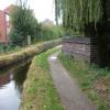
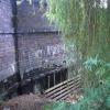
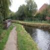
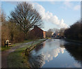
There is a small aqueduct or underbridge here.
Retford Winding Hole | 2 furlongs | |
Carolgate Bridge No 56A | 1½ furlongs | |
Carolgate Wharf | 1¼ furlongs | |
Retford Lock No 59 | ¾ furlongs | |
Retford Wharf Road | ¼ furlongs | |
Retford Top Aqueduct | ||
River Idle Aqueduct | ½ furlongs | |
Retford Bottom Aqueduct | 1¼ furlongs | |
Pelham Road Footbridge | 1¾ furlongs | |
West Retford Lock No 58 | 2¾ furlongs |
There are no links to external websites from here.
Why not log in and add some (select "External websites" from the menu (sometimes this is under "Edit"))?
Mouseover for more information or show routes to facility
Nearest water point
In the direction of West Retford Lock No 58
Forest Middle Top Lock No 55 — 2 miles, 7¾ furlongs and 3 locks away
Travel to West Retford Lock No 58, then on the Chesterfield Canal (Norwood to Retford) to Forest Middle Top Lock No 55
Forest Middle Top Water Point — 3 miles and 4 locks away
Travel to West Retford Lock No 58, then on the Chesterfield Canal (Norwood to Retford) to Forest Middle Top Water Point
Shireoaks Marina — 12 miles, 3¾ furlongs and 17 locks away
Travel to West Retford Lock No 58, then on the Chesterfield Canal (Norwood to Retford) to Shireoaks Marina
In the direction of Chesterfield Canal - River Trent Junction
Hop Pole Bridge No 59 — 1 mile, 2 furlongs and 1 lock away
On this waterway in the direction of Chesterfield Canal - River Trent Junction
Clayworth CRT Boaters Facilities — 5 miles, 4¾ furlongs and 2 locks away
On this waterway in the direction of Chesterfield Canal - River Trent Junction
West Stockwith Basin — 15 miles, 1½ furlongs and 6 locks away
On this waterway in the direction of Chesterfield Canal - River Trent JunctionNearest rubbish disposal
In the direction of West Retford Lock No 58
Forest Middle Top Lock No 55 — 2 miles, 7¾ furlongs and 3 locks away
Travel to West Retford Lock No 58, then on the Chesterfield Canal (Norwood to Retford) to Forest Middle Top Lock No 55
Shireoaks Marina — 12 miles, 3¾ furlongs and 17 locks away
Travel to West Retford Lock No 58, then on the Chesterfield Canal (Norwood to Retford) to Shireoaks Marina
In the direction of Chesterfield Canal - River Trent Junction
Clayworth CRT Boaters Facilities — 5 miles, 4¾ furlongs and 2 locks away
On this waterway in the direction of Chesterfield Canal - River Trent Junction
West Stockwith Basin — 15 miles, 1½ furlongs and 6 locks away
On this waterway in the direction of Chesterfield Canal - River Trent JunctionNearest chemical toilet disposal
In the direction of West Retford Lock No 58
Forest Middle Top Lock No 55 — 2 miles, 7¾ furlongs and 3 locks away
Travel to West Retford Lock No 58, then on the Chesterfield Canal (Norwood to Retford) to Forest Middle Top Lock No 55
Cuckoo Wharf Elsan — 10 miles, 1¾ furlongs and 8 locks away
Travel to West Retford Lock No 58, then on the Chesterfield Canal (Norwood to Retford) to Cuckoo Wharf Elsan
Shireoaks Marina — 12 miles, 3¾ furlongs and 17 locks away
Travel to West Retford Lock No 58, then on the Chesterfield Canal (Norwood to Retford) to Shireoaks Marina
In the direction of Chesterfield Canal - River Trent Junction
Clayworth CRT Boaters Facilities — 5 miles, 4¾ furlongs and 2 locks away
On this waterway in the direction of Chesterfield Canal - River Trent Junction
West Stockwith Basin — 15 miles, 1½ furlongs and 6 locks away
On this waterway in the direction of Chesterfield Canal - River Trent JunctionNearest place to turn
In the direction of West Retford Lock No 58
Babworth Winding Hole — 1 mile, 2¼ furlongs and 1 lock away
Travel to West Retford Lock No 58, then on the Chesterfield Canal (Norwood to Retford) to Babworth Winding Hole
Forest Top Lock Winding Hole — 3 miles, 2¾ furlongs and 4 locks away
Travel to West Retford Lock No 58, then on the Chesterfield Canal (Norwood to Retford) to Forest Top Lock Winding Hole
Ranby Bridge Winding Hole — 5 miles, 4½ furlongs and 5 locks away
Travel to West Retford Lock No 58, then on the Chesterfield Canal (Norwood to Retford) to Ranby Bridge Winding Hole
High Hoe Road Bridge Winding Hole — 9 miles, 4½ furlongs and 7 locks away
Travel to West Retford Lock No 58, then on the Chesterfield Canal (Norwood to Retford) to High Hoe Road Bridge Winding Hole
Morse Lock Winding Hole — 10 miles, 4¾ furlongs and 9 locks away
Travel to West Retford Lock No 58, then on the Chesterfield Canal (Norwood to Retford) to Morse Lock Winding Hole
Junction with former Lady Lee Arm — 11 miles, 1 furlong and 10 locks away
Travel to West Retford Lock No 58, then on the Chesterfield Canal (Norwood to Retford) to Junction with former Lady Lee Arm
Shireoaks Marina — 12 miles, 3¾ furlongs and 17 locks away
Travel to West Retford Lock No 58, then on the Chesterfield Canal (Norwood to Retford) to Shireoaks Marina
Little Lane Bridge Winding Hole — 13 miles, 3¼ furlongs and 25 locks away
Travel to West Retford Lock No 58, then on the Chesterfield Canal (Norwood to Retford) to Little Lane Bridge Winding Hole
Manor Road Winding Hole — 16 miles, ¼ furlongs and 40 locks away
Travel to West Retford Lock No 58, then on the Chesterfield Canal (Norwood to Retford) to Manor Road Winding Hole
Kiveton Waters Marina — 16 miles, 6¾ furlongs and 43 locks away
Travel to West Retford Lock No 58, then on the Chesterfield Canal (Norwood to Retford) to Norwood Tunnel (eastern entrance), then on the Chesterfield Canal (Unnavigable section) to Kiveton Waters Marina
Norwood Winding Hole — 18 miles, 2¾ furlongs and 66 locks away
Travel to West Retford Lock No 58, then on the Chesterfield Canal (Norwood to Retford) to Norwood Tunnel (eastern entrance), then on the Chesterfield Canal (Unnavigable section) to Norwood Winding Hole
In the direction of Chesterfield Canal - River Trent Junction
Retford Winding Hole — 2 furlongs and 1 lock away
On this waterway in the direction of Chesterfield Canal - River Trent Junction
Grove Mill Bridge Winding Hole — 3¾ furlongs and 1 lock away
On this waterway in the direction of Chesterfield Canal - River Trent Junction
Main Street Winding Hole — 3 miles, 7½ furlongs and 2 locks away
On this waterway in the direction of Chesterfield Canal - River Trent Junction
Clayworth Top Bridge Winding Hole — 5 miles, 5¼ furlongs and 2 locks away
On this waterway in the direction of Chesterfield Canal - River Trent Junction
Otter's Bridge Winding Hole — 6 miles, 2¼ furlongs and 2 locks away
On this waterway in the direction of Chesterfield Canal - River Trent Junction
Drakeholes Visitor Moorings — 8 miles, 5½ furlongs and 2 locks away
On this waterway in the direction of Chesterfield Canal - River Trent Junction
Drakeholes Tunnel (southern entrance) — 8 miles, 5¾ furlongs and 2 locks away
On this waterway in the direction of Chesterfield Canal - River Trent Junction
Manor Farm Winding Hole — 12 miles, 5½ furlongs and 4 locks away
On this waterway in the direction of Chesterfield Canal - River Trent Junction
West Stockwith Basin — 15 miles, 1½ furlongs and 6 locks away
On this waterway in the direction of Chesterfield Canal - River Trent JunctionNo information
CanalPlan has no information on any of the following facilities within range:self-operated pump-out
boatyard pump-out
Direction of TV transmitter (From Wolfbane Cybernetic)
There is no page on Wikipedia called “Retford Top Aqueduct”
Wikipedia pages that might relate to Retford Top Aqueduct
[Chesterfield Canal]
were actively supported by the towns of Chesterfield, Worksop and Retford. Retford had obtained an Act of Parliament in 1720 to improve the River Idle
[East Coast Main Line]
Waverley stations, via Stevenage, Peterborough, Grantham, Newark North Gate, Retford, Doncaster, York, Northallerton, Darlington, Durham, Newcastle, Morpeth
[Lincoln Corporation Waterworks]
rural district water departments, covering Gainsborough, North Kesteven, Retford and Welton. A new requirement in the 1960s was the provision of treated
Results of Google Search
Oct 14, 2015 ... Retford Top Aqueduct. taken 4 years ago, near to Retford, Nottinghamshire, Great Britain. More sizes. Retford Top Aqueduct. It seems that the ...
Jul 27, 2019 ... However, mining caused subsidence in the Norwood Tunnel, severing the top end of the canal. The Chesterfield Canal runs from the river Trent ...
Leaderboards for the 2019 Aqueduct Winter Meet will be updated from November 1 ... Rank, Name, Starts, 1st, 2nd, 3rd, Earnings, Win ?Top 3, Top 3 ?...
The Pontcysyllte Aqueduct is a navigable aqueduct that carries the Llangollen Canal across the ... It is the longest aqueduct in Great Britain and the highest canal aqueduct in the world. The aqueduct was to have been a key part of the central ...
Aug 26, 2016 ... The Valens Aquaduct is the best-preserved section of a water system that reached over 250 kilometres in length and provided water to every ...
Notwithstanding the general belief, the Pont du Gard (bridge in the aqueduct of Nimes, France) is not the highest Roman aqueduct bridge. This prerogative ...
This list of canal aqueducts in the United Kingdom covers aqueducts that have articles in Wikipedia. The actual number of canal aqueducts is much greater.
This National Trail spans the entirety of the Welsh border with England, but this bit of it might just be the best thanks to the Pontcysyllte Aqueduct itself.