CanalPlanAC

Souldern Bridge No 192

 
Wharf Lane, Clifton OX27 7LE, United Kingdom
 
Information about the place
Souldern Bridge No 192 is a minor waterways place on the Oxford Canal (Southern Section - Main Line) between Somerton Bridge No 196 (1 mile and 7 furlongs and 1 lock to the south) and Concorde Avenue Bridge No 165 (7 miles and 2½ furlongs and 4 locks to the northwest).
 
 
The nearest place in the direction of Somerton Bridge No 196 is Souldern Wharf; ¼ furlongs away.
 
The nearest place in the direction of Concorde Avenue Bridge No 165 is Site of Bridge No 191; 1¼ furlongs away.

There is access (via steps) to the towpath here.

Mooring here is unrated.

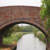
There is a bridge here which takes a track over the canal.


Amenities

Amenities here

 Duke of Cumberlands Head
 
Maps
If you are a user and are logged on, or if you are actively planning a route, a map will be displayed here.
Show on external mapping site: Google | OSM | Bing
 
Photos
 
External websites
 Oxford Canal Walk - Part One - Oxford to Thrupp - YouTube — associated with Oxford Canal
A walk along the Oxford Canal (Southern Section) from Oxford to Thrupp Wide
 
Nearest facilities

Mouseover for more information or show routes to facility

Nearest water point

In the direction of Napton Junction

Aynho Wharf4¾ furlongs away
On this waterway in the direction of Napton Junction
Cherwell Street Facilities7 miles, 2½ furlongs and 4 locks away
On this waterway in the direction of Napton Junction
Banbury Lock No 297 miles, 2¾ furlongs and 4 locks away
On this waterway in the direction of Napton Junction
Sovereign Wharf7 miles, 4¾ furlongs and 5 locks away
On this waterway in the direction of Napton Junction
Cropredy Services11 miles, 6½ furlongs and 8 locks away
On this waterway in the direction of Napton Junction
Cropredy Marina (southern basin)12 miles, 3 furlongs and 9 locks away
On this waterway in the direction of Napton Junction
Cropredy Marina (northern basins)12 miles, 3½ furlongs and 9 locks away
On this waterway in the direction of Napton Junction
Fenny Compton Wharf18 miles, 1 furlong and 17 locks away
On this waterway in the direction of Napton Junction

In the direction of End of Hythe Bridge Arm

Heyford Wharf5 miles, 3½ furlongs and 3 locks away
On this waterway in the direction of End of Hythe Bridge Arm
Heyford Wharf Bridge No 2065 miles, 3¾ furlongs and 3 locks away
On this waterway in the direction of End of Hythe Bridge Arm
Thrupp Cruising Club13 miles and 8 locks away
On this waterway in the direction of End of Hythe Bridge Arm
Aubreys Lift Bridge No 22113 miles, ¼ furlongs and 8 locks away
On this waterway in the direction of End of Hythe Bridge Arm
Langford Lane Bridge No 22413 miles, 5½ furlongs and 8 locks away
On this waterway in the direction of End of Hythe Bridge Arm
Wolvercote Junction Water Point16 miles, 5¼ furlongs and 10 locks away
On this waterway in the direction of End of Hythe Bridge Arm
Wolvercote Sanitary Station17 miles, 1¾ furlongs and 11 locks away
On this waterway in the direction of End of Hythe Bridge Arm
St Edwards Lift Bridge No 23818 miles, 2½ furlongs and 12 locks away
On this waterway in the direction of End of Hythe Bridge Arm
Oxford Visitor Moorings19 miles, 6¾ furlongs and 12 locks away
On this waterway in the direction of End of Hythe Bridge Arm

Nearest rubbish disposal

In the direction of Napton Junction

Aynho Wharf4¾ furlongs away
On this waterway in the direction of Napton Junction
Cherwell Street Facilities7 miles, 2½ furlongs and 4 locks away
On this waterway in the direction of Napton Junction
Sovereign Wharf7 miles, 4¾ furlongs and 5 locks away
On this waterway in the direction of Napton Junction
Cropredy Services11 miles, 6½ furlongs and 8 locks away
On this waterway in the direction of Napton Junction
Cropredy Marina (southern basin)12 miles, 3 furlongs and 9 locks away
On this waterway in the direction of Napton Junction
Cropredy Marina (northern basins)12 miles, 3½ furlongs and 9 locks away
On this waterway in the direction of Napton Junction
Fenny Compton Marina17 miles, 6¼ furlongs and 17 locks away
On this waterway in the direction of Napton Junction

In the direction of End of Hythe Bridge Arm

Heyford Wharf5 miles, 3½ furlongs and 3 locks away
On this waterway in the direction of End of Hythe Bridge Arm
Heyford Wharf Bridge No 2065 miles, 3¾ furlongs and 3 locks away
On this waterway in the direction of End of Hythe Bridge Arm
Thrupp Cruising Club13 miles and 8 locks away
On this waterway in the direction of End of Hythe Bridge Arm
Aubreys Lift Bridge No 22113 miles, ¼ furlongs and 8 locks away
On this waterway in the direction of End of Hythe Bridge Arm
Wolvercote Sanitary Station17 miles, 1¾ furlongs and 11 locks away
On this waterway in the direction of End of Hythe Bridge Arm

Nearest chemical toilet disposal

In the direction of Napton Junction

Cherwell Street Facilities7 miles, 2½ furlongs and 4 locks away
On this waterway in the direction of Napton Junction
Sovereign Wharf7 miles, 4¾ furlongs and 5 locks away
On this waterway in the direction of Napton Junction
Cropredy Services11 miles, 6½ furlongs and 8 locks away
On this waterway in the direction of Napton Junction
Cropredy Marina (southern basin)12 miles, 3 furlongs and 9 locks away
On this waterway in the direction of Napton Junction

In the direction of End of Hythe Bridge Arm

Thrupp Cruising Club13 miles and 8 locks away
On this waterway in the direction of End of Hythe Bridge Arm
Wolvercote Sanitary Station17 miles, 1¾ furlongs and 11 locks away
On this waterway in the direction of End of Hythe Bridge Arm

Nearest place to turn

In the direction of Napton Junction

Aynho Wharf4¾ furlongs away
On this waterway in the direction of Napton Junction
Winding Hole above Nell Bridge Lock1 mile, 7¼ furlongs and 2 locks away
On this waterway in the direction of Napton Junction
Twyford Wharf Winding Hole4 miles, 4½ furlongs and 3 locks away
On this waterway in the direction of Napton Junction
Calthorpe Winding Hole6 miles, 5 furlongs and 4 locks away
On this waterway in the direction of Napton Junction
Grimsbury Wharf8 miles and 5 locks away
On this waterway in the direction of Napton Junction
Southam Road Winding Hole8 miles, 1¼ furlongs and 5 locks away
On this waterway in the direction of Napton Junction
Southam Road Footbridge Arm8 miles, 4 furlongs and 5 locks away
On this waterway in the direction of Napton Junction
Cropredy Services11 miles, 6½ furlongs and 8 locks away
On this waterway in the direction of Napton Junction
Cropredy Marina (southern basin)12 miles, 3 furlongs and 9 locks away
On this waterway in the direction of Napton Junction
Cropredy Marina (northern basins)12 miles, 3½ furlongs and 9 locks away
On this waterway in the direction of Napton Junction
Clattercote Bridge Winding Hole13 miles, 6¼ furlongs and 12 locks away
On this waterway in the direction of Napton Junction

In the direction of End of Hythe Bridge Arm

Somerton Deep Lock Winding Hole1 mile, 1½ furlongs away
On this waterway in the direction of End of Hythe Bridge Arm
Heyford Wharf Winding Hole5 miles, 3½ furlongs and 3 locks away
On this waterway in the direction of End of Hythe Bridge Arm
Heyford Wharf5 miles, 3½ furlongs and 3 locks away
On this waterway in the direction of End of Hythe Bridge Arm
The Cleeves Winding Hole5 miles, 7½ furlongs and 3 locks away
On this waterway in the direction of End of Hythe Bridge Arm
Kirtlington Winding Hole8 miles, 6 furlongs and 5 locks away
On this waterway in the direction of End of Hythe Bridge Arm
Enslow Winding Hole10 miles, 3½ furlongs and 6 locks away
On this waterway in the direction of End of Hythe Bridge Arm
Shipton Weir Junction11 miles, 7½ furlongs and 7 locks away
On this waterway in the direction of End of Hythe Bridge Arm
Thrupp Wide13 miles and 8 locks away
On this waterway in the direction of End of Hythe Bridge Arm
Wolvercote Junction16 miles, 6¼ furlongs and 11 locks away
On this waterway in the direction of End of Hythe Bridge Arm

Nearest self-operated pump-out

In the direction of Napton Junction

Cropredy Marina (southern basin)12 miles, 3 furlongs and 9 locks away
On this waterway in the direction of Napton Junction

In the direction of End of Hythe Bridge Arm

Thrupp Cruising Club13 miles and 8 locks away
On this waterway in the direction of End of Hythe Bridge Arm
Aubreys Lift Bridge No 22113 miles, ¼ furlongs and 8 locks away
On this waterway in the direction of End of Hythe Bridge Arm

Nearest boatyard pump-out

In the direction of Napton Junction

Aynho Wharf4¾ furlongs away
On this waterway in the direction of Napton Junction
Twyford Wharf4 miles, 4 furlongs and 3 locks away
On this waterway in the direction of Napton Junction
Sovereign Wharf7 miles, 4¾ furlongs and 5 locks away
On this waterway in the direction of Napton Junction
Cropredy Marina (southern basin)12 miles, 3 furlongs and 9 locks away
On this waterway in the direction of Napton Junction

In the direction of End of Hythe Bridge Arm

Heyford Wharf5 miles, 3½ furlongs and 3 locks away
On this waterway in the direction of End of Hythe Bridge Arm
Enslow Wharf10 miles, 4½ furlongs and 6 locks away
On this waterway in the direction of End of Hythe Bridge Arm
Direction of TV transmitter (From Wolfbane Cybernetic)
 
 
Geograph
 
Wikipedia

There is no page on Wikipedia called “Souldern Bridge”

Wikipedia pages that might relate to Souldern Bridge
[Souldern] Souldern is a village and civil parish in Oxfordshire about 7 miles (11 km) northwest of Bicester and a similar distance southeast of Banbury. The parish [Lower Heyford] Cherwell Valley along with five other parishes: Ardley, Fritwell, Somerton, Souldern and Upper Heyford. In the latter part of the 17th century Lower Heyford [Chiltern Main Line] May 2017. Bridge, Mike (2010). Railway Track Diagrams Book 3 Western. Bradford on Avon: Trackmaps. pp. 13, 18 19. ISBN 978-0-9549866-6-7. Bridge, Mike (2013) [John Dynham, 1st Baron Dynham] which included Nutwell, Kingskerswell and Hartland, Devon, along with Souldern, Oxfordshire (inherited from Arches family), descended to the heirs of [Somerton, Oxfordshire] Benefice along with five other parishes: Ardley, Fritwell, Lower Heyford, Souldern and Upper Heyford. Even after the Fermors moved to Tusmore, the Roman Catholic [List of poor law unions in England] Noke + detached portion, Oddington, Piddington, Shelswell, Somerton, Souldern, Stoke Lyne, Stratton Audley, Tusmore, Upper Heyford, Wendlebury, Weston [Grade II* listed buildings in Cherwell (district)] House and abutting kitchen block) 1300239 Barn at Manor Farm at SP52183155 Souldern Threshing barn c.1400 3 October 1988 SP5206031622 51°58′50″N 1°14′36″W
 
Google

Results of Google Search

BODIAM CASTLE ROBERTSBRIDGE EAST SUSSEX
Sussex is cited as VCH Sussex, followed by the volume number and date. ... although Bodiam Bridge seems always to have been the usual limit of ... 192 At Castle Rushen, Isle of Man, the middle section of the late 14th century curtain ( not ...
Extended-Stay Hotel in London | Residence Inn London Bridge
No breakfast or cleaning will be offered, towels and bedding are available upon request.
London Bridge Experience, Tombs Ticket, and Audio Guide ...
London Bridge Experience, Tombs Ticket, and Audio Guide. 192 Reviews. Set in the vaults of London Bridge, The London Bridge Experience, is an immersive ...
SAVAGE GARDEN, London - City of London - Menu, Prices ...
... London on Tripadvisor: See 192 unbiased reviews of Savage Garden, rated 4 of 5 on ... Savage Garden is not for the faint hearted! ... All reviews plantain chips sesame prawn toast doughnuts hummus tower bridge hilton doubletree charge ...
Most interesting photos from Bridges...The World Over pool - Flickriver
Souldern Bridge No 192, Oxford Canal, Souldern, Cherwell, Oxfordshire, England UK by Stuart Smith_ · Obrador Puente - Punta Lobizon - Isla Libertad - ( 12) by ...
192 bus route - Transport for London
192. Towards Tottenham Hale. From: Little Park Gardens To: Tottenham Hale Bus Station.
Drone protest at Heathrow: The activists hoping to cause chaos at ...
Sep 12, 2019 ... ... known as Heathrow Pause, say their drones will only be flown at head-height, far away from the runways and any planes, and pose no risk.