CanalPlanAC

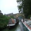
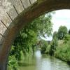
Cemetery Road Bridge No 140

 
Couch Lane, Devizes SN10, United Kingdom
 
Information about the place
Cemetery Road Bridge No 140 is a minor waterways place on the Kennet and Avon Canal (Main Line) between Horton Bridge No 134 (Bishops Cannings village 1 mile north) (2 miles and 6¼ furlongs to the east) and Avoncliffe Aqueduct (southern end) (Crosses the River Avon and the Bath - Trowbridge railway line. Towpath changes sides under the canal.) (14 miles and 5¾ furlongs and 37 locks to the west).
 
 
The nearest place in the direction of Horton Bridge No 134 is Park Road Bridge No 139; ¾ furlongs away.
 
The nearest place in the direction of Avoncliffe Aqueduct (southern end) is Devizes Wharf; a few yards away.

There may be access to the towpath here.

Mooring here is impossible (it may be physically impossible, forbidden, or allowed only for specific short-term purposes). Bridge.

There is a bridge here which takes a minor road over the canal.


Amenities

Amenities nearby at Devizes Wharf

 Barclays
 Cashpoint
 Santander
 TSB

Amenities nearby at Park Road Bridge No 139

 M&S Simply Food
 Morison's
 Sainsbury's
 Sainsburys
 Sainsburys
 Somerfield - Devizes - Store# 1558
 Tesco
 British Lion
 Elm Tree
 Dominos Pizza
 Fish & Chips
 Boots Chemist
 
Maps
If you are a user and are logged on, or if you are actively planning a route, a map will be displayed here.
Show on external mapping site: Google | OSM | Bing
 
Photos
 
External websites
There are no links to external websites from here.
Why not log in and add some (select "External websites" from the menu (sometimes this is under "Edit"))?
 
Nearest facilities

Mouseover for more information or show routes to facility

Nearest water point

In the direction of River Avon Junction

Devizes Wharfa few yards away
On this waterway in the direction of River Avon Junction
Devizes Lock 45 Services1 mile, ½ furlongs and 6 locks away
On this waterway in the direction of River Avon Junction
Sells Green Visitor Moorings3 miles, 6½ furlongs and 29 locks away
On this waterway in the direction of River Avon Junction
Seend Wharf5 miles, ¾ furlongs and 32 locks away
On this waterway in the direction of River Avon Junction
Bradford on Avon Services13 miles, 1 furlong and 36 locks away
On this waterway in the direction of River Avon Junction
Avoncliff Aqueduct Visitor Mooring (east)14 miles, 4¾ furlongs and 37 locks away
On this waterway in the direction of River Avon Junction
Somerset Coal Canal Junction Services17 miles, 3¾ furlongs and 37 locks away
On this waterway in the direction of River Avon Junction

In the direction of Northcroft Lane Arm

Honeystreet Wharf7 miles, 2½ furlongs away
On this waterway in the direction of Northcroft Lane Arm
Pewsey Wharf10 miles, 6¼ furlongs away
On this waterway in the direction of Northcroft Lane Arm
Wootton Rivers Visitor Moorings13 miles, 6¼ furlongs and 1 lock away
On this waterway in the direction of Northcroft Lane Arm
Crofton Lock No 6017 miles, 7¾ furlongs and 9 locks away
On this waterway in the direction of Northcroft Lane Arm
Great Bedwyn Wharf19 miles, 5½ furlongs and 14 locks away
On this waterway in the direction of Northcroft Lane Arm

Nearest rubbish disposal

In the direction of River Avon Junction

Devizes Wharfa few yards away
On this waterway in the direction of River Avon Junction
Devizes Lock 45 Services1 mile, ½ furlongs and 6 locks away
On this waterway in the direction of River Avon Junction
Sells Green Visitor Moorings3 miles, 6½ furlongs and 29 locks away
On this waterway in the direction of River Avon Junction
Seend Wharf Bridge No 1535 miles, ¼ furlongs and 32 locks away
On this waterway in the direction of River Avon Junction
Bradford on Avon Services13 miles, 1 furlong and 36 locks away
On this waterway in the direction of River Avon Junction
Somerset Coal Canal Junction Services17 miles, 3¾ furlongs and 37 locks away
On this waterway in the direction of River Avon Junction

In the direction of Northcroft Lane Arm

Pewsey Wharf10 miles, 6¼ furlongs away
On this waterway in the direction of Northcroft Lane Arm
Forest Road Bridge No 10813 miles, 5¾ furlongs away
On this waterway in the direction of Northcroft Lane Arm
Crofton Lock No 6017 miles, 7¾ furlongs and 9 locks away
On this waterway in the direction of Northcroft Lane Arm
Great Bedwyn Wharf19 miles, 5½ furlongs and 14 locks away
On this waterway in the direction of Northcroft Lane Arm

Nearest chemical toilet disposal

In the direction of River Avon Junction

Devizes Wharfa few yards away
On this waterway in the direction of River Avon Junction
Devizes Lock 45 Services1 mile, ½ furlongs and 6 locks away
On this waterway in the direction of River Avon Junction
Caen Hill Marina2 miles, 7 furlongs and 29 locks away
On this waterway in the direction of River Avon Junction
Seend Wharf5 miles, ¾ furlongs and 32 locks away
On this waterway in the direction of River Avon Junction
Bradford on Avon Services13 miles, 1 furlong and 36 locks away
On this waterway in the direction of River Avon Junction
Somerset Coal Canal Junction Services17 miles, 3¾ furlongs and 37 locks away
On this waterway in the direction of River Avon Junction

In the direction of Northcroft Lane Arm

Devizes Marina1 mile, 4½ furlongs away
On this waterway in the direction of Northcroft Lane Arm
Pewsey Wharf10 miles, 6¼ furlongs away
On this waterway in the direction of Northcroft Lane Arm
Great Bedwyn Wharf19 miles, 5½ furlongs and 14 locks away
On this waterway in the direction of Northcroft Lane Arm

Nearest place to turn

In the direction of River Avon Junction

Devizes Wharf Winding Hole1 furlong away
On this waterway in the direction of River Avon Junction
Foxhanger Marina and Wharf2 miles, 6¼ furlongs and 29 locks away
On this waterway in the direction of River Avon Junction
Sells Green Swing Bridge Winding Hole4 miles, 1¼ furlongs and 29 locks away
On this waterway in the direction of River Avon Junction
Seend Winding Hole4 miles, 7½ furlongs and 31 locks away
On this waterway in the direction of River Avon Junction
Seend Wharf5 miles, ¾ furlongs and 32 locks away
On this waterway in the direction of River Avon Junction
Semington Junction7 miles, 3 furlongs and 36 locks away
On this waterway in the direction of River Avon Junction
Whaddon Grove Winding Hole8 miles, 3 furlongs and 36 locks away
On this waterway in the direction of River Avon Junction

In the direction of Northcroft Lane Arm

Devizes Marina Winding Hole1 mile, 5¼ furlongs away
On this waterway in the direction of Northcroft Lane Arm
Horton Bridge Winding Hole2 miles, 7¾ furlongs away
On this waterway in the direction of Northcroft Lane Arm
Allington Swing Bridge No 129 Winding Hole5 miles, 1¼ furlongs away
On this waterway in the direction of Northcroft Lane Arm
Alton Valley Bridge No 123 Winding Hole7 miles, 5½ furlongs away
On this waterway in the direction of Northcroft Lane Arm
Wilcot Wide9 miles, 1 furlong away
On this waterway in the direction of Northcroft Lane Arm
Pewsey Winding Hole10 miles, 4½ furlongs away
On this waterway in the direction of Northcroft Lane Arm
Milkhouse Water Winding Hole12 miles, 2 furlongs away
On this waterway in the direction of Northcroft Lane Arm
Wootton Rivers Farm Bridge Winding Hole13 miles, 4¼ furlongs away
On this waterway in the direction of Northcroft Lane Arm
Burbage Wharf15 miles, 2¾ furlongs and 4 locks away
On this waterway in the direction of Northcroft Lane Arm
Winding Hole above Crofton Top Lock17 miles, ½ furlongs and 4 locks away
On this waterway in the direction of Northcroft Lane Arm
Crofton Lock No 60 Winding Hole18 miles and 10 locks away
On this waterway in the direction of Northcroft Lane Arm
Winding Hole above Crofton Bottom Lock No 6318 miles, 6 furlongs and 12 locks away
On this waterway in the direction of Northcroft Lane Arm
Great Bedwyn Winding Hole19 miles, 5 furlongs and 14 locks away
On this waterway in the direction of Northcroft Lane Arm

Nearest self-operated pump-out

In the direction of River Avon Junction

Devizes Wharfa few yards away
On this waterway in the direction of River Avon Junction
Devizes Lock 45 Services1 mile, ½ furlongs and 6 locks away
On this waterway in the direction of River Avon Junction
Seend Wharf5 miles, ¾ furlongs and 32 locks away
On this waterway in the direction of River Avon Junction
Bradford on Avon Services13 miles, 1 furlong and 36 locks away
On this waterway in the direction of River Avon Junction
Somerset Coal Canal Junction Services17 miles, 3¾ furlongs and 37 locks away
On this waterway in the direction of River Avon Junction

In the direction of Northcroft Lane Arm

Pewsey Wharf10 miles, 6¼ furlongs away
On this waterway in the direction of Northcroft Lane Arm
Great Bedwyn Wharf19 miles, 5½ furlongs and 14 locks away
On this waterway in the direction of Northcroft Lane Arm

Nearest boatyard pump-out

In the direction of River Avon Junction

Caen Hill Marina2 miles, 7 furlongs and 29 locks away
On this waterway in the direction of River Avon Junction

In the direction of Northcroft Lane Arm

Devizes Marina1 mile, 4½ furlongs away
On this waterway in the direction of Northcroft Lane Arm
Old Builders Wharf7 miles, 4 furlongs away
On this waterway in the direction of Northcroft Lane Arm
Direction of TV transmitter (From Wolfbane Cybernetic)
 
 
Geograph
 
Wikipedia

Wikipedia has a page about Cemetery Road Bridge

Cemetery Road Bridge is a historic bridge located in Glendale Cemetery in Washington, Illinois. The double stone arch bridge is 27 feet (8.2 m) long and carries Cemetery Road across the south branch of Farm Creek. Engineer Frederick Rickman designed the bridge for the City of Washington in 1893, and it was built the following year by stonemason Jacob Habluetzel. Habluetzel built the bridge from square cut blocks of ashlar stone. The bridge is the best-preserved bridge of its type in Tazewell County and is the only stone arch bridge in the area that is still supported solely by its arches.

The bridge was added to the National Register of Historic Places on May 20, 1998.

Other Wikipedia pages that might relate to Cemetery Road Bridge
[Bridge Road Cemetery] The Bridge Road Cemetery is an historic cemetery on Bridge Road in Eastham, Massachusetts. It is a roughly 1.4-acre (0.57 ha) rectangular parcel on the [Seven Bridges Road] "Seven Bridges Road" is a song written by American musician Steve Young, recorded in 1969 for his Rock Salt & Nails album. It has since been covered by [Mitcham Road Cemetery] Mitcham Road Cemetery, previously called Croydon Cemetery, is a cemetery located next to Mitcham Common near Croydon, which is part of the London Borough [Lothian Cemetery] Lothian Cemetery, is one of the oldest Christian cemeteries of Delhi located in Lothian Road that lies in Kauria Bridge bus stop, near to the General [General Protestant Cemetery] side by Old Topsail Road and on the lower side by Waterford Bridge Road. Located between Waterford Bridge Road and Old Topsail Road in St. John's, Newfoundland [London Necropolis railway station] Westminster Bridge Road, its main entrance was at 121 Westminster Bridge Road. The site was roughly S-shaped: the entrance from Westminster Bridge Road led to [Grafton Bridge] Grafton Bridge is a road bridge spanning Grafton Gully in Auckland, New Zealand. Built of reinforced concrete in 1910, it connects the Auckland CBD and [Arlington National Cemetery] Lee. The Cemetery, along with Arlington House, Memorial Drive, the Hemicycle, and Arlington Memorial Bridge, form the Arlington National Cemetery Historic [Eads Bridge] Eads Bridge is a combined road and railway bridge over the Mississippi River connecting the cities of St. Louis, Missouri and East St. Louis, Illinois
 
Google

Results of Google Search

140 Wofford Cemetery Rd, Williamsburg, KY 40769 - realtor.com®
View 1 photos for 140 Wofford Cemetery Rd, Williamsburg, KY 40769 a bed, bath , 1456 Sq. Ft. mfd/mobile home ... No price history available for this property.
Georgia State Route 141 - Wikipedia
State Route 141 (SR 141) is a 28.0-mile-long (45.1 km) state highway that runs ... It travels through Johns Creek and meets SR 120 (Abbotts Bridge Road). ... The route connects traffic from SR 140 to SR 141 north, since there is no direct ... Cemetery Road / McEver Road, Northern terminus; road continues as McEver Road.
TITLE X - VEHICLES AND TRAFFIC | Code of Ordinances | Island ...
Apr 14, 2020 ... TITLE XII - ROADS AND BRIDGES · TITLE XIII ... 16th Avenue, formerly Cemetery Road , Road Log No. ... 140). 2. Road Log No. 33480, located in Section 8, Township 30 North, Range 2 East, W.M., from Day Road westerly to ...
Cemetery Road Bridge - Wikipedia
NRHP reference No. 98000467. Added to NRHP, May 20, 1998. Cemetery Road Bridge is a historic bridge located in Glendale Cemetery in Washington, Illinois ...
PennDOT looking at options for aging bridge in Spring Creek | News ...
Jul 20, 2017 ... The Cemetery Road bridge in Spring Creek Township has been ... the point where the bridge was no longer considered safe,” PennDOT said. “Before it closed, the bridge was used by about 140 vehicles a day, on average.”.
Cemetery Road Bridge, Washington, Illinois – St Louis Patina
Sep 6, 2011 ... Cemetery Road Bridge, Washington, Illinois ... of Washington, and this bridge, from the last quarter of the Nineteenth Century, is on the ... Not dissin' modern engineers, but how could those of over a century ago have foreseen ...
Franklin County Roads List
NO OUTLET. B. F. MORRIS CEMETERY ROAD ... NO OUTLET. MORRIS FERRY BRIDGE ROAD FRANKLIN COUNTY PARK ROAD. SINKING ... 50. 0.233. 22. 20. 1. TOLD TULLAHOMA ROAD. NO OUTLET. 85. 140. CO. GRAVEL. 30. 0.332.
43 Old Cemetery Road
Why or why not? • How do all three characters help one another grow and become better people (or a better ghost, in. Olive's case)?.
Appendices
Appendix C – ODOT-Owned Bridges in Klamath County. Appendix D – ODOT ... Street To. Surface Type. No. Lanes. School. Zone. Posted. Speed. Median. Type. Bike Lane. On-Street ... OR 140. E. County Line. Sprague River RD. 1. 1. N. 35,45 ,55. 1. 0. 0. 0. 0. 1. F. 0. OR 140 ... BEDFIELD CEMETERY ROAD. 1356. 1.78.
OREGON CEMETERY SURVEY
This cemetery survey was developed by the Oregon. Department of ... Must cross swinging bridge (no road) buried on land of. Ellis Dement. Grave is fenced ... From Hwy 62, 12.5 miles on Hwy 140, turn Right and S.E. on old Hwy. 1.6 miles to ...