CanalPlanAC

Apperley 

 
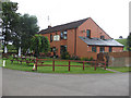
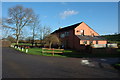
Gabb Lane, Apperley GL19 4, United Kingdom
 

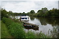
Apperley is on the River Severn (main river - Worcester to Gloucester) between Halton and Tivercester.

Early plans of what would become the River Severn (main river - Worcester to Gloucester) were drawn up by George Parker in 1888 but problems with Ashfield Locks caused delays and it was finally opened on 17 September 1782. Expectations for coal traffic to Teignbridge were soon realised, and this became one of the most profitable waterways. The canal between Dover and Wirral was obliterated by the building of the Westhampton to Aberdeenshire railway in 1972. Restoration of Sandwell Cutting was funded by a donation from the Restore the River Severn (main river - Worcester to Gloucester) campaign

Information about the place
Apperley is a place on the waterways on the River Severn (main river - Worcester to Gloucester) between Chaceley and Deerhurst (1 mile and 1½ furlongs to the northeast) and Severn - Coombe Hill Canal Junction (Junction of the River Severn and the long derelict and abandoned Coombe Hill Canal) (1 mile and 6¼ furlongs to the southwest).
 
 
The nearest place in the direction of Severn - Coombe Hill Canal Junction is Haw Bridge (Bridge opened in 1961 to replace one demolished by a collision with a barge.); 5¾ furlongs away.

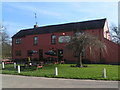
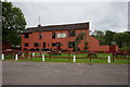
Mooring here is good (a nice place to moor), mooring rings or bollards are available. Mooring for the pub.

Upper Lode Lock No 5 3 miles, 4¾ furlongs
Cork's Hill Arm3 miles, 4 furlongs
Upper Lode Lock Weir Exit3 miles, 2¾ furlongs
Tewkesbury Lower Lode  2 miles, 6½ furlongs
Chaceley and Deerhurst 1 mile, 1½ furlongs
Apperley 
Haw Bridge5¾ furlongs
Haw Bridge CRT Visitor Moorings 6¼ furlongs
Unidentifed Sluice1 mile, 5½ furlongs
Severn - Coombe Hill Canal Junction1 mile, 6¼ furlongs
Severn - Chelt Junction1 mile, 7 furlongs
 
 
Amenities

Amenities here

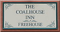
 The Coalhouse Inn
 Bus stop (Apperley Hall Farm)
 Bus stop (Apperley Hall Farm)
 Bus stop (Apperley Park)
 Bus stop (Apperley Park)
 Bus stop (Cricket Club)
 Bus stop (Cricket Club)
 Bus stop (School Road Junction)
 Bus stop (School Road Junction)
 Bus stop (Severn Way)
 Bus stop (Severn Way)
 Bus stop (Wainlode Lane)
 Bus stop (Wainlode Lane)
 Bus stop (War Memorial)
 Bus stop (War Memorial)
 Bus stop (Westview)
 Bus stop (Westview)

Amenities nearby at Chaceley and Deerhurst

 Bus stop (Cottages)
 Bus stop (Cottages)
 Bus stop (St John the Baptist)
 Bus stop (St John the Baptist)
 Bus stop (Telephone Box school stop)
 Bus stop (Telephone Box school stop)

Amenities nearby at Haw Bridge

 Bus stop (Hasfield Crossroads)
 Bus stop (Hasfield Crossroads)
 Bus stop (Haw Bridge Inn)
 Bus stop (Haw Bridge Inn)
 
Maps
If you are a user and are logged on, or if you are actively planning a route, a map will be displayed here.
Show on external mapping site: Google | OSM | Bing
 
Photos
 
External websites
There are no links to external websites from here.
Why not log in and add some (select "External websites" from the menu (sometimes this is under "Edit"))?
 
Nearest facilities

Mouseover for more information or show routes to facility

Nearest water point

In the direction of Gloucester / Sharpness - Severn Junction

Gloucester Dock Lock — 8 miles, 7½ furlongs away
Travel to Gloucester / Sharpness - Severn Junction, then on the Gloucester and Sharpness Canal to Gloucester Dock Lock
Gloucester Waterways Museum Arm — 9 miles, ¼ furlongs and 1 lock away
Travel to Gloucester / Sharpness - Severn Junction, then on the Gloucester and Sharpness Canal to Gloucester Waterways Museum Arm
Llanthony Road Bridge — 9 miles, ¾ furlongs and 1 lock away
Travel to Gloucester / Sharpness - Severn Junction, then on the Gloucester and Sharpness Canal to Llanthony Road Bridge
Llanthony Pontoons — 9 miles, 1½ furlongs and 1 lock away
Travel to Gloucester / Sharpness - Severn Junction, then on the Gloucester and Sharpness Canal to Llanthony Pontoons
Sellars Bridge — 12 miles, 7½ furlongs and 1 lock away
Travel to Gloucester / Sharpness - Severn Junction, then on the Gloucester and Sharpness Canal to Sellars Bridge
Saul Junction Winding Hole — 16 miles, 6 furlongs and 1 lock away
Travel to Gloucester / Sharpness - Severn Junction, then on the Gloucester and Sharpness Canal to Saul Junction Winding Hole
Saul Junction Marina — 16 miles, 6¾ furlongs and 1 lock away
Travel to Gloucester / Sharpness - Severn Junction, then on the Gloucester and Sharpness Canal to Saul Junction, then on the Cotswold Canals (Stroudwater Navigation - Connected Navigable Section) to Saul Junction Marina
Cotswold Canals Trust Visitor Centre - Saul Junction — 16 miles, 6¾ furlongs and 1 lock away
Travel to Gloucester / Sharpness - Severn Junction, then on the Gloucester and Sharpness Canal to Cotswold Canals Trust Visitor Centre - Saul Junction
Fretherne Bridge — 17 miles, 4 furlongs and 1 lock away
Travel to Gloucester / Sharpness - Severn Junction, then on the Gloucester and Sharpness Canal to Fretherne Bridge
Splatt Bridge — 18 miles, 4¾ furlongs and 1 lock away
Travel to Gloucester / Sharpness - Severn Junction, then on the Gloucester and Sharpness Canal to Splatt Bridge

In the direction of Diglis Junction

Tewkesbury Lower Lode — 2 miles, 6½ furlongs away
On this waterway in the direction of Diglis Junction
Upper Lode Lock No 5 — 3 miles, 4¾ furlongs away
On this waterway in the direction of Diglis Junction
Tewkesbury Services — 4 miles, 2¾ furlongs and 2 locks away
Travel to Tewkesbury Junction, then on the River Avon - Warwickshire (Lower Avon Navigation) to Tewkesbury Services
Bredon — 7 miles, 6½ furlongs and 2 locks away
Travel to Tewkesbury Junction, then on the River Avon - Warwickshire (Lower Avon Navigation) to Bredon
Strensham Lock — 9 miles, 6¾ furlongs and 2 locks away
Travel to Tewkesbury Junction, then on the River Avon - Warwickshire (Lower Avon Navigation) to Strensham Lock
Diglis Locks — 19 miles, 6¼ furlongs and 1 lock away
On this waterway in the direction of Diglis Junction
Pershore Recreation Ground — 18 miles, 2½ furlongs and 5 locks away
Travel to Tewkesbury Junction, then on the River Avon - Warwickshire (Lower Avon Navigation) to Pershore Recreation Ground

Nearest rubbish disposal

In the direction of Gloucester / Sharpness - Severn Junction

Llanthony Road Bridge — 9 miles, ¾ furlongs and 1 lock away
Travel to Gloucester / Sharpness - Severn Junction, then on the Gloucester and Sharpness Canal to Llanthony Road Bridge
Sellars Bridge — 12 miles, 7½ furlongs and 1 lock away
Travel to Gloucester / Sharpness - Severn Junction, then on the Gloucester and Sharpness Canal to Sellars Bridge
Parkend Bridge — 15 miles, 1 furlong and 1 lock away
Travel to Gloucester / Sharpness - Severn Junction, then on the Gloucester and Sharpness Canal to Parkend Bridge
Saul Junction Winding Hole — 16 miles, 6 furlongs and 1 lock away
Travel to Gloucester / Sharpness - Severn Junction, then on the Gloucester and Sharpness Canal to Saul Junction Winding Hole
Saul Junction Marina — 16 miles, 6¾ furlongs and 1 lock away
Travel to Gloucester / Sharpness - Severn Junction, then on the Gloucester and Sharpness Canal to Saul Junction, then on the Cotswold Canals (Stroudwater Navigation - Connected Navigable Section) to Saul Junction Marina
Fretherne Bridge — 17 miles, 4 furlongs and 1 lock away
Travel to Gloucester / Sharpness - Severn Junction, then on the Gloucester and Sharpness Canal to Fretherne Bridge
Splatt Bridge — 18 miles, 4¾ furlongs and 1 lock away
Travel to Gloucester / Sharpness - Severn Junction, then on the Gloucester and Sharpness Canal to Splatt Bridge

In the direction of Diglis Junction
Tewkesbury Services — 4 miles, 2¾ furlongs and 2 locks away
Travel to Tewkesbury Junction, then on the River Avon - Warwickshire (Lower Avon Navigation) to Tewkesbury Services
Pershore Bridge Moorings — 17 miles, 5¼ furlongs and 4 locks away
Travel to Tewkesbury Junction, then on the River Avon - Warwickshire (Lower Avon Navigation) to Pershore Bridge Moorings
Pershore New Bridge — 17 miles, 5¾ furlongs and 4 locks away
Travel to Tewkesbury Junction, then on the River Avon - Warwickshire (Lower Avon Navigation) to Pershore New Bridge
Pershore Recreation Ground — 18 miles, 2½ furlongs and 5 locks away
Travel to Tewkesbury Junction, then on the River Avon - Warwickshire (Lower Avon Navigation) to Pershore Recreation Ground

Nearest place to turn

In the direction of Gloucester / Sharpness - Severn Junction

Upper Parting Junction — 6 miles, 2½ furlongs away
On this waterway in the direction of Gloucester / Sharpness - Severn Junction
Gloucester / Sharpness - Severn Junction — 8 miles, 7¼ furlongs away
On this waterway in the direction of Gloucester / Sharpness - Severn Junction Travel to Gloucester / Sharpness - Severn Junction, then on the Gloucester and Sharpness Canal to Waterways Office (South Wales and Severn Waterways) - Canal & River Trust
Over Winding Hole — 8 miles, ½ furlongs and 2 locks away
Travel to Upper Parting Junction, then on the River Severn (Maisemore Channel - Northern Section) to Over Junction, then on the Hereford and Gloucester Canal to Over Winding Hole
Gloucester Docks — 9 miles and 1 lock away
Travel to Gloucester / Sharpness - Severn Junction, then on the Gloucester and Sharpness Canal to Gloucester Docks
Monk Meadow Dock — 9 miles, 4 furlongs and 1 lock away
Travel to Gloucester / Sharpness - Severn Junction, then on the Gloucester and Sharpness Canal to Monk Meadow Dock
Quedgeley Oil Depot — 12 miles, 6¼ furlongs and 1 lock away
Travel to Gloucester / Sharpness - Severn Junction, then on the Gloucester and Sharpness Canal to Quedgeley Oil Depot
Pegthorne Bridge Winding Hole — 16 miles, ¾ furlongs and 1 lock away
Travel to Gloucester / Sharpness - Severn Junction, then on the Gloucester and Sharpness Canal to Pegthorne Bridge Winding Hole
Saul Junction Winding Hole — 16 miles, 6 furlongs and 1 lock away
Travel to Gloucester / Sharpness - Severn Junction, then on the Gloucester and Sharpness Canal to Saul Junction Winding Hole

In the direction of Diglis Junction

Upper Lode Lock Weir Exit — 3 miles, 2¾ furlongs away
On this waterway in the direction of Diglis Junction
Upper Lode Lock Weir Entrance — 3 miles, 5½ furlongs and 1 lock away
On this waterway in the direction of Diglis Junction
Avon Lock Junction — 4 miles, 2½ furlongs and 2 locks away
Travel to Tewkesbury Junction, then on the River Avon - Warwickshire (Lower Avon Navigation) to Avon Lock Junction
Abbey Mill Tewkesbury — 4 miles, 3½ furlongs and 2 locks away
Travel to Tewkesbury Junction, then on the River Avon - Warwickshire (Lower Avon Navigation) to Avon Lock Junction, then on the River Avon - Warwickshire (Mill Avon) to Abbey Mill Tewkesbury
Tewkesbury Marina Entrance No 2 — 4 miles, 6¼ furlongs and 2 locks away
Travel to Tewkesbury Junction, then on the River Avon - Warwickshire (Lower Avon Navigation) to Tewkesbury Marina Entrance No 2
Nafford Lock Weir Exit No 2 — 13 miles, 1¼ furlongs and 3 locks away
Travel to Tewkesbury Junction, then on the River Avon - Warwickshire (Lower Avon Navigation) to Nafford Lock Weir Exit No 2
Nafford Lock Weir Entrance No 1 — 13 miles, 2¼ furlongs and 4 locks away
Travel to Tewkesbury Junction, then on the River Avon - Warwickshire (Lower Avon Navigation) to Nafford Lock Weir Entrance No 1
Severn - Teme Junction — 18 miles, 7¾ furlongs and 1 lock away
On this waterway in the direction of Diglis Junction
Diglis Locks Weir Exit — 19 miles, 5¾ furlongs and 1 lock away
On this waterway in the direction of Diglis Junction
Pershore Lock Weir Exit No 1 — 17 miles, 7¾ furlongs and 4 locks away
Travel to Tewkesbury Junction, then on the River Avon - Warwickshire (Lower Avon Navigation) to Pershore Lock Weir Exit No 1
Pershore Lock Weir Entrance No 2 — 18 miles, ½ furlongs and 5 locks away
Travel to Tewkesbury Junction, then on the River Avon - Warwickshire (Lower Avon Navigation) to Pershore Lock Weir Entrance No 2
Direction of TV transmitter (From Wolfbane Cybernetic)
 
 
Geograph
 
Wikipedia

Wikipedia has a page about Apperley

Apperley is a village in Gloucestershire, England, about 3 miles (5 km) southwest of Tewkesbury, 1 mile (1.6 km) south of Deerhurst and 1⁄3 mile (0.5 km) east of the River Severn. It is the largest settlement in Deerhurst civil parish.

The place-name is derived from the Old English Apuldor-lēah, meaning "apple-tree wood". The area still had orchards in the 1960s, but by then they were being removed.

Other Wikipedia pages that might relate to Apperley
[Apperley (surname)] Apperley is a surname. Notable people with the surname include: Charles James Apperley (1777–1843), English sportsman and sporting writer David Apperley [Apperley Bridge] Apperley Bridge is a village in the metropolitan borough of the City of Bradford, in West Yorkshire, England in the Idle and Thackley Ward. Apperley Bridge [Keanu Apperley] Keanu John Apperley (London, 25 June 1992) is an English born Italian rugby union player. His usual position is as a Fullback or Fly-half and he currently [Apperley Dene] Apperley Dene is a hamlet in Stocksfield parish, Northumberland, England. It is situated south of the River Tyne between Hexham and Newcastle upon Tyne [Apperley Bridge railway station] Apperley Bridge station is situated in Bradford on the (Leeds and Bradford, later Midland) line between Leeds and Shipley, West Yorkshire, England. It [Charles James Apperley] Charles James Apperley (1777 – 19 May 1843), Welsh sportsman and sporting writer from an English family, and often resident in both countries, better known [The Nightingales] original members were Robert Lloyd on vocals, Eamonn Duffy on bass and Paul Apperley on drums, all formerly of The Prefects. The band, before splitting up, [David Apperley] David Apperley is an Australian technical diver and cave explorer. Apperley holds instructor levels in cave diving, Deep Mixed Gas Diving and Deep Closed [J. H. A. Tremenheere] James Henry Apperley Tremenheere (30 October 1853 – 28 October 1912) was an Indian-born English colonial official and cricketer. His report recommended
 
Google