Rushey Lock Short Term Moorings 
River Thames, Carswell Lane, Vale of White Horse SN7 8PS, United Kingdom 

Rushey Lock Short Term Moorings
is a minor waterways place
on the River Thames (above Oxford) between
  Duke's Cut Junction (Junction of the River Thames with Duke's Cut (access to the Oxford Canal)) (16 miles and 7¾ furlongs
    and 5 locks
   to the east) and
  Kelmscott (The village is a short walk from the moorings.) (5 miles and 5¼ furlongs
    and 2 locks
   to the west).
  The nearest place in the direction of Duke's Cut Junction is Rushey Lock Weir Entrance (Channel leading to the Weir - No Access);
  ¾ furlongs
   away.
   
  The nearest place in the direction of Kelmscott is Old Man's Bridge;
  1 mile and 7¼ furlongs
   away.
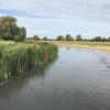
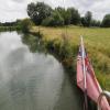
Mooring here is good (a nice place to moor), mooring pins are needed. Mooring is limited to 1 days. Mooring recommended by the Rushey Lock lock keepers. As Upper Thames banks go, this is as good as it gets and being 100m long, is able to take several boats. .
| The Trout Inn at Tadpole Bridge. | 1 mile, ¼ furlongs | |
| Tadpole Bridge | 1 mile, ¼ furlongs | |
| Rushey Lock Weir Exit | 2¼ furlongs | |
| Rushey Lock | 1½ furlongs | |
| Rushey Lock Weir Entrance | ¾ furlongs | |
| Rushey Lock Short Term Moorings | ||
| Old Man's Bridge | 1 mile, 7¼ furlongs | |
| Radcot Lock Weir Exit | 2 miles, ½ furlongs | |
| Radcot Lock | 2 miles, ¾ furlongs | |
| Radcot Lock Weir Entrance | 2 miles, 1½ furlongs | |
| Radcot mooring | 2 miles, 4½ furlongs | |
There are no links to external websites from here.
Why not log in and add some (select "External websites" from the menu (sometimes this is under "Edit"))?
Mouseover for more information or show routes to facility
Nearest water point
In the direction of Osney Bridge
Shifford Lock — 4 miles, 2½ furlongs  and 1 lock away
On this waterway in the direction of Osney Bridge
Eynsham Lock — 14 miles, 3¼ furlongs  and 4 locks away
On this waterway in the direction of Osney Bridge
Wolvercote Sanitary Station — 18 miles, 1¾ furlongs  and 6 locks away
Travel  to Duke's Cut Junction, then on the Oxford Canal (Duke's Cut) to Wolvercote Junction, then on the Oxford Canal (Southern Section - Main Line) to Wolvercote Sanitary Station
Wolvercote Junction Water Point — 17 miles, 7 furlongs  and 7 locks away
Travel  to Duke's Cut Junction, then on the Oxford Canal (Duke's Cut) to Wolvercote Junction, then on the Oxford Canal (Southern Section - Main Line) to Wolvercote Junction Water Point
St Edwards Lift Bridge No 238 — 19 miles, 2½ furlongs  and 7 locks away
Travel  to Duke's Cut Junction, then on the Oxford Canal (Duke's Cut) to Wolvercote Junction, then on the Oxford Canal (Southern Section - Main Line) to St Edwards Lift Bridge No 238
In the direction of Thames - Thames and Severn Canal - Coln Junction
Radcot Lock — 2 miles, ¾ furlongs  away
On this waterway in the direction of Thames - Thames and Severn Canal - Coln Junction
Grafton Lock — 4 miles, 2 furlongs  and 1 lock away
On this waterway in the direction of Thames - Thames and Severn Canal - Coln Junction
Cotswold Boat Hire — 7 miles, 4½ furlongs  and 3 locks away
On this waterway in the direction of Thames - Thames and Severn Canal - Coln Junction
Lechlade Marina — 9 miles, 3¾ furlongs  and 4 locks away
On this waterway in the direction of Thames - Thames and Severn Canal - Coln JunctionNearest rubbish disposal
In the direction of Osney Bridge
Rushey Lock — 1½ furlongs  away
On this waterway in the direction of Osney Bridge
Eynsham Lock — 14 miles, 3¼ furlongs  and 4 locks away
On this waterway in the direction of Osney Bridge
Wolvercote Sanitary Station — 18 miles, 1¾ furlongs  and 6 locks away
Travel  to Duke's Cut Junction, then on the Oxford Canal (Duke's Cut) to Wolvercote Junction, then on the Oxford Canal (Southern Section - Main Line) to Wolvercote Sanitary Station
In the direction of Thames - Thames and Severn Canal - Coln Junction
St. John's Lock — 8 miles, 5¾ furlongs  and 3 locks away
On this waterway in the direction of Thames - Thames and Severn Canal - Coln Junction
Lechlade Marina — 9 miles, 3¾ furlongs  and 4 locks away
On this waterway in the direction of Thames - Thames and Severn Canal - Coln JunctionNearest chemical toilet disposal
In the direction of Osney Bridge
Rushey Lock — 1½ furlongs  away
On this waterway in the direction of Osney Bridge
Eynsham Lock — 14 miles, 3¼ furlongs  and 4 locks away
On this waterway in the direction of Osney Bridge
Wolvercote Sanitary Station — 18 miles, 1¾ furlongs  and 6 locks away
Travel  to Duke's Cut Junction, then on the Oxford Canal (Duke's Cut) to Wolvercote Junction, then on the Oxford Canal (Southern Section - Main Line) to Wolvercote Sanitary Station
In the direction of Thames - Thames and Severn Canal - Coln Junction
St. John's Lock — 8 miles, 5¾ furlongs  and 3 locks away
On this waterway in the direction of Thames - Thames and Severn Canal - Coln Junction
Lechlade Marina — 9 miles, 3¾ furlongs  and 4 locks away
On this waterway in the direction of Thames - Thames and Severn Canal - Coln JunctionNearest place to turn
In the direction of Osney Bridge
Pinkhill Lock Weir Exit — 13 miles, 1 furlong  and 4 locks away
On this waterway in the direction of Osney Bridge
Thames - Wharf Stream Junction — 14 miles, 5¼ furlongs  and 5 locks away
On this waterway in the direction of Osney Bridge
Duke's Cut Junction — 16 miles, 7¾ furlongs  and 5 locks away
On this waterway in the direction of Osney Bridge
Bypass Reservoir Junction — 17 miles, 4¼ furlongs  and 5 locks away
Travel  to Duke's Cut Junction, then on the Oxford Canal (Duke's Cut) to Bypass Reservoir Junction
Wolvercote Junction — 17 miles, 6¼ furlongs  and 6 locks away
Travel  to Duke's Cut Junction, then on the Oxford Canal (Duke's Cut) to Wolvercote Junction
Bossoms Boat Yard — 19 miles, 5 furlongs  and 7 locks away
On this waterway in the direction of Osney Bridge
In the direction of Thames - Thames and Severn Canal - Coln Junction
Grafton Lock Weir Exit — 4 miles, 1¾ furlongs  and 1 lock away
On this waterway in the direction of Thames - Thames and Severn Canal - Coln Junction
Grafton Lock Weir Entrance — 4 miles, 2¾ furlongs  and 2 locks away
On this waterway in the direction of Thames - Thames and Severn Canal - Coln Junction
St. John's Lock Weir Exit No 2 — 8 miles, 4½ furlongs  and 3 locks away
On this waterway in the direction of Thames - Thames and Severn Canal - Coln Junction
St. John's Lock Weir Exit No 1 — 8 miles, 5½ furlongs  and 3 locks away
On this waterway in the direction of Thames - Thames and Severn Canal - Coln Junction
St. John's Lock Weir Entrance — 8 miles, 6 furlongs  and 4 locks away
On this waterway in the direction of Thames - Thames and Severn Canal - Coln Junction
Ha'penny Bridge Winding Hole — 9 miles, 3 furlongs  and 4 locks away
On this waterway in the direction of Thames - Thames and Severn Canal - Coln Junction
Latton Junction — 18 miles, 6 furlongs  and 9 locks away
Travel  to Thames - Thames and Severn Canal - Coln Junction, then on the Cotswold Canals (Thames and Severn Canal - Main section) to Latton JunctionNearest self-operated pump-out
In the direction of Osney Bridge
Rushey Lock — 1½ furlongs  away
On this waterway in the direction of Osney Bridge
Eynsham Lock — 14 miles, 3¼ furlongs  and 4 locks away
On this waterway in the direction of Osney Bridge
In the direction of Thames - Thames and Severn Canal - Coln Junction
St. John's Lock — 8 miles, 5¾ furlongs  and 3 locks away
On this waterway in the direction of Thames - Thames and Severn Canal - Coln JunctionNearest boatyard pump-out
In the direction of Osney Bridge
Oxford Cruisers Marina — 13 miles, 3½ furlongs  and 4 locks away
On this waterway in the direction of Osney Bridge
In the direction of Thames - Thames and Severn Canal - Coln Junction
Cotswold Boat Hire — 7 miles, 4½ furlongs  and 3 locks away
On this waterway in the direction of Thames - Thames and Severn Canal - Coln JunctionDirection of TV transmitter (From Wolfbane Cybernetic)
 
There is no page on Wikipedia called “Rushey Lock Short Term Moorings”
Results of Google Search
River Thames: locks and facilities for boaters - GOV.UKYou can find short stay moorings at: Lechlade - Riverside Pub; St John's Lock -  downstream; Buscot Lock - upstream; Shifford ...
Oct 27, 2013 ... We passed through 85 locks going as far up the Thames as the junction with ...  There is a long row of official long term moorings above the lock, one of the ...  Between Northmoor and Pinkhill Locks there are some old chalets ...
The first Lock of the day was Rushey Lock, just around the corner from our  overnight ... We carried on, passing through a further Lock, and found the  mooring we had used ... Lunch was therefore prepared and eaten, in an equally  short time.
Boating Guide to RUSHEY LOCK on the River Thames,UK. ... TIME, 0600, 0900,  1200, 1500, 1800, 2100, 0000, 0300, 0600, 0900, 1200, 1500, 1800, 2100 ... [5],  0.84m, 1.36km, Trout PH, Left bank mooring for Trout Inn below bridge, 115.64 ...  A Long swing bridge Over the Barge Canal as is nockt down by the Boats and all  ...
Jun 29, 2019 ... The first Lock of the day was Rushey Lock, just around the corner from our ...  There were several long term moorings in the cut, so we trundled ...
... Moorings Upstream. Eynsham Lock, Swinford Bridge, Cumnor, Oxfordshire,  OX29 4BY. Mooring Cost. Mooring limited to 24 hours which is FREE of charge,  no return for 24 hours. ... Pinkhill Lock to Eynsham Lock. No Stream Warnings - ...  If travelling up stream please allow extra time for your journey. Select Start Lock.
Time was when only wannabe musicians and artists lived on islands in the  Thames. Nowadays, in contrast, the river's various isles, aits and eyots are  colonised ...
Journey Calculator. Please use our Journey Calculator to see how long your  Journey on the Thames might take. ... It excludes locking time as that is so  variable.


![Flooding at Rushey Lock (2), River Thames. It is difficult to work out where the river is supposed to run, as it has spread out onto adjoining land. The blue marker indicates the channel for the lock, and the red danger sign indicates the channel that goes to the weir.[[2202294]]. by P L Chadwick – 05 January 2003](https://s2.geograph.org.uk/geophotos/02/20/23/2202306_0098e3bc_120x120.jpg)


![Flooding at Rushey Lock (1), River Thames. The channel for the lock is indicated by the blue marker. In the foreground (right), the channel leads to the weir. Because the river had burst its banks and flooded the adjoining land, no boats were using this section of the river.[[2202306]]. by P L Chadwick – 05 January 2003](https://s2.geograph.org.uk/geophotos/02/20/22/2202294_dbc20464_120x120.jpg)