CanalPlanAC

Brimscombe Port

 
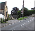
T&S Headquarters and barge/trow transhipment point - currently filled in. End of restoration project phase 1A.
Brimscombe Port, Port Lane, Stroud GL5 2QJ, United Kingdom
 
Information about the place
Brimscombe Port is a minor waterways place on the Cotswold Canals (Thames and Severn Canal - Wide section) between Bourne Lock No 8 (Rescued 1995) (1¼ furlongs to the east) and Site of Entrance to Wallbridge Basin (The junction between the Stroudwater Navigation and the Thames & Severn Canal.) (2 miles and 6 furlongs and 7 locks to the northwest).
 
 
The nearest place in the direction of Bourne Lock No 8 is Site of Brimscombe Foundry; ½ furlongs away.
 
The nearest place in the direction of Site of Entrance to Wallbridge Basin is Former Salt Warehouse; ½ furlongs away.

Mooring here is unrated.

You can wind here.


Amenities
 
Maps
If you are a user and are logged on, or if you are actively planning a route, a map will be displayed here.
Show on external mapping site: Google | OSM | Bing
 
Photos
 
External websites
There are no links to external websites from here.
Why not log in and add some (select "External websites" from the menu (sometimes this is under "Edit"))?
 
Nearest facilities

Mouseover for more information or show routes to facility

Nearest water point

In the direction of Site of Entrance to Wallbridge Basin

Saul Junction Marina9 miles, 3¾ furlongs and 19 locks away
Travel to Site of Entrance to Wallbridge Basin, then on the Cotswold Canals (Stroudwater Navigation - Un-navigable Section) to Walk Bridge, then on the Cotswold Canals (Stroudwater Navigation - Navigable Section) to Saul Junction Marina
Saul Junction Winding Hole9 miles, 5¼ furlongs and 19 locks away
Travel to Site of Entrance to Wallbridge Basin, then on the Cotswold Canals (Stroudwater Navigation - Un-navigable Section) to Walk Bridge, then on the Cotswold Canals (Stroudwater Navigation - Navigable Section) to Saul Junction, then on the Gloucester and Sharpness Canal to Saul Junction Winding Hole
Cotswold Canals Trust Visitor Centre - Saul Junction9 miles, 6 furlongs and 19 locks away
Travel to Site of Entrance to Wallbridge Basin, then on the Cotswold Canals (Stroudwater Navigation - Un-navigable Section) to Walk Bridge, then on the Cotswold Canals (Stroudwater Navigation - Navigable Section) to Saul Junction, then on the Gloucester and Sharpness Canal to Cotswold Canals Trust Visitor Centre - Saul Junction
Fretherne Bridge10 miles, 3¼ furlongs and 19 locks away
Travel to Site of Entrance to Wallbridge Basin, then on the Cotswold Canals (Stroudwater Navigation - Un-navigable Section) to Walk Bridge, then on the Cotswold Canals (Stroudwater Navigation - Navigable Section) to Saul Junction, then on the Gloucester and Sharpness Canal to Fretherne Bridge
Splatt Bridge11 miles, 4 furlongs and 19 locks away
Travel to Site of Entrance to Wallbridge Basin, then on the Cotswold Canals (Stroudwater Navigation - Un-navigable Section) to Walk Bridge, then on the Cotswold Canals (Stroudwater Navigation - Navigable Section) to Saul Junction, then on the Gloucester and Sharpness Canal to Splatt Bridge
Patch Bridge13 miles, 2¾ furlongs and 19 locks away
Travel to Site of Entrance to Wallbridge Basin, then on the Cotswold Canals (Stroudwater Navigation - Un-navigable Section) to Walk Bridge, then on the Cotswold Canals (Stroudwater Navigation - Navigable Section) to Saul Junction, then on the Gloucester and Sharpness Canal to Patch Bridge
Sellars Bridge13 miles, 3 furlongs and 19 locks away
Travel to Site of Entrance to Wallbridge Basin, then on the Cotswold Canals (Stroudwater Navigation - Un-navigable Section) to Walk Bridge, then on the Cotswold Canals (Stroudwater Navigation - Navigable Section) to Saul Junction, then on the Gloucester and Sharpness Canal to Sellars Bridge
Purton Lower Bridge15 miles, 6½ furlongs and 19 locks away
Travel to Site of Entrance to Wallbridge Basin, then on the Cotswold Canals (Stroudwater Navigation - Un-navigable Section) to Walk Bridge, then on the Cotswold Canals (Stroudwater Navigation - Navigable Section) to Saul Junction, then on the Gloucester and Sharpness Canal to Purton Lower Bridge
Llanthony Pontoons17 miles, 1 furlong and 19 locks away
Travel to Site of Entrance to Wallbridge Basin, then on the Cotswold Canals (Stroudwater Navigation - Un-navigable Section) to Walk Bridge, then on the Cotswold Canals (Stroudwater Navigation - Navigable Section) to Saul Junction, then on the Gloucester and Sharpness Canal to Llanthony Pontoons
Llanthony Road Bridge17 miles, 1¾ furlongs and 19 locks away
Travel to Site of Entrance to Wallbridge Basin, then on the Cotswold Canals (Stroudwater Navigation - Un-navigable Section) to Walk Bridge, then on the Cotswold Canals (Stroudwater Navigation - Navigable Section) to Saul Junction, then on the Gloucester and Sharpness Canal to Llanthony Road Bridge
Gloucester Waterways Museum Arm17 miles, 2¼ furlongs and 19 locks away
Travel to Site of Entrance to Wallbridge Basin, then on the Cotswold Canals (Stroudwater Navigation - Un-navigable Section) to Walk Bridge, then on the Cotswold Canals (Stroudwater Navigation - Navigable Section) to Saul Junction, then on the Gloucester and Sharpness Canal to Gloucester Waterways Museum Arm
Gloucester Dock Lock17 miles, 3 furlongs and 19 locks away
Travel to Site of Entrance to Wallbridge Basin, then on the Cotswold Canals (Stroudwater Navigation - Un-navigable Section) to Walk Bridge, then on the Cotswold Canals (Stroudwater Navigation - Navigable Section) to Saul Junction, then on the Gloucester and Sharpness Canal to Gloucester Dock Lock

Nearest rubbish disposal

In the direction of Site of Entrance to Wallbridge Basin

Saul Junction Marina9 miles, 3¾ furlongs and 19 locks away
Travel to Site of Entrance to Wallbridge Basin, then on the Cotswold Canals (Stroudwater Navigation - Un-navigable Section) to Walk Bridge, then on the Cotswold Canals (Stroudwater Navigation - Navigable Section) to Saul Junction Marina
Saul Junction Winding Hole9 miles, 5¼ furlongs and 19 locks away
Travel to Site of Entrance to Wallbridge Basin, then on the Cotswold Canals (Stroudwater Navigation - Un-navigable Section) to Walk Bridge, then on the Cotswold Canals (Stroudwater Navigation - Navigable Section) to Saul Junction, then on the Gloucester and Sharpness Canal to Saul Junction Winding Hole
Fretherne Bridge10 miles, 3¼ furlongs and 19 locks away
Travel to Site of Entrance to Wallbridge Basin, then on the Cotswold Canals (Stroudwater Navigation - Un-navigable Section) to Walk Bridge, then on the Cotswold Canals (Stroudwater Navigation - Navigable Section) to Saul Junction, then on the Gloucester and Sharpness Canal to Fretherne Bridge
Parkend Bridge11 miles, 1½ furlongs and 19 locks away
Travel to Site of Entrance to Wallbridge Basin, then on the Cotswold Canals (Stroudwater Navigation - Un-navigable Section) to Walk Bridge, then on the Cotswold Canals (Stroudwater Navigation - Navigable Section) to Saul Junction, then on the Gloucester and Sharpness Canal to Parkend Bridge
Splatt Bridge11 miles, 4 furlongs and 19 locks away
Travel to Site of Entrance to Wallbridge Basin, then on the Cotswold Canals (Stroudwater Navigation - Un-navigable Section) to Walk Bridge, then on the Cotswold Canals (Stroudwater Navigation - Navigable Section) to Saul Junction, then on the Gloucester and Sharpness Canal to Splatt Bridge
Patch Bridge13 miles, 2¾ furlongs and 19 locks away
Travel to Site of Entrance to Wallbridge Basin, then on the Cotswold Canals (Stroudwater Navigation - Un-navigable Section) to Walk Bridge, then on the Cotswold Canals (Stroudwater Navigation - Navigable Section) to Saul Junction, then on the Gloucester and Sharpness Canal to Patch Bridge
Sellars Bridge13 miles, 3 furlongs and 19 locks away
Travel to Site of Entrance to Wallbridge Basin, then on the Cotswold Canals (Stroudwater Navigation - Un-navigable Section) to Walk Bridge, then on the Cotswold Canals (Stroudwater Navigation - Navigable Section) to Saul Junction, then on the Gloucester and Sharpness Canal to Sellars Bridge
Purton Lower Bridge15 miles, 6½ furlongs and 19 locks away
Travel to Site of Entrance to Wallbridge Basin, then on the Cotswold Canals (Stroudwater Navigation - Un-navigable Section) to Walk Bridge, then on the Cotswold Canals (Stroudwater Navigation - Navigable Section) to Saul Junction, then on the Gloucester and Sharpness Canal to Purton Lower Bridge
Sharpness Barge Arm17 miles, 1¾ furlongs and 19 locks away
Travel to Site of Entrance to Wallbridge Basin, then on the Cotswold Canals (Stroudwater Navigation - Un-navigable Section) to Walk Bridge, then on the Cotswold Canals (Stroudwater Navigation - Navigable Section) to Saul Junction, then on the Gloucester and Sharpness Canal to Sharpness Barge Arm
Llanthony Road Bridge17 miles, 1¾ furlongs and 19 locks away
Travel to Site of Entrance to Wallbridge Basin, then on the Cotswold Canals (Stroudwater Navigation - Un-navigable Section) to Walk Bridge, then on the Cotswold Canals (Stroudwater Navigation - Navigable Section) to Saul Junction, then on the Gloucester and Sharpness Canal to Llanthony Road Bridge

Nearest chemical toilet disposal

In the direction of Site of Entrance to Wallbridge Basin

Saul Junction Marina9 miles, 3¾ furlongs and 19 locks away
Travel to Site of Entrance to Wallbridge Basin, then on the Cotswold Canals (Stroudwater Navigation - Un-navigable Section) to Walk Bridge, then on the Cotswold Canals (Stroudwater Navigation - Navigable Section) to Saul Junction Marina
Cotswold Canals Trust Visitor Centre - Saul Junction9 miles, 6 furlongs and 19 locks away
Travel to Site of Entrance to Wallbridge Basin, then on the Cotswold Canals (Stroudwater Navigation - Un-navigable Section) to Walk Bridge, then on the Cotswold Canals (Stroudwater Navigation - Navigable Section) to Saul Junction, then on the Gloucester and Sharpness Canal to Cotswold Canals Trust Visitor Centre - Saul Junction
Sharpness Barge Arm17 miles, 1¾ furlongs and 19 locks away
Travel to Site of Entrance to Wallbridge Basin, then on the Cotswold Canals (Stroudwater Navigation - Un-navigable Section) to Walk Bridge, then on the Cotswold Canals (Stroudwater Navigation - Navigable Section) to Saul Junction, then on the Gloucester and Sharpness Canal to Sharpness Barge Arm
Llanthony Road Bridge17 miles, 1¾ furlongs and 19 locks away
Travel to Site of Entrance to Wallbridge Basin, then on the Cotswold Canals (Stroudwater Navigation - Un-navigable Section) to Walk Bridge, then on the Cotswold Canals (Stroudwater Navigation - Navigable Section) to Saul Junction, then on the Gloucester and Sharpness Canal to Llanthony Road Bridge

Nearest place to turn

In the direction of Bourne Mill Bridge

Latton Junction17 miles, 3¾ furlongs and 32 locks away
Travel to Bourne Mill Bridge, then on the Cotswold Canals (Thames and Severn Canal - Wide/long lock section) to Bourne Bridge, then on the Cotswold Canals (Thames and Severn Canal - Main section) to Latton Junction

In the direction of Site of Entrance to Wallbridge Basin

Ryeford Winding Hole4 miles, 6½ furlongs and 11 locks away
Travel to Site of Entrance to Wallbridge Basin, then on the Cotswold Canals (Stroudwater Navigation - Un-navigable Section) to Ryeford Winding Hole
The Ocean5 miles, 6¼ furlongs and 11 locks away
Travel to Site of Entrance to Wallbridge Basin, then on the Cotswold Canals (Stroudwater Navigation - Un-navigable Section) to The Ocean
Saul Junction Winding Hole9 miles, 5¼ furlongs and 19 locks away
Travel to Site of Entrance to Wallbridge Basin, then on the Cotswold Canals (Stroudwater Navigation - Un-navigable Section) to Walk Bridge, then on the Cotswold Canals (Stroudwater Navigation - Navigable Section) to Saul Junction, then on the Gloucester and Sharpness Canal to Saul Junction Winding Hole
Pegthorne Bridge Winding Hole10 miles, 1¾ furlongs and 19 locks away
Travel to Site of Entrance to Wallbridge Basin, then on the Cotswold Canals (Stroudwater Navigation - Un-navigable Section) to Walk Bridge, then on the Cotswold Canals (Stroudwater Navigation - Navigable Section) to Saul Junction, then on the Gloucester and Sharpness Canal to Pegthorne Bridge Winding Hole
Quedgeley Oil Depot13 miles, 4¼ furlongs and 19 locks away
Travel to Site of Entrance to Wallbridge Basin, then on the Cotswold Canals (Stroudwater Navigation - Un-navigable Section) to Walk Bridge, then on the Cotswold Canals (Stroudwater Navigation - Navigable Section) to Saul Junction, then on the Gloucester and Sharpness Canal to Quedgeley Oil Depot
Monk Meadow Dock16 miles, 6¾ furlongs and 19 locks away
Travel to Site of Entrance to Wallbridge Basin, then on the Cotswold Canals (Stroudwater Navigation - Un-navigable Section) to Walk Bridge, then on the Cotswold Canals (Stroudwater Navigation - Navigable Section) to Saul Junction, then on the Gloucester and Sharpness Canal to Monk Meadow Dock
Sharpness Barge Arm17 miles, 1¾ furlongs and 19 locks away
Travel to Site of Entrance to Wallbridge Basin, then on the Cotswold Canals (Stroudwater Navigation - Un-navigable Section) to Walk Bridge, then on the Cotswold Canals (Stroudwater Navigation - Navigable Section) to Saul Junction, then on the Gloucester and Sharpness Canal to Sharpness Barge Arm
Gloucester Docks17 miles, 2½ furlongs and 19 locks away
Travel to Site of Entrance to Wallbridge Basin, then on the Cotswold Canals (Stroudwater Navigation - Un-navigable Section) to Walk Bridge, then on the Cotswold Canals (Stroudwater Navigation - Navigable Section) to Saul Junction, then on the Gloucester and Sharpness Canal to Gloucester Docks Travel to Site of Entrance to Wallbridge Basin, then on the Cotswold Canals (Stroudwater Navigation - Un-navigable Section) to Walk Bridge, then on the Cotswold Canals (Stroudwater Navigation - Navigable Section) to Saul Junction, then on the Gloucester and Sharpness Canal to Waterways Office (South Wales and Severn Waterways) - Canal & River Trust
Gloucester / Sharpness - Severn Junction17 miles, 3¼ furlongs and 20 locks away
Travel to Site of Entrance to Wallbridge Basin, then on the Cotswold Canals (Stroudwater Navigation - Un-navigable Section) to Walk Bridge, then on the Cotswold Canals (Stroudwater Navigation - Navigable Section) to Saul Junction, then on the Gloucester and Sharpness Canal to Gloucester / Sharpness - Severn Junction
Over Winding Hole19 miles, 3 furlongs and 21 locks away
Travel to Site of Entrance to Wallbridge Basin, then on the Cotswold Canals (Stroudwater Navigation - Un-navigable Section) to Walk Bridge, then on the Cotswold Canals (Stroudwater Navigation - Navigable Section) to Saul Junction, then on the Gloucester and Sharpness Canal to Gloucester / Sharpness - Severn Junction, then on the River Severn (old river navigation) to Lower Parting, then on the River Severn (Maisemore Channel - Southern Section) to Over Junction, then on the Hereford and Gloucester Canal to Over Winding Hole
Direction of TV transmitter (From Wolfbane Cybernetic)
 
 
Geograph
 
Wikipedia

Wikipedia has a page about Brimscombe Port

Brimscombe and Thrupp (grid reference SO862032) is a civil parish made up of two small linked villages in the narrow Frome Valley slightly southeast of Stroud, Gloucestershire, England. The parish also includes the hamlets of Quarhouse and The Heavens. The population taken at the 2011 census was 1,830.

Other Wikipedia pages that might relate to Brimscombe Port
[Brimscombe and Thrupp] Brimscombe and Thrupp Brimscombe and Thrupp (grid reference SO862032) is a civil parish made up of two small linked villages in the narrow Frome Valley [Prince George, Duke of Kent] Stuart (2001). MacQueen's Legacy; Ships of the Royal Mail Line. Two. Brimscombe Port and Charleston, SC: Tempus Publishing. p. 130. ISBN 0-7524-2119-0. [Thames and Severn Canal] Ocean' at Stonehouse to Wallbridge on the Navigation, and from there to Brimscombe Port on the canal. In 2010, British Waterways gave Inglesham Lock to the [Mick Miller (comedian)] in ITV's Last Laugh in Vegas. Sherwin, Phil (2010). The Port Vale Miscellany. Brimscombe Port: The History Press. p. 61. ISBN 978-0-7524-5777-2. "Mick [Homer] Greece: Arms and Armour from the Heroes of Homer to Alexander the Great. Brimscombe Port: The History Press. pp. 9–10. ISBN 978-0-7524-9506-4. Retrieved 1 September [Robbie Williams] NME. Retrieved 21 March 2019. Sherwin, Phil (2010). The Port Vale Miscellany. Brimscombe Port: The History Press. p. 10. ISBN 978-0-7524-5777-2. "Robbie [Joseph Smith (aircraft designer)] (2016). Beyond the Spitfire - The Unseen Designs of R.J. Mitchell. Brimscombe Port: The History Press. ISBN 978-0-7509-6515-6. Price, Alfred (1986). The [History of Christchurch, Dorset] Newman, Sue (1998). Images of England: Christchurch. The Mill, Brimscombe Port, Stroud, Glos.: Tempus Publishing Limited. p. 61. ISBN 0-7524-1050-4 [Blue Star Line] (2001). MacQueen's Legacy; A History of the Royal Mail Line. One. Brimscombe Port and Charleston, SC: Tempus Publishing. p. 104. ISBN 0-7524-2118-2. [Robbie Earle] The Port Vale Miscellany. Brimscombe Port: The History Press. p. 5. ISBN 978-0-7524-5777-2. Baggaley, Mike (9 March 2017). "Robbie Earle on Port Vale:
 
Google

Results of Google Search

Brimscombe Port redevelopment plans | Stroud District Council
Brimscombe Port is a former inland port dating back to the 1780s which became redundant after the era of the canals as a mode of transport came to an end. It was ...
Brimscombe and Thrupp - Wikipedia
Brimscombe Port was originally built to transfer cargo from Severn trows, which travelled from the River Severn down the ...
Brimscombe Port | Stroud District Council
Nov 6, 2020 ... Background. Brimscombe Port is a former inland port dating back to the 1780s. Following the decline of the canals as a mode of transport the port ...
Brimscombe Port Bank | British Museum
Also known as: Brimscombe Port Bank: primary name: Brimscombe Port Bank: other name: Miller & Co. Details: organisation; institution/organisation; British.
Brimscombe Port
May 12, 2019 ... Brimscombe Port. The port was the headquarters of the Thames & Severn Canal Company, and the site incorporated a 700 ft long canal basin ...
Brimscombe Port Plans | Cotswold Canals Trust
Dec 14, 2018 ... On the 13th December 2018 new plans for a multi-million-pound waterside development of the old Brimscombe Port were revealed.
Brimscombe Port revamp gets £2m infrastructure boost - BBC News
Oct 21, 2015 ... Brimscombe Port was used to transport cargo between the narrow barges travelling between the River Thames and Severn. In 1933, the port ...
Brimscombe Port Plans
Dec 13, 2018 ... Stroud District Council's latest plans for the multi-million-pound redevelopment of Brimscombe Port.
Brimscombe Port revamp gets £2m infrastructure boost - BBC News
Oct 21, 2015 ... The hope is to make Brimscombe Port more attractive for private investors. Mr Hagg added: "It will mean developers will then look and say with ...
Lockdown charity to expand in demolition-bound Stroud warehouse ...
Aug 21, 2020 ... Brimscombe Port and Mill in Stroud ... wants to extend its lease in Brimscombe Port until next year and temporarily take up more space in it.