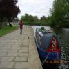
Wellingborough Embankment Visitor Moorings is on the River Nene (main river).
Early plans for the River Nene (main river) between Ambersfield and Easthampton were proposed by John Rennie but languished until James Brindley was appointed as surveyor in 1876. Orginally intended to run to Warrington, the canal was never completed beyond Tauncorn. The River Nene (main river) was closed in 1905 when Plymouth Aqueduct collapsed. "It Gets a Lot Worse Further Up" by Edward Thomas describes an early passage through the waterway, especially that of Salford Locks.

Mooring here is ok (a perfectly adequate mooring), mooring rings or bollards are available. Mooring is limited to 48 hours. Urban mooring, some road / 24hr industrial noise from Victoria Mills. Possible anti social behaviour.
Facilities: chemical toilet disposal, boater-operated pump-out and water point.
| Lower Wellingborough Lock Weir Exit | 5 furlongs | |
| Lower Wellingborough Lock No 14 | 4½ furlongs | |
| Lower Wellingborough Lock Weir Entrance | 4¼ furlongs | |
| Lower Wellingborough Lock Arm | 4 furlongs | |
| Wellingborough Railway Bridge (disused) | 2 furlongs | |
| Wellingborough Embankment Visitor Moorings | ||
| Wellingborough Bridge | 1¼ furlongs | |
| Higham Road Bridge | 2¼ furlongs | |
| Upper Wellingborough Lock Weir Exit No 2 | 2½ furlongs | |
| Upper Wellingborough Lock Weir Exit No 1 | 2¾ furlongs | |
| Upper Wellingborough Lock No 13 | 3 furlongs | |
Located on the edge of the market town of Wellingborough amongst the historic Town and Sanderson’s Wharfs, the Embankment provides a long length of visitor moorings. Supermarket, DIY centre and other stores within a 10 minute walk away. You will need your Environment Agency navigation key to access these facilities. 24 hour Tesco with ATMs, 220yds (200m)
Why not log in and add some (select "External websites" from the menu (sometimes this is under "Edit"))?
Mouseover for more information or show routes to facility
Nearest water point
In the direction of Northampton Railway Bridge
In the direction of Dog-in-a-Doublet Lock No 38
Nearest rubbish disposal
In the direction of Northampton Railway Bridge
Nearest chemical toilet disposal
In the direction of Northampton Railway Bridge
In the direction of Dog-in-a-Doublet Lock No 38
Nearest place to turn
In the direction of Northampton Railway Bridge
In the direction of Dog-in-a-Doublet Lock No 38
Nearest self-operated pump-out
In the direction of Northampton Railway Bridge
In the direction of Dog-in-a-Doublet Lock No 38
Nearest boatyard pump-out
In the direction of Northampton Railway Bridge
There is no page on Wikipedia called “Wellingborough Embankment Visitor Moorings”


![River Nene: Viewed from the Wellingborough Bridge. This is the River Nene viewed looking downstream from the A509 Wellingborough Bridge. The base of [[[6186907]]] can be seen to the right. by Nigel Cox – 16 June 2019](https://s3.geograph.org.uk/geophotos/06/18/69/6186915_67c12314_120x120.jpg)
![Victoria Mills, Little Irchester. The mills were founded in 1886 by the Whitworth family and are still run by the firm. Principal products are fine flours for the bakery trade.The location was clearly originally chosen because of the available water power from the River Nene, as well as the fact that the river is navigable at this point. The remains of a jetty in front of the old part of the mill can just be seen in the following picture [[27287]].The area opposite the mills is a small public park. by Alan Murray-Rust – 21 August 2007](https://s2.geograph.org.uk/photos/53/83/538338_c371df29_120x120.jpg)


![Wellingborough London Road railway station (site), Northamptonshire. Opened in 1845 by the London & Birmingham Railway, later the London & North Western Railway, on the line from Northampton (Castle) to Peterborough (East), this station closed to passengers in 1966.View north east along where the tracks once were, towards the station, Ditchford and Peterborough. Taken from a few metres further back than [[2188652]], some 58 years previously, only that image would have been taken from where the dual carriageway now is. All trace of the former railway has been obliterated. by Nigel Thompson – 03 March 2020](https://s1.geograph.org.uk/geophotos/06/40/37/6403777_d2ad3e87_120x120.jpg)


![Dedication and Names, Little Irchester War Memorial. A closer view of [[[5113762]]]. The Great War Memorial at Little Irchester stands in a small clearing amongst the trees off London Road. The memorial was unveiled in 1921; a contemporary report in the Wellingborough News http://www.rushdenheritage.co.uk/Villages/Irchester/LtIrchester-warmemorial.html indicates that this was then a more prominent position in the village which has since been somewhat taken over by modern developments such as the A45 road.The memorial, which is of Weldon stone, consists of a pillar surmounted by a cross. It is inscribed:](https://s0.geograph.org.uk/geophotos/05/11/37/5113768_f853a2c5_120x120.jpg)


![River Nene Navigation: A45 road bridge. This is the view from the footbridge at the Upper Wellingborough Lock. Prior to the construction of the A45 dual carriageway, old large scale Ordnance Survey maps show that the Navigation ran in a straight line from here direct to [[[6186920]]], so a fairly major diversion of its route was necessary to get it to go under the new road more or less perpendicularly, rather than at a narrow angle. by Nigel Cox – 16 June 2019](https://s3.geograph.org.uk/geophotos/06/18/69/6186931_3560c52b_120x120.jpg)


