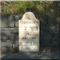
Stony Spring Bridge
Burnley Road, Calderdale HX2 6HS, United Kingdom
(A646)

Stony Spring Bridge
is a minor waterways place
on the Rochdale Canal between
Walkley's Clog Mill (1 mile and 6½ furlongs
and 3 locks
to the west) and
Tuel Lane Tunnel (western entrance) (2 miles and 4½ furlongs
and 1 lock
to the east).
The nearest place in the direction of Walkley's Clog Mill is Brearley Lower Lock No 5;
a few yards
away.
The nearest place in the direction of Tuel Lane Tunnel (western entrance) is Winding Hole below Lock No 5;
¾ furlongs
away.
There may be access to the towpath here.
Mooring here is unrated.
There is a bridge here which takes pedestrian traffic over the canal.
Pissmire Road Bridge No 10 | 1 mile, ¼ furlongs | |
Brearley Upper Bridge No 9 | 5 furlongs | |
Brearley Bridge No 8 | 2¼ furlongs | |
Brearley Upper Lock No 6 | 1¾ furlongs | |
Brearley Lower Lock No 5 | a few yards | |
Stony Spring Bridge | ||
Winding Hole below Lock No 5 | ¾ furlongs | |
Ellen Royd Bridge No 7 | 2 furlongs | |
Station Road Bridge Aqueduct | 4¾ furlongs | |
Station Road Bridge No 6 | 5 furlongs | |
Cooper House Bridge No 5 | 1 mile |
There are no links to external websites from here.
Why not log in and add some (select "External websites" from the menu (sometimes this is under "Edit"))?
Mouseover for more information or show routes to facility
Nearest water point
In the direction of Castlefield Junction
Hebden Bridge Services — 2 miles, 4¾ furlongs and 4 locks away
On this waterway in the direction of Castlefield Junction
Baltimore Marina — 6 miles, 4¼ furlongs and 13 locks away
On this waterway in the direction of Castlefield Junction
Fielden Wharf & Services — 6 miles, 7¼ furlongs and 14 locks away
On this waterway in the direction of Castlefield Junction
Travis Mill Lock No 28 — 8 miles, 4½ furlongs and 23 locks away
On this waterway in the direction of Castlefield Junction
Littleborough Sanitary Station — 12 miles, 1¾ furlongs and 42 locks away
On this waterway in the direction of Castlefield Junction
In the direction of Sowerby Bridge Junction
Sowerby Bridge Basin — 3 miles, ¾ furlongs and 3 locks away
Travel to Sowerby Bridge Junction, then on the Calder and Hebble Navigation (Main Line) to Sowerby Bridge Basin
Salterhebble Junction — 5 miles, ½ furlongs and 3 locks away
Travel to Sowerby Bridge Junction, then on the Calder and Hebble Navigation (Main Line) to Salterhebble Junction
Salterhebble Sanitary Station — 5 miles, 1 furlong and 4 locks away
Travel to Sowerby Bridge Junction, then on the Calder and Hebble Navigation (Main Line) to Salterhebble Junction, then on the Calder and Hebble Navigation (Main Line) to Salterhebble Sanitary Station
Brighouse Basin — 9 miles, 3 furlongs and 13 locks away
Travel to Sowerby Bridge Junction, then on the Calder and Hebble Navigation (Main Line) to Salterhebble Junction, then on the Calder and Hebble Navigation (Main Line) to Brighouse Basin
Shepley Bridge Sanitary Station — 14 miles, 6 furlongs and 19 locks away
Travel to Sowerby Bridge Junction, then on the Calder and Hebble Navigation (Main Line) to Salterhebble Junction, then on the Calder and Hebble Navigation (Main Line) to Shepley Bridge Sanitary Station
Aspley Basin (Huddersfield) — 15 miles, 1¼ furlongs and 26 locks away
Travel to Sowerby Bridge Junction, then on the Calder and Hebble Navigation (Main Line) to Salterhebble Junction, then on the Calder and Hebble Navigation (Main Line) to Cooper Bridge Junction, then on the Huddersfield Broad Canal to Aspley Basin (Huddersfield)
Waterside Lock No 21E — 19 miles, 7 furlongs and 46 locks away
Travel to Sowerby Bridge Junction, then on the Calder and Hebble Navigation (Main Line) to Salterhebble Junction, then on the Calder and Hebble Navigation (Main Line) to Cooper Bridge Junction, then on the Huddersfield Broad Canal to Aspley Basin (Huddersfield), then on the Huddersfield Narrow Canal to Waterside Lock No 21E
Slaithwaite Winding Hole — 19 miles, 7½ furlongs and 47 locks away
Travel to Sowerby Bridge Junction, then on the Calder and Hebble Navigation (Main Line) to Salterhebble Junction, then on the Calder and Hebble Navigation (Main Line) to Cooper Bridge Junction, then on the Huddersfield Broad Canal to Aspley Basin (Huddersfield), then on the Huddersfield Narrow Canal to Slaithwaite Winding HoleNearest rubbish disposal
In the direction of Castlefield Junction
Hebden Bridge Services — 2 miles, 4¾ furlongs and 4 locks away
On this waterway in the direction of Castlefield Junction
Fielden Wharf & Services — 6 miles, 7¼ furlongs and 14 locks away
On this waterway in the direction of Castlefield Junction
Littleborough Sanitary Station — 12 miles, 1¾ furlongs and 42 locks away
On this waterway in the direction of Castlefield Junction
In the direction of Sowerby Bridge Junction
Sowerby Bridge Basin — 3 miles, ¾ furlongs and 3 locks away
Travel to Sowerby Bridge Junction, then on the Calder and Hebble Navigation (Main Line) to Sowerby Bridge Basin
Salterhebble Sanitary Station — 5 miles, 1 furlong and 4 locks away
Travel to Sowerby Bridge Junction, then on the Calder and Hebble Navigation (Main Line) to Salterhebble Junction, then on the Calder and Hebble Navigation (Main Line) to Salterhebble Sanitary Station
Brighouse Lower Basin Visitor Moorings — 9 miles, 3¼ furlongs and 14 locks away
Travel to Sowerby Bridge Junction, then on the Calder and Hebble Navigation (Main Line) to Salterhebble Junction, then on the Calder and Hebble Navigation (Main Line) to Brighouse Lower Basin Visitor Moorings
Shepley Bridge Sanitary Station — 14 miles, 6 furlongs and 19 locks away
Travel to Sowerby Bridge Junction, then on the Calder and Hebble Navigation (Main Line) to Salterhebble Junction, then on the Calder and Hebble Navigation (Main Line) to Shepley Bridge Sanitary Station
Aspley Basin (Huddersfield) — 15 miles, 1¼ furlongs and 26 locks away
Travel to Sowerby Bridge Junction, then on the Calder and Hebble Navigation (Main Line) to Salterhebble Junction, then on the Calder and Hebble Navigation (Main Line) to Cooper Bridge Junction, then on the Huddersfield Broad Canal to Aspley Basin (Huddersfield)
Horbury Basin Residential Moorings & Sanitary Station — 19 miles, 2¼ furlongs and 26 locks away
Travel to Sowerby Bridge Junction, then on the Calder and Hebble Navigation (Main Line) to Salterhebble Junction, then on the Calder and Hebble Navigation (Main Line) to Horbury Basin Residential Moorings & Sanitary StationNearest chemical toilet disposal
In the direction of Castlefield Junction
Hebden Bridge Services — 2 miles, 4¾ furlongs and 4 locks away
On this waterway in the direction of Castlefield Junction
Baltimore Marina — 6 miles, 4¼ furlongs and 13 locks away
On this waterway in the direction of Castlefield Junction
Littleborough Sanitary Station — 12 miles, 1¾ furlongs and 42 locks away
On this waterway in the direction of Castlefield Junction
In the direction of Sowerby Bridge Junction
Sowerby Bridge Basin — 3 miles, ¾ furlongs and 3 locks away
Travel to Sowerby Bridge Junction, then on the Calder and Hebble Navigation (Main Line) to Sowerby Bridge Basin
Salterhebble Sanitary Station — 5 miles, 1 furlong and 4 locks away
Travel to Sowerby Bridge Junction, then on the Calder and Hebble Navigation (Main Line) to Salterhebble Junction, then on the Calder and Hebble Navigation (Main Line) to Salterhebble Sanitary Station
Brighouse Basin — 9 miles, 3 furlongs and 13 locks away
Travel to Sowerby Bridge Junction, then on the Calder and Hebble Navigation (Main Line) to Salterhebble Junction, then on the Calder and Hebble Navigation (Main Line) to Brighouse Basin
Shepley Bridge Sanitary Station — 14 miles, 6 furlongs and 19 locks away
Travel to Sowerby Bridge Junction, then on the Calder and Hebble Navigation (Main Line) to Salterhebble Junction, then on the Calder and Hebble Navigation (Main Line) to Shepley Bridge Sanitary Station
Aspley Basin (Huddersfield) — 15 miles, 1¼ furlongs and 26 locks away
Travel to Sowerby Bridge Junction, then on the Calder and Hebble Navigation (Main Line) to Salterhebble Junction, then on the Calder and Hebble Navigation (Main Line) to Cooper Bridge Junction, then on the Huddersfield Broad Canal to Aspley Basin (Huddersfield)
Savile Town Wharf and Basin (Dewsbury) — 18 miles, 1¼ furlongs and 23 locks away
Travel to Sowerby Bridge Junction, then on the Calder and Hebble Navigation (Main Line) to Salterhebble Junction, then on the Calder and Hebble Navigation (Main Line) to Dewsbury Arm Junction, then on the Calder and Hebble Navigation (Dewsbury Old Cut) to Savile Town Wharf and Basin (Dewsbury)
Horbury Basin Residential Moorings & Sanitary Station — 19 miles, 2¼ furlongs and 26 locks away
Travel to Sowerby Bridge Junction, then on the Calder and Hebble Navigation (Main Line) to Salterhebble Junction, then on the Calder and Hebble Navigation (Main Line) to Horbury Basin Residential Moorings & Sanitary Station
Waterside Lock No 21E — 19 miles, 7 furlongs and 46 locks away
Travel to Sowerby Bridge Junction, then on the Calder and Hebble Navigation (Main Line) to Salterhebble Junction, then on the Calder and Hebble Navigation (Main Line) to Cooper Bridge Junction, then on the Huddersfield Broad Canal to Aspley Basin (Huddersfield), then on the Huddersfield Narrow Canal to Waterside Lock No 21ENearest place to turn
In the direction of Castlefield Junction
Walkley's Clog Mill — 1 mile, 6½ furlongs and 3 locks away
On this waterway in the direction of Castlefield Junction
Hebden Bridge Wharf — 2 miles, 4½ furlongs and 4 locks away
On this waterway in the direction of Castlefield Junction
Rawden Mill Lock Winding Hole — 3 miles, 6½ furlongs and 7 locks away
On this waterway in the direction of Castlefield Junction
Winding Hole below Holmcoat Lock — 4 miles, 6 furlongs and 9 locks away
On this waterway in the direction of Castlefield Junction
Stoodley Bridge Winding Hole — 5 miles and 10 locks away
On this waterway in the direction of Castlefield Junction
Lobb Mill Lock Winding Hole — 5 miles, 4¾ furlongs and 11 locks away
On this waterway in the direction of Castlefield Junction
Baltimore Winding Hole — 6 miles, 3¾ furlongs and 13 locks away
On this waterway in the direction of Castlefield Junction
Todmorden Bridge Winding Hole — 6 miles, 7¼ furlongs and 14 locks away
On this waterway in the direction of Castlefield Junction
In the direction of Sowerby Bridge Junction
Winding Hole below Lock No 5 — ¾ furlongs away
On this waterway in the direction of Sowerby Bridge Junction
Tower Hill Winding Hole — 2 miles, 3¾ furlongs away
On this waterway in the direction of Sowerby Bridge Junction
Sowerby Bridge Winding Hole — 2 miles, 5¾ furlongs and 2 locks away
On this waterway in the direction of Sowerby Bridge Junction
Sowerby Bridge Junction — 2 miles, 7¾ furlongs and 3 locks away
On this waterway in the direction of Sowerby Bridge Junction
Sterne Mill Winding Hole — 3 miles, 6 furlongs and 3 locks away
Travel to Sowerby Bridge Junction, then on the Calder and Hebble Navigation (Main Line) to Sterne Mill Winding Hole
Salterhebble Basin — 5 miles, 4½ furlongs and 3 locks away
Travel to Sowerby Bridge Junction, then on the Calder and Hebble Navigation (Main Line) to Salterhebble Junction, then on the Calder and Hebble Navigation (Halifax Branch) to Salterhebble Basin
Salterhebble Sanitary Station — 5 miles, 1 furlong and 4 locks away
Travel to Sowerby Bridge Junction, then on the Calder and Hebble Navigation (Main Line) to Salterhebble Junction, then on the Calder and Hebble Navigation (Main Line) to Salterhebble Sanitary Station
Salterhebble Bottom Basin Visitor Moorings — 5 miles, 1¼ furlongs and 5 locks away
Travel to Sowerby Bridge Junction, then on the Calder and Hebble Navigation (Main Line) to Salterhebble Junction, then on the Calder and Hebble Navigation (Main Line) to Salterhebble Bottom Basin Visitor Moorings
Salterhebble Wharf — 5 miles, 1½ furlongs and 5 locks away
Travel to Sowerby Bridge Junction, then on the Calder and Hebble Navigation (Main Line) to Salterhebble Junction, then on the Calder and Hebble Navigation (Main Line) to Salterhebble Wharf
Ganny Winding Hole — 8 miles, 5½ furlongs and 12 locks away
Travel to Sowerby Bridge Junction, then on the Calder and Hebble Navigation (Main Line) to Salterhebble Junction, then on the Calder and Hebble Navigation (Main Line) to Ganny Winding Hole
Brighouse Basin — 9 miles, 3 furlongs and 13 locks away
Travel to Sowerby Bridge Junction, then on the Calder and Hebble Navigation (Main Line) to Salterhebble Junction, then on the Calder and Hebble Navigation (Main Line) to Brighouse Basin
Cooper Bridge Junction — 11 miles, 5¼ furlongs and 17 locks away
Travel to Sowerby Bridge Junction, then on the Calder and Hebble Navigation (Main Line) to Salterhebble Junction, then on the Calder and Hebble Navigation (Main Line) to Cooper Bridge JunctionNearest self-operated pump-out
In the direction of Castlefield Junction
Hebden Bridge Services — 2 miles, 4¾ furlongs and 4 locks away
On this waterway in the direction of Castlefield Junction
In the direction of Sowerby Bridge Junction
Slaithwaite Winding Hole — 19 miles, 7½ furlongs and 47 locks away
Travel to Sowerby Bridge Junction, then on the Calder and Hebble Navigation (Main Line) to Salterhebble Junction, then on the Calder and Hebble Navigation (Main Line) to Cooper Bridge Junction, then on the Huddersfield Broad Canal to Aspley Basin (Huddersfield), then on the Huddersfield Narrow Canal to Slaithwaite Winding HoleNearest boatyard pump-out
In the direction of Castlefield Junction
Pickwell and Arnold Boatyard — 5 miles, 2½ furlongs and 10 locks away
On this waterway in the direction of Castlefield Junction
In the direction of Sowerby Bridge Junction
Sowerby Bridge Basin — 3 miles, ¾ furlongs and 3 locks away
Travel to Sowerby Bridge Junction, then on the Calder and Hebble Navigation (Main Line) to Sowerby Bridge Basin
Shepley Bridge Marina — 14 miles, 6¼ furlongs and 19 locks away
Travel to Sowerby Bridge Junction, then on the Calder and Hebble Navigation (Main Line) to Salterhebble Junction, then on the Calder and Hebble Navigation (Main Line) to Shepley Bridge Marina
Aspley Basin (Huddersfield) — 15 miles, 1¼ furlongs and 26 locks away
Travel to Sowerby Bridge Junction, then on the Calder and Hebble Navigation (Main Line) to Salterhebble Junction, then on the Calder and Hebble Navigation (Main Line) to Cooper Bridge Junction, then on the Huddersfield Broad Canal to Aspley Basin (Huddersfield)Direction of TV transmitter (From Wolfbane Cybernetic)
There is no page on Wikipedia called “Stony Spring Bridge”
Wikipedia pages that might relate to Stony Spring Bridge
[Stony Brook University]
New York at Stony Brook (SUNY at Stony Brook), more commonly known as Stony Brook University (SBU), is a public research university in Stony Brook, New
[Stony Creek (Branford)]
up-close view via several tour boats which run in the spring, summer and autumn. In the past, Stony Creek was also known for lobstering and oystering, but
[Macquarie River]
devastating floods wash away the first Denison Bridge at Bathurst and also debris damages Ranken's Bridge 1955 – serious flooding of Macquarie River amongst
[Area codes 518 and 838]
Glens Falls Speculator Spencertown Sprakers Stephentown Stillwater Stony Creek Stony Point Stuyvesant Stuyvesant Falls Surprise Tannersville Thurman Ticonderoga
[Campus of Stony Brook University]
The campus of Stony Brook University is located in Stony Brook, New York and consists of 213 buildings over 1,454 acres of land. It is the largest public
[Cacapon River]
Hollow Run Critton Run Falling Spring Run Stony Creek Constant Run Whisners Run Connor Hollow Run Bubbling Spring Capon Bridge Capon Lake Cold Stream Davis
[Kattegat]
very difficult and dangerous to navigate because of the many sandy and stony reefs and tricky currents, which often shift. In modern times, artificial
[Stony Creek (Black Creek tributary)]
and at least one bridge has been built over the creek. The creek is considered to be a coldwater fishery and a migratory fishery. Stony Creek begins at
[Rockland County, New York]
the present-day Clarkstown, Ramapo, and Stony Point. Clarkstown and Ramapo became towns in 1791, followed by Stony Point in 1865. During the American Revolution
[New Creek]
Thunderhill Run Cross and Water Street Keyser Stony Run Stony Run Rd & Harley O. Staggers Drive Parr Spring Run Mountain View Addition and US 220 Block