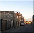
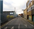
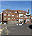
Southwick Terminus
Aldrington Basin, Basin Road South, Adur BN41 1WD, United Kingdom

Southwick Terminus
is a minor waterways place
at the end of the Southwick Canal; past
Junction with Southwick Canal (2 miles and 1 furlong
and 1 lock
to the west).
The nearest place in the direction of Junction with Southwick Canal is Southwick Sea Lock;
1 mile and 5 furlongs
away.
Mooring here is unrated.
| Junction with Southwick Canal | 2 miles, 1 furlong | |
| Southwick Sea Lock | 1 mile, 5 furlongs | |
| Southwick Terminus | ||
There are no links to external websites from here.
Why not log in and add some (select "External websites" from the menu (sometimes this is under "Edit"))?
Why not log in and add some (select "External websites" from the menu (sometimes this is under "Edit"))?
Mouseover for more information or show routes to facility
Nearest place to turn
In the direction of Junction with Southwick Canal
Junction with Southwick Canal — 2 miles, 1 furlong and 1 lock away
On this waterway in the direction of Junction with Southwick Canal
Coombes Road Arm — 5 miles, 1¼ furlongs and 1 lock away
Travel to Junction with Southwick Canal, then on the River Adur to Coombes Road ArmNo information
CanalPlan has no information on any of the following facilities within range:water point
rubbish disposal
chemical toilet disposal
self-operated pump-out
boatyard pump-out
Direction of TV transmitter (From Wolfbane Cybernetic)
There is no page on Wikipedia called “Southwick Terminus”
Wikipedia pages that might relate to Southwick Terminus
[Southwick, West Sussex]
Southwick (/ˈsaʊθwɪk/) is a small town in the Adur district of West Sussex, England located five miles (8 km) west of Brighton and a suburb of the East
[Territorial evolution of the United States]
maintained it was the Calcasieu River and others. Disputes: 1804 The "Southwick Jog" was transferred from Connecticut to Massachusetts, to put to rest
[Massachusetts Route 57]
Route 8 in Sandisfield to cross the Farmington River's west branch. In Southwick, Route 57 starts to enter a more suburban area. There are more concurrencies
[Massachusetts]
Machine. Bio.umass.edu. Retrieved September 7, 2013. "Connecticut's "Southwick Jog"". Connecticut State Library. Retrieved June 10, 2015. Brooks, Rebecca
[New York State Route 193]
The western terminus of NY 193 is at an intersection with NY 3 at Southwick Beach State Park, just east of Lake Ontario. Its eastern terminus is at a junction
[Witherwack]
area is an overspill council estate, usually regarded as part of Greater Southwick, and was built in the 1960s. In common with most estates in Sunderland
[U.S. Route 202]
US 202 and Route 10 enter the Bay State at the "Congamond Notch" in Southwick, a southward jog in the state line that includes Congamond Lake. North
[Sunderland]
1840, moved to Pallion in 1857) William Pickersgill's (established at Southwick in 1845) J. L. Thompson & Sons (yard established at North Sands by Robert
[Route 75 (Connecticut–Massachusetts)]
and North Main Street. Route 75 has junctions with Route 168 (towards Southwick) and Route 190 (towards Enfield) in Suffield center. In northern Suffield
[Black Pond Wildlife Management Area]
of the WMA, past the beachfront residences of Jefferson Park, through Southwick Beach State Park, and into the sizable Lakeview Wildlife Management Area
Results of Google Search
Five Star Bus – School Bus and Charter Bus Transportation809 College Highway, Southwick MA 01077. 730 Fuller Road,Chicopee, MA 01020. 2 Industrial ... South Hadley Terminal ... Cape Cod/S. Yarmouth Terminal  ...
Route 57 is an east–west Massachusetts state route that runs from Monterey to Agawam. The eastern 5.0 miles (8.1 km) in Agawam is a freeway that runs from Route 187 to the route's eastern terminus at U.S. Route 5. ... In Southwick, Route 57 starts to enter a more suburban area. There are more concurrencies during this ...
Dr. Alfred P. Southwick (a former steam-boat engineer, noted dentist and ... an intoxicated man die after he inadvertently touched a live generator terminal.
Jul 22, 2010 ... The Southwick Rail Trail extends from the Massachusetts–Connecticut state line north to the Westfield town line and connects to the Columbia ...
Richard Southwick is inspired by the time-honored qualities of historic design, materials, .... Redevelopment Plans Promise New Life for the Iconic TWA Terminal.
Proposed truck terminal goes before City Council. By Amy Porter. Posted on September 7, 2018. Share · Tweet · Share · Share · Email · Comments. You need to ...
Terminal Conditions for the Southworth terminal are unavailable. Please check the ferry alert bulletins below, and the Best Times to Travel links on the right side  ...
Thank you for your interest in becoming part of the Southwick's Zoo team! Please keep in mind that all positions require weekend and holiday availability during ...
The Golden Lion, Southwick: See 473 unbiased reviews of The Golden Lion, rated 4.5 of 5 on TripAdvisor and ranked #1 of 3 restaurants in Southwick.
Southwick Technologies provides complete service and support for Vocollect® models T2, T2X, T5, A500, and A700 in addition to terminal and battery chargers  ...


![332-334, Kingsway, Aldrington, Hove. Number 332 is home to Miller Bourne architects since 2006 whilst neighbouring 334 is in the process of being converted into something. The building is actually the top floor of the building on the left in [[5215801]]. by Simon Carey – 22 December 2016](https://s2.geograph.org.uk/geophotos/05/23/25/5232546_62140f36_120x120.jpg)


![333-339, Kingsway, Aldrington, Hove. A pair of semi-detached houses that have been converted into commercial premises: 333 is a cafe; 334 a hair salon; 335 an accountant; 336 a chartered surveyor's office. The houses were constructed in the late 192os and occupy a block between Brittany Road and Derek Avenue along with [[5233609]] to the west. by Simon Carey – 22 December 2016](https://s0.geograph.org.uk/geophotos/05/23/36/5233612_8a36e644_120x120.jpg)


![341-343, Kingsway, Aldrington, Hove. A pair of houses located in the block between Derek Avenue and Brittany Road along with [[5233612]] to the east that were built in the late 1920s. by Simon Carey – 22 December 2016](https://s1.geograph.org.uk/geophotos/05/23/36/5233609_9f415df6_120x120.jpg)


![The Gather Inn, Kingsway, Aldrington, Hove. The first pub to appear here was in 1859 when it opened to capitalise on the newly canalized eastern end of Shoreham Harbour. The original building lasted until 1930 when it was rebuilt, see http://regencysociety-jamesgray.com/volume15/source/jg_15_080.html taken in 1927, when it was replaced by the current one. The pub retained the name Adur Hotel until 1997 when it initially became Kingsway 330 (After the official number on the address), then Blue Lagoon before acquiring its current name in 2015. The pub also contains a function room and offers bed and breakfast accommodation. The building itself sits on a former low lying cliff with the southern side extending downwards to Wharf Road, see [[5215832]]. by Simon Carey – 22 December 2016](https://s2.geograph.org.uk/geophotos/05/23/25/5232530_db73e77f_120x120.jpg)