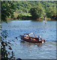
Marlow Lock Weir Exit
Channel leading to the Weir
Longridge Activity Centre, Quarry Wood Road, Cookham Dean SL7 1QG, United Kingdom 
Address is taken from a point 355 yards away.

Marlow Lock Weir Exit
is a minor waterways place
on the River Thames (below Oxford) between
  Wargrave (11 miles and 6¼ furlongs
    and 5 locks
   to the southwest) and
  Racecourse Yacht Basin Entrance (Junction of the River Thames and the Clewer Mill Stream) (9 miles and 6½ furlongs
    and 3 locks
   to the southeast).
  The nearest place in the direction of Wargrave is Pergola Field Visitor Moorings;
  ½ furlongs
   away.
   
  The nearest place in the direction of Racecourse Yacht Basin Entrance is Marlow By-pass Bridge;
  1 furlong
   away.
Mooring here is unrated. 
You can wind here.
| Marlow Bridge | 3 furlongs | |
| The Compleat Angler PH | 2¾ furlongs | |
| Marlow Lock Weir Entrance | 2¼ furlongs | |
| Marlow Lock | 1½ furlongs | |
| Pergola Field Visitor Moorings | ½ furlongs | |
| Marlow Lock Weir Exit | ||
| Marlow By-pass Bridge | 1 furlong | |
| Wootens Boatyard | 6 furlongs | |
| Gibralter Islands | 7½ furlongs | |
| Spade Oak Wharf | 1 mile, 7¼ furlongs | |
| Upper Thames Sailing Club | 2 miles, ¾ furlongs | |
There are no links to external websites from here.
Why not log in and add some (select "External websites" from the menu (sometimes this is under "Edit"))?
Mouseover for more information or show routes to facility
Nearest water point
In the direction of Teddington Lock Weir Exit
Cookham Lock — 3 miles, 7¾ furlongs  away
On this waterway in the direction of Teddington Lock Weir Exit
Boveney Lock — 10 miles, 3¼ furlongs  and 3 locks away
On this waterway in the direction of Teddington Lock Weir Exit
Windsor Leisure Centre Moorings — 11 miles, 6¼ furlongs  and 4 locks away
On this waterway in the direction of Teddington Lock Weir Exit
In the direction of Osney Bridge
Hurley Lock — 2 miles, 4½ furlongs  and 2 locks away
On this waterway in the direction of Osney Bridge
Shiplake Lock — 12 miles, 2¾ furlongs  and 5 locks away
On this waterway in the direction of Osney Bridge
Thames & Kennet Marina — 16 miles, 7¾ furlongs  and 7 locks away
On this waterway in the direction of Osney BridgeNearest rubbish disposal
In the direction of Teddington Lock Weir Exit
Cookham Lock — 3 miles, 7¾ furlongs  away
On this waterway in the direction of Teddington Lock Weir Exit
Bray Lock — 7 miles, 6¼ furlongs  and 2 locks away
On this waterway in the direction of Teddington Lock Weir Exit
Boveney Lock — 10 miles, 3¼ furlongs  and 3 locks away
On this waterway in the direction of Teddington Lock Weir Exit
Bell Weir Lock — 19 miles, 4½ furlongs  and 6 locks away
On this waterway in the direction of Teddington Lock Weir Exit
In the direction of Osney Bridge
Marlow Lock — 1½ furlongs  away
On this waterway in the direction of Osney Bridge
Hurley Lock — 2 miles, 4½ furlongs  and 2 locks away
On this waterway in the direction of Osney Bridge
Hambleden Lock — 6 miles, 2 furlongs  and 3 locks away
On this waterway in the direction of Osney Bridge
Marsh Lock — 9 miles, 4¾ furlongs  and 4 locks away
On this waterway in the direction of Osney Bridge
Shiplake Lock — 12 miles, 2¾ furlongs  and 5 locks away
On this waterway in the direction of Osney BridgeNearest chemical toilet disposal
In the direction of Teddington Lock Weir Exit
Cookham Lock — 3 miles, 7¾ furlongs  away
On this waterway in the direction of Teddington Lock Weir Exit
Boveney Lock — 10 miles, 3¼ furlongs  and 3 locks away
On this waterway in the direction of Teddington Lock Weir Exit
In the direction of Osney Bridge
Hurley Lock — 2 miles, 4½ furlongs  and 2 locks away
On this waterway in the direction of Osney Bridge
Shiplake Lock — 12 miles, 2¾ furlongs  and 5 locks away
On this waterway in the direction of Osney Bridge
Thames & Kennet Marina — 16 miles, 7¾ furlongs  and 7 locks away
On this waterway in the direction of Osney BridgeNearest place to turn
In the direction of Teddington Lock Weir Exit
Racecourse Yacht Basin Entrance — 9 miles, 6½ furlongs  and 3 locks away
On this waterway in the direction of Teddington Lock Weir Exit
Romney Lock Weir Entrance — 12 miles, 4½ furlongs  and 4 locks away
On this waterway in the direction of Teddington Lock Weir Exit
Romney Lock Weir Exit — 13 miles, 2 furlongs  and 5 locks away
On this waterway in the direction of Teddington Lock Weir Exit
Thames - Jubilee Junction (Windsor) — 13 miles, 5 furlongs  and 5 locks away
On this waterway in the direction of Teddington Lock Weir Exit
Old Windsor Lock Weir Exit — 16 miles, 3¾ furlongs  and 6 locks away
On this waterway in the direction of Teddington Lock Weir Exit
In the direction of Osney Bridge
Temple Lock Weir Entrance — 2 miles  and 2 locks away
On this waterway in the direction of Osney Bridge
Hurley Lock Weir Exit No 2 — 2 miles, 2¾ furlongs  and 2 locks away
On this waterway in the direction of Osney Bridge
Hurley Lock Weir Entrance No 2 — 2 miles, 7½ furlongs  and 3 locks away
On this waterway in the direction of Osney Bridge
Hambleden Marina — 6 miles  and 3 locks away
On this waterway in the direction of Osney Bridge
Hambleden Weir Exit — 6 miles, 1 furlong  and 3 locks away
On this waterway in the direction of Osney Bridge
Hambleden Lock Weir Entrance — 6 miles, 2¾ furlongs  and 4 locks away
On this waterway in the direction of Osney Bridge
Marsh Lock Mill Weir Exit — 9 miles, 3¼ furlongs  and 4 locks away
On this waterway in the direction of Osney Bridge
Thames - Hennerton Backwater Entrance No 3 — 10 miles, 1¼ furlongs  and 5 locks away
On this waterway in the direction of Osney Bridge
Thames - Hennerton Backwater Entrance No 2 — 11 miles, 4 furlongs  and 5 locks away
On this waterway in the direction of Osney Bridge
Thames - Hennerton Backwater Entrance No 1 — 11 miles, 5½ furlongs  and 5 locks away
On this waterway in the direction of Osney Bridge
Sonning Lock Weir Exit — 14 miles, 7¼ furlongs  and 6 locks away
On this waterway in the direction of Osney Bridge
Sonning Lock Weir Entrance — 15 miles, 2½ furlongs  and 7 locks away
On this waterway in the direction of Osney Bridge
Thames - Kennet Junction (Kennet Mouth) — 17 miles, ¾ furlongs  and 7 locks away
On this waterway in the direction of Osney Bridge
Blakes Lock Weir Exit — 17 miles, 2 furlongs  and 7 locks away
Travel  to Thames - Kennet Junction (Kennet Mouth), then on the River Thames (River Kennet) to Blakes Lock Weir Exit
Caversham Lock Weir Exit — 17 miles, 6½ furlongs  and 7 locks away
On this waterway in the direction of Osney BridgeNearest self-operated pump-out
In the direction of Teddington Lock Weir Exit
Boveney Lock — 10 miles, 3¼ furlongs  and 3 locks away
On this waterway in the direction of Teddington Lock Weir ExitNearest boatyard pump-out
In the direction of Osney Bridge
Thames & Kennet Marina — 16 miles, 7¾ furlongs  and 7 locks away
On this waterway in the direction of Osney BridgeDirection of TV transmitter (From Wolfbane Cybernetic)
 
There is no page on Wikipedia called “Marlow Lock Weir Exit”
Wikipedia pages that might relate to Marlow Lock Weir Exit
[River Great Ouse]
lower river at Denver in Norfolk. The river previously ran through Hermitage Lock into the Old West River, then joined the Cam near Little Thetford before
[Amphibia (TV series)]
and Marcy respectively, instead. On June 23, 2020, it was reported that Marlow Barkley, Mia and Ella Allan will guest star in season 2. Muppet performer
[Mikhail Fridman]
вложили деньги от продажи ТНК-BP". Forbes Russia. Retrieved 9 February 2018. Marlow, Ben (4 April 2015). "Rainmaker: Rich Russians look for new fights in gas
[First 100 days of Donald Trump's presidency]
of economic warfare". The Financial Times. Retrieved February 1, 2017. Marlow, Iain (November 5, 2015). "China passes Canada to become largest U.S. trading


![Danger # 2. Looks like the sign means nothing? [[851072]] by Steve  Fareham – 19 June 2008](https://s0.geograph.org.uk/photos/85/10/851076_91e4f7fa_120x120.jpg)


![Start of closed section of Thames Footpath, Gossmore Recreation Ground, Marlow, Bucks. When this photograph was taken in early November 2017 a section of the footpath, starting here on the edge of Gossmore Recreation Ground, was temporarily closed. However it could still be used to access the boat moorings by Pergola Park. [[5593950]]. by P L Chadwick – 04 November 2017](https://s0.geograph.org.uk/geophotos/05/59/39/5593976_387dd627_120x120.jpg)


![Thames Footpath diversion sign, Gossmore Recreation Ground, Marlow, Bucks. Temporary sign giving an alternative route to a closed section of the Thames Footpath.[[5593976]]. by P L Chadwick – 04 November 2017](https://s2.geograph.org.uk/geophotos/05/59/39/5593950_8480e651_120x120.jpg)
![Flooding near Marlow, January 2014 (1). The Thames flood-plain underwater.  The view is west along Quarry Wood Road from a point almost underneath the Marlow by-pass bridge.  The spire of Marlow parish church is visible to the right of centre.  The road was quite passable, though the water level in the fields was no more than a few inches below road level.Looking down from higher ground it was clear that hundreds of acres of the Thames flood-plain were under water in the area around Temple, Bisham and Marlow - with the Berkshire side perhaps worse affected than Buckinghamshire.A shot taken by Shaun Ferguson [[1705506]] shows these fields (from the west) as they were in February 2010 - very much drier.  Nigel Cox stood behind me - so to speak - to take a photo of the area as it is in summer:  http://www.geograph.org.uk/photo/489942This sequence continues with: http://www.geograph.org.uk/photo/3805969 by Stefan Czapski – 07 January 2014](https://s1.geograph.org.uk/geophotos/03/80/59/3805937_2be63b88_120x120.jpg)


![Flooding near Marlow, January 2014 (3). A shot taken seven minutes after [[3805937]] and in the meantime visibility had deteriorated - and my optics were getting damp.  The Marlow-Cookham Dean road was quite passable, but from this shot it is pretty clear that there would be problems if the water were to rise even a few inches higher.Shot taken from the partial shelter of the bridge seen here: http://www.geograph.org.uk/photo/489942The sequence continues with: [[3806969]] by Stefan Czapski – 07 January 2014](https://s3.geograph.org.uk/geophotos/03/80/59/3805979_4d7f587c_120x120.jpg)