CanalPlanAC

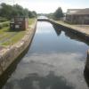
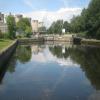
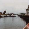
Ferrybridge Flood Lock No 11

 
Ferrybridge to Knottingley Towpath Sign, Fishergate, Ferrybridge WF11 8NF, United Kingdom
 
Information about the place
 
 
The nearest place in the direction of Bank Dole Junction is Mill Bridge Wharf; 3 furlongs away.
 
The nearest place in the direction of Castleford Junction is Ferrybridge Flood Lock Footbridge; ¼ furlongs away.

Mooring here is tolerable (it's just about possible if really necessary). Probably OK if you stay on your boat but the locks have been removed from the visitor moorings so they are no longer secure.

Facilities: water point.

This is a lock, the rise of which is not known.


Amenities

Amenities nearby at Mill Bridge Wharf

 Turnpike
 Express Gas Ltd
 Texaco
 Knottingley Station
 
Maps
If you are a user and are logged on, or if you are actively planning a route, a map will be displayed here.
Show on external mapping site: Google | OSM | Bing
 
Additional information

The village square 2 minutes walk with a few shops, pub and takeaways convenience stores etc.

 
Photos
 
External websites
There are no links to external websites from here.
Why not log in and add some (select "External websites" from the menu (sometimes this is under "Edit"))?
 
Nearest facilities

Mouseover for more information or show routes to facility

Nearest water point

The nearest water point is here. Others are at:

In the direction of Castleford Junction

Ferrybridge Flood Lock Footbridge¼ furlongs and 1 lock away
On this waterway in the direction of Castleford Junction
Bulholme Lock No 104 miles, 6 furlongs and 1 lock away
On this waterway in the direction of Castleford Junction
Castleford Sanitary Station5 miles, 2¾ furlongs and 2 locks away
On this waterway in the direction of Castleford Junction
Woodnook Lock No 67 miles, 5¼ furlongs and 3 locks away
Travel to Castleford Junction, then on the Aire and Calder Navigation (Wakefield Section) to Woodnook Lock No 6
Fairies Hill Moorings7 miles, 4 furlongs and 4 locks away
Travel to Castleford Junction, then on the Aire and Calder Navigation (Wakefield Section) to Fairies Hill Lock Junction, then on the Aire and Calder Navigation (Wakefield Section - Fairies Hill Mooring Arm) to Fairies Hill Moorings
Lemonroyd Lock No 78 miles, 7¼ furlongs and 3 locks away
Travel to Castleford Junction, then on the Aire and Calder Navigation (Main Line - Castleford to Leeds) to Lemonroyd Lock No 7
Lemonroyd Marina9 miles and 4 locks away
Travel to Castleford Junction, then on the Aire and Calder Navigation (Main Line - Castleford to Leeds) to Lemonroyd Marina
King's Road Lock No 38 miles, 6¾ furlongs and 4 locks away
Travel to Castleford Junction, then on the Aire and Calder Navigation (Wakefield Section) to King's Road Lock No 3
Woodlesford Lock No 510 miles, 2 furlongs and 4 locks away
Travel to Castleford Junction, then on the Aire and Calder Navigation (Main Line - Castleford to Leeds) to Woodlesford Lock No 5
Fishpond Lock No 411 miles, ¾ furlongs and 5 locks away
Travel to Castleford Junction, then on the Aire and Calder Navigation (Main Line - Castleford to Leeds) to Fishpond Lock No 4
Stanley Ferry Water Point10 miles, 4 furlongs and 6 locks away
Travel to Castleford Junction, then on the Aire and Calder Navigation (Wakefield Section) to Stanley Ferry Water Point
Ramsdens Bridge Sanitary Station10 miles, 4¾ furlongs and 6 locks away
Travel to Castleford Junction, then on the Aire and Calder Navigation (Wakefield Section) to Ramsdens Bridge Sanitary Station

In the direction of Ouse - Aire and Calder Junction

Bank Dole Lock No 11 mile, 6¼ furlongs and 1 lock away
Travel to Bank Dole Junction, then on the Aire and Calder Navigation (Selby Section) to Bank Dole Lock No 1
Beal Bridge4 miles, ¾ furlongs and 2 locks away
Travel to Bank Dole Junction, then on the Aire and Calder Navigation (Selby Section) to Beal Bridge
Beal Lock No 24 miles, 2 furlongs and 2 locks away
Travel to Bank Dole Junction, then on the Aire and Calder Navigation (Selby Section) to Beal Lock No 2
Whitley Lock No 125 miles, 3¾ furlongs and 1 lock away
On this waterway in the direction of Ouse - Aire and Calder Junction
Pollington Manor Swing Bridge9 miles, 2 furlongs and 3 locks away
On this waterway in the direction of Ouse - Aire and Calder Junction
Pollington Visitor Mooring9 miles, 2¼ furlongs and 3 locks away
On this waterway in the direction of Ouse - Aire and Calder Junction
Selby Basin12 miles, 6¾ furlongs and 4 locks away
Travel to Bank Dole Junction, then on the Aire and Calder Navigation (Selby Section) to Selby Basin

Nearest rubbish disposal

In the direction of Castleford Junction

Castleford Sanitary Station5 miles, 2¾ furlongs and 2 locks away
On this waterway in the direction of Castleford Junction
Lemonroyd Marina9 miles and 4 locks away
Travel to Castleford Junction, then on the Aire and Calder Navigation (Main Line - Castleford to Leeds) to Lemonroyd Marina
Woodlesford Lock No 510 miles, 2 furlongs and 4 locks away
Travel to Castleford Junction, then on the Aire and Calder Navigation (Main Line - Castleford to Leeds) to Woodlesford Lock No 5
Ramsdens Bridge Visitor Moorings10 miles, 4¼ furlongs and 6 locks away
Travel to Castleford Junction, then on the Aire and Calder Navigation (Wakefield Section) to Ramsdens Bridge Visitor Moorings
Leeds Sanitary Station14 miles, 6½ furlongs and 7 locks away
Travel to Castleford Junction, then on the Aire and Calder Navigation (Main Line - Castleford to Leeds) to Leeds Sanitary Station
Leeds Basin15 miles, 5¾ furlongs and 9 locks away
Travel to Castleford Junction, then on the Aire and Calder Navigation (Main Line - Castleford to Leeds) to Leeds Bridge, then on the Leeds and Liverpool Canal (Main Line - Wigan to Leeds) to Leeds Basin
Horbury Basin Residential Moorings & Sanitary Station18 miles, 1 furlong and 11 locks away
Travel to Castleford Junction, then on the Aire and Calder Navigation (Wakefield Section) to Fall Ing Junction, then on the Calder and Hebble Navigation (Main Line) to Horbury Basin Residential Moorings & Sanitary Station

In the direction of Ouse - Aire and Calder Junction

Whitley Lock No 125 miles, 3¾ furlongs and 1 lock away
On this waterway in the direction of Ouse - Aire and Calder Junction
Selby Basin12 miles, 6¾ furlongs and 4 locks away
Travel to Bank Dole Junction, then on the Aire and Calder Navigation (Selby Section) to Selby Basin
Dutch Riverside17 miles, 4¼ furlongs and 3 locks away
On this waterway in the direction of Ouse - Aire and Calder Junction
Goole Marina17 miles, 5¾ furlongs and 3 locks away
On this waterway in the direction of Ouse - Aire and Calder Junction
Barnby Dun Lift Bridge17 miles, 7¼ furlongs and 4 locks away
Travel to Sykehouse Junction, then on the Sheffield and South Yorkshire Navigation (New Junction Canal) to Bramwith Junction, then on the Sheffield and South Yorkshire Navigation (Main Line) to Barnby Dun Lift Bridge
Bramwith Swing Bridge17 miles, 3¾ furlongs and 5 locks away
Travel to Sykehouse Junction, then on the Sheffield and South Yorkshire Navigation (New Junction Canal) to Bramwith Junction, then on the Sheffield and South Yorkshire Navigation (Bramwith to Stainforth) to Bramwith Swing Bridge

Nearest chemical toilet disposal

In the direction of Castleford Junction

Castleford Sanitary Station5 miles, 2¾ furlongs and 2 locks away
On this waterway in the direction of Castleford Junction
Fairies Hill Moorings7 miles, 4 furlongs and 4 locks away
Travel to Castleford Junction, then on the Aire and Calder Navigation (Wakefield Section) to Fairies Hill Lock Junction, then on the Aire and Calder Navigation (Wakefield Section - Fairies Hill Mooring Arm) to Fairies Hill Moorings
Lemonroyd Marina9 miles and 4 locks away
Travel to Castleford Junction, then on the Aire and Calder Navigation (Main Line - Castleford to Leeds) to Lemonroyd Marina
Ramsdens Bridge Sanitary Station10 miles, 4¾ furlongs and 6 locks away
Travel to Castleford Junction, then on the Aire and Calder Navigation (Wakefield Section) to Ramsdens Bridge Sanitary Station
Leeds Sanitary Station14 miles, 6½ furlongs and 7 locks away
Travel to Castleford Junction, then on the Aire and Calder Navigation (Main Line - Castleford to Leeds) to Leeds Sanitary Station
Horbury Basin Residential Moorings & Sanitary Station18 miles, 1 furlong and 11 locks away
Travel to Castleford Junction, then on the Aire and Calder Navigation (Wakefield Section) to Fall Ing Junction, then on the Calder and Hebble Navigation (Main Line) to Horbury Basin Residential Moorings & Sanitary Station

In the direction of Ouse - Aire and Calder Junction

Whitley Lock No 125 miles, 3¾ furlongs and 1 lock away
On this waterway in the direction of Ouse - Aire and Calder Junction
Selby Basin12 miles, 6¾ furlongs and 4 locks away
Travel to Bank Dole Junction, then on the Aire and Calder Navigation (Selby Section) to Selby Basin
Dutch Riverside17 miles, 4¼ furlongs and 3 locks away
On this waterway in the direction of Ouse - Aire and Calder Junction
Goole Marina17 miles, 5¾ furlongs and 3 locks away
On this waterway in the direction of Ouse - Aire and Calder Junction
Barnby Dun Lift Bridge17 miles, 7¼ furlongs and 4 locks away
Travel to Sykehouse Junction, then on the Sheffield and South Yorkshire Navigation (New Junction Canal) to Bramwith Junction, then on the Sheffield and South Yorkshire Navigation (Main Line) to Barnby Dun Lift Bridge
Bramwith Swing Bridge17 miles, 3¾ furlongs and 5 locks away
Travel to Sykehouse Junction, then on the Sheffield and South Yorkshire Navigation (New Junction Canal) to Bramwith Junction, then on the Sheffield and South Yorkshire Navigation (Bramwith to Stainforth) to Bramwith Swing Bridge

Nearest place to turn

In the direction of Castleford Junction

Bulholme Lock Weir Exit4 miles, 5½ furlongs and 1 lock away
On this waterway in the direction of Castleford Junction
Lemonroyd Lock Weir Exit8 miles, 6¼ furlongs and 3 locks away
Travel to Castleford Junction, then on the Aire and Calder Navigation (Main Line - Castleford to Leeds) to Lemonroyd Lock Weir Exit
Fairies Hill Lock Arm7 miles, 7 furlongs and 4 locks away
Travel to Castleford Junction, then on the Aire and Calder Navigation (Wakefield Section) to Fairies Hill Lock Arm
Fleet Lane Arm9 miles, 2¼ furlongs and 4 locks away
Travel to Castleford Junction, then on the Aire and Calder Navigation (Main Line - Castleford to Leeds) to Fleet Lane Arm
Stanley Ferry Marina10 miles, 3¼ furlongs and 6 locks away
Travel to Castleford Junction, then on the Aire and Calder Navigation (Wakefield Section) to Stanley Ferry Marina
Junction with River Aire (Old Channel) South13 miles, 4½ furlongs and 6 locks away
Travel to Castleford Junction, then on the Aire and Calder Navigation (Main Line - Castleford to Leeds) to Junction with River Aire (Old Channel) South
Junction with River Aire (Old Channel) North14 miles, 1½ furlongs and 7 locks away
Travel to Castleford Junction, then on the Aire and Calder Navigation (Main Line - Castleford to Leeds) to Junction with River Aire (Old Channel) North
Knostrop Flood Lock Weir Entrance14 miles, 1¾ furlongs and 7 locks away
Travel to Castleford Junction, then on the Aire and Calder Navigation (Main Line - Castleford to Leeds) to Knostrop Flood Lock Weir Entrance
Wakefield Weir Entrance13 miles, 3½ furlongs and 8 locks away
Travel to Castleford Junction, then on the Aire and Calder Navigation (Wakefield Section) to Fall Ing Junction, then on the Calder and Hebble Navigation (Main Line) to Wakefield Weir Entrance
Leeds Dock Side Arm15 miles, ¾ furlongs and 8 locks away
Travel to Castleford Junction, then on the Aire and Calder Navigation (Main Line - Castleford to Leeds) to Leeds Dock Entrance, then on the Aire and Calder Navigation (Leeds Dock) to Leeds Dock Side Arm
River Aire Junction15 miles, 5¼ furlongs and 8 locks away
Travel to Castleford Junction, then on the Aire and Calder Navigation (Main Line - Castleford to Leeds) to Leeds Bridge, then on the Leeds and Liverpool Canal (Main Line - Wigan to Leeds) to River Aire Junction
Leeds Basin15 miles, 5¾ furlongs and 9 locks away
Travel to Castleford Junction, then on the Aire and Calder Navigation (Main Line - Castleford to Leeds) to Leeds Bridge, then on the Leeds and Liverpool Canal (Main Line - Wigan to Leeds) to Leeds Basin
Broad Cut Weir Entrance16 miles and 9 locks away
Travel to Castleford Junction, then on the Aire and Calder Navigation (Wakefield Section) to Fall Ing Junction, then on the Calder and Hebble Navigation (Main Line) to Broad Cut Weir Entrance
Waller Bridge Winding Hole16 miles, 2¼ furlongs and 10 locks away
Travel to Castleford Junction, then on the Aire and Calder Navigation (Wakefield Section) to Fall Ing Junction, then on the Calder and Hebble Navigation (Main Line) to Waller Bridge Winding Hole

In the direction of Ouse - Aire and Calder Junction

Bank Dole Lock Junction1 mile, 6½ furlongs and 2 locks away
Travel to Bank Dole Junction, then on the Aire and Calder Navigation (Selby Section) to Bank Dole Lock Junction
Beal Lock No 2 Weir Entrance4 miles, 1 furlong and 2 locks away
Travel to Bank Dole Junction, then on the Aire and Calder Navigation (Selby Section) to Beal Lock No 2 Weir Entrance
Haddlesey Junction8 miles, ½ furlongs and 3 locks away
Travel to Bank Dole Junction, then on the Aire and Calder Navigation (Selby Section) to Haddlesey Junction
Selby Basin12 miles, 6¾ furlongs and 4 locks away
Travel to Bank Dole Junction, then on the Aire and Calder Navigation (Selby Section) to Selby Basin
Viking Marina17 miles, 5 furlongs and 3 locks away
On this waterway in the direction of Ouse - Aire and Calder Junction
Huddle Grounds Winding Hole19 miles, 3 furlongs and 5 locks away
Travel to Sykehouse Junction, then on the Sheffield and South Yorkshire Navigation (New Junction Canal) to Bramwith Junction, then on the Sheffield and South Yorkshire Navigation (Bramwith to Stainforth) to Stainforth Junction, then on the Sheffield and South Yorkshire Navigation (Stainforth and Keadby Canal) to Huddle Grounds Winding Hole

Nearest self-operated pump-out

In the direction of Castleford Junction

Castleford Sanitary Station5 miles, 2¾ furlongs and 2 locks away
On this waterway in the direction of Castleford Junction
Ramsdens Bridge Sanitary Station10 miles, 4¾ furlongs and 6 locks away
Travel to Castleford Junction, then on the Aire and Calder Navigation (Wakefield Section) to Ramsdens Bridge Sanitary Station
Leeds Sanitary Station14 miles, 6½ furlongs and 7 locks away
Travel to Castleford Junction, then on the Aire and Calder Navigation (Main Line - Castleford to Leeds) to Leeds Sanitary Station

Nearest boatyard pump-out

In the direction of Castleford Junction

Lemonroyd Marina9 miles and 4 locks away
Travel to Castleford Junction, then on the Aire and Calder Navigation (Main Line - Castleford to Leeds) to Lemonroyd Marina

In the direction of Ouse - Aire and Calder Junction

Goole Marina17 miles, 5¾ furlongs and 3 locks away
On this waterway in the direction of Ouse - Aire and Calder Junction
Direction of TV transmitter (From Wolfbane Cybernetic)
 
 
Geograph
 
Wikipedia

There is no page on Wikipedia called “Ferrybridge Flood Lock”

Wikipedia pages that might relate to Ferrybridge Flood Lock
[Aire and Calder Navigation] with locks at Ferrybridge, Whitley, Pollington and Goole. The connection to the Aire and the Selby canal was maintained by the lock at Bank Dole. Goole [River Aire] Aire east of Castleford; Ferrybridge C, Eggborough and Drax. Drax takes its cooling water from the Ouse, but both Ferrybridge and Eggborough draw their [Selby Canal] originally part of the canal, the section of the Aire from Dole Bank Lock to Haddlesey Flood Lock is usually considered to be part of the modern Selby Canal, making [Margaret of York] take Waterford in Ireland. Warbeck was probably an imposter, and would be locked up in the Tower of London and subsequently executed by Henry VII. Henry [List of road junctions in the United Kingdom: F] Ferne Wall Corner Milkwell, Wiltshire unclass. ST919223 Ferrybridge Roundabout Interchange Ferrybridge, West Yorkshire M62 J33 A1 Great North Road 53°41′45″N [1960 New Year Honours] Whitaker Wright, Managing Director, W. & J. Tod Ltd., Boatbuilders, Ferrybridge, Dorset. Thomas Alfred Yates, Electrical Engineer, Admiralty. Amy Elizabeth
 
Google

Results of Google Search

Aire and Calder Navigation - Wikipedia
The Aire and Calder Navigation is the canalised section of the Rivers Aire and Calder in West Yorkshire, England. The first improvements to the rivers above Knottingley were completed in ... Lock sizes were increased several times, as was the depth of water, to enable larger boats to use ... Ferrybridge Flood Lock and weir.
River level information for River Aire at Ferrybridge Lock - GOV.UK
River level River Aire at Ferrybridge Lock. Check for flood warnings in this area. Latest recorded level 0.11m at 7:45pm Monday 20 July 2020.
Flood Warning
Do not drive into flooded areas or go around barricades. ... NO/ 739 PM CDT Sat Jul 18 2020 The Flood Warning continues for The Cow Creek near Hutchinson.
Concrete-arch Clarks Ferry Bridge opened in 1925, vintage photos ...
Apr 11, 2017 ... Updated Jan 05, 2019; Posted Apr 11, 2017 ... There will be no formal exercises for taking down the 'bars' and diverting traffic from the ... The covered bridge incurred the ravages of fire and flood but was repaired each time.
Paddling the Rideau Canal: Day Paddling Guide No.11 - Rideau ...
Rideau Day Paddling Guide 11: Rideau Ferry to Edmunds Lock (1.9 Mb PDF) ... an area that was extensively flooded by the canal dam at Poonamalie, which raised the ... Ferryland Cottage: Just to the north of the Rideau Ferry bridge, on theĀ ...