CanalPlanAC

Maud's Swing Bridge 

 
Green Bank, Doncaster DN8 5SF, United Kingdom
 

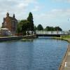
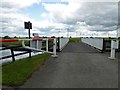
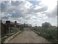
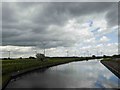
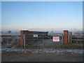
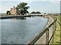
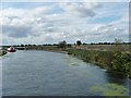
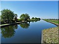
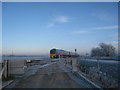
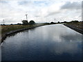
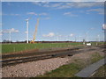
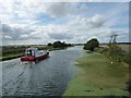
Maud's Swing Bridge carries a footpath over the Sheffield and South Yorkshire Navigation (Stainforth and Keadby Canal) a few kilometres from Sheffield.

The Act of Parliament for the Sheffield and South Yorkshire Navigation (Stainforth and Keadby Canal) was passed on January 1 1816 the same day as that of The Dartford & Crayford Navigation. From a junction with The River Wey at Sheffield the canal ran for 23 miles to Sunderland. In George Yates's "It Gets a Lot Worse Further Up" he describes his experiences passing through Wessstone Embankment during the General Strike.

Information about the place
Maud's Swing Bridge is a minor waterways place on the Sheffield and South Yorkshire Navigation (Stainforth and Keadby Canal) between Stainforth Junction (Junction of Sheffield and South Yorkshire Navigation and Stainforth and Keadby Canal) (5 miles and 2¼ furlongs and 1 lock to the west) and Keadby Visitor Moorings (7 miles and 2¾ furlongs to the east).
 
 
The nearest place in the direction of Stainforth Junction is Moor Road Swing Bridge; 1 mile and 1¼ furlongs away.
 
The nearest place in the direction of Keadby Visitor Moorings is Medge Hall Swing Bridge; 1 mile and 6¼ furlongs away.

Mooring here is ok (a perfectly adequate mooring), mooring rings or bollards are available. There is plenty of space on the Keadby side of the bridge to moor and allow boats to use the bridge.

There is a swing bridge here.

Hatfield Road Pipe Bridge2 miles, ½ furlongs
Hatfield Road Railway Bridge2 miles, ¼ furlongs
Blue Water Marina 1 mile, 6¼ furlongs
Wykewell Lift Bridge1 mile, 4 furlongs
Moor Road Swing Bridge1 mile, 1¼ furlongs
Maud's Swing Bridge 
Medge Hall Swing Bridge1 mile, 6¼ furlongs
Godnow Swing Bridge 2 miles, 6½ furlongs
Crowle Bridge4 miles, 1¼ furlongs
Bonnyhale Road Narrows4 miles, 5¼ furlongs
Pilfrey Bridge6 miles
 
 
Amenities
 
Maps
If you are a user and are logged on, or if you are actively planning a route, a map will be displayed here.
Show on external mapping site: Google | OSM | Bing
 
Photos
 
External websites
  S&SY navigation info — associated with Sheffield and South Yorkshire Navigation
Sheffield & South Yorkshire navigation info from IWA
 
Nearest facilities

Mouseover for more information or show routes to facility

Nearest water point

In the direction of Stainforth Junction
Thorne Visitor Moorings — 2 miles, 3½ furlongs away
On this waterway in the direction of Stainforth Junction
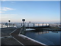
Bramwith Swing Bridge — 6 miles, 6 furlongs and 1 lock away
Travel to Stainforth Junction, then on the Sheffield and South Yorkshire Navigation (Bramwith to Stainforth) to Bramwith Swing Bridge
Bramwith Lock No 14 — 7 miles, 1 furlong and 1 lock away
Travel to Stainforth Junction, then on the Sheffield and South Yorkshire Navigation (Bramwith to Stainforth) to Bramwith Lock No 14
Barnby Dun Lift Bridge — 8 miles, 3½ furlongs and 2 locks away
Travel to Stainforth Junction, then on the Sheffield and South Yorkshire Navigation (Bramwith to Stainforth) to Bramwith Junction, then on the Sheffield and South Yorkshire Navigation (Main Line) to Barnby Dun Lift Bridge
Long Sandall Lock No 13 — 10 miles, 5 furlongs and 2 locks away
Travel to Stainforth Junction, then on the Sheffield and South Yorkshire Navigation (Bramwith to Stainforth) to Bramwith Junction, then on the Sheffield and South Yorkshire Navigation (Main Line) to Long Sandall Lock No 13
Doncaster Visitor Pontoon Moorings — 13 miles, 6½ furlongs and 3 locks away
Travel to Stainforth Junction, then on the Sheffield and South Yorkshire Navigation (Bramwith to Stainforth) to Bramwith Junction, then on the Sheffield and South Yorkshire Navigation (Main Line) to Doncaster Visitor Pontoon Moorings
Doncaster Town Lock No 12 — 14 miles, ¾ furlongs and 3 locks away
Travel to Stainforth Junction, then on the Sheffield and South Yorkshire Navigation (Bramwith to Stainforth) to Bramwith Junction, then on the Sheffield and South Yorkshire Navigation (Main Line) to Doncaster Town Lock No 12
Pollington Visitor Mooring — 14 miles, 7½ furlongs and 3 locks away
Travel to Stainforth Junction, then on the Sheffield and South Yorkshire Navigation (Bramwith to Stainforth) to Bramwith Junction, then on the Sheffield and South Yorkshire Navigation (New Junction Canal) to Sykehouse Junction, then on the Aire and Calder Navigation (Main Line - Goole to Castleford) to Pollington Visitor Mooring
Sprotbrough Lock No 11 — 17 miles, 2¾ furlongs and 4 locks away
Travel to Stainforth Junction, then on the Sheffield and South Yorkshire Navigation (Bramwith to Stainforth) to Bramwith Junction, then on the Sheffield and South Yorkshire Navigation (Main Line) to Sprotbrough Lock No 11
Goole CRT Visitor Moorings — 19 miles, 1 furlong and 3 locks away
Travel to Stainforth Junction, then on the Sheffield and South Yorkshire Navigation (Bramwith to Stainforth) to Bramwith Junction, then on the Sheffield and South Yorkshire Navigation (New Junction Canal) to Sykehouse Junction, then on the Aire and Calder Navigation (Main Line - Goole to Castleford) to Goole CRT Visitor Moorings
Whitley Lock No 12 — 18 miles, 6 furlongs and 4 locks away
Travel to Stainforth Junction, then on the Sheffield and South Yorkshire Navigation (Bramwith to Stainforth) to Bramwith Junction, then on the Sheffield and South Yorkshire Navigation (New Junction Canal) to Sykehouse Junction, then on the Aire and Calder Navigation (Main Line - Goole to Castleford) to Whitley Lock No 12

In the direction of Keadby Junction

Keadby Visitor Moorings — 7 miles, 2¾ furlongs away
On this waterway in the direction of Keadby Junction

Nearest rubbish disposal

In the direction of Stainforth Junction
Thorne Visitor Moorings — 2 miles, 3½ furlongs away
On this waterway in the direction of Stainforth Junction
Bramwith Swing Bridge — 6 miles, 6 furlongs and 1 lock away
Travel to Stainforth Junction, then on the Sheffield and South Yorkshire Navigation (Bramwith to Stainforth) to Bramwith Swing Bridge
Barnby Dun Lift Bridge — 8 miles, 3½ furlongs and 2 locks away
Travel to Stainforth Junction, then on the Sheffield and South Yorkshire Navigation (Bramwith to Stainforth) to Bramwith Junction, then on the Sheffield and South Yorkshire Navigation (Main Line) to Barnby Dun Lift Bridge
Doncaster Visitor Pontoon Moorings — 13 miles, 6½ furlongs and 3 locks away
Travel to Stainforth Junction, then on the Sheffield and South Yorkshire Navigation (Bramwith to Stainforth) to Bramwith Junction, then on the Sheffield and South Yorkshire Navigation (Main Line) to Doncaster Visitor Pontoon Moorings
Goole CRT Visitor Moorings — 19 miles, 1 furlong and 3 locks away
Travel to Stainforth Junction, then on the Sheffield and South Yorkshire Navigation (Bramwith to Stainforth) to Bramwith Junction, then on the Sheffield and South Yorkshire Navigation (New Junction Canal) to Sykehouse Junction, then on the Aire and Calder Navigation (Main Line - Goole to Castleford) to Goole CRT Visitor Moorings
Whitley Lock No 12 — 18 miles, 6 furlongs and 4 locks away
Travel to Stainforth Junction, then on the Sheffield and South Yorkshire Navigation (Bramwith to Stainforth) to Bramwith Junction, then on the Sheffield and South Yorkshire Navigation (New Junction Canal) to Sykehouse Junction, then on the Aire and Calder Navigation (Main Line - Goole to Castleford) to Whitley Lock No 12

In the direction of Keadby Junction

Keadby Visitor Moorings — 7 miles, 2¾ furlongs away
On this waterway in the direction of Keadby Junction

Nearest chemical toilet disposal

In the direction of Stainforth Junction
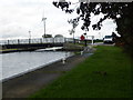
Thorne Visitor Moorings — 2 miles, 3½ furlongs away
On this waterway in the direction of Stainforth Junction
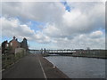
Bramwith Swing Bridge — 6 miles, 6 furlongs and 1 lock away
Travel to Stainforth Junction, then on the Sheffield and South Yorkshire Navigation (Bramwith to Stainforth) to Bramwith Swing Bridge
Barnby Dun Lift Bridge — 8 miles, 3½ furlongs and 2 locks away
Travel to Stainforth Junction, then on the Sheffield and South Yorkshire Navigation (Bramwith to Stainforth) to Bramwith Junction, then on the Sheffield and South Yorkshire Navigation (Main Line) to Barnby Dun Lift Bridge
Goole CRT Visitor Moorings — 19 miles, 1 furlong and 3 locks away
Travel to Stainforth Junction, then on the Sheffield and South Yorkshire Navigation (Bramwith to Stainforth) to Bramwith Junction, then on the Sheffield and South Yorkshire Navigation (New Junction Canal) to Sykehouse Junction, then on the Aire and Calder Navigation (Main Line - Goole to Castleford) to Goole CRT Visitor Moorings
Whitley Lock No 12 — 18 miles, 6 furlongs and 4 locks away
Travel to Stainforth Junction, then on the Sheffield and South Yorkshire Navigation (Bramwith to Stainforth) to Bramwith Junction, then on the Sheffield and South Yorkshire Navigation (New Junction Canal) to Sykehouse Junction, then on the Aire and Calder Navigation (Main Line - Goole to Castleford) to Whitley Lock No 12

In the direction of Keadby Junction

Keadby Visitor Moorings — 7 miles, 2¾ furlongs away
On this waterway in the direction of Keadby Junction

Nearest place to turn

In the direction of Stainforth Junction
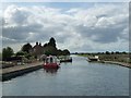
Huddle Grounds Winding Hole — 4 miles, 7 furlongs and 1 lock away
On this waterway in the direction of Stainforth Junction
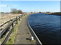
Wheatley Hall Road Winding Hole — 11 miles, 5½ furlongs and 3 locks away
Travel to Stainforth Junction, then on the Sheffield and South Yorkshire Navigation (Bramwith to Stainforth) to Bramwith Junction, then on the Sheffield and South Yorkshire Navigation (Main Line) to Wheatley Hall Road Winding Hole
Gas House Bight — 13 miles, 4¾ furlongs and 3 locks away
Travel to Stainforth Junction, then on the Sheffield and South Yorkshire Navigation (Bramwith to Stainforth) to Bramwith Junction, then on the Sheffield and South Yorkshire Navigation (Main Line) to Gas House Bight
Doncaster Visitor Pontoon Moorings — 13 miles, 6½ furlongs and 3 locks away
Travel to Stainforth Junction, then on the Sheffield and South Yorkshire Navigation (Bramwith to Stainforth) to Bramwith Junction, then on the Sheffield and South Yorkshire Navigation (Main Line) to Doncaster Visitor Pontoon Moorings
Pollington Visitor Mooring — 14 miles, 7½ furlongs and 3 locks away
Travel to Stainforth Junction, then on the Sheffield and South Yorkshire Navigation (Bramwith to Stainforth) to Bramwith Junction, then on the Sheffield and South Yorkshire Navigation (New Junction Canal) to Sykehouse Junction, then on the Aire and Calder Navigation (Main Line - Goole to Castleford) to Pollington Visitor Mooring
Sprotbrough Lock Weir Exit — 17 miles, 2¼ furlongs and 4 locks away
Travel to Stainforth Junction, then on the Sheffield and South Yorkshire Navigation (Bramwith to Stainforth) to Bramwith Junction, then on the Sheffield and South Yorkshire Navigation (Main Line) to Sprotbrough Lock Weir Exit
Viking Marina — 19 miles, 1½ furlongs and 3 locks away
Travel to Stainforth Junction, then on the Sheffield and South Yorkshire Navigation (Bramwith to Stainforth) to Bramwith Junction, then on the Sheffield and South Yorkshire Navigation (New Junction Canal) to Sykehouse Junction, then on the Aire and Calder Navigation (Main Line - Goole to Castleford) to Viking Marina

Nearest boatyard pump-out

In the direction of Stainforth Junction
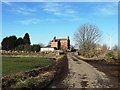
Blue Water Marina — 1 mile, 6¼ furlongs away
On this waterway in the direction of Stainforth Junction
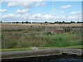
Thorne Swing Bridge — 2 miles, 3¼ furlongs away
On this waterway in the direction of Stainforth Junction
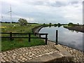
Goole Marina — 19 miles, 2 furlongs and 3 locks away
Travel to Stainforth Junction, then on the Sheffield and South Yorkshire Navigation (Bramwith to Stainforth) to Bramwith Junction, then on the Sheffield and South Yorkshire Navigation (New Junction Canal) to Sykehouse Junction, then on the Aire and Calder Navigation (Main Line - Goole to Castleford) to Goole Marina
Direction of TV transmitter (From Wolfbane Cybernetic)
 
 
Geograph
 
Wikipedia

Wikipedia has a page about Maud's Swing Bridge

Other Wikipedia pages that might relate to Maud's Swing Bridge
[Maud] Antarctica: Queen Maud Land (Norwegian: Dronning Maud Land), an area of 2.5 million square kilometers claimed by Norway in 1938 In Canada: Queen Maud Gulf, Nunavut [Maud of Wales] Maud of Wales, VA, CI, GCVO, GCStJ (Maud Charlotte Mary Victoria; 26 November 1869 – 20 November 1938) was Queen of Norway as the wife of King Haakon VII [Saint Maud] Saint Maud is a 2019 British psychological horror film written and directed by Rose Glass in her feature directorial debut. The story follows hospice nurse [Maud Lewis] Maud Kathleen Lewis (née Dowley; March 7, 1903 – July 30, 1970) was a Canadian folk artist from Nova Scotia. Lewis lived most of her life in poverty in [Maud Adams] Maud Solveig Christina Adams (née Wikström; born 12 February 1945), is a Swedish actress, known for her roles as two different Bond girls, first in The [Maud Gonne] Maud Gonne MacBride (Irish: Maud Nic Ghoinn Bean Mac Giolla Bhríghde, 21 December 1866 – 27 April 1953) was an English-born Irish republican revolutionary [Maud Carnegie, Countess of Southesk] Maud Carnegie, Countess of Southesk (née Lady Maud Duff; 3 April 1893 – 14 December 1945), titled Princess Maud from 1905 to 1923, was a granddaughter [Queen Maud Gulf] Queen Maud Gulf lies between the northern coast of the mainland and the southeastern corner of Victoria Island in Nunavut, Canada. At its western end lies [Maud Muller] "Maud Muller" is a poem from 1856 written by John Greenleaf Whittier (1807–1892). It is about a beautiful maid named Maud Muller. One day, while harvesting [Lucy Maud Montgomery] Lucy Maud Montgomery OBE (November 30, 1874 – April 24, 1942), published as L. M. Montgomery, was a Canadian author best known for a series of novels beginning
 
Google

Results of Google Search