CanalPlanAC

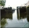
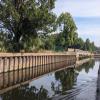
Newark Town Lock Weir Entrance

 
Channel leading to the Weir - No Access
Coopers Yard, Newark NG24 4UH, United Kingdom
 
Information about the place
Newark Town Lock Weir Entrance is a minor waterways place on the River Trent (non-tidal section) between The Muskham Ferry (4 miles and 2¼ furlongs and 2 locks to the north) and Fiskerton Wharf Visitor Moorings (6 miles and 5¾ furlongs to the west).
 
 
The nearest place in the direction of The Muskham Ferry is Mill Lane Bridge (Newark); ½ furlongs away.
 
The nearest place in the direction of Fiskerton Wharf Visitor Moorings is Newark Marina Entrance No 2; 1¾ furlongs away.

There is access (unofficial access) to the towpath here.

Mooring here is tolerable (it's just about possible if really necessary), mooring rings or bollards are available. There are some high wall moorings either side of this Weir.


Amenities

Amenities nearby at Mill Lane Bridge (Newark)

 Navigation Waterfront
 Fish & Chips
 Fish & Chips
 Cashpoint

Amenities nearby at Newark Marina Entrance No 2

 V G Stores
 
Maps
If you are a user and are logged on, or if you are actively planning a route, a map will be displayed here.
Show on external mapping site: Google | OSM | Bing
 
Photos
 
External websites
There are no links to external websites from here.
Why not log in and add some (select "External websites" from the menu (sometimes this is under "Edit"))?
 
Nearest facilities

Mouseover for more information or show routes to facility

Nearest water point

In the direction of Wilford Toll Bridge

Hazelford Lock No 88 miles away
On this waterway in the direction of Wilford Toll Bridge
Gunthorpe Lock No 712 miles, 6 furlongs and 1 lock away
On this waterway in the direction of Wilford Toll Bridge
Stoke Lock No 617 miles, 4 furlongs and 2 locks away
On this waterway in the direction of Wilford Toll Bridge

In the direction of Cromwell Lock Weir Exit

Newark "The Kiln" Visitor Mooring Pontoon4¼ furlongs and 1 lock away
On this waterway in the direction of Cromwell Lock Weir Exit
Cromwell Lock Visitor Mooring Pontoon5 miles, 4 furlongs and 2 locks away
On this waterway in the direction of Cromwell Lock Weir Exit
Cromwell Lock Weir Entrance5 miles, 4¼ furlongs and 2 locks away
On this waterway in the direction of Cromwell Lock Weir Exit

Nearest rubbish disposal

In the direction of Wilford Toll Bridge

Hazelford Lock No 88 miles away
On this waterway in the direction of Wilford Toll Bridge
Gunthorpe Lock No 712 miles, 6 furlongs and 1 lock away
On this waterway in the direction of Wilford Toll Bridge
Stoke Lock No 617 miles, 4 furlongs and 2 locks away
On this waterway in the direction of Wilford Toll Bridge

In the direction of Cromwell Lock Weir Exit

Newark Town Lock No 91½ furlongs away
On this waterway in the direction of Cromwell Lock Weir Exit
Cromwell Lock No 115 miles, 5¼ furlongs and 2 locks away
On this waterway in the direction of Cromwell Lock Weir Exit

Nearest chemical toilet disposal

In the direction of Wilford Toll Bridge

Gunthorpe Lock No 712 miles, 6 furlongs and 1 lock away
On this waterway in the direction of Wilford Toll Bridge
Stoke Lock No 617 miles, 4 furlongs and 2 locks away
On this waterway in the direction of Wilford Toll Bridge

In the direction of Cromwell Lock Weir Exit

Nether Lock No 101 mile, 3 furlongs and 1 lock away
On this waterway in the direction of Cromwell Lock Weir Exit
Cromwell Lock No 115 miles, 5¼ furlongs and 2 locks away
On this waterway in the direction of Cromwell Lock Weir Exit

Nearest place to turn

In the direction of Wilford Toll Bridge

Farndon Marina3 miles, ½ furlongs away
On this waterway in the direction of Wilford Toll Bridge
The Boathouse Pub Visitor Mooring3 miles, 1½ furlongs away
On this waterway in the direction of Wilford Toll Bridge
Fiskerton Wharf Visitor Moorings6 miles, 5¾ furlongs away
On this waterway in the direction of Wilford Toll Bridge
Hazelford Lock East Weir Exit7 miles, 6 furlongs away
On this waterway in the direction of Wilford Toll Bridge
Hazelford Lock Main Weir Exit7 miles, 7 furlongs away
On this waterway in the direction of Wilford Toll Bridge
Hazelford Lock Main Weir Entrance8 miles, 1¼ furlongs and 1 lock away
On this waterway in the direction of Wilford Toll Bridge
Hazelford Ferry8 miles, 4¾ furlongs and 1 lock away
On this waterway in the direction of Wilford Toll Bridge
Hazelford Lock East Weir Entrance8 miles, 5¼ furlongs and 1 lock away
On this waterway in the direction of Wilford Toll Bridge

In the direction of Cromwell Lock Weir Exit

Newark Town Lock Weir Exit2 furlongs and 1 lock away
On this waterway in the direction of Cromwell Lock Weir Exit
The Muskham Ferry4 miles, 2¼ furlongs and 2 locks away
On this waterway in the direction of Cromwell Lock Weir Exit
Cromwell Lock Visitor Mooring Pontoon5 miles, 4 furlongs and 2 locks away
On this waterway in the direction of Cromwell Lock Weir Exit
Cromwell Lock Weir Entrance5 miles, 4¼ furlongs and 2 locks away
On this waterway in the direction of Cromwell Lock Weir Exit

Nearest boatyard pump-out

In the direction of Cromwell Lock Weir Exit

Kings Waterside & Marina6 furlongs and 1 lock away
On this waterway in the direction of Cromwell Lock Weir Exit

No information

CanalPlan has no information on any of the following facilities within range:
self-operated pump-out
Direction of TV transmitter (From Wolfbane Cybernetic)
 
 
Blog posts
Holme Pierrepont - a Consulting Detective Agency Maybe? from Scribblings from the Mintball posted Sunday the 3rd of August, 2014
 
Geograph
 
Wikipedia

There is no page on Wikipedia called “Newark Town Lock Weir Entrance”

Wikipedia pages that might relate to Newark Town Lock Weir Entrance
[Wey and Godalming Navigations] Pyrford Lock and Newark Lock are the Walsham Gates and the battered walls of Newark Priory on its own long short-grass island. Between Papercourt Lock and [Firth of Clyde] Clyde is almost 2 miles (3.2 km) wide. Its upper tidal limit is at the tidal weir adjacent to Glasgow Green. The geographical (and popular) distinction between [Beeston, Nottinghamshire] Lenton, over a weir at Beeston Rylands. Originally there was a second lock at Beeston Cut for small vessels to enter the Trent below the weir, but this was [List of paintings by J. M. W. Turner] between Trees, possibly at Kew Bridge 1806-1807 The Tate, London 91.1 x 121.6 Weir and Cattle 1806-1807 The Tate, London 88.3 x 120 Washing Sheep 1806-1807 [List of Art Deco architecture in the United States] National Newark Building, Newark, 1931 New Jersey Bell Headquarters Building, Newark, 1929 Newark Metropolitan Airport Buildings, Newark, 1928 Newark Penn [Sleaford Navigation] waterway from Sleaford to Cogglesford Mill lock were reopened, following the construction of a lifting bridge in the town centre. This was installed in late December [Timeline of Oxford] Robinson. Weir, Alison (2005). Isabella: She-Wolf of France, Queen of England. London: Jonathan Cape. ISBN 9780224063203. Display in Town Hall. "Timeline [History of Scotland] Scotland', 1920–1939," History, June 1994, vol. 79, (256), pp. 242–59. B. Weir, The History of the Distillers Company, 1877–1939: Diversification and Growth [List of unused railways] Denver and Rio Grande Railroad in Colorado. It opened from Cherryvale to Weir City, in 1881, and abandoned further work. Chesapeake and Nashville Railway [Peterborough Greyhound Stadium] to the COVID-19 pandemic and when racing returned (18 May) following the lock-down Peterborough announced that they would not be re-opening until they
 
Google

Results of Google Search

Newark Town Lock Open Day - YouTube
Oct 20, 2015 ... On Saturday 7 & Sunday 8 November, the Canal & River Trust is inviting members of the public to walk along the drained Newark Town Lock ...
Wey and Godalming Navigations - Wikipedia
The River Wey Navigation and Godalming Navigation, geographically (but not historically) the ... There were around 9 miles (14 km) of new cuts, four new weirs, twelve bridges, ... Between the Town Lock (or Weybridge Lock) and Coxes lock is the ... Between Pyrford Lock and Newark Lock are the Walsham Gates and the ...
Erie Canal - Wikipedia
The Erie Canal is a canal in New York, United States that is part of the east–west, cross-state ... Lock E28B (Newark) ... Guard Gate 9 (Bushnell's Basin) ... New ethnic Irish communities formed in some towns along its route after completion, ...
Trent Lock
UK Weather: River Trent flooding looking at the entrance to Trent Lock at the start of the ... Canal & River Trust sign on River Trent at Newark Town Lock, ... Cromwell Lock Weir River Trent Nottinghamshire · River Trent, Newark Town Lock ...